Share now
Map of Balochistan

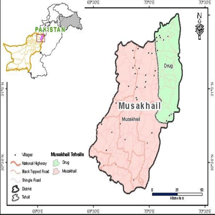
Map of Musakhel District
Balochistan Districts
- Quetta District Profile
- Awaran district Profile
- Barkhan District Profile
- Bolan District Profile
- Chagai District Profile
- Dera Bugti District Profile
- Gwadar District Profile
- Harnai District Profile
- Jaffarabad District Profile
- Jhal Magsi District Profile
- Kalat District Profile
- Kech District Profile
- Kharan District Profile
- Khuzdar District Profile
- Killa Abdullah District Profile
- Killa Saifullah District Profile
- Kohlu District Profile
- Lasbela District Profile
- Loralai District Profile
- Mastung District Profile
- Musakhel District Profile
- Nasirabad District Profile
- Nushki District Profile
- Panjgur District Profile
- Pishin District Profile
- Sherani District Profile
- Sibi District Profile
- Washuk District Profile
- Zhob District Profile
- Ziarat District Profile
Also visit: Sindh, Punjab, Khyber Pakhtunkhwa
Introduction/Geographical Details; Musakhel District
Musakhel (also spelled Musakhail) is located between 30° 17Ꞌ 28” to 31° 28Ꞌ 53” north latitudes and 69° 27Ꞌ 38” to 70° 16Ꞌ 26” east longitudes. It is bounded in the north by the Dera Ismail Khan district (Khyber Pakhtunkhwa province), in the east by the Dera Ghazi Khan district (Punjab province), in the south by the Barkhan district, and in the west by the Loralai and Zhob districts.
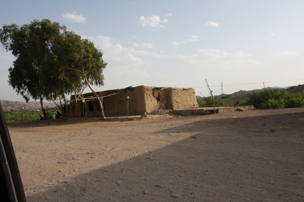
Figure 1.3 A View of Kingri, Musakhel
Musakhel District at a Glance
| Name of District | Musakhel District | |
| Headquarters | Musakhel Bazaar | |
| Population[1] | 167,017 persons | |
| Area[2] | 5,728 km2 | |
| Population Density[3] | 27.9 persons/ km2 | |
| Growth Rate[4] | 1.2% | |
| Male Population[5] | 54.0% | |
| Female Population[6] | 46.0% | |
| Urban Population[7] | 8.5% | |
| Tehsils/ Talukas | 02 Tehsils:
1. Drug Tehsil 2. Musakhel Tehsil |
|
| Main Towns/ Villages | Musakhel Bazaar, Kingri, Sadar Musakhel, Drug, Toisar, Zam, Wah Hassan Khel, and Rarasham | |
| Literacy Rate[8] | 43.0% | |
| Male Literacy Rate[9] | 57.0% | |
| Female Literacy Rate[10] | 28.0% | |
| Major Economic Activity[11] | Agriculture, forestry & fishing | 57.7% |
| Community, Social & Personal Services | 20.6% | |
| Construction | 8.2% | |
| Electricity, Gas & Water | 6.7% | |
| Wholesale, Retail Trade, Hotel/Restaurant | 5.8% | |
| Transport, Storage & Communication | 0.6% | |
| Others | 0.5% | |
| Main Crops | Wheat, barley, jowar, maize, moong, maash, bajra, sugarcane and tobacco (both in minor quantity), rapeseed and mustard | |
| Major Fruits | Almonds, apples, apricots, pomegranate, musk melon, and watermelon | |
| Major Vegetables | Onion, potato, tomatoes, okra, tinda, spinach, turnip, carrot, cauliflower, peas, brinjal, cucumber, and chilies | |
| Forest Area[12] | 4,173 HA[13] | |
| Black Topped Roads[14] | 184.0 km | |
| Shingle Roads[15] | 306.0 km | |
| Electricity[16] | Supplied by Quetta Electric Supply Company (QESCO) | |
| Telephone Exchanges[17] | 03 telephone exchanges, providing 488 landlines, 713 wireless phones, and 383 broadband connections | |
| Industrial Zones[18] | There is no industry in the district | |
| Major Industry[19] | There is 1 flour mill and a few furniture making workshops | |
| Household Size[20] | 7.0 persons per house. | |
| Houses with Piped Water[21] | 5.8% | |
| Houses with Electricity[22] | 33.6% | |
Table 1.1 Musakhel District at a Glance
[1] 2017 Census
[2] 1998 Census
[3] 2017 Census
[4] 2017 Census
[5] 2017 Census
[6] 2017 Census
[7] 2017 Census
[8] Pakistan Social & Living Measurement Survey 2014-15 (PSLM); latest available
[9] PSLM
[10] PSLM
[11] 1998 Census; 2017 Census Data has not been made public yet.
[12] Balochistan Development Statistics 2018-19
[13] Land Utilization Statistics report 4,173 HA under forests.
[14] Balochistan Development Statistics 2018-19
[15] Balochistan Development Statistics 2018-19
[16] Balochistan Development Statistics 2018-19
[17] Balochistan Development Statistics 2018-19
[18] Musakhel District Development Profile 2011 by P&D Department GoB
[19] Musakhel District Development Profile 2011 by P&D Department GoB
[20] 1998 Census; 2017 Census Data has not been made public yet.
[21] 1998 Census; 2017 Census Data has not been made public yet.
[22] 1998 Census; 2017 Census Data has not been made public yet.
Brief History – Governmental Structure – Administrative Divisions – Historical/ Heritage Sites and Tourism/ Picnic Spots
Brief History; Musakhel District
Early history of the Musakhel region of Balochistan is obscure, and no authentic records exist. Since the district is located in northern Balochistan, which was part of Kandahar province till the British annexed it and made it a part of British India, its early history can be surmised from that of Kandahar province. It can be asserted, then that this area has been ruled by the Ghaznavids (977-1186), Maliks of Kurt Dynasty,[1] Amir Timur and his successors (1383-1470 AD), Sultan Husain Mirza of Herat (1470-1480 AD), and Amir Shuja-ud-Din Zunnun (1480-1504). In 1505 AD, the Mughals conquered the province of Kandahar and held it till 1559, when the Safavid Kings of Persia acquired it. The Mughals regained control of the province in 1595 but lost it again in 1622 AD, this time to the Safavid Kings of Persia. Shah Abbas, one of the Safavid Monarchs, conferred the government of Pishin and its tribal dependencies upon Sher Khan Tareen[2] who became semi-independent; on the death of Shah Abbas, he refused to submit to Ali Mardan Khan, the Safavid governor of Kandahar. However, Ali Mardan attacked his fort, Kila Sheran, during Sher Khan’s absence. Sher Khan returned to try and regain his fort but was defeated, and had to retire towards Duki (Loralai district). In 1709, the Afghan inhabitants rebelled, led by Mir Wais Ghilzai, and established the Ghilzai power in Kandahar. The Ghilzai power was terminated by Nadir Shah in 1737 AD. After the assassination of Nadir Shah in 1747 AD, the first democratic government was established in Kandahar by the Afghans as they elected Ahmed Shah Durrani/Abdali as their ruler. In 1826, the first Amir of Afghanistan, Dost Muhammad Barakzai, took hold of the area and annexed it to Afghanistan.
In 1879 AD, the British took control of the northern areas of Balochistan under the treaty of Gandamak.[3] From 1879-84, efforts were made to extend the British influence over the Khetran and Musakhel territories which are now part of Musakhel district. The Musakhel Tribe was subdued by the British after they sent a military expedition against them; the Musakhels were defeated and forced to submit to British authority. Thus, on November 1, 1887, the entire area was declared a part of British India. Zhob Agency was formed in 1890 and Musakhel territory was annexed to it. Musakhel was made a Tehsil in 1892, and was transferred to Loralai district in October 1903.
Musakhel became a district on 1 January 1992, when Loralai district was divided into 3 districts: Musakhel, Barkhan, and Loralai. On 31 December 2000, the district was merged back into Loralai district, but on 1 January 2003 Musakhel district was restored.
Governmental Structure; Musakhel District
At the Federal level, Musakhel district is allocated a set number of representatives in both the National Assembly and the Provincial Assembly:
- Number of seats in the National Assembly[4] 1
- Number of seats in the Provincial Assembly 1
Under the Local Government Act 2010, Amended in 2011, Musakhel district has 1 District Council with 17 Union Councils. It has 1 Municipal Committee as follows:
- Musakhel
Each Union Council is represented by one member in the District Council. In addition, there is special representation of women (33%), and of workers and peasants (5% each).
Administrative Divisions; Musakhel district
Musakhel district has a total area of 5,728 km2 and is divided into 2 Tehsils and 10 Union Councils as follows:
| Drug (Durug) Tehsil[5] | 02 Union Councils |
| Musakhel Tehsil | 08 Union Councils |
Table 1.2 Musakhel Administrative Divisions
[1] Maliks of Kurt Dynasty were a subordinate of the Ghori Dynasty
[2] Tareen or Tarin tribe are descendants of one of the sons of Qais Abdul Rasheed, the forefather of most of the Afghani tribes who is supposed to have embraced Islam at the hands of Prophet Muhammad (PBUH). They had arrived with Sher Shah Suri, the Afghan King, and settled in parts of Balochistan.
[3] Signed between the British and the then Amir of Afghanistan, King Muhammad Yaqub Khan, on 25 May, 1879 AD, the treaty ended the Second Anglo-Afghan War
Historical/ Heritage Sites and Tourism/ Picnic Spots; Musakhel District
There are some sites which are archeologically and historically[1] important; these are:
- Sali Archeological Site: Sali is the name of a small village where this site exists
- Safari Valley and Archeological Site
The following villages/areas are beautiful and can be easily developed into tourist spots[2] as these provide good picnic areas:
- Shahsar, Torghar Area: The entire area is surrounded by hills and there is a main spring cascading down the hills. The area is well-known for its forested areas and wildlife
- Surghar: This mountain hosts 4 villages: Merdadzai, Hasankhel, Inzai, and Sadozai. This area is well-forested and full of wildlife
- Gharhi (Zimri Palaseen): This area is famous for thick pine forests and wildlife
- Rodh: Beautiful scenic valley, which is well-forested and full of wildlife
- Gokar (Chassan): there is a large dam in the center of the village which provides a wetland and homing ground for migratory birds
- Safa: It has a wetland which provides resting areas for migratory birds. It is the habitat of ducks, see-see partridges, chakor partriges, wild pigeons, and eagles. The forest mainly consists of olives, phulai, figs, and wild pistachios
[1] Information on historically significant sites has been drawn from Musakhel District Development Profile 2011, P&D Department GoB, with UNICEF
[2] Information on Tourist Spots has been drawn from Identification of Biodiversity Hot Spots in Musakhel District, Balochistan, by M Yahya Musakhel for WWF, 2005
[4] This seat is shared by Musakhel, Barkhan, and Loralai
[5] formed in 2005
Topography; Musakhel District
The district is mountainous for the most part, with 2 principal ranges running in a north‒south direction, called Surghar (also spelled as Sur Ghar) and Torghar. Both mountain ranges are off-shoots of Suleiman Mountain Range. The Surghar Range lies in the west, and comprises of the Satyara (2,405 m), Khiazah (2,187 m), Charkundae (2,316 m), and Kakal (1,807 m) peaks. The Torghar Range lies in the east and includes the Nashtarghar or Mizri Roh (3,109 m), Chappar, Salai, Narai, Tiar (2,329 m), Buj (2,323 m), Hazargat (2,455 m) and Behu (2,429 m) peaks.[1]
The main valley[2] of the district is the Musakhel Sahra which lies from southwest to northeast, enclosed on all sides by hills. It is divided into two parts by the Tang[3] (and/ or Vihowa) stream, with the northern portion being called the Bar Sahra and the southern, Lar Sahra. Besides the Sahra, the district has other smaller valleys, the drainage of which, uniting below Khan Muhammad Kot, forms Luni River or the northern branches of the Sanghar. The Bar Sahra comprises of the tracts of Talao, Ghund, Baha, Talai, and Ulmai. Lar Sahra, which is much smaller than Bar Sahra, is divided into two unequal portions by Razana Stream, which joins Toi near its exit from the Gat Defile.[4] The western portion contains the Loghai and Daman tracts. The general elevation of the Sahra Valley varies from 900 to 1,200 m.
Rivers, Streams, and Lakes; Musakhel district
The general drainage[5] of the valley is from west to east, and is carried by 3 main streams: the Toi, Luni, and Sanghar. In the northeast, the Zamarai country is drained by smaller hill torrents, the Ramak, and Guzai. The Toi is formed by the junction of Razana, Tang, and Kharspun or Tangi Sar and is known beyond the boundaries of the district as Vihowa River.
The Lang and Zarni are the 2 source tributaries which form the Sanghar; the two tributaries meet at the Drug valley; in its further course, the river is called Drah, and it drains the Drug valley. The important affluents of the Luni are Rod, Lori Tang (made up of Dab and Khajuri), Kingri, and Sarin.
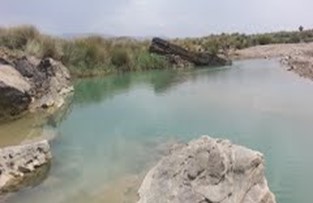
Figure 1.4 Saran Lahar, Rarasham, Musakhel
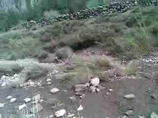
Figure 1.5 A rivulet near Musakhel Bazar
Forests; Musakhel district
The type of forests found in the area is known as Sub Tropical Broad Leaved Evergreen Scrub Forests, consisting mainly of olive and phulai. There is only 1 notified forest area in the district at Surghundi or Sukandai, measuring 4,173 HA.
Main tree species that dominate these forests include natural olive (Olea ferrugenea) and phulai (Acacia modesta) associated occasionally with edible gurgara or ganger (Reptonia buxifolia), edible pine (Pinus gerardiana) and pine (Pinus excels), tamarisk (Tamarix articulate and Tamarix orientalis), dwarf palm or mazri (Nannorrhops ritchiana), sanatha (Dodonea viscosa), a thorny plant (Gymnospora spinose), ber (Zizyphus jujube), wild pistachios (Pistacia cabulica), varieties of ber (Zizyphus nummularia, Zizyphus oxyphylla, Zizyphus nummularia), many-flowered plant (Anabasis multiflora), wild almond (Prunus ebernea), spulmae or aak (Calotropis procera), urgalam or sihar or dogbane (Rhazya stricta), khamazurae or Indian rennet (Withania cougulans), pamangi or a flowering plant (Bouceros Aucheriana), bushka or hoary cress (Lepidium draba), barberry or rasaut (Berberis vulgaris), shung or wild ash (Fraxinus xanthoxyloides), barhara or bata (Periploca aphylla), plawan or peelu (Salvadora oleoides), zoze or camel thorn (Alhagi camelorum), spandae or harmal (Peganum Harmala), wild garlic (Allium sphaerocephalum), gandarae or oleander (Nerium odorum), malaghunae or olive daphne (Daphne oloides), ghuzera or dwarf sophora (Sophora griffithii) and makhi or pea shrub (Caragana ambigua). The ground cover is constituted mainly by Stipa pennata, Pennisetum orientalis, Chrysopogon aucheri, Cymbopogon jwarancusa, and Sorghum halepens.
The following table shows the types of forests and their area in the district (Balochistan Development Statistics 2018-19):
| Total Forest Area | 10,311 A | Scrub Forests | 10,311 A |
| Rangelands | – A | Coniferous Forests | – A |
| Irrigated Plantations | – A | Riverine Forests | – A |
| Coastal/Mangrove Forests | – A |
Table 1.3 Musakhel Forests
Soils; Musakhel district
The Atlas of Pakistan[6] describes the land of Musakhel as rock outcrops with loamy, very shallow steep high mountain soils of mainly arid and semi-arid zones (rock outcrops and Lithic Camborthids[7]). The foot hills are covered with talus cones and alluvial fans, generally composed of gravel, pebbles, and sands. Beyond the foot hills, the valley floors are covered with silt and loam. These are fertile soils of great agricultural value in the rocky waste.
Locally, about 6 types of soils are found in Musakhel. Lasai or Sur Khaurai is a soft red soil containing silt or mat, and is found in Kingri Circle and the Sahra Valley. This land is used for the cultivation of wheat, jowar, and bajra. Tor Khaurai is dark hard loam found in Drug and Rarasham areas, and is used for wheat and maize. Sandy loam, the Sagai, is found in Rod Kingri and Rod Karher areas. The Zhghalina (gravely) in Drug Circle is used for cultivating moong. In some areas of Toisar and Drug, the earth is spread in rocky ground to form artificial soil. Locally, it is called Navrina Mzakka and it is used to cultivate barley and maize. Barley is also cultivated on saline soils, called Tarkhbandae, of Sanghar hills, Rod Srin, Mirzai, and Toisar.
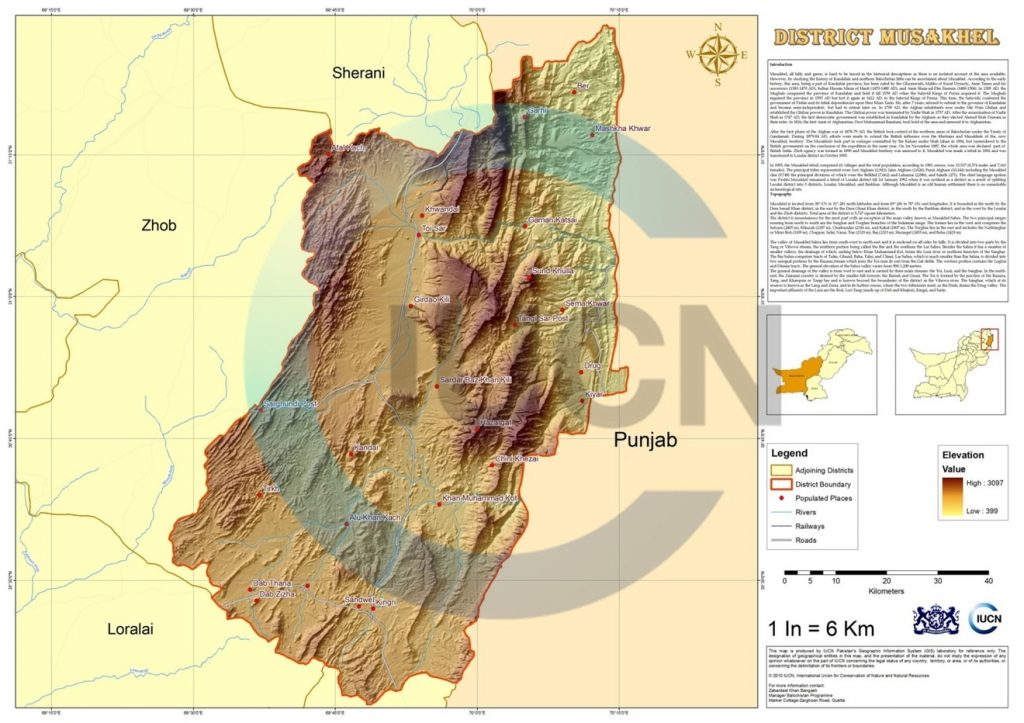
Figure 1.6 IUCN GIS Map Musakhel District
Climate; Musakhel district
The climate of Musakhel, which is located 1,200-2,400 m above sea level, is semi-arid and can be placed in the “warm summer and mild winter” temperatures category. The summer is hot, and begins in April, ending in October, with mean temperatures ranging from 21 °C to 32 °C. June is the hottest month, when maximum temperature can exceed 32 °C and occasionally rise above 38 °C. In winter, the temperature drops below 21 °C, but even in the coolest month (January) the mean monthly temperature does not drop below 10 °C. However, the mercury may touch the freezing point during cold spells. The mean annual rainfall is 400 mm, most of which occurs during July and August.
Seismic Activity; Musakhel district
The district belongs to Zone 3 of the Seismic Zone Map of Pakistan which means moderate to severe damage due to earthquakes.
[1] Names of the peaks are drawn from Loralai District Gazetteer 1907, p. 325
[2] The information in this paragraph is extracted from the Musakhel District Development Profile 2011 by GoB with UNICEF
[3] According to District Development Plan 2011 by GoB and UNICEF Tang and Vihowa are two names for one stream, but the British Gazetteer describes Tang as a tributary of Vihowa stream
[4] A narrow pass or gorge between hills or mountain
[5] Musakhel District Development Plan 2011, P&D department, GoB with UNICEF
[6] Musakhel District Profile, Bureau of Statistics, Planning Studies Section with P&D Department GoB,1997
[7] lithic soils have rock outcrops, and camborthid soils are fine soils
Population; Musakhel District
The following table shows the population of Musakhel district as per 2017 Census:
| District/Tehsil | Area
km2 |
Population | Male% | Female% | Urban % | Growth Rate % | |||
| Musakhel District | 5,728 | 167,017 | 54.0 | 46.0 | 8.5 | 1.16 | |||
| Musakhel Tehsil | 5,728 | 129,502 | |||||||
| Drug Tehsil | Created in 2005, out of Musakhel | 37,515 | |||||||
Table 1.4 Musakhel Population Statistics
Religions; Musakhel district[1]
| Muslims | 99.6% |
| Christians | Negligible % |
| Hindus | Negligible % |
| Ahmadis | 0.4% |
| Scheduled Castes | Negligible % |
| Others | Negligible % |
Table 1.5 Musakhel Religions
Languages; Musakhel district[2]
| Urdu | 0.2% |
| Punjabi | 0.1% |
| Sindhi | Negligible % |
| Pushto | 78.9% |
| Balochi | 13.6% |
| Seraiki | 0.9% |
| Others[3] | 6.4% |
Table 1.6 Musakhel Languages
[1] 1998 Census; 2017 Census data has not been released yet.
[2] 1998 Census; 2017 Census data has not been released yet.
[3] includes Brahvi language
Economic Activity – Economic Infrastructure
Economic Activity; Musakhel District
The main economic activities of the district are[1]:
- Agriculture, forestry & fishing (57.7%)
- Community, Social & Personal Services (20.6%)
- Construction (8.2%)
- Electricity, Gas & Water (6.7%)
- Wholesale, Retail Trade, Hotel/ Restaurant (5.8%)
- Transport, Storage & Communication (0.6%)
- Others (0.5%)
[1] 1998 Census; 2017 Census data has not been released yet.
Land Use; Musakhel district
The following table shows the main land use statistics of the district as per Balochistan Development Statistics 2018-19:
| Total Area | 572,800 HA | Reported Area | 48,316 HA |
| Total Cultivated Area | 13,882 HA | Net Sown | 6,156 HA |
| Current Fallow | 7,726 HA | Total Uncultivated Area | 34,434 HA |
| Culturable Waste | 10,411 HA | Forest Area | 4,173 HA |
Table 1.7 Musakhel Land Use Statistics
Agriculture; Musakhel district
The district belongs to the Temperate Agro-Ecological Zone and the Western Dry Mountain Agro-Ecological Zone of Pakistan. Agriculture in the district mostly depends on rainfall. The crops of the district include wheat, barley, jowar, maize, moong, maash, bajra, sugar cane and tobacco (both in minor quantity), as well as rapeseed and mustard.
The fruits grown in the district include almonds, apples, apricots, pomegranate, musk melon, and watermelon.
Vegetables include onion, potato, tomatoes, okra, tinda, spinach, turnip, carrot, cauliflower, peas, brinjal, cucumber, and chilies.
Livestock Breeding; Musakhel district
Livestock breeding is the second most important sector of the economy. It is the main source of income for nomadic families. The following table shows the position of the livestock population according to the 2006 Census of Livestock (qtd. in Balochistan Development Statistics 2018-19) in the district:
| Cattle | 197,318 Heads | Buffalo | 1,650 Heads | Sheep | 977,748 Heads |
| Goats | 464,126 Heads | Camels | 17,639 Heads | Horses | 3,588 Heads |
| Mules | 96 Heads | Asses | 21,226 Heads |
Table 1.8 Musakhel Livestock Statistics
Indigenous livestock breeds of the district include: kohi (camel); koh-i-Suleiman or lohani (cattle); shinghari and sperki or pidie (donkey); Balochi (horse); kakari, musakhaili, kajjale, bibrik (sheep); and Koh-iSuleimani (goat).
Poultry Farms; Musakhel district
According to the Musakhel District Development Plan 2011, by P&D Department, GoB with UNICEF, there is one government-owned poultry farm and small private/commercial poultry farms of boilers and layer breeds in the district.
Bee Keeping/Apiary Musakhel district
Bee keeping is not an economic activity in the district.
Fisheries; Musakhel district
There are no fisheries in the district. Some fishing is done in the rivulets of the district for local consumption.
Irrigation Network; Musakhel district
The main sources of irrigation in the district are tube wells, canals, wells and dug karezes/springs. The following table shows the mode of irrigation and area being irrigated by the mode (Balochistan Development Statistics 2018-19):
| Total Irrigated Area | 3,793 HA | Government Canals | – HA |
| Private Canals | – HA | Wells | – HA |
| Tube wells | 3,079 HA | Karez/Spring/Others | 714 HA |
Table 1.10 Musakhel Irrigation Statistics
The number and names of karezes in Musakhel district are included in the chapter on Loralai district.
Bund Dam and Mirdadzai Dam are Delay Action Dams; construction on Bund Dam is now complete, while Mirdadzai is still under construction. Combined, the dams will help preserve and improve water supply in the district.
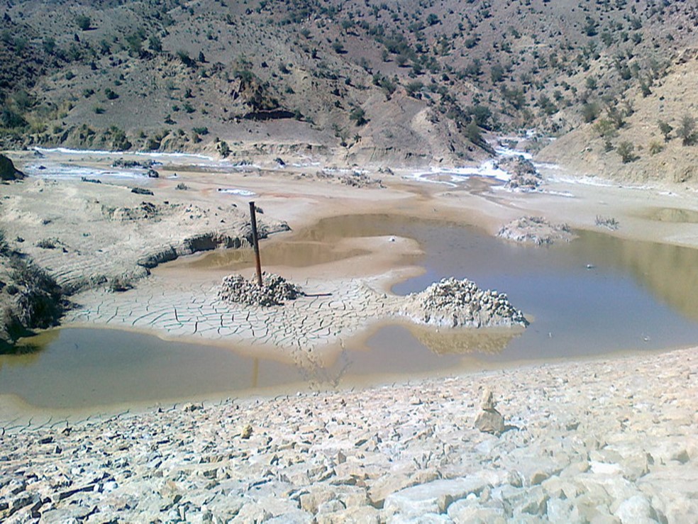
Figure 1.8 Bund Dam Reservoir & Embankment, Musakhel
Manufacturing/ Industry; Musakhel district
No significant industrial or manufacturing activities have been reported in Musakhel district. There was a small Diesel Power Generation Plant in Musakhel, but it has not been in operation since 1997, when the transformer was vandalized.[1]
Mining; Musakhel district
According to the Musakhel District Development Plan 2011, by P&D Department GoB with UNICEF, the exposed sedimentary sequence comprises of shale, sandstone, limestone, marl, and conglomerate. The occurrence of carbonaceous matter has an economic significance as a source for coal and hydrocarbon generation in this area. Petroleum prospecting was carried out by Oil and Gas Development Company in Musakhel, and different feasible structures for oil resources have been reported. Coal concessions are granted to the private sector and some coal is being mined in the district.
Oil and gas is being explored in the district.
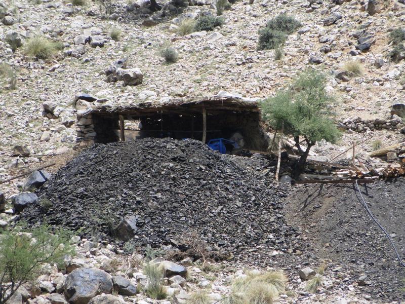
Figure 1.7 Coal Mine, Musakhel
Handicrafts; Musakhel district
Women in Musakhel are experts in traditional embroidery work, but for the most part, this work is done on women’s dresses for personal use. Although, at present, it is not a commercial activity, it can be developed as a cottage industry if proper guidance were to be provided to the women.
[1] Musakhel District Development Plan, 2011 P&D Department GoB with UNICEF
Economic Infrastructure; Musakhel District
Musakhel district is mostly rural. It is connected with other parts of the province and the country with black topped as well as shingle roads. There is no railway or airport in the district.
Road Statistics; Musakhel district
According to the Balochistan Development Statistics 2018-19, following are the road statistics of the district:
| Total Roads | 490.0 km |
| High Type Roads/black topped | 184.0 km |
| Low Type Roads/Shingle | 306.0 km |
Table 1.9 Musakhel Road Statistics
Some of the important roads of the district are:
- National Highway N-70 passes through the district (Kila Saifullah-Multan)
- Road connecting Loralai-Dera Ghazi Khan via Kingri
- Road connecting Musakhel Bazaar to National Highway N-50
Rail and Airways; Musakhel district
No railway services or airways exist in the district. The nearest airport to Musakhel Bazaar is Zhob Airport. The nearest railway station to the district is located in Dera Ghazi Khan.
Radio and Television; Musakhel district
Musakhel district has no radio or TV stations, or even a TV booster. TV can be viewed through satellite.
Telecommunications; Musakhel district
The district is connected to other parts of the country through telephone and telegraph. There are 03 telephone exchanges in Musakhel district which provide 488 landlines, 713 wireless phones and 383 broadband connections in the district (Balochistan Development Statistics 2018-19). Cellular phone companies also provide their services in the district.
Post Offices/ Courier Services; Musakhel district
There are 03 post offices[1] in the district. Courier services are not available.
Banking/ Financial Institutions; Musakhel district
There is only 01 branch of National Bank of Pakistan in Musakhel district[2].
Electricity and Gas; Musakhel district
Quetta Electric Supply Company (QESCO) looks after the supply of electricity. There was a Diesel Power Generating Plant in Kingri, which supplied electricity to the town but was closed in 1997, after the transformer was vandalized, as described already.
[1] Balochistan Development Statistics 2018-19
[2] List of Reporting Bank Branches 2019, by State Bank of Pakistan.
Educational Institutions; Musakhel district
The following table shows the number of educational institutions in the district as per Balochistan Development Statistics 2018-19:
| Institution | Boys/Girls | Institution | Boys/Girls |
| Primary Schools | 205/67 | Middle Schools | 13/07 |
| High Schools | 15/04 | Community Schools | 11 |
| Higher Secondary | 03/01 | Degree Colleges | 01/- |
| Universities | – | Mosque Schools[1] | – |
| Vocational Training Schools | 01 | Private Schools[2] | 01 |
Table 1.11 Musakhel Educational Institutes
Healthcare Facilities; Musakhel district
The following table shows the Government Health Care Institutions in Musakhel district as per Balochistan Development Statistics 2018-19:
| Institution | No./beds | Institution | No./beds |
| Teaching Hospitals | – | Hospitals | 02/70 |
| Rural health Centers | 04/30 | Basic Health Units | 20/- |
| Dispensaries | 06/- | Mother Child Health Centers | 02/- |
| TB/Leprosy Clinics etc. | -/- | Private Hospitals | -/- |
| Private Dispensaries | -/- |
Table 1.12 Musakhel Health Institutes
Policing; Musakhel district
For the purposes of administration, the district is divided into two areas: “A” and “B”. The urban area of Musakhel district comes under “A” area and the rest of the area of the district falls in “B” area. “A” area is controlled by a regular police force headed by the Deputy Superintendent of Police (DSP). This DSP is assisted by a Station House Officer (SHO), Inspector Police, and other staff. “B” area is controlled by levies force. Levies are a conventional force to help maintain law and order, comprised mainly of men of different tribes. The levies force comes under the direct control of the Deputy Commissioner (DC). Generally, the levies force is well equipped to deal with the law and order situation in the district.
The policing of Musakhel district is looked after by the Regional Police Officer (RPO) Loralai. This RPO is assisted by 2 SubDivisional Police Officers (SDPO), with one stationed at Musakhel Bazaar and the other at Kingri. In all, there are 03 police stations[3] in the district.
[1] included in primary schools
[2] 2011 data
[3] Table no. 19.7 (a) Number of Police Stations by Division/District 2019
Environment and Biodiversity; Musakhel district
Environmental pollution, especially brown pollution, is almost negligible, as there is no industrial set up or heavy traffic in the district.
Flora and Fauna; Musakhel district
Flora; Musakhel district
Vegetation zones[1] of the district mainly consist of the following categories:
- Hills: Common flora includes olive (Olea ferrugenea), phulai (Acacia modesta), shung or Afghanash (Fraxinus xanthoxyloides), pine (Pinus gerardiana) and Himalyan blue pine (Pinus excelsa), gurgara or ganger (Reptonia buxifolia), sanatha or hopbush (Dodonaea viscosa), mastic tree (Pistacia cabulica), kankera (Gymnosporia spinosa), ber (Zizyphus nummularia), and mazri palm (Nannorrhops ritchiana)
- Plains: Common flora of the plains includes phulai (Acacia modesta), a thorny tree (Gymnosporia spinosa), ber (Zizyphus nummularia), and mazri or dwarf palm (Nannorrhops ritchiana), wild almond (Prunus ebernea), spulmae or aak/rubber bush (Calotropis procera), urgalam or harmal (Rhazya stricta), khamazurae or Indian rennet (Withania cougulans), pamangi, a flowering plant (Bouceros Aucheriana), karkana, a variety of ber (Zizyphus nummulariana), bushka or hoary cress (Lepidium draba), barberry (Berberis vulgaris), shung or ash (Fraxinus xanthoxyloides), barhara or milk broom (Periploca aphylla), plawan, or vann, or peelu (Salvadora oleoides), zoze or camelthorn (Alhagi camelorum), spandae or harmal (Peganum harmala), black spear grass (Heteropogon contortus), wild garlic (Allium sphaerocephalum), gangu, a fodder grass (Orthonnopsis intermedia), gandarae or oleander (Nerium odorum), malaghunae or olive daphne (Daphne oleoides), ghuzera or pea flowered tree (Sophora griffithii) and makhi or pea shrub (Caragana ambigua). The ground cover is constituted mainly by Stipa pennata, Pennisetum orientalis, Chrysopogon aucheri, and Cymbopogon jwarancusa, and Sorghum halepens
- Stream Beds: Commonly found in the entire district, where tamarisk (Tamarix articulate and Tamarix orientalis) and wild sugarcane (Saccharam spp.) are commonly seen
Fauna; Musakhel District
Mammals found in the district include Suleiman markhor, wild sheep, fox, Asiatic jackal, hyena, cape hare, mongoose, stone marten, porcupine, and Afghan hedgehog.
Birds of the district include chakor, see-see partridge, magpie, houbara bustard, a number of sparrows, finches, buntings, seasonal/ migratory waterfowls, hawks, and sand grouse. The area also provides a corridor to migratory bird species, including common crane and demoiselle crane.
Reptiles of the district include Afghan tortoise, brown cobra, saw-scaled viper, Levantine viper, and goh.
Protected Wildlife Areas and Fauna; Musakhel District
There are no Protected Wildlife Areas in the district.
[1] Musakhel District Development Plan, 2011 P&D Department GoB with UNICEF