Share now
Map of Balochistan

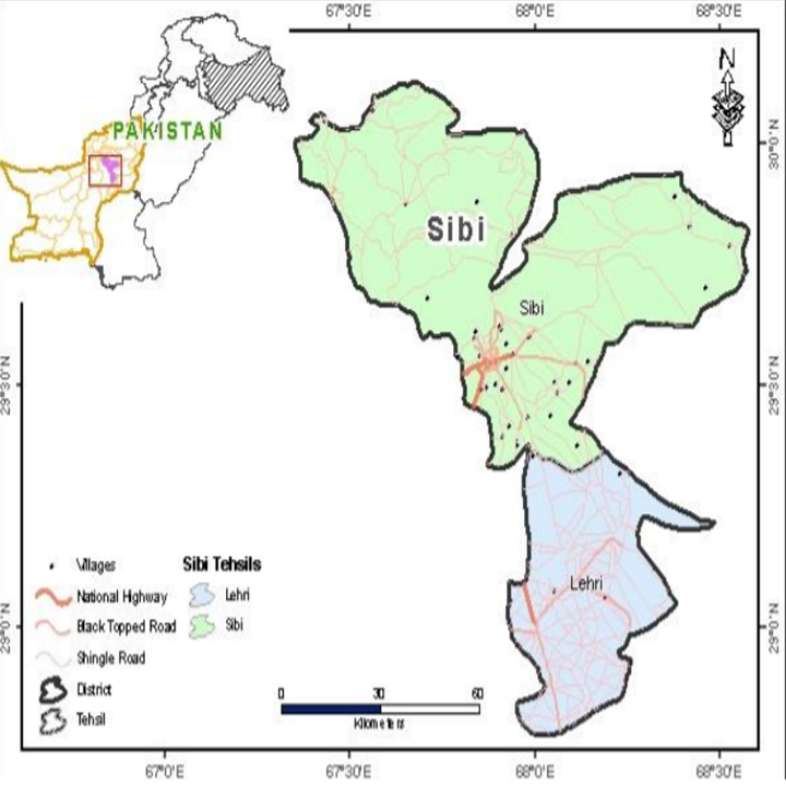
Map of Sibi District
Balochistan Districts
- Quetta District Profile
- Awaran District Profile
- Barkhan District Profile
- Bolan District Profile
- Chagai District Profile
- Dera Bugti District Profile
- Gwadar District Profile
- Harnai District Profile
- Jaffarabad District Profile
- Jhal Magsi District Profile
- Kalat District Profile
- Kech District Profile
- Kharan District Profile
- Khuzdar District Profile
- Killa Abdullah District Profile
- Killa Saifullah District Profile
- Kohlu District Profile
- Lasbela District Profile
- Loralai District Profile
- Mastung District Profile
- Musakhel District Profile
- Nasirabad District Profile
- Nushki District Profile
- Panjgur District Profile
- Pishin District Profile
- Sherani District Profile
- Sibi District Profile
- Washuk District Profile
- Zhob District Profile
- Ziarat District Profile
Also visit: Sindh, Punjab, Khyber Pakhtunkhwa
Introduction/Geographical Details; Sibi District
The district is located between 28° 46Ꞌ 40” to 30° 07Ꞌ 34” north latitudes, and 67° 21Ꞌ 3” to 68° 34Ꞌ 38” east longitudes. The district is bordered by Harnai district on the north and northwest, Kohlu district on the south and northeast, and by Bolan district on the west. Sibi is named after its headquarters, the town of Sibi, which, in turn, derives its name from Siwi, a Hindu lady of the Sewa race;[1] the Sewas were the ancient rulers of this area.
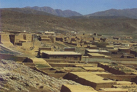
Figure 1.3 An Aerial View of Sibi Town
Sibi District at a Glance
| Name of District | Sibi District | ||
| District Headquarter | Sibi Town | ||
| Population[2] | 253,618 persons | ||
| Area[3] | 5,304 km2 | ||
| Population Density[4] | 27.4 persons/ km2 | ||
| Population Growth Rate[5] | 1.5% | ||
| Male Population[6] | 52.5% | ||
| Female Population[7] | 47.5% | ||
| Urban Population[8] | 30.8% | ||
| Tehsils/Talukas |
02 Tehsils: 1. Sibi Tehsil 2. Lehri Tehsil |
||
| Main Towns | Sibi, Lehri, Sangan, Pir Ismail, Khajak, Kut Mundai, Kurak, Talli, Babar Kach, Tarehar, and Khair Wah | ||
| Literacy Rate[9] | 45.0% | ||
| Male Literacy Rate[10] | 55.0% | ||
| Female Literacy Rate[11] | 34.0% | ||
| Major Economic Activity[12] | Agriculture with its Allied Livestock Breeding & Fishing | 26.1% | |
| Community, Social & Personal Services | 25% | ||
| Construction | 19% | ||
| Electricity, Gas & Water | 16% | ||
| Others | 13.9% | ||
| Main Crops | Wheat, barley, rapeseed & mustard, masoor, rice, jowar, bajra, maize, sesanum, moong, moath, sugarcane, gram, cotton, sugarbeet, guar seed, linseed, sunflower, and indigo | ||
| Major Fruits | Watermelon, musk melon, apple, apricot, grapes, peach, plum, pear, pomegranate, mangoes, citrus, ber, guava, loquat, chikoo, dates, and mulberry | ||
| Major Vegetables | Onions, garlic, potatoes, tomatoes, okra, tinda, spinach, turnip, cabbage, carrots, bitter gourd, pumpkins, cauliflower, peas, brinjal, cucumber, chilies, and coriander | ||
| Forests (Area)[13] | 351,855 HA[14] | ||
| Black Topped Road[15] | 707.0 km | ||
| Shingle Roads[16] | 282.0 km | ||
| No of Grid Stations | Electricity supplied by Quetta Electric Supply Company (QESCO) | ||
| No. of Tel. Exchanges[17] | 04 telephone exchanges, with 1,408 landlines, 409 wireless phones, and 1,302 broadband connections | ||
| Industrial Zones[18] | There is a Carpet Center and a leather Embroidery Center in the district | ||
| Major Industry[19] | Flour Mill | 1 Unit | |
| Leather | 1 Unit | ||
| Plaster of Paris | 1 Unit | ||
| Daal Processing Unit | 1 Unit | ||
| Pole Plant | 1 Unit | ||
| Household Size[20] | 6.3 persons per house | ||
| Houses with Piped Water[21] | 31.7% | ||
| Houses with Electricity[22] | 54.0% | ||
Table 1.1 Sibi District at a Glance
[1] Sibi District Gazetteer 1907, p. 1
[2] 2017 Census
[3] 1998 Census
[4] 2017 Census
[5] 2017 Census
[6] 2017 Census
[7] 2017 Census
[8] 2017 Census
[9] Pakistan Social & Living Measurement Survey 2014-15 (PSLM); Data for Sibi subdivision; Latest available
[10] PSLM
[11] PSLM
[12] 1998 Census; 2017 Census Data has not been released yet.
[13] Balochistan Development Statistics 2018-19
[14] Land Utilization Statistics report 8,920 HA under forests.
[15] Balochistan Development Statistics 2018-19; includes data of Harnai district also
[16] Balochistan Development Statistics 2018-19; includes data of Harnai district also
[17] Balochistan Development Statistics 2018-19
[18] Sibi District Development Plan 2011, by GoB, and UNICEF
[19] Sibi District Development Plan 2011, by GoB, and UNICEF
[20] 1998 Census; 2017 Census Data has not been released yet.
[21] 1998 Census; 2017 Census Data has not been released yet.
[22] 1998 Census; 2017 Census Data has not been released yet.
Brief History – Governmental Structure – Administrative Divisions – Tourist Attractions – Historic Places
Brief History of Sibi District
The history of the district[1] revolves chiefly around Sibi (also spelled Siwi) Town which, owing to its position at the mouth of the Bolan Pass, has always been a place of considerable importance. All local traditions hold that the former[2] rulers of this part of the country (including Kalat) were Hindus called Sewas.
A tribe named Sibi or Sibia is mentioned in the histories of Alexander the Great’s invasion of India, but beyond a similarity in name, no other historical evidence has been found to show that this tribe was connected with Sibi city. Both before and during the rise of Islam, Sibi formed a portion of a Hindu Kingdom on the Indus, which, at the time of the 7th century (664 AD) Arab invasion, was ruled by Rai Sihra, with its capital at Alor, a city near Bhakkar. This monarch was killed in a battle with the Arabs in Makran. He was succeeded by Shahsi, after whose death the kingdom passed into the hands of Rai Chach, the Brahmin, who ruled Sindh for 40 years.
The Muslim invasion under Mohammad bin Qasim—the 16 year old Muslim General of Caliph Walid—took place during the reign of Raja Dahir, the son of Rai Chach. Bin Qasim’s victorious army marched through Makran (including Sibi) enroute to Sindh, and conquered the area up to and including Multan.
For the next 300 years, nothing is known of the history of the district. It is known that, at the beginning of the 11th century, Sibi and its neighbouring areas were a part of the Ghaznavid Empire, under Sultan Mahmud of Ghazni, who captured Multan in 1004. Sibi is mentioned as forming one of the seven kingdoms of the Sindh tributary to Multan and also as being ruled by Rana Wakija, son of Punnun Channun, a petty Muslim feudatory[3] of Hindu descent in 1225, which is during the time of Nasiruddin Kabacha,[4] who asserted the independence of Sindh during the rule of Altamash (also spelled as Iltumish), the Slave King of Delhi.
The subsequent history is again obscure, but the Sibi town and its dependencies are said to have been held by Rai Sihra, the Chief of the Langah Tribe of Multan, about 1250 AD.
In 1470, Sultan Husain Mirza of Herat[5] is said to have handed over the territories of Shal (Quetta), Pushang (Pishin), and Sibi to Amir Shuja-uddin Zunnun, the Arghun.[6] According to the Ain-e-Akbari (the history/ Constitution of the Mughal Emperor, Akbar the Great), Sibi was conferred as a fiefdom in 1488 on Shah Beg, the son of Amir Shuja-uddin Zunnun, by Jam Nizam-uddin of Sindh, also known as Jam Nanda (or Jam Nindo). Shah Beg died in 1522 and was succeeded by Mirza Shah Husain. Shah Husain, in turn, died in 1554, and after his death, his territory was divided between Mirza Isa Tarkhan (who was appointed as the Governor of Tatta, or Thatta, Sindh) and Sultan Muhammad (who retained the territory of Bhakkar including Sibi). In 1573, Sultan Muhammad tendered his allegiance to Emperor Akbar, and his territory was confirmed to him as a fief. After his death in 1578, he was succeeded by Sayyid Muhammad as governor of Bhakkar. Areas belonging to Sibi came under the rule of the Panri tribe[7] of the Ghurgusht Pathans, who had started gaining power as the Arghun rule began declining.
The Panri tribe (Barozai tribe) continued to rule Sibi until 1595, when Sibi Fort was captured by the forces of Mughal Emperor Akbar. During Akbar’s rule, then, Sibi was a part of the Bhakkar district of Multan province. It remained such till the time of Mughal Emperor Aurangzeb (1618-1707), who appointed Prince Muhammad Moizuddin, his grandson, as governor of Multan suba/province. At this time, both the Sibi and Upper Sindh areas were held by the chief of the Panri tribe, Mirza Khan Barozai, who had received the title of Nawab from the Mughals in 1695, and also administered the affairs of Upper Sindh.[8]
In 1712, Yar Muhammad Kalhora of Sindh was appointed Governor of Bhakkar by Moizuddin, who had ascended the throne of Delhi as Jehandar Shah. Yar Muhammad was given the title of Nawab, and afterwards that of Khuda Yar Khan Abbasi. In 1731, Abdullah Khan, the Brahui Khan of Kalat (Muhabat Khan’s father), was killed in a battle with Nur Muhammad, the son of Yar Muhammad.
In 1739, Nadir Shah (Shah of Iran from 1736 to 1747) annexed the provinces west of the Indus (which included most of Balochistan’s territories) to the Persian Empire. Nadir Shah gave the Kachhi area to Muhabat Khan as Jagir (fiefdom) in compensation for the murder of Abdullah Khan, his father. After the death of Nadir Shah, the Panri tribe again seized the Sibi and Sangan (now in Iran) areas. The Durranis,[9] then, retained the Barozai Chiefs in the position they had acquired, but as Hakims or governors rather than as independent rulers. The Barozais remained in power in Sibi during the rule of Barakzai.[10] At the outbreak of the First Anglo-Afghan War in 1839, Misri Khan, the chief of the Panri tribe, tendered his services to Shah Shuja[11] and was taken into the British Service as the Baloch Levy. At the termination of this War, Sibi was handed over by the British to the Khan of Kalat, but he never really occupied it, and in 1843, the district again came under the rule of the Barakzais.
In November 1887 the Kach-Kawas and Harnai valleys, as well as Sibi, Duki, and Thal-Chotiali were declared a part of British India. Due to the disputes between the Zarghuns and the Maris, Kohlu was brought under British India and added to the Thal-Chotiali district in 1892. In October 1903, the Barkhan, Duki and Sanjawai Tehsils were transferred to the new Loralai district, and the name of Thal-Chotiali district was changed to Sibi.
At the time of the 1947 Partition, a Jirga of tribal elders and leaders of Balochistan was held in Quetta. This Jirga opted for Pakistan, and thus, the area became a part of Pakistan.
In 1974, the district was bifurcated to create Naseerabad and Kohlu districts, and in 1983, Dera Bugti district was created out of Sibi; Ziarat was made into a separate district in 1986. In 2007, Harnai valley and the Shahrig area was separated, and made into the new Harnai district.
[1]Most of the history of the district has been summarized based on information from the Sibi District Gazetteer, by A. McConaghey
[2] Sibi District Gazetteer p. 22. The actual timeframe has not been mentioned, but is presumed to be antiquity
[3] District Gazetteer Sibi, 1907, p.23
[4] Nasiruddin Kabacha (also spelled Qabacha) was the Governor of Multan, appointed by Sultan Shahabuddin Muhammad Ghori in 1203
[5] Before 1470 AD, Quetta (Shal) was a territory of Herat (Afghanistan) under the rule of Sultan Husain Mirza.
[6] The Arghun Dynasty ruled the southern part of Afghanistan and Sindh province of Pakistan from the late 15th century to early 16th century.
[7] The Panri tribe is also called the Barozai tribe
[8] Sibi District Gazetteer 1907 p.25
[9] The Durrani Empire ruled Afghanistan from 1747-1842
[10] The Barakzai Dynasty was established by Dost Muhammad Khan after the Durranis were removed from power in 1826.
[11] Shah Shuja was the Durrani/Abdali ruler of Afghanistan from 1803 to 1809 and then from 1839 to 1842. He allied Afghanistan with the British in 1809 as a defense against a Russian invasion.
Governmental Structure; Sibi District
At the Federal level, Sibi district is allocated a set number of representatives in both the National Assembly and the Provincial Assembly:
- Number of seats in the National Assembly[1] 1
- Number of seats in the Provincial Assembly 1
Under the Local Government Act 2010, Amended in 2011, Sibi district has 1 District Council with 5 Union Councils. It has 1 Municipal Committee as follows:
- Sibi
Each Union Council is represented by 1 member in the District Council. In addition, there is special representation of women (33%) and of workers and peasants (5% each).
[1] This seat is shared by Kohlu, and Dera Bugti
Administrative Divisions; Sibi district
The district has a total area of 5,304 km2 and is divided into 2 Tehsils as follows:
| Sibi Tehsil | 09 Union Councils |
| Lehri Tehsil | 06 Union Councils |
Table 1.2 Sibi Administrative Divisions
Tourist Attractions; Sibi district
Following are some important historically significant tourist attractions in Sibi district:
- The Bolan Pass connects Jacobabad in Sindh to Sibi and Quetta in Balochistan. There is a railway line that connects Sibi to Quetta. This railway route has 21 tunnels
- Sibi Mela: A week long horse and cattle show with other activities held during the months of February and March. This fair was first held during British Rule, and has been held annually since
Figure 1.7 A Dancing Horse at Sibi Mela
Historic Places; Sibi district
There are several well-known shrines and historical buildings in the district, which have historical value, and thus, need to be protected under Pakistan’s Laws. The most important of these are:
- Mir Chakar Khan Rind’s Fort (1468-1565): This has been attributed to Mir Chakar Khan Rind or Chakar-e-Azam
- Jirga Hall: This building was constructed during British Rule, around 1903. Quaid-e-Azam Muhammad Ali Jinnah is known to have presided over a Jirga here in 1948. This hall has now been converted into a museum, with pieces collected from the archeological sites of Mehr Garh on display
- Shrine of Pirak Pir: A Marri Saint
- Shrine of Akhund Sahib at Safi
- Shrines of Pir Haji and Pir Bukhari near Sibi
- Syed Noor Muhammad at Sangan
- Nari Gauge from where the Nari Canal takes off
- Pirak Mound: This is an archeological mound, excavated between 1968, and 1974

Figure 1.8 Sandeman Library at Sibi
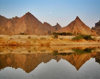
Figure 1.9 Nari Guage
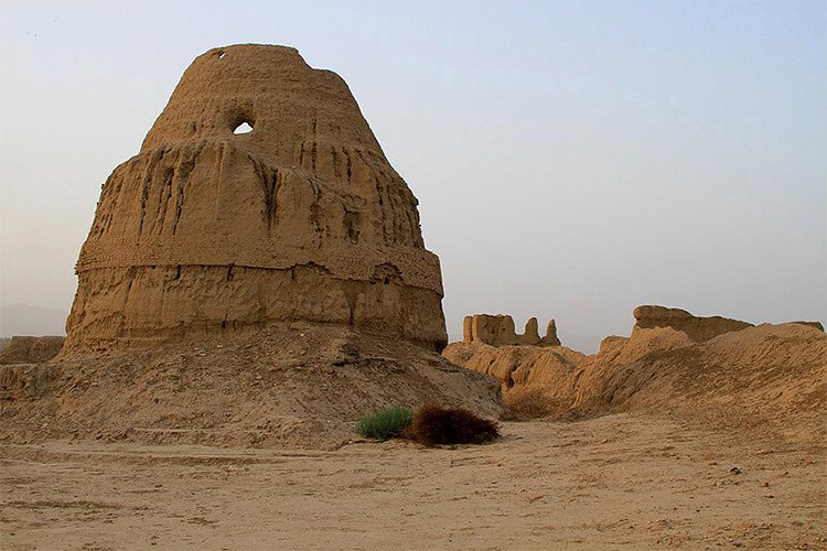
Figure 1.10 Mir Chakar Khan Rind’s Fort
Topography of Sibi District
The Sibi district is located at the apex of the Kachhi Plain[1] and thus, consists mostly of a level plain locally known as pat. This pat is extremely low in elevation, as no part of it is higher than 152 m above mean sea level.
The rest of the district is mountainous. The mountains rise in a series of terraces from the lower hills of the Suleiman Range. These hills include Zen (1,105 m) in Bugti Country, and Bambor (1,490 m) and Dungan with Butur (about 1,829 m) in Marri Country. Northwestward, the mountains stretch to the watershed of the Central Brahvi Range in Zarghun and Khalifat, at a ground elevation of 3,566 m.
Mountain Passes; Sibi district
The Bolan Pass is located in the Central Brahui Range of mountains near the Afghan Border. Bolan Pass is the main entrance to Quetta and joins Punjab and Upper Sindh through the town of Sibi by road and by train. The Bolan Pass railway track was laid by the British and goes through 21 tunnels.
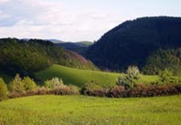
Figure 1.4 View of Sibi Mountains
Rivers, Streams, and Lakes; Sibi district
River Nari and its tributaries drain the district, and is one of the largest rivers of Balochistan. At its point of origin in Shahrig Tehsil, it does not have perennial water and is known as Babai. The main tributaries of the river are Mara River, Sehan and Watagan Rivers (the Sehan and Watagan have perennial waters); after the tributaries join the Nari River, the river is known as Loralai River. This river then passes the Zati Tangi gorge and from that point onward, it is referred to as Anambar. Later it is joined by the Lakhi Stream and further on by Narechi Stream, both with perennial waters, and the name is changed to Beji River. The Dada Stream and Sangan Stream from Harnai then join the river. The Beji River debouches into the Sibi Plain.
River Chakar or Talli River is another important river in the district; its tributaries include Chachar Ganda, Qaisar Ganda, Sultan Kot Ganda, and Tali Ganda. Phujal River, Kharo Nala, Lehri Nala, and Khajjak Rud are other streams/nalas of the district. All these nalas/streams originate from the mountains and remain dry most of the year but become raging torrents after rains.
Forests; Sibi district
The following table shows the area and type of forests in Sibi district (Balochistan Development Statistics 2018-19):
| Total Forest Area | 869,452 A | Scrub Forests | 63,876 A |
| Rangelands | 757,760 A | Coniferous Forests | 43,658 A |
| Irrigated Plantations | – A | Riverine Forests | 4,158 A |
| Coastal/Mangrove Forests | – |
Table 1.3 Sibi Forests
There are two types of forests in the district; these are the Sub-Tropical Semi-Evergreen Scrub Forest (Olive-Acacia type) and Tropical Desert Thorn Forests.[2] The flora of the former type of forests includes wild olives (Olea cuspidate) and Amritsar gum or phulai (Acacia modesta). The predominant shrubs are hop bush (Dodonaea), kankera (Gymnosporia spinosa), mazri palm (Nannorrhops ritcheana) and ber (Zizyphus nummularia). The flora of the latter type of forests includes vann (Salvadora oleoides), maru (Maerua crassifolia), karir (Capparis decidua) and kikri (Acacia jacquemontii).
Some of the forests of Sibi district include Dehpal Forest, Gulushehar Forest, Abdul Khaili Forest, Nari Bank Forest, Lehri Forest, Talli Forest, Nam Kach Forest, Nam Tangi Forest, Dingloeghar Forest, Tangisar Forest, Chasnak Forest, and Pan Chuman Forest.
Soils of Sibi district
The soils of the pat area are alluvial soils formed by the clay deposited by the Rivers Bolan, Nari, and other hill torrents.
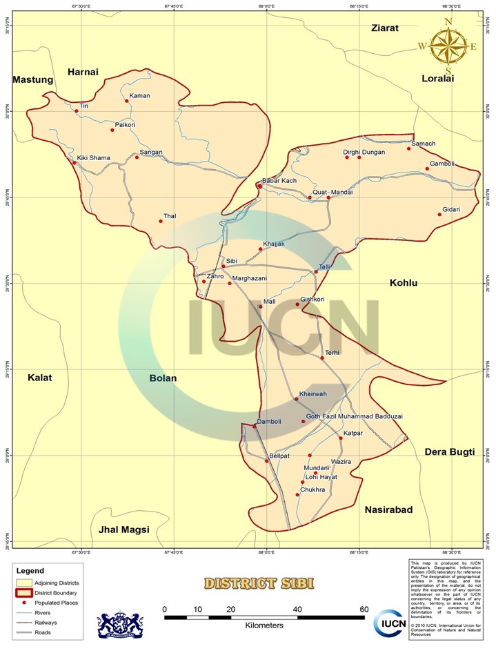
Figure 1.5 Sibi District GIS Map, IUCN
Climate of Sibi district
The climate of the district is arid and hot. The plains of Sibi are extremely hot, and in fact, Sibi town is considered to be the hottest place in Pakistan. The district is situated outside the Monsoon area. Rainfall is, thus, scanty and irregular. The summer season starts in April and lasts till mid-November. June is the hottest month, with mean maximum and minimum temperatures ranging between 31 °C and 46 °C. June temperatures have reached 50 °C and sometimes more as well in some years. Winter is from November to March. January is the coldest month, with mean maximum and minimum temperatures staying between 5 °C and 23 °C.
Mean annual rainfall in the district is 50 mm.
Seismic Activity; Sibi district
According to Pakistan’s Seismic Zone Map, Sibi district belongs to Zone 3, which means moderate to high damage due to earthquakes.
[1] Taken from Sibi District Gazetteer text compiled by A. McConaghey
[2] Overview of Balochistan Forests and Wildlife by Forest Department, Balochistan
Population of Sibi District
The following table shows the population of the district as per 2017 Census:
| District |
Area km2 |
Population | Male% | Female% |
Urban % |
Growth Rate % | ||
| Sibi district | 5,304[1] | 253,618 | 52.5 | 47.5 | 30.8 | 1.45 | ||
| Sibi Tehsil | NA | 135,572 | ||||||
| Lehri Tehsil | NA | 118,046 | ||||||
Table 1.4 Sibi Population Statistics
Religions; Sibi district[2]
| Muslims | 96.8% |
| Christians | 0.6% |
| Hindus | 2.5% |
| Ahmadis | 0.1% |
| Schedule Castes | Negligible % |
| Others | Negligible % |
Table 1.5 Sibi Religions
Languages; Sibi district[3]
| Urdu | 2.7% |
| Punjabi | 5.6% |
| Sindhi | 20.4% |
| Pushto | 10.8% |
| Balochi | 44.5% |
| Seraiki | 8.2% |
| Others[4] | 7.4% |
Table 1.6 Sibi Languages
[1] Only Sibi Tehsil data is being reproduced here Kohlu and Naseerabad are no longer part of Sibi District
[2] Data for Sibi tehsil, 1998 census; 2017 Census Data has not been released yet.
[3] Data for Sibi tehsil, 1998 census; 2017 Census Data has not been released yet.
[4] these include Brahui etc
Economic Activity – Economic Infrastructure
Economic Activity; Sibi District
The main economic occupations of the district[1] include:
- Agriculture with its Allied Livestock Breeding & Fishing (26.1%)
- Community, Social & Personal Services (25%)
- Construction (19%)
- Electricity, Gas & Water (16%)
- Others (13.9%)
Land Use; Sibi district
The following table shows the land use statistics of Sibi district (Balochistan Development Statistics 2018-19):
| Total Area | 551,700 HA | Reported Area | 393,847 HA |
| Total Cultivated Area | 304,317 HA | Net Sown | 21,720 HA |
| Current Fallow | 282,597 HA | Uncultivated Area | 89,530 HA |
| Culturable Waste | 43,626 HA | Forest Area | 8,920 HA |
Table 1.7 Sibi Land Use Statistics
Agriculture; Sibi district
Sibi district belongs to the Southern Irrigated Plains Agro-Ecological Zone of Pakistan. Agriculture is the mainstay of the economy. The crops grown in the district include wheat, barley, rapeseed & mustard, masoor, rice, jowar, bajra, maize, sesanum, moong, moath, sugarcane, gram, cotton, sugarbeet, guar seed, linseed, sunflower, and indigo.
The fruits grown in the area include watermelon, musk melon, apple, apricot, grapes, peach, plum, pear, pomegranate, mangoes, citrus, ber, guava, loquat, chikoo, dates, and mulberry.
The vegetable crops include onions, garlic, potatoes, tomatoes, okra, tinda, spinach, turnip, cabbage, carrots, bitter gourd, pumpkins, cauliflower, peas, brinjal, cucumber, chilies, and coriander. Liquorice or mulaithi is also grown in the district.
Figure 1.6 Agricultural Fields in Luni, Sibi District
Livestock Breeding; Sibi district
Livestock breeding plays an important role in the economy and is a major source of cash income for most rural women. The following table shows the statistics of livestock according to the 2006 Census of Livestock (qtd. in Balochistan Development Statistics 2018-19) for Sibi and Harnai districts:
| Cattle | 54,709 Heads | Buffaloes | 6,133 Heads | Sheep | 200,946 Heads |
| Goats | 208,133 Heads | Camels | 1,866 Heads | Horses | 2,776 Heads |
| Mules | 52 Heads | Asses | 10,473 Heads |
Table 1.8 Sibi Livestock Statistics
The indigenous livestock breeds of the district include lohani cattle, bhagnari cattle, Harnai sheep, dumbi sheep, Balochi sheep, bibrik sheep, lehri goat, khorasani goat, piddie breed of donkey, and brahui camel. The sheep are mostly reared for their wool.
Poultry Farms; sibi district
There are 03 poultry farms in Sibi/ Harnai district.[2]
Fishing; Sibi district
Fish in the Nari River are found in the lower reaches, near the plains. Hence, very little commercial fishing activity is carried out in the district.
Bee Keeping’Api Culture; Sibi district
Though Sibi district is one of the most important horticultural areas of Balochistan, bee keeping is not utilized as an economic activity in the district.
Irrigation Network; Sibi district
Sibi district depends upon the Nari Canal for irrigation. A large area is irrigated through the spate or rod kohi irrigation system. Data on total area irrigated through spate irrigation is not available. The following table shows the mode of irrigation and area irrigated by it (Balochistan Development Statistics 2018-19):
| Total Irrigated Area | 36,679 HA | Private Canal Irrigated | – HA |
| Government Canals | 13,161 HA | Wells | – HA |
| Tube Wells | 18,204 HA | Karezes/Springs etc | 5,314 HA |
Table 1.11 Sibi Irrigation Statistics
There are no karezes in the district, and Shahrig Dam (on River Nari) is being built in the district.
Mining; Sibi district
There are large deposits of gypsum and anhydrite in the Spintangi area of Sibi district. Exploration for oil and gas is being undertaken by OGDCL, and gas reserves have recently been discovered.
Industry and Manufacturing; Sibi districy
Sibi district[3] has not been industrialized yet. The district is lacking in raw materials and in labour resources, which has contributed to industrial investors’ hesitation. The potential for industrialization can be improved with some investment in infrastructural developments.
At present, there are 5 industrial units operating in the district:
| Flour Mills | 1 Unit |
| Pole plant | 1 Unit |
| Leather | 1 Unit |
| Plaster of Paris | 1 Unit |
| Daal Unit | 1 Unit |
Table 1.9 Sibi Industries
Trade; Sibi district
There is no large scale trade being undertaken in the district.
Handicrafts; Sibi district
The handicrafts of the region consist of household items made with the leaves of the Mazri Palm. Other handicrafts are rugs made of goats’ hair, and sacks made of hides and skin (made and used for carrying water). Goldsmiths, carpentry, and pottery are also notable cottage industries. The district is well-known for Jok needlework, in which fine threads of various colors and shades are used.
[1] 1998 data including Harnai districct; 2017 Census Data has not been released yet.
[2] Table 17, Number of Commercial Poultry Farms and Number of Birds by Size of Flock
[3] Sibi District Profile 2011, P & D Department GoB with UNICEF
Economic Infrastructure; Sibi District
Roads are the most important means of transport, and form the backbone of the district’s economy. The district is connected with other parts of Pakistan through black topped roads, but most of the interior roads of the district (link roads) are shingle. The district is also linked with other parts of the country through the railway and an airport.
Road Statistics; Sibi district
According to the Balochistan Development Statistics 2018-19, the road statistics[1] of Sibi district are as follows:
| Total Roads | 989.0 km |
| High Type Roads | 707.0 km |
| Low Type Roads | 282.0 km |
Table 1.10 Sibi Road Statistics
Some of the important roads of the district include
- National Highway N-65 (Sukkar-Sibi-Saryab/Quetta) passes through the district
- Talli Road
- Khajjok Road
- Sibi-Kurak Road
- Loralai-Kot Mandai-Kachhi Road
- Road connecting Sibi to National Highway N-55
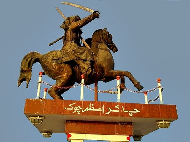
Figure 1.11 Mir Chakar Khan Rind Chowk, Sibi
Rail and Airways; Sibi district
There is a train track connecting Sukkur with Sibi. There are 2 railway stations in the district, with one at Sibi and the other at Khost.
There is a commercial airport at Sibi, called Sibi Airport.
Radio and Television; Sibi district
There are no TV or radio broadcasting stations in the district, but programs broadcast from Karachi, Quetta, and Islamabad as well as Zahidan (Iran), Kabul (Afghanistan) and the BBC can be heard throughout the district. TV can be viewed through cable.
Telecommunication; Sibi district
Sibi district is connected to other parts of Pakistan and the world via a modern digital telephone exchange. There are 04 telephone exchanges which provide 1,408 landlines, 409 wireless phones, and 1,302 broadband connections in the district.[2] Cellular phone services, with considerable coverage in all major towns are also available.
Post Offices; Sibi district
According to Balochistan Development Statistics 2018-19, there are a total of 04 post offices in the district. All the major courier companies provide their services in the district as well.
Electricity and Gas; Sibi district
Quetta Electric Supply Company (QESCO) looks after the supply and transmission of electricity to the district.
Banking/ Financial Services; Sibi district
The following banks all have their branches[3] in the district:
- Allied Bank Ltd.
- Habib Bank Ltd.
- KASB Bank Ltd.
- National Bank of Pakistan
- United Bank Ltd.
- Zarai Taraqiati Bank Ltd.
In all there are 10 branches of various conventional banks in the District, Islamic Banking is not available.
Educational Institutions; Sibi district
The following table shows the number of Educational Institutions in Sibi district as per Balochistan Development Statistics 2018-19:
| Institution | Boys/Girls | Institution | Boys/Girls |
| Primary Schools | 136/79 | Middle Schools | 16/13 |
| High Schools | 17/30 | Community Schools | 17 |
| Higher Secondary | -/- | Degree Colleges | 01/01 |
| Universities | – | Mosque Schools[4] | |
| Vocational Training Schools | 01 | Private Schools[5] | 04 |
Table 1.12 Sibi Educational Institutes
Healthcare Facilities; Sibi district
The following table shows the Government Health Care Institutions in Sibi district as per Balochistan Development Statistics 2018-19:
| Institution | No./beds | Institution | No./beds |
| Teaching Hospitals | – | Hospitals | 1/100 |
| Rural health Centers | 03/30 | Basic Health Units | 15/- |
| Dispensaries | 16/- | Mother Child Health Centers | 04/- |
| TB/Leprosy Clinics etc. | 01/- | Private Hospitals | 01/16 |
| Private Dispensaries | 01/- |
Table 1.13 Sibi Healthcare Institutes
Policing; Sibi district
The larger part of Sibi district is bifurcated into an “A” and a “B” area. The “A” area, comprising towns and highways, has a police force. A police station has a jurisdiction of maximum 8 km radius. A “B” area does not have a police force. All major law and order situations in the “B” area are dealt with by levies.
A levy is a conventional force for maintaining law and order and installed during British Rule. Levy members are recruited along tribal or clan lines. The levies fall under the direct command of the Deputy Commissioner (DC), with powers delegated to the assistant commissioners, and tehsildars. The levies in Sibi district are classified as Sepoy, Hawaldar, Dafeedar, Jameedar, and Risaldar. Every district in Balochistan has its own levies, named after the district. Recently, at the initiation of the DC administration, a new levy force has been recruited on district level, known as the Task Force. This Task Force is better trained and equipped with advanced weapons.
The policing of Sibi district is managed by the Regional Police Officer (RPO) Sibi. The RPO is assisted by 1 SubDivisional Police Officer (SDPO) stationed at Sibi. In all, there are 02 police stations[6] in the district.
[1] The data includes statistics for Harnai District also
[2] Balochistan Development Statistics 2018-19.
[3] List of Reporting Bank Branches 2013, provided by the State Bank of Pakistan
[4] included in Primary schools
[5] 2011 data
[6] Table no. 19.7 (a) Number of Police Stations by Division/District 2019 by Federal Bureau of Statistics.
Environment and Biodiversity; Sibi District
Environmental pollution, especially brown pollution, is almost negligible, as there is no industrial set up or heavy traffic in the district.
Flora and Fauna; Sibi district
Flora; Sibi district
The flora[1] of the district is scanty and consists of stunted scrub. Vegetation zones of the district consist mainly of the following categories:
- Farmlands, canal side, roadside: The common tree species in this zone are babul (Acacia nilotica), shisham (Dalbergia sissoo), ber (Zizyphus nummularia), farash (Tamarix aphylla), black siris (Albizzia lebbek), white siris (Albizzia procera), neem (Azadirachta indica), and Eucalyptus sp.
- Plains (Pats): The vegetation in pats is mainly comprised of shrubs like tamarisk (Tamarix troupii), shrubby seablite (Suaeda fruticosa), and karir (Capparis deciduas); the main grass species is blue panicum (Panicum antidotale)
- Rivers, Nullahs: The vegetation in rivers and nullahs mainly comprises of trees/ shrubs like ghaz (Tamarix dioica), poplar (Populus euphratica), and babul (Acacia nilotica); the main grasses are wild sugar cane (Saccharum munja), cattail (Typha angustifolia), and bansi (Panicum antidotale)
- Foothills and Mountains: The vegetation in the foothills includes trees/shrubs like kandi (Prosopis cineraria), peelu (Salvadora oleoides), ber (Zizyphus mauritiana), and aak (Calotropis procera), whereas, on hills adjoining the Harnai district, jangli zaitoon or wild olives (Olea ferruginea) and mazri (Nannorrhops ritchieana) are also present
Fauna; Sibi district
Mammals of the district include chinkara deer, wolf, common fox, Asiatic jackal, honey badger, grey mongoose, and wild boar.
Birds include the kala titar, bhora titar, bateir, houbara bustard, kingfisher, hud hud, common myna, rose-ringed parakeet, coppersmith, white-cheeked bulbul, a number of seasonal/migratory waterfowls, sparrows, and crows.
Reptiles include goh, sanda, Indian cobra, sangchoor, python, and soft shell river turtle.
Protected Areas and Endangered Fauna; Sibi district
There are no Wildlife Protected Areas in the district, nor are any of the historical buildings protected.
[1] Sibi District Profile 2011, by P&D Department, GoB with UNICEF