Share now
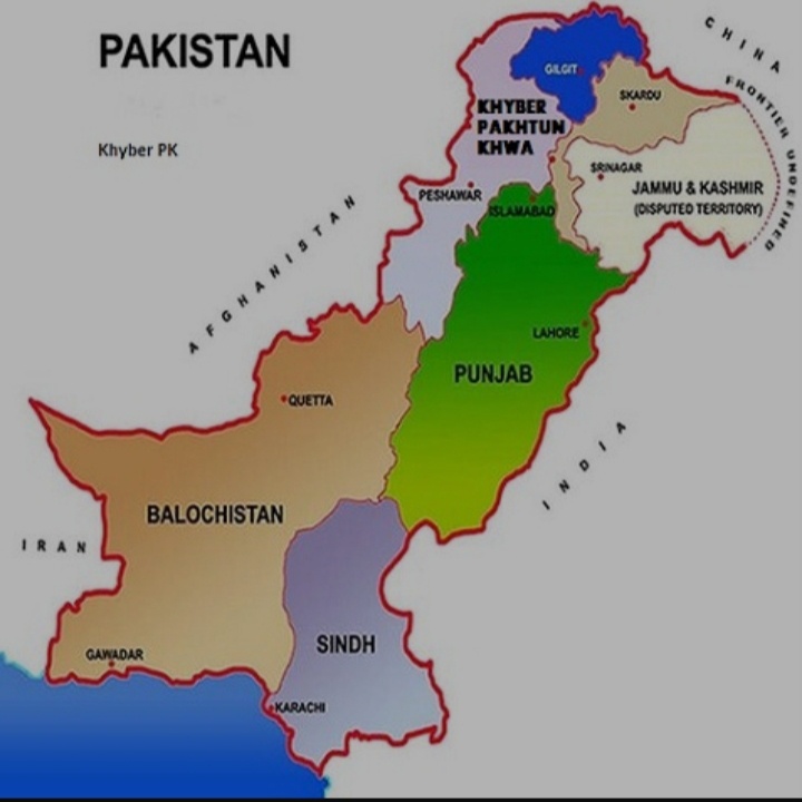
Map of Pakistan
Punjab Govt. Seal/ Coat of Arms

Punjab and its Districts

Flag of Punjab

Punjab Districts
- Islamabad Capital Territory Profile
- Lahore District Profile
- Attock District Profile
- Bahawalnagar District Profile
- Bahawalpur District Profile
- Bhakkar District Profile
- Chakwal District Profile
- Chiniot District Profile
- Dera Ghazi Khan District Profile
- Faisalabad District Profile
- Gujranwala District Profile
- Gujrat District Profile
- Hafizabad District Profile
- Jhang District Profile
- Jhelum District Profile
- Kasur District Profile
- Khanewal District Profile
- Khushab District Profile
- Layyah District Profile
- Lodhran District Profile
- Mandi Bahauddin District Profile
- Mianwali District Profile
- Multan District Profile
- Muzaffargarh District Profile
- Narowal District Profile
- Nankana Sahib District Profile
- Okara District Profile
- Pakpattan District Profile
- Rahimyar Khan District Profile
- Rajanpur District Profile
- Rawalpindi District Profile
- Sahiwal District Profile
- Sargodha District Profile
- SheikhupuraDistrict Profile
- Sialkot District Profile
- Toba Tek Singh District Profile
- Vehari District Profile
Also visit: Sindh, Balochistan, Khyber Pakhtunkhwa
Introduction – Punjab at a Glance
Introduction/Geographical Details Punjab Province
Punjab literally means “five waters” or “five rivers”; the province derives its name from the five rivers that flow through it: Sutlej, Beas, Ravi, Jhelum, and Chenab. These rivers all join up at Mithankot, Punjab before flowing into River Indus. The province is located between 27° 40Ꞌ to 34° 01Ꞌ north latitude and 69° 20Ꞌ to 75° 20Ꞌ east longitude. The province is bordered on the north by Khyber Pakhtunkhwa (KP) and Federal Capital Territory Islamabad, on the northeast by Azad Jammu and Kashmir, on both the east and south by India, on the south by Sindh and on the west by Balochistan as well as Federally Administered Tribal Areas (FATA) and KP. (FATA is now part of Khyber Pakhtunkhwa since 2018)
Punjab Province at a Glance
| Name of Province/ District | Punjab province | ||
| Capital/ Headquarter | Lahore city | ||
| Population[1] | 110,012,000 persons | ||
| Area[2] | 205,345 km2 | ||
| Population Density | 535.7 persons/ km2 | ||
| Population Growth Rate[3] | 2.1% | ||
| Male Population[4] | 50.8% | ||
| Female Population[5] | 49.2% | ||
| Urban Population[6] | 36.7% | ||
| Districts | 36 districts:
1. Attock 2. Bahawalnagar 3. Bahawalpur 4. Bhakkar 5. Chakwal 6. Chiniot 7. Dera Ghazi Khan 8. Faisalabad 9. Gujrat 10. Gujranwala 11. Hafizabad 12. Jhang 13. Jhelum 14. Kasur 15. Khushab 16. Khanewal 17. Lahore 18. Layyah 19. Lodhran 20. Mandi Bahauddin 21. Mianwali 22. Multan 23. Muzaffargarh 24. Nankana Sahib 25. Narowal 26. Okara 27. Pakpattan 28. Rahim Yar Khan 29. Rajanpur 30. Rawalpindi 31. Sahiwal 32. Sargodha 33. Sheikhupura 34. Sialkot 35. Toba Tek Singh 36. Vehari. |
||
| Main Towns | Lahore, Gujrat, Faisalabad, Multan, Bahawalpur, Jhang, Okara, Rawalpindi, Sargodha, Sialkot, Sheikhupura, Khushab, Raiwind, Mianwali Attock, Fatehjang, Jhelum, Sahiwal, Dera Ghazi Khan, Gujranwala, Muzaffargarh, Kalabagh, Sargodha, Kasur, Wah Cantonment, Chiniot, Khanewal, Wazirabad, Chakwal, Hasan Abdal, and Kharian. | ||
| Literacy Rate[7] | 64.7% | ||
| Male Literacy Rate[8] | 72.2% | ||
| Female Literacy Rate[9] | 57.4% | ||
| Major Economic Activity[10]
|
Agriculture | 40.0% | |
| Mining & Quarrying | 0.04% | ||
| Manufacture | 17.7% | ||
| Electricity, Gas & Water | 0.3% | ||
| Construction | 7.0% | ||
| Wholesale/Retail Trade, Hotel/Restaurant | 14.2% | ||
| Transport Storage & Communication | 4.9% | ||
| Financing, Real Estate, Insurance | 2.1% | ||
| Community, Social & Personal Services | 13.8% | ||
| Main Crops | Wheat, rice, sugarcane, cotton, maize, moong, mash, masoor and other lentils/ pulses, bajra, jowar (sorghum), guar seed, castor seed, sunn hemp, groundnut, sesanum, fodder, rapeseed & mustard, millet, tobacco, barley, gram, safflower, canola, linseed, jute, and sugar beet. | ||
| Major Fruits | Citrus, mango, banana, apple, pomegranate, guava, dates, apricot, peach, pear, plum, almond, jaamun, leechee, phalsa, walnut, ber, loquat, mulberry, melons, and watermelon. | ||
| Major Vegetables | Okra, tinda, brinjal, bitter gourd, bottle gourd, pumpkin, turnip, carrots, spinach, tomatoes, cauliflower, cabbage, sweet potato, and radish. | ||
| Forests (area)[11] | 673,000 HA[12] | ||
| Total Black Topped Roads[13] | 87,419 km | ||
| National Highways[14] | 2,062 km | ||
| Motorways[15] | 443 km | ||
| Provincial Highways[16] | 81,540 km | ||
| Sugar Cess[17] Roads[18] | 3,374 km | ||
| Electricity Generation[19] | Total Hydro Electricity Generation | 1,802 MW | |
| Total Thermal Power Generation | 12,191 MW | ||
| Nuclear Power | 1,330 MW | ||
| Renewable Energy +Bagasse | 914 MW | ||
| No. of Tel. Exchanges[20] | More than 9 million land line phone subscribers, and more than 82.8 million cellular phone subscribers | ||
| Industrial Zones[21] | 24 Industrial Estates housing more than 70,000 industrial
Units and more than 40,000 small and medium size industrial units. |
||
| Major Industry | Textile, cotton ginning and yarn, sports goods, electric fans, woolen textile, leather tanning, footwear, fabricated metal products, paper & paper board, fertilizers, cement, motor vehicles, bicycles, diesel engines, surgical instruments, and washing machines | ||
| Household Size[22] | 6.3 persons per house | ||
| Houses with Piped Water Inside[23] | 69.4% | ||
| Houses with Electricity[24] | 95% | ||
Table 1.1 Punjab Province at a Glance
[1] 2017 Census
[2] 2017 Census
[3] 2017 Census
[4] 2017 Census.
[5] 2017 Census.
[6] 2017 Census.
[7] Pakistan Economic Survey 2018-19
[8] Pakistan Economic Survey 2018-19
[9] Pakistan Economic Survey 2018-19
[10] Labour Force Survey Pakistan 2017-18
[11] Punjab Development Statistics 2017-18
[12] Land Utilization Statistics report 482,000 HA under Forests.
[13] Punjab Development Statistics 2017-18
[14] Punjab Development Statistics 2017-18
[15] Punjab Development Statistics 2017-18
[16] Punjab Development Statistics 2017-18
[17] Sugar Cess roads are roads specifically constructed to provide access to sugar industry (Cess means sugar cane development)
[18] Punjab Development Statistics 2017-18
[19] State of Industry Report 2019, by National Power Regulatory Authority.
[20] 2019 Statistical Pocket Book of Punjab.
[21] Pakistan Investment Guide, Punjab 2013
[22] Multiple Indicator Cluster Survey Punjab 2017-18 (MICS)
[23] Pakistan Social & Living Mensurent Survey 2013-14 (PASLM) (latest Available)
[24] PSLM