Share now
Map of Balochistan

Map of Panjgur District

Balochistan Districts
- Quetta District Profile
- Awaran district Profile
- Barkhan District Profile
- Bolan District Profile
- Chagai District Profile
- Dera Bugti District Profile
- Gwadar District Profile
- Harnai District Profile
- Jaffarabad District Profile
- Jhal Magsi District Profile
- Kalat District Profile
- Kech District Profile
- Kharan District Profile
- Khuzdar District Profile
- Killa Abdullah District Profile
- Killa Saifullah District Profile
- Kohlu District Profile
- Lasbela District Profile
- Loralai District Profile
- Mastung District Profile
- Musakhel District Profile
- Nasirabad District Profile
- Nushki District Profile
- Panjgur District Profile
- Pishin District Profile
- Sherani District Profile
- Sibi District Profile
- Washuk District Profile
- Zhob District Profile
- Ziarat District Profile
Also visit: Sindh, Punjab, Khyber Pakhtunkhwa
Introduction/ Geographical Details; Panjgur District
The district is located between 26° 08Ꞌ 54” to 27° 17Ꞌ 55” north latitudes, and 63° 04Ꞌ 50” to 65° 20Ꞌ 11” east longitudes. It is bounded on the north by Kharan and Washuk districts, on the southeast by Awaran district, on the south by Kech district, and on the west by Iran.
The word Panjgur is a combination of two words: Panch (five) and gor (grave). Thus, the word Panjgur means five graves. It is said that five saints, believed to be companions of Hazrat Omar Farooq[1] had arrived in the region with the Arab army in 640 AD; it is believed that they were buried in this region, which is why it is called Panjgur.
Panjgur District at a Glance
| Name of District | Panjgur District | |
| Headquarters | Chitkan Town | |
| Population[2] | 316,385 persons | |
| Area[3] | 16,891 km2 | |
| Population Density[4] | 18.0 persons/ km2 | |
| Growth Rate[5] | 1.6% | |
| Male Population[6] | 52.7% | |
| Female Population[7] | 47.3% | |
| Urban Population[8] | 25.4% | |
| Administrative Units | 02 Tehsils:
1. Panjgur Tehsil 2. Gowargo Tehsil |
|
| Main Towns | Tasp, Paroom, Washbood, Gramkhan, Kudabadan, Surdoo, Chitkan, Taroffice, Sarikoran, Bonistan, Ihrap, Sarekalat, Isaai, and Surdhoo | |
| Literacy Rate[9] | 43.0% | |
| Male Literacy Rate[10] | 65.0% | |
| Female Literacy Rate[11] | 15.0% | |
| Major Economic Activity[12] | Agriculture with its Allied Livestock Breeding and Fishing/ Hunting | 53.8%
|
| Construction | 18.5% | |
| Community, Social & Personal Services | 12.7% | |
| Wholesale, Retail & Hotel/Restaurant | 4% | |
| Electricity Gas & Water | 3.9 | |
| Others | 7.2% | |
| Main Crops | Wheat, barley, cumin, masoor, jowar, bajra, maize, moong, moath, cotton, rice, and fodder | |
| Major Fruits | Almonds, apples, grapes, peach, pomegranate, plum, mangoes, guava, dates, watermelon, musk melon, sarda, and fig | |
| Major Vegetables | Tomatoes, okra, radish, spinach, turnip, broad beans, cabbage, carrots, pumpkins, peas, brinjal, luffa, cucumber, chilies, garlic, coriander, and tinda | |
| Forest Area[13] | – HA[14] | |
| Black Topped Roads[15] | 447.0 km | |
| Shingle Roads[16] | 1,492.0 km | |
| Electricity[17] | Quetta Electric Supply Company (QESCO) looks after supply of electricity to the district; a Gas Turbine Power Generation Unit produces 39 MW of electricity in the district, and is owned by WAPDA | |
| Telephone Exchanges[18] | 04, telephone exchanges with 1,140 landlines, 1,357 wireless phones, and 1,041 broadband connections | |
| Industrial Zones[19] | No Industrial Estate | |
| Major Industry[20] | No Industry | |
| Household Size[21] | 6.2 persons per house | |
| Houses with Piped Water[22] | 71.4% | |
| Houses with Electricity[23] | 5.2% | |
Table 1.1 Panjgur District at a Glance
[1] Umar Farooq (RA) was a companion of the Prophet Muhammad (PBUH) and the Third Caliph of the Islamic Empire
[2] 2017 Census
[3] 1998 Census
[4] 2017 Census
[5] 2017 Census
[6] 2017 Census
[7] 2017 Census
[8] 2017 Census
[9] Pakistan Social & Living Measurement Survey 2014-15 (PSLM) does not contain the data for Panjgur district because of Law & Order situation (which restricted access for surveyors); this data is from PSLM 2011-2012
[10] PSLM 2011-2012
[11] PSLM 2011-2012
[12] 1998 Census; 2017 Census Data has not been released yet.
[13] Balochistan Development Statistics 2018-19
[14] Land Utilization Statistics report 0 HA forests.
[15] Balochistan Development Statistics 2018-19
[16] Balochistan Development Statistics 2018-19
[17] Balochistan Development Statistics 2018-19
[18] Balochistan Development Statistics 2018-19
[19] District Development Profile, 2011 Panjgur District, P&D GoB, with UNICEF
[20] District Development Profile, 2011 Panjgur District, P&D GoB, with UNICEF
[21] 1998 Census; 2017 Census Data has not been released yet.
[22] 1998 Census; 2017 Census Data has not been released yet.
[23] 1998 Census; 2017 Census Data has not been released yet.
Brief History – Governmental Structure – Administrative Divisions – Historical/ Heritage Sites and Tourism/ Picnic Spots
Brief History of Panjgur District
Panjgur is located in the Makran region of Balochistan. Makran was a Princely State in subsidiary alliance with British India, which then became a Princely State in Pakistan and remained such till 1955 when all Princely States were abolished under the One Unit Policy. Over the years, the area has been divided into 3 districts: Gwadar, Kech/ Turbat and Panjgur. The Makran State did not include the enclave of Gwadar, which was under Oman rule till 1958.
Makran[1] was an important route between the Middle East and India, and the region’s folklore and oral history dates back to ancient times. One such story recounts the time of prophet Dawood, when people committed suicide by entombing themselves in small cairns (known as dambi in the local Baloch parlance) to escape famine. The area is said to have been ruled by the Iranian King Kaus followed by Afrasiab of Turan and then by Kai Khusrau, also an Iranian. Kai Khusrau is credited with developing agriculture in the region.
The region was ruled by a long list of rulers, including Lehrasp, Gushtasp, Bahman, Huma, and Darab, till the year 325 BC, when an army contingent of Alexander the Great passed through Makran, (then known as Gadrosia) on its way from India to Macedonia. At that time, the areas belonging to Panjgur were known as Kanazbun, and the region supplied food and horses to the Greek army. Greek historian Arrian has commented on land, environment and people of the area. He found the climate to be too hot, the soil sandy and the land inadequate for human settlement. After Alexander’s death, the area was ruled by Seleucus Nicator, one of Alexander’s Generals, who lost it to Chandragupta Maurya in 303 BC.
There are no further historical accounts about the Panjgur region, until Shermah, the Malik of Hind, gave the country of Sindh and Makran as part of her dowry to his daughter on her marriage to Bahram-i-Gor (404 to 427 AD).[2] After that, an authentic account of the area’s history is again lost, but an account is later found in 643 AD, when, during the reign of Khalifa Umar bin Khatab (second Khalifa-e-Rashidoon), the Islamic army, under the command of Abdullah Ibn Uthban, conquered Makran. Abdullah Ibn Uthban wrote to Caliph Umar about the aridity of the land. Arabs ruled the land successively; in 711 AD Muhammad bin Qasim passed through the area on his way to Sindh; at that time, Makran was part of Sindh.
Although many invaders, like the Seljuks, the Ghaznivids, the Ghorids, the Mongols and the Portuguese conquered the land, they did not stay or exercise their authority in the region. The local rulers, which included the Hoths, Rinds, Maliks, Buledais, and the Gichkis, continued to rule the area.
Two regimes of local rulers, of Buledais and Gichkis, are notable. The Buledais gained power with the rise of the Zikri sect (a sect of Islam). These rulers are said to be connected with the rulers of Maskat (Muscat) and were called Buledais in reference to the valley of Buleda where they lived. The Buledai ruled the area for more than a century, up to the year 1740. In the last few years of their regime they embraced the Sunni sect of Islam. The Zikri followers joined hands with the Gichkis, who were also Zikri by faith. After a complete takeover of the area, the older[3] branch of the Gichkis took hold of Panjgur. The family feuds and internal dissension among the Gichkis resulted in 9 (either partially or fully successful) expeditions by Mir Nasir Khan I (ruler of Kalat from 1749-94). Panjgur was the target of his first expedition. It is said that the main motive behind all these expeditions was to eliminate the Zikris as he belonged to an anti-Zikri sect of Islam. These expeditions resulted in the division of revenues between the Khan and Gichkis. Mir Mehrab Khan, successor of Mir Nasir Khan I, appointed Faqir Muhammad Bizenjo as his naib (assistant) in the area to maintain his stronghold. This naib represented the Khan in the area for more than 40 years. After Bizenjo, other local and influential people were appointed as naibs of the Khan due to ineffectiveness of non-local naibs. However, even though the Khan of Kalat appointed local naibs, the Gichkis managed to gain an upper hand and became Hakims (rulers) of the area with foreign support and the fragmented local population of the Baloch.
The First Afghan War (1838-39) directed the attention of the British to the area. Major Goldsmith visited the area in 1861, and an Assistant Political Agent was appointed in Gwadar in 1863. In 1882, Mir Gajian, Sardar (Chief) of Panjgur and the Khan’s naib, was killed by Mir Nauroz Khan Nausherwani, the Chief of Kharan. The internal feuds continued for years, and in 1903, an Assistant Political Agent was appointed to the area by the British, with his headquarters at Panjgur. He was also an ex-officio Commandant of the Makran Levy Corps, appointed to enforce the Khan of Kalat’s authority and to maintain peace. Panjgur remained under the control of the Khan of Kalat during the colonial era; however, the British rulers exercised influence in the affairs of the region.
After Partition in 1947, Makran joined the Balochistan States Union in early 1949 along with Kalat, Lasbela, and Kharan. In October 1955, Makran was given the status of a district of the West Pakistan Province. On 1st July 1970, when One Unit was dissolved, and Balochistan gained the status of a province, Makran became one of its districts. On 1st July 1977, Makran was declared a division and was divided into 3 districts: Panjgur, Turbat (renamed Kech) and Gwadar. Panjgur was, thus, notified as a district on July 1, 1977.
There are 2 predominant etymological explanations for the word Panjgur. According to one, the word is a combination of two Balochi words: panch (five), and gor (grave), as described in the Introduction of this chapter. According to local legend, the original name was Panchnur (five lights) in reference to the same five saints.
The second explanation is a geographical one: Panjgur is said to be a descriptive term for the land of panch (five) kor (stream). The word panchkor evolved, with the passage of time, to Panjgur.
There is no city/town or village in the district named Panjgur. The district headquarters are stationed at Chitkan, which is, to some extent, a central place and in close vicinity to 11 other villages within a radius of 3-4 km alongside the bank of Rakhshan River.
Governmental Structure; Panjgur District
At the Federal level, Panjgur district is allocated a set number of representatives in both the National Assembly and the Provincial Assembly:
- Number of seats in the National Assembly[4] 1
- Number of seats in the Provincial Assembly 2
Under the Local Government Act 2010, Amended in 2011, Panjgur district has 1 District Council with 21 Union Councils. It has 2 Municipal Committees as follows:
- Chitkan
- Tasp
Each Union Council is represented by 1 member in the District Council. In addition, there is special representation of women (33%), and of workers and peasants (5% each).
Administrative Divisions; Panjgur District
Panjgur district has a total area of 16,891 km2 and is divided into 2 tehsils and 16 Union Councils as follows:
| Panjgur Tehsil | 11 Union Councils |
| Gowargo Tehsil | 05 Union Councils |
Table 1.2 Panjgur Administrative Divisions
[1] Most of the history of the district has been extracted from 2 sources: Makran and Kharan District Gazetteer 1908 and Panjgur District Development Profile 2011 by P&D Balochistan, in collaboration with UNICEF
[2] Bahram-i-Gor was the 14th king of the Sassanian Empire
[3] Balochistan District Gazetteer Series Makran District Gazetteer 1906 p.49
[4] This seat is shared by Kharan district
Historical/ Heritage Sites and Tourism/ Picnic Spots; Panjgur District
There are no tourist attractions in the district. Infrastructure for development of tourism is non-existent, but there is potential for development.
There are a few archeological sites of interest in the district, but these are not on the Government of Pakistan’s list of Protected Heritage Buildings/Sites. These are:
- Fort of Nawab Habibullah Khan of Kharan at Khudabadan: Nawab Habibullah Khan was the last ruler of Kharan; in 1952, he was deprived of his royal privileges and Kharan was made a district. Azad Khan, his forefather, had built a total of 11 forts.The two biggest were the Fort of Karez and the Fort of Kharan City. The forts of Noruz Kalat, Gazi, Gorjok, Jhalawan, and Khudabadan (Panjgur) were smaller and designed to contain a small band of troops. The Khudabadan fort is made of mud and small red bricks
- Kuhna Kalat: This is also known as the old court of the Khan of Kalat, and is made of large red baked bricks
- Tomb of Malik Asa and other tombs: These tombs were built of burnt brick with panels of various stamped and appliqué designs on the bricks, which consist of animals, humans, and mythological figures. These tombs are as famous as the Nikoderian tombs[1] and are the Towers of Silence[2] of the Zoroastrians
- Band-e-Gillar: This is an ancient dam on River Rakhshan near Kuhna Kalat
- Shrine of Shah Qalander: The shrine is made of glazed tiles with human and animal figures indicating pre-Islamic pattern or motifs
- Shrine of Pir Umar
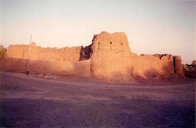
Figure 1.10 Mud Fort, Khudabadan, Panjgur
[1] These are ancient burial grounds of the Zoroastrians dating back to 800 AD. This site spreads between the towns of Nag (in Kharan district) and Panjgur town.
[2] Towers of Silence are the towers for the ritual last rites of the Zoroastrian faith.
Topography of Panjgur District
Geographically, the district is mountainous with the direction of mountains from northeast to southwest. It is located between 2 important mountain ranges: the Siahan Range in the north, which separates it from Kharan district, and the Central Makran Range in the south, which separates it from Kech district. In between these two ranges are the Rakhshan Raghoi Hills.
The central part of the district is known as Rakhshan plain, which is a vast plain with an average elevation of 600 to 1,000 m above sea level. The Zangi Lak Hills separate Rakhshan plains/ basin from the Raghai Valley. The highest peak is Zangi Lak which is 1,657 m above sea level.
The district’s characteristic feature is its closed drainage systems, locally known as kaps, which occur in Parome and Balgattar. The principal of these kaps, near Parome, is about 20 km in diameter. Ordinarily, these are dry, but after heavy rain, the water rushing from the surrounding hills forms a shallow lake. After evaporation of the water, the lakebed is covered with a thin layer of salt which looks like an expanse of dazzling whiteness. Salt obtained from the kaps contains a high percentage of Sodium Chloride.
General elevation of the district ranges from 900 to 1,350 m above mean sea level
Rivers, Streams, and Lakes; Panjgur district
The main river in the district is the Rakhshan, which enters from the northeast and flows southwest. The only other running stream is Tank, which flows along the northeastern boundary. The Gowargo, Jawan Gazz, Newankor, and Asken are the main tributaries of River Rakhshan. After collecting waters from the tributaries, the main river turns northwards and joins Mashkel River on the Iranian side. The Gichki and Raghai are tributaries of River Tank.
There are a large number of streams/ hill torrents that generate in the hills and flow during rainy season; some of these are Janat Kaur, Moran Kaur, and Dumban Kaur.
Panjgur Lake and Isa-Ab Lake are two important lakes of the district.
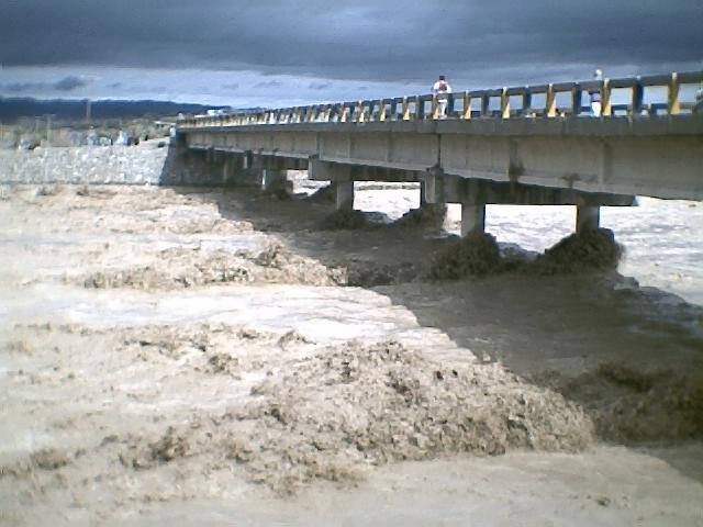
Figure 1.4 Rakhshan River, Panjgur
Forests; Panjgur district
The district has remained an inaccessible and remote part of southern Balochistan till the recent past. It is located in the Dry Tropical Thorn and Sand Dunes Scrub vegetation zone. Such forests occur generally on free draining dry sites. Geographically, the district is located in Siahan Range of the Makran region, and reflects vegetation generally found in southern Balochistan. At present, no area has been specified as notified forestland.
The characteristic species are kahur or jand (Prosopis spicigera), karag or fig (Ficus bengalensis), chigirid or kikri or benth (Accacia jacquemontii), kabbar or peelu (Salvadora oleoides), gawanik or sufaid sanbhalu (Vitex trifoliate), taghaz or black saxaul (Haloxylon ammodendron), harmal or Syrian rue (Peganum harmala), date palm (Phoenix dactylifera), kander or camel thorn (Alhagi camelorum), sodom apple or aak (Calotropis procera), harmal (Rhazya stricta), burako or cudweed (Filago arvensis), milk broom (Periploca aphylla), love grass or cane grass (Eragrostis cynosuroides), mazri palm or pish (Nannorhops ritchiana), karir (Capparis aphylla), phog or abal (Calligonum comosum), purchinik or blue mint bush (Ziziphora clinopodioides), fodder eaten by sheep and not identified (Shirakah, Simsur), and sohrpul (Gaillonia eriantha), are generally spread almost all over the entire district. Similarly, French tamarisk or ghaz or kiri (Tamarix galica), anab (Tamarix macrocarpa) and other large shrub species are also present sparsely. Among grasses are included gandil or granachin or goose grass (Eleusine flagellifera), gomaz or round headed leek (Allium sphaerocephalum), indarkah or desert horse pursilane (Trianthema pentandra), sweet fenugreek (Trigonella stocksii), kash or kan grass (Saccharum spontaneum), dill or sweet cane (Saccharum ciliare), and barshonk or karley rose (Pennisetum dichotomum).
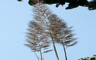
Figure 1.5 Saccharum Grass (Used for thatching roof etc)
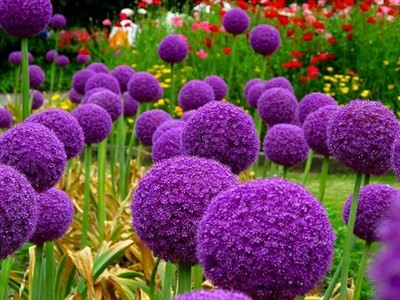
Figure 1.6 Allium Sphaerocephalum Grass
Soils; Panjgur District
The soils in Panjgur district are of 2 types. The western part of the district consists of alluvial soil while the eastern part has desert soil (the eastern part of the district belongs to the Kharan Desert). In the west, wide basins bounded by hills and mountains are covered with alluvial soils. The foothills are covered with talus cones[1] and alluvial fans, and are generally composed of gravel, pebbles, and sands. Beyond the foothills, the valley floors are covered with silt and loam.
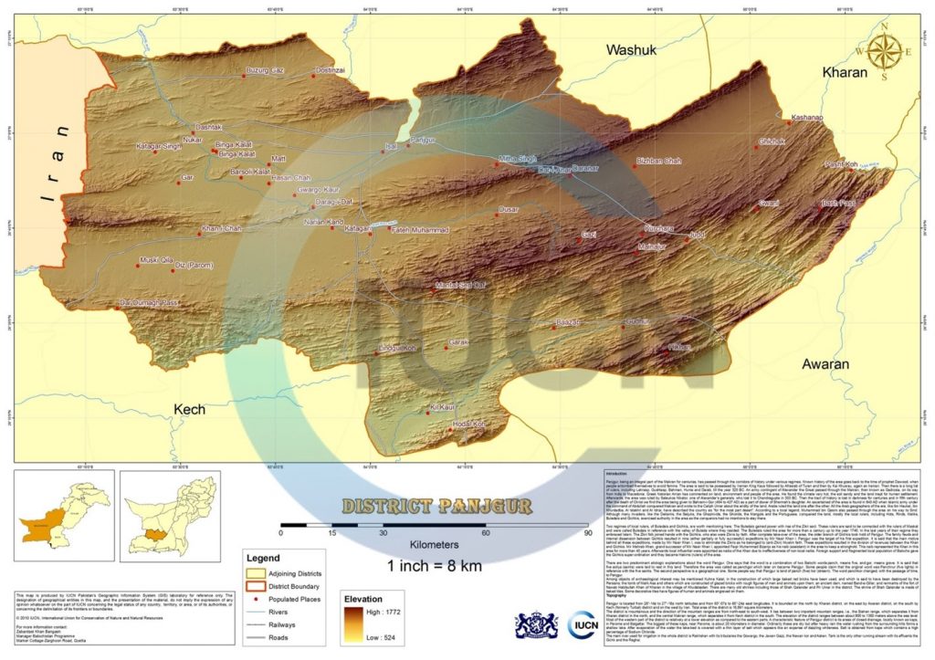
Figure 1.7 IUCN GIS Map District Panjgur
Climate; Panjgur district
The climate of the district is hot in the summer and very cold in the winter. The summer season starts in May and continues till October. The winter season starts in November and goes up to April. June is the hottest month, with mean maximum and minimum temperatures of about 39 °C and 24 °C respectively. January is the coldest month, with mean maximum and minimum temperatures of 17 °C and 4 °C respectively. During winter, a cold wind called gorich blows from the northwest.
The area is outside the Monsoon current, and thus, rainfall is scanty and uncertain. Most of the rainfall is during the winter season. Mean annual rainfall recorded at Panjgur station is 110 mm.
Seismic Activity; Panjgur district
The district belongs to Zone 2B of the Seismic Zone Map of Pakistan which means minor to moderate damage due to earthquakes.
[1] Talus cones are steep (e.g., 30-40º), cone-shaped landform at the base of a cliff or escarpment composed of poorly sorted rock and soil debris.
Population; Panjgur District
The following table shows the population of Panjgur district as per 2017 Census:
| District/Tehsil | Area
km2 |
Population | Male% | Female% | Urban % | Growth Rate % | ||
| Panjgur District | 16,891 | 316,385 | 52.7 | 47.3 | 25.4 | 1.6 | ||
| Panjgur Tehsil | 16,891 | 260,852 | ||||||
| Gowargo Tehsil | Part of Panjgur Tehsil | 55,533 | ||||||
Table 1.3 Panjgur Population Statistics
Religions; Panjgur district[1]
| Muslims | 99.3% |
| Christians | Negligible % |
| Hindus | Negligible % |
| Ahmadis | 0.1% |
| Scheduled Castes | 0.2% |
| Others | 0.4% |
Table 1.4 Panjgur Religions
Languages; Panjgur district[2]
| Urdu | 0.1% |
| Punjabi | 0.2% |
| Sindhi | Negligible % |
| Pushto | Negligible % |
| Balochi | 99.6% |
| Seraiki | Negligible % |
| Others[3] | 0.1% |
Table 1.5 Panjgur Languages
[1] 1998 Census; 2017 Census Data has not been released yet.
[2] 1998 Census; 2017 Census Data has not been released yet.
[3] Includes Brahvi language
Economic Activity – Economic Infrastructure
Economic Activity; Panjgur District
The economic occupations of the district are[1]:
- Agriculture with its Allied Livestock Breeding & Fishing/Hunting (53.8%)
- Construction (18.5%)
- Community, Social & Personal Services (12.7%)
- Whole Sale, Retail & Hotel/Restaurant (4%)
- Electricity Gas & Water (3.9%)
- Others (7.2%)
[1] 1998 Census; 2017 Census Data has not been released yet.
Land Use; Panjgur district
The following table shows the main land use statistics of the district as per Balochistan Development Statistics 2018-19:
| Total Area | 1,689,100 HA | Reported Area | 673,228 HA |
| Total Cultivated Area | 37,584 HA | Net Sown | 26,218 HA |
| Current Fallow | 11,366 HA | Total Uncultivated Area | 635,644 HA |
| Culturable Waste | 40,767 HA | Forest Area | – HA |
Table 1.6 Panjgur Land Use Statistics
Agriculture; Panjgur district
The district belongs to the Sub-Tropical Agro-Ecological Zone; it falls under the Dry Western Plateau Agro-Ecological Zone of Pakistan, and Zone I of Balochistan. The main crops of the district include wheat, barley, cumin, masoor, jowar, bajra, maize, moong, moath, cotton, rice, and fodder.
Fruits include almonds, apples, grapes, peach, pomegranate, plum, mangoes, guava, dates, watermelon, musk melon, sarda, and fig. Tomatoes, okra, radish, spinach, turnip, broad beans, cabbage, carrots, pumpkins, peas, brinjal, luffa, cucumber, chilies, garlic, coriander, and tinda are the vegetable produce of the district.
Livestock Breeding; Panjgur district
Livestock breeding is the second most important sector of the economy. It is the main source of income for nomadic families. The following table shows the position of the livestock population according to the 2006 Census of Livestock (qtd. in Balochistan Development Statistics 2018-19):
| Cattle | 22,508 Heads | Buffaloes | 49 Heads | Sheep | 91,032 Heads |
| Goats | 139,383 Heads | Camels | 8,074 Heads | Horses | 95 Heads |
| Mules | 08 Heads | Asses | 8,386 Heads |
Table 1.7 Panjgur Livestock Statistics
Indigenous livestock breeds of the district have been presumed to be the same as that of Chagai and the Kharan Desert Region, and include kharani camel, khurasani and morak goat, and rakhshani sheep.
Poultry Farms; Panjgur district
Data on number of poultry farms[1] in the district is not available.
Bee Keeping/Api Culture; Punjgur district
Bee keeping is not taken up as an economic activity in the district.
Fisheries; Panjgur district
Panjgur—while partly a land of mahikhoran (fish eaters)—is devoid of economically significant fisheries activity. Fish is imported, then, from Pasni, Gwadar, and Jiwani, and is consumed in large quantities.
[1] Table 17 Number of Commercial Poultry Farms and Number of Birds by Size of Flock
Irrigation Network; Panjgur district
The major source of irrigation in Panjgur is Kaurjo, a small water channel taken to fields from a pit dug into the bed of a perennial flow to obtain under-surface water. Other significant sources are tube wells, operated by diesel, and open surface wells from where water is taken out for irrigation with the help of diesel pumps. A small proportion of land is irrigated with karezes and springs, while the remaining is khushkaba or sailaba land, dependent on rainfall. The following table shows the mode of irrigation and area being irrigated by the mode (Balochistan Development Statistics 2018-19):
| Total Irrigated Area | 27,082 HA | Government Canals | – HA |
| Private Canals | – HA | Wells | 2,945 HA |
| Tube Wells | 22,553 HA | Karez/Spring/Others | 1,584 HA |
Table 1.9 Panjgur Irrigation Statistics
According to the Pakistan Water Gateway Website for Karezes in Balochistan, there are 188 karezes in the district, some[1] of which are Attaabad Karez, Niazabad Karez, Allahabad Karez, Faizabad Karez, Churro Karez, Pir Jhalag Karez, Soro Karez, and Kaur Jo Chummag Karez.
[1] For names of all Karezes in the district please visit http://waterinfo.net.pk/?q=karez
Manufacturing/ Industry; Panjgur district
There is no manufacturing industry in the district.
Mining; Panjgur district
The district area is mainly covered with sandstone, limestone, shale, and clay material. Antimony (in the area of Korkian, Padkash and Sabzab), and gold bearing quartz veins occur at different localities. Sulphur and salt are other minerals found in the region.
Oil and gas is being explored in the district.
Handicrafts; Panjgur district
Wooden furniture, embroidery work done by women, and mats and basket-making by using pish (dwarf palm or mazri palm leaves), are the major handicrafts of the district.
Economic Infrastructure; Panjgur District
In Panjgur, economic infrastructure and communication facilities are inadequate. The district has limited road linkages within the district as well as with other parts of the province. Most of the roads are shingle roads. Availability of electricity is limited and there is no gas supply. Postal, telephone, and banking facilities are available, though to a limited extent. There is no railway line in the district.
Road Statistics; Panjgur district
According to the Balochistan Development Statistics 2018-19, the road statistics of the district are as follows:
| Total Roads | 1,939.0 km |
| High Type Roads/black topped | 447.0 km |
| Low Type Roads/Shingle | 1,492.0 km |
Table 1.8 Panjgur Road Statistics
Some of the important roads of the district are:
- National Highway N-85 (Hoshab-Surab) passes through the district connecting Panjgur to Surab and Turbat
- Panjgur is connected to Iran through a link road connecting Highway 92 of Iran to Panjgur
- Road connecting Panjgur-Kharan
Rail and Airways; Panjgur district
There is no railway station in the district. The nearest railway stations to Panjgur are the railway stations located in Sibi district. The district has a commercial airport which caters to only domestic flights, called Panjgur Airport.
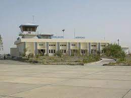
Figure 1.11 Panjgur Airport
Radio and Television; Panjgur district
Panjgur district has no radio station, but there is a TV booster. Moreover, cable TV is also available.
Telecommunications; Panjgur district
The district is connected to other parts of the country through telephone and telegraph. There are 04 telephone exchanges in Panjgur district which provide 1,140 landlines, 1357 wireless phones, and 1,041 broadband connections in the district (Balochistan Development Statistics 2018-19). Cellular phone companies also provide their services in the district.
Post Offices/ Courier Services; Panjgur district
There are 05 post offices[1] in the district, and most of the courier services provide services as well.
Banking/ Financial Institutions; Panjgur district
The following banks[2] all have their branches in the district:
- Allied Bank Ltd.
- Habib Bank Ltd.
- Muslim Commercial Bank Ltd.
- National Bank of Pakistan Ltd.
- United Bank Ltd.
- Zarai Taraqiati Bank Ltd.
In all there are 09 branches of various conventional banks and 02 branches of different Islamic banks in the District.
Electricity and Gas; Panjgur district
Quetta Electric Supply Company (QESCO) looks after the supply of electricity. WAPDA owns and operates a Gas Turbine Power Generation Plant in Panjgur, the total capacity of which is 39 MW. This has been added to the National Grid.
[1] Balochistan Development Statistics 2018-19
[2] List of Reporting Bank Branches 2019, provided by the State Bank of Pakistan
Educational Institutions; Panjgur district
The following table shows the number of primary, middle, secondary, and mosque schools in the district as per Balochistan Development Statistics 2018-19:
| Institution | Boys/Girls | Institution | Boys/Girls |
| Primary Schools | 183/132 | Middle Schools | 26/23 |
| High Schools | 22/15 | Community Schools | 22 |
| Higher Secondary | 01/01 | Degree Colleges | 01/01 |
| Universities | – | Mosque Schools[1] | |
| Vocational Training Schools | – | Private Schools[2] | 02 |
Table 1.10 Panjgur Educational Institutes
There is a Cadet College in the district.
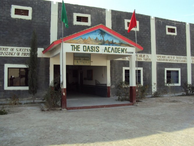
Figure 1.12 A Private School, Panjgur
Healthcare Facilities; Panjgur district
The following table shows the Government Health Care Institutions in Panjgur district as per Balochistan Development Statistics 2018-19:
| Institution | No./beds | Institution | No./beds |
| Teaching Hospitals | – | Hospitals | 01/36 |
| Rural Health Centers | 01/10 | Basic Health Units | 25/- |
| Dispensaries | 13/- | Mother Child Health Centers | 04/- |
| TB/Leprosy Clinics etc. | 01/- | Private Hospitals | 01/08 |
| Private Dispensaries | -/- |
Table 1.11 Panjgur Health Institutes
Policing; Panjgur district
For the purposes of administration, the district is divided into two areas: “A” and “B”. The urban area of Panjgur comes under “A” area, and the rest of the area of the district falls in “B” area. “A” area is controlled by a regular police force headed by the Deputy Superintendent of Police (DSP). This DSP is assisted by Station House Officer (SHO), Inspector Police, and other staff. “B” area is controlled by levies force. Levies are a conventional force to maintain law and order. In levies, men of different tribes are employed. The levies force comes under the direct control of the Deputy Commissioner (DC). Generally, the levies force is well equipped to deal with the law and order situation in the district.
The policing of Panjgur district is looked after by the Regional Police Officer (RPO) Makran. This RPO is assisted by one SubDivisional Police Officer (SDPO) stationed at Panjgur. In all, there is 05 police station[3] in the district.
[1] included in primary schools
[2] 2011 data
[3] Table no. 19.7 (a) Number of Police Stations by Division/District 2019 by Federal Bureau of Statistics
Environment and Bio Diversity; Panjgur District
The district is devoid of any industry, and only a few motor vehicles ply the roads, hence there is no brown pollution in the district, but non-disposal of solid waste and soil erosion due to wind are major environmental threats.
Flora and Fauna; Panjgur district
Flora; Panjgur district
There are 2 vegetation zones[1] in the district; these are
- Uphill Steep Cliffs: Fig or karag (Ficus bengalensis), chigirid or kikri or benth (Accacia jecquemontii), purchink or blue mint (Ziziphora clinopodioides), gandil or granachin or goose grass (Eleusine flagellifera), gomaz or round headed leek (Allium sphaerocephalum), indarkah or desert horse pursilane (Trianthema pentandra), and shimsh or sweet fenugreek (Trigonella stocksii)
- Foothills and Plains: kabbar or peelu (Salvadora oleoides), gawanik or sufaid sanbhalu (Vitex trifoliate), taghaz or black saxaul (Haloxylon ammodendron), Syrian rue or harmal (Peganum harmala), date palm (Phoenix dactylifera), kandar or camelthorn (Alhagi camelorum), sodom apple or aak (Calotropice procera), harmal (Rhazya stricta), burako or cudweed (Filago arvensis), Apo (a salsolaceous plant/ bush), milk broom (Periploca aphylla), love grass (Eragrostis cynosuroides), pish or mazri palm (Nannorhops ritchiana), karir (Caparis aphylla), phog or abal (Calligonum comosum), purchink or blue mint (Ziziphora clinopodioides), shirakah and simsur (fodder eaten by sheep, not identified), and sohrpul (Gaillonia eriantha), are generally spread almost over the entire district.
The district also has ghaz or French tamarisk or kiri (Tamarix galica), anab (Tamarix macrocarpa), kash or kan grass (Saccharum spontaneum), dil or sweet cane (Saccharum ciliare), drab or love grass (Eragrostis cynosuroides), barshonk or karley rose (Pennisetum dichotomum), sundum or beech grass (Epilacia ammophila), magher or salt bush (Atiplex dimorphostegium), and nadag or oil grass (Andropogon jwarancusa).
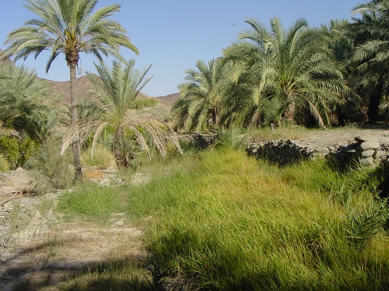
Figure 1.8 Date palms, Panjgur
Fauna; Panjgur district
According to the data provided by the Provincial and District Forest Departments, IUCN, UNDP, WWF, and GEF, the mammals found in the district include Sindh ibex, wild sheep, Asiatic jackal, cape hare, porcupine, Afghan hedgehog, desert deer, goitered gazelle, and honey badger. The desert deer, goitered gazelles, and honey badgers are endangered species which still inhabit parts of the district.
The avifauna includes houbara bustard, see-see partridge, a number of sparrows, finches, buntings, seasonal/migratory fowls, hawks, and sand grouse.
Reptilian fauna includes Turkestan rock gecko, sharp-tailed spider gecko, Lumsdeni gecko, whip-tailed sand gecko, Baloch spiny-tailed lizard, mountain dwarf gecko, short-toed sand swimmer, Easter dwarf skink, Indian desert monitor, Reticulate desert Lacerta, Caspian desert Lacerta, Chagai desert Lacerta, dark-headed dwarf racer, tartary sand boa, spotted desert racer, dark-headed gamma snake, Maynard’s awl-headed snake, Afghan tortoise, Indian cobra, leaf nose viper, and lizards like Agamura femoralis, and Stenodactylus maynardi.
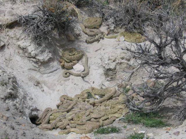
Figure 1.9 Snakes of Tasp Mountains, Panjgur
[1] Panjgur District Development Profile by P & D Department, GoB with UNICEF
Wildlife Protected Areas; Panjgur district
There are no Wildlife Protected Areas in the district.