Share now
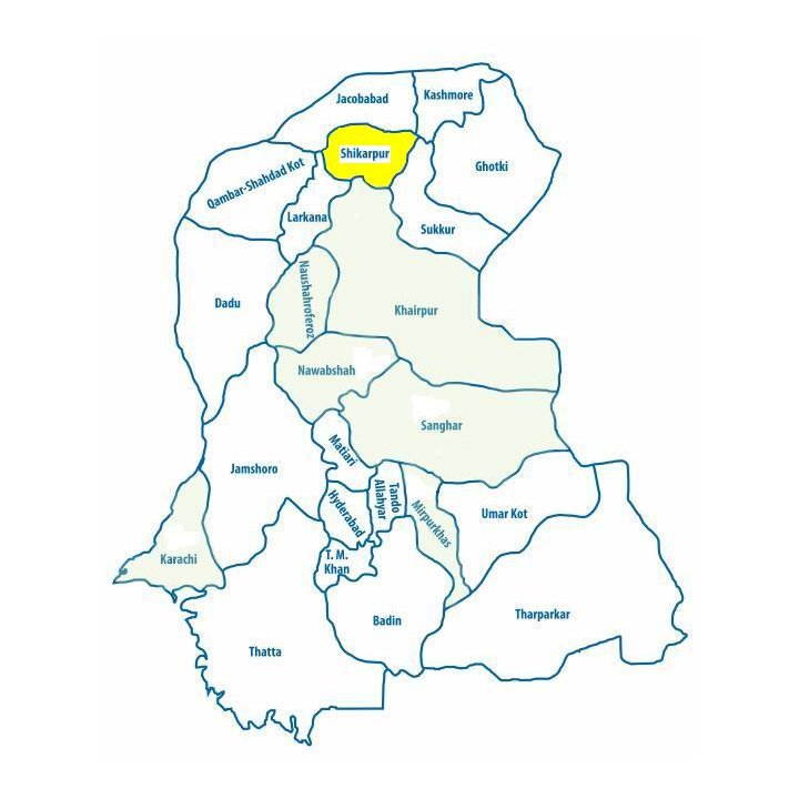
Map of Sindh
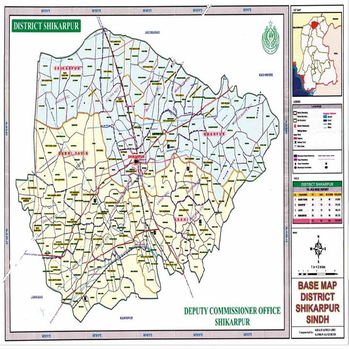
Map of Shikarpur District
Sindh Districts
- Karachi District Profile
- Badin District Profile
- Dadu District Profile
- Ghotki District Profile
- Hyderabad District Profile
- Jacobabad District Profile
- Jamshoro District Profile
- Kashmore District Profile
- Khairpur District Profile
- Larkana District Profile
- Matiari District Profile
- Mirpurkhas District Profile
- Naushero FerozeDistrict Profile
- Sanghar District Profile
- Shahdadkot District Profile
- Shaheed Benazirabad District Profile
- Shikarpur District Profile
- Sukkhur District Profile
- Tando AllahYar District Profile
- Tando Mohammad Khan District Profile
- Tharparkar District Profile
- Thatta-Sajawal District Profile
- Umerkot District Profile
Also visit: Punjab, Balochistan, Khyber Pakhtunkhwa
Shikarpur District Profile
Introduction/Geographical Location; Shikarpur district
Shikarpur district is situated between 27° 38Ꞌ to 28° 10Ꞌ North latitudes and 68° 16′ to 69° 05Ꞌ East longitudes. It is bounded on the North by Jacobabad district, in the East by River Indus and Sukkur districts, in the South again by River Indus—as it flows around the district’s border (beyond which is Khairpur district)—and on the West by Larkana district.
Shikarpur District at a Glance
| Name of District | Shikarpur District | ||
| District Headquarter | Shikarpur City | ||
| Population[1] | 1,231,000 persons | ||
| Area[2] | 2,512 km2 | ||
| Population Density | 490 persons/ km2 | ||
| Population Growth Rate[3] | 1.8% | ||
| Male Population[4] | 51.6% | ||
| Female Population[5] | 48.4% | ||
| Urban Population[6] | 24.6% | ||
| Tehsils/Talukas |
04 Talukas 1. Shikarpur Taluka 2. Garhi Yaseen Taluka 3. Khanpur Taluka 4. Lakhi Taluka |
||
| Main Towns | Shikarpur, Garhi Yaseen, Beechangi, Chak, Khanpur, Mian-ji-Goth, Madeji, Rustam, Lakhi, and Village Arain | ||
| Literacy Rate[7] | 45% | ||
| Male Literacy Rate[8] | 60% | ||
| Female Literacy Rate[9] | 29% | ||
| Major Economic Activity[10] | Elementary Occupations[11] | 45% | |
| Agriculture, Livestock breeding fishing | 36.1 | ||
| Service Workers & Shop/market sales | 7.5% | ||
| Others | 11.4% | ||
| Main Crops | Cotton, rice, wheat, jowar, bajra, maize, gram, barley, rapeseed & mustard, sesanum, sugarcane, sunflower, maash, moong, masoor, sugar beet, safflower, guar seed, and linseed | ||
| Major Fruits | Bananas, dates, guava, mangoes, musk melon, citrus, jaamun, mulberry, and ber | ||
| Major Vegetables | Okra, tinda, brinjal, bitter gourd, bottle gourd, cucumber, long melon, beans, field vetch, lotus roots, chilies, onions, potatoes, tomatoes, cauliflower, cabbage, coriander, garlic, peas, turnips, carrots, spinach, sweet potatoes, radish, fenugreek, and lettuce | ||
| Forests (Area)[12] | 15,937 HA[13] | ||
| Provincial Roads[14] | 26.9 km | ||
| Access Roads[15] | 528.6 km | ||
| Secondary Roads | 345.8 km | ||
| No of Grid Stations[16] | 3 grid stations in total, one each of capacity 132 KV, 220 KV, and 66 KV. | ||
| No. of Tel. Exchanges | No data available | ||
| Industrial Zones | One Small Industries Estate in Shikarpur city | ||
| Major Industry and Industrial Units[17] | Textile | 01 Units | |
| Beverages | 01 Units | ||
| Rice Husking Mills | 20 Units | ||
| Engineering | 02 Units | ||
| Agricultural Implements | 02 Units | ||
| Household Size[18] | 5.9 persons per house | ||
| Houses (Piped Water Inside)[19] | 20.3% | ||
| Houses with Electricity[20] | 70% | ||
Table 1.1 Shikarpur District at a Glance
[1] 2017 Census.
[2] 1998 Census
[3] 2017 Census
[4] 2017 Census
[5] 2017 Census
[6] 2017 Census
[7] Pakistan Social & Living Measurement Survey 2014-15 (PSLM); Latest available.
[8] PSLM
[9] PSLM
[10] 1998 Census; 2017 Census Data has not been made public yet.
[11] Elementary Occupations are those involving the performance of simple and routine tasks which may require the use of hand-held tools and considerable physical effort. (from Pakistan Standard Classification of Occupation)
[12] Sindh Development Profile 2017-18
[13] Land Utilization Statistics reports 27,000 HA as Forest area.
[14] Road List Issued by GoS 2009 (latest available)
[15] Road List
[16] Environment & Social Assessment HESCO by Elan Partners; 2007, Latest available.
[17] Official Website of National Vocational and Technical Training Commission; retrieved July 2020 http://www.skillingpakistan.org/employer/province/9/district/51?page=2
[18] 1998 Census; 2017 Census Data has not been made public yet.
[19] 1998 Census; 2017 Census Data has not been made public yet.
[20] 1998 Census; 2017 Census Data has not been made public yet.
Brief History – Governmental Structure – Administrative Divisions – Heritage Buildings/ Archaeological Sites
Brief History; Shikarpur District
Shikarpur has a rich cultural and historical heritage, with clear links to indigenous theatre and music. A Natak Sabha theatre, for example, was established on the banks of Begari Canal. Sessions Judges, and people like Thakurdas Nagrani, Aga Sufi, Maharaj Tejbhandas, and others established the first dramatic society—Dharamupkars, a Dramatic Society for Amateurs, in Shikarpur.
Historically, Shikarpur has been well-known for poets like Saami, one of the three major poets in the Sindhi poetic tradition—the other two being Shah Abdul Latif, and Sachal Sarmast. Shikarpur has also been home to the greatest modern poet of Sindh: Sheikh Ayaz. The first Sindhi college, Satramdas Chellasingh College, was also based in Shikarpur.
Till 1977, Shikarpur district was part of Sukkur district. 4 Talukas from Sukkur were separated to form a new administrative district now called the Shikarpur district.
The region shares its ancient history[1] with that of Sukkur district, and has been recounted in the relevant chapter. The region now part of the Shikarpur district earned its name and its distinct identity once the Sukkur region was conquered and annexed by the Mughal Empire in 1599. During the rule of Mughal Emperor Akbar (1556-1605), the current Shikarpur city and its surrounding areas were the hunting fields or Shikargah of the Mughals and bordered Sibi, Balochistan. The Daudpota, a tribe loyal to the Mughals was gifted the lands of the Shikargah by Mughal Emperor Jehangir (1605-1628). The Mehrs who owned lands near Lakhi (a taluka in present day Shikarpur), however, were unhappy with the favors shown to the Daudpota, and started creating trouble for them, which resulted in a feud between the two tribes. This feud between the Mehrs and the Daudpotas continued until the year 1603, when the Mehr tribe was defeated by the Daudpota. In 1617, the Daudpota Chief, Amir Bahadur Khan, laid the foundations of a town and called it Shikarpur.
Amir Bahadur Khan remained chief of the Daudpota till his death in 1678 and was succeeded by his son Amir Bahadur II. The Daudpota enclosed the Shikarpur town by a fort with thick walls and 8 gates. The gates were named after the towns or villages in whose direction they opened. These names have survived to-date: Lakhidar, Hazaridar, Hathidar (the direction where elephants were kept), Khanpuridar, Sibidar (en route to Sibi, Balochistan), Wagnodar, Karandar, and Nausherodar. The walls were known as Alaam Panah. After the death of Amir Bahadur II, his son, Amir Mubarak, took over. Almost as soon as Amir Mubarak ascended the throne, the Nawab of Sibi usurped Shikarpur from him, having taken advantage of his youth. Amir Mubarak fled to Miranshah near Mirpur (present day Federally Administered Tribal Agency or FATA), where he was given lands by Jehan Khan, who was the chief of Miranshah.
During the rule of the Mughal Emperor Shah Alam (son of Emperor Aurangzeb; 1728-1806), Moizuddin Mughal (son of Emperor Shah Alam) was appointed Governor of Sindh and Multan. Amir Mubarak appealed to Moizuddin Mughal’s court and, with his help, regained control of Shikarpur. During this time, Yar Muhammad Kalhora became the chief of the Kalhora tribe and attacked Shikarpur. The Daudpota were forced to sign a peace treaty. Yar Muhammad Kalhora died in 1718 and was succeeded by his son Noor Muhammad Kalhora who succeeded in wrestling Shikarpur from the Daudpota.
In 1739, Nadir Shah attacked Sindh, and upon conquering it, divided Sindh into 3 parts, with Noor Muhammad Kalhora given Lower Sindh, the Daudpota allocated Shikarpur and Sehwan areas, and Muhammad Khan Baloch given the areas of Sindh that are now part of Balochistan. On Nadir Shah’s death in 1748, Sindh became a tributary of Ahmad Shah Durrani of Afghanistan’s domain. During the Afghan rule, trade, commerce and social development, including education, became the focus, bringing prosperity. Hunting, especially that of the hog deer and gazelle as well as of water fowl, remained a favorite pastime.
In 1782, the Kalhora were defeated by the Talpurs (a Balochi Tribe) and Shikarpur came under their rule. The Talpurs continued with the investment in development and the area became a hub of trade and commerce. When Sindh was annexed to the British Empire in 1843, after the defeat of the Talpurs at the battle of Miani in 1843, the British made Shikarpur the headquarters of Shikarpur district. This district comprised of 4 subdivisions: Rohri, Sukkur, Larkana, and Mehar. Larkana and Mehar were detached in 1901 to form a new district of Larkana. The other two were merged into Sukkur district making Shikarpur a taluka of Sukkur district. Thus, Sukkur district became composed of Shikarpur, Naushero Abro, [2] and Sukkur Taluka.
With the construction of the railway line extending into Balochistan, the existing trade route through Shikarpur became superfluous, and trade in the region slowed. Even though traditional trade routes were made redundant, the region continued to flourish due to British investment in infrastructure. During the British Rule, for example, a large number of public welfare buildings were constructed using sun-dried bricks with an arched verandah, like the Merewether pavilion, clock tower, Government High School, colleges, Rao Bahadur Udawdas Tarachand (RBUT) Hospital, and Lady Dufferin Hospital. An underground water and sewerage system was built in 1890.
People of this district participated significantly in the Independence Movement, the Tehreek-e-Khilafat, and also the Raishmi Romaal Tehreek. When Sindh was given the status of a separate province in 1937, Sir Ghulam Hussain Hayatullah from Shikarpur was appointed as the first Chief Minister of the province. He was also appointed as the first Governor of Sindh on August 14, 1947.
The area was reconstituted as a district in 1977.
Governmental Structure; Shikarpur District
At the Federal level, Shikarpur district is allocated a set number of representatives in both the National Assembly and the Provincial Assembly:
- Number of seats in the National Assembly 2
- Number of seats in the Provincial Assembly 4
The district has 1 Municipal Committee—Shikarpur—and 6 Town Committees:
- Khanpur
- Garhi Yaseen
- Madiji
- Lakhi
- Rustam
- Chak
Administrative Divisions; Shikarpur District
There are 4 Talukas of Shikarpur District, which are as follows:
| Garhi Yaseen | 12 Union Councils |
| Shikarpur | 15 Union Councils |
| Khanpur | 10 Union Councils |
| Lakhi | 10 Union Councils |
Table 1.2 Shikarpur Administrative Divisions
Heritage Buildings/Archaeological Sites; Shikarpur District
There are no cultural heritage buildings declared as protected in Shikarpur district either by Sindh Government or Government of Pakistan.
The district is an old and historic district, however. [1] Even though none of the buildings have been protected either by the Federal or Sindh government, there are a number of buildings which are very old and can be classified as historical buildings. These are as follows:
- The Bank of India, located at Kakran Jo Thalo, Shaikh Mohalla; Shikarpur district
- Shahi Bagh of Shikarpur, located at Circular Road, Deenpur Mohalla; Shikarpur district
- Qazi Habibullah School, located at Hazari Gate, Shikarpur
- The RBUT Hospital, located at Station Road, Shikarpur
- Christian Hospital, near Sunny Petrol Pump, Shikarpur
- The High School No. 2, Station Road, Shikarpur. This school was once called Hopeful Academy, and was constructed by Wadho Mal in the early 20th century. It is located opposite Ganesh Park
- The High School No. 1, Station Road, Shikarpur
- The Qazi Mohalla Primary School, Qazi Mohalla, Shikarpur
- C&S Degree College, Rustam Road, Shikarpur
- Old Gates of the City (Lakhidar, Hazaridar, Hathidar, Khanpuridar, Sibidar, Wagnodar, Karandar, and Nausherodar). The walls were known as Alaam Panah
There are also a large number of shrines/ tombs of various saints in the district:
- Tomb of Sultan Muhammad Ibrahim Shah near Lakhi; Shikarpur district
- Shrine of Khwaja Abdul Rehman Turk; Shikarpur district
- Shrine of Syed Mahar Ali Shah Ghazi; Shikarpur district
- Shrine of Syed Manochar Shah called Muchar Shah; Shikarpur district
- Shrine of Hazrat Shah Bukhari; Shikarpur district
- Shrine of Hazrat Abdul Latif Shah; Shikarpur district
- Shrine of Hazrat Haji Faqirullah Shah Alavi; Shikarpur district
- Shrine of Hazrat Amin Shah Chisti; Shikarpur district
- Shrine of Alif Shah Shaheed; Shikarpur district
- Shrine of Syed Awal Shah; Shikarpur district
- Shrine of Hazrat Mulla Awais Ahmad; Shikarpur district
- Shrine of Hazrat Khawaja Amir Hyder Sarhandi; Shikarpur district
- Shrine of Hazrat Khwaja Nizamuddin Sarhandi; Shikarpur district
- Shrine of Khalifo Nasrullah; Shikarpur district
Annual Urs are held for the sufi saints whose shrines have been listed here.
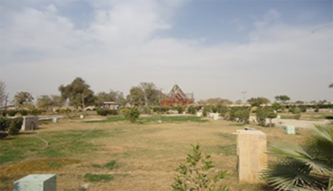
Figure 1.3 Shahi Bagh, Shikarpur
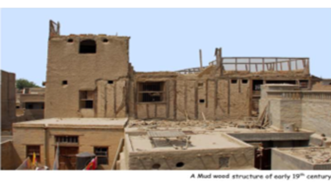
Figure 1.4 Early 19th Century Mud and Wood Structure
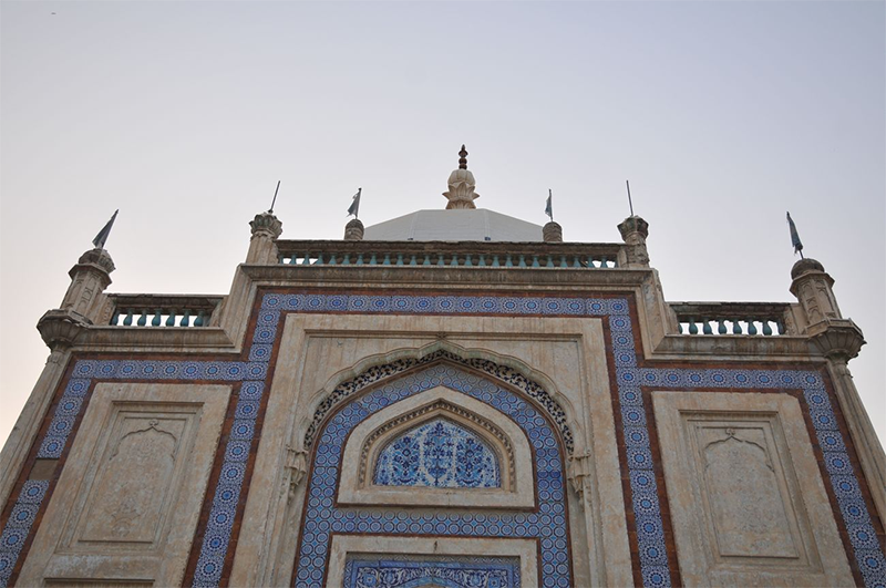
Figure 1.5 200 year old Dargah/
Picnic Spots/ Recreational Areas; Shikarpur District
Some of the recreational areas of Shikarpur district are:
- Shahi Bagh: Built in 1871; Shikarpur district
- Ganesh Park renamed as Liaqat Park; Shikarpur district
- Shaheed Benazir Bhutto Park; Shikarpur district
- Park at Mirani Mohalla; Shikarpur district
- Sindh Wah; Shikarpur district. This is an irrigation channel that has remained a picnic point throughout Sindh province. Murid Setharja village is situated at the bank of this channel or wah. Other irrigation channels and water courses also offer nice spots for a day long excursion
- The various shrines and historical buildings named already, with their grand architecture and facades, also function as recreational spots
[1] Shikarpur Heritage: An Illustrated Journey through History by Naseem Mughal (Sindh Archives)
[1] Most of the historical account presented in this chapter is paraphrased from Shikarpur Heritage: An Illustrated History by Naseem Mughal, 2012
[2] Naushero Abro is a town in Shikarpur district and is not to be confused with Naushero Feroze district
Topography; Shikarpur District
Shikarpur district is a plain formed by the River Indus. There are no mountains or hill formations in all of Shikarpur district. The land gently slopes from Northwest to Southeast. The general elevation of the land surface varies from about 50 m to 100 m above sea level.
Rivers, Streams, and Lakes; Shikarpur District
The River Indus flows through the district’s Northeast and Southwest boundaries. On entering Shikarpur district, the river forks and flows in 2 parts; one part flows in Shikarpur district and the other in Sukkur district. The two parts merge in Sukkur district. Other natural streams of the district are Bohar Wah and Mirzan Wah.
Two barrages, the Sukkur Barrage and the Guddu Barrage, have been constructed on River Indus, and the district gets its water sourced from canals off-taking from these barrages.
There are no lakes or any other rivers or streams in the district.
Forests; Shikarpur District
Shikarpur district is home to riverine forests and irrigated plantations. Total designated forest cover in the district is 27,000 HA. The main flora of riverine forests is babul (Acacia nilotica), bahan or poplar (Populus euphratica), lai or athel pine (Tamarix aphylla), lai or salt cedar (Tamarix dioca), and kandi or khejri (Prosopis cineraria).
Flora of the rangelands include gum Arabic or khumbat (Acacia senegal), jand (Prosopis cineraria), desert teak or rohida (Tecomella undulate), kikri or baonli (Acacia jacquemontii), peelu or vann (Salvadora oleoides), karir (Capparis deciduas), African foxtail grass (Cenchrus ciliaris), Indian sandbur (Cenchrus biflorus), desert grass (Panicum Turgidum), and bansi grass (Panicum antidotale).
Important riverine forests of the district are[1]:
- New Gublo (466 HA)
- Gandher (177 HA)
- Badani (290 HA)
- Gihalpur (1,840 HA)
- Garhi Yaseen (5,142 HA)
- Andaldal (267 HA)
- Mohramari: (2,880 HA)
- Reserved Rangelands (16,500 HA)
Soils; Shikarpur District
The soils are heavily saturated with moisture, and are locally known as sailabi. Thus, the soil requires no irrigation from planting to harvest when used for agriculture.
The plain area of Shikarpur, locally known as pat, expanding from the town towards, and beyond, its northwestern boundary, consists of an indurated[2] alluvial clay. The irrigation system extending from Sukkur Barrage makes the region fertile and productive.
Climate; Shikarpur District
The climate of the district is extremely hot in summers and moderate in winters. The summer season begins in April and continues till October. May, June, and July are the hotter months, with June being the hottest, when the mean maximum and minimum monthly temperatures are 44 °C and 28 °C respectively. The temperature falls abruptly at night. The climate is tempered by the sea breeze, which blows for 8 months—from March to October—making the hot weather tolerable.
Winter months are November to February with January being the coldest month. The mean maximum and minimum temperatures during this month are 23 °C and 8 °C respectively. The months of August and September are monsoonal months, and thus, stuffy and suffocating. Most of the annual rainfall is during these months. The mean annual rainfall of the district is 100 mm.
Seismic Activity/Seismicity; Shikarpur District
The district falls under Zone 2 A of Pakistan’s Seismic Zone Map, which means that there will be moderate to low damage by earthquakes.
[1] Environmental and Social Assessment for Construction of 500 KV Grid Station and Allied Transmission line in Shikarpur
[2] A soil horizon compacted to the extent that it limits rooting depth and impedes drainage, and may give rise to a perched water table (saturated layer of soil separated from water table by another layer of soil). Indurated layers occur naturally or may be man-made.
Population; Shikarpur District
The following table shows the population figures for the district as per 2017 Census:
| District/Taluka |
Area km2 |
Population % | Male % | Female % | Urban% | Growth Rate % |
| Shikarpur District | 2,512 | 1,231,481 | 51.6 | 48.4 | 24.6 | 1.8 |
| Shikarpur Taluka | 561 | 391,172 | ||||
| Khanpur Taluka | 629 | 276,283 | ||||
| Garhi Yaseen | 971 | 315,883 | ||||
| Lakhi Tehsil | 351 | 248,143 |
Table 1.3 Shikarpur Population Statistics
Religions; Shikarpur District[1]
| Muslims | 98% |
| Christians | 0.1% |
| Hindus | 1.7% |
| Ahmadis | Negligible % |
| Scheduled Castes | 0.1% |
| Others | 0.1% |
Table 1.4 Shikarpur Religions
Languages; Shikarpur District[2]
| Urdu | 1.8% |
| Punjabi | 0.2% |
| Sindhi | 95.8% |
| Pashto | 1% |
| Seraiki | 0.6 |
| Others | 0.4% |
Table 1.5 Shikarpur Languages
[1] 1998 census; 2017 Census Data has not been made public yet.
[2] 1998 census; 2017 Census Data has not been made public yet.
Economic Activity – Economic Infrastructure
Economic Activity; Shikarpur District
The major economic activities of the district are:
- Elementary Occupations (45%)
- Agriculture, Livestock Breeding, Fishing (36.1)
- Service Workers & Shop/Market Sales (7.5%)
- Others (11.4%)
Land Use; Shikarpur District
Following is the main land use pattern of the district as per Sindh Development Statistics 2017-18:
| Land Use | Area | Land Use | Area |
| Total Area | 284,000 HA | Reported Area | 284,000 HA |
| Total Cultivated Area | 113,000 HA | Current Fallows | 15,000 HA |
| Forest Area[1] | 27,000 HA | Culturable Waste | 126,000 HA |
Table 1.6 Shikarpur Land Use Statistics
Irrigation Network; Shikarpur District
Shikarpur district is irrigated by Guddu and Sukkur Barrages. The Begari Canal, Sindh Wah and Choi Branch off-taking from Guddu Barrage and Kirthar Canal off Sukkur Barrage are the main canals irrigating the district.
The following table shows the mode of irrigation and area irrigated by the mode as per Sindh Development Statistics 2017-18:
| Mode of Irrigation | Area | Mode of Irrigation | Area |
| Total Irrigated Area | 52,808 HA | Canal Irrigated | 50,669 HA |
| Well Irrigated | – HA | Tube Well Irrigated | 2,139 HA |
| Un-Irrigated Area | 45,534 HA |
Table 1.10 Shikarpur Irrigation Statistics
Groundwater is sweet and potable through aquifer recharge in Shikarpur district.
Agriculture; Shikarpur District
Shikarpur district belongs to the Southern Irrigated Plains Agro-Ecological Zone of Pakistan and is a major rice producing district. Crops of the district include cotton, rice, wheat, jowar, bajra, maize, gram, barley, rapeseed & mustard, sesanum, sugarcane, sunflower, maash, moong, masoor, sugar beet, safflower, guar seed, and linseed.
The vegetables grown in the district are okra, tinda, brinjal, bitter gourd, bottle gourd, cucumber, long melon, beans, field vetch, lotus roots, chilies, onions, potatoes, tomatoes, cauliflower, cabbage, coriander, garlic, peas, onions, turnips, carrots, spinach, cauliflower, cabbage, sweet potatoes, radish, fenugreek, and lettuce.
The fruits grown in the district are banana, dates, guava, mango, musk melon, citrus, jaamun, mulberry, and ber.
Livestock Breeding; Shikarpur District
Livestock contribute roughly one-third to the total share of agricultural production. The following table shows the number of livestock in the district as per Livestock Census 2006 (latest available) reported in the Sindh Development Statistics 2017-18:
| Livestock | Numbers | Livestock | Numbers |
| Cattle | 511,000 Heads | Buffaloes | 550,000 Heads |
| Sheep | 293,000 Heads | Goats | 342,000 Heads |
| Camels | 1,000 Heads | Horses | 2,000 Heads |
| Asses | 57,000 Heads | Mules | 2,000 Heads |
Table 1.7 Shikarpur Livestock Statistics
Sindhi desi goats and kachhi goats are the indigenous breeds of the district.
Poultry Farms; Shikarpur District
Most farmers keep a few head of poultry for their eggs and meat. There are 108 poultry farms in the district, most of which are located in the urban areas of the district.[1]
Fishing; Shikarpur District
Inland fishing is carried out in the district on quite a large scale. The Indus River and the canals provide the main fishing areas.
Bee Keeping/Api Culture; Shikarpur District
Honey-bee keeping was introduced in Pakistan in the 1980s, when IUCN and UNDP introduced apiculture in the coastal villages of Sindh, especially in Badin and Thatta. Currently, bee keeping is one of the allied activities of agriculture, livestock breeding, fisheries, and hunting.
Minerals and Mining; Shikarpur District
Oil and gas are being mined in the district. Other minerals found in the district include limestone and fireclay.
Industry and Manufacturing; Shikarpur District
There is one Industrial Estate in Shikarpur district. The following table shows the major industrial units of the district[1]:
| Textile | 01 Units |
| Beverages | 01 Units |
| Rice Husking Mills | 20 Units |
| Engineering | 02 Units |
| Agricultural Implements | 02 Units |
Table 1.8 Shikarpur Industries
Handicrafts; Shikarpur District
Shikarpur district is most famous for its pickle, or achar. Other handicrafts include metal ware, furniture, bricks, pottery, and handloom weaving. Ralli, a quilted handmade sheet used as bed spreads, is very popular. Embroidery on leather, as well as wooden tobacco pipes, knitted garments, and hand woven cloth are also notable handicrafts of the district.
Economic Infrastructure; Shikarpur District
Shikarpur district was famous throughout undivided India for education and other civic amenities until the first half of the 20th Century. Some of the famous institutions included Rau Bahadur Udhau-Das Tara Chand Hospital, Heeranand Ganga Bai Ladies Hospital, Chella Ram and Seetal Das College, and 2 old High Schools now known as school No. 1 & 2 as well as a Girls College.
Road Statistics; Shikarpur District
The total length of different types of roads in the district, as per Road List 2009 issued by Government of Sindh, is:
| Provincial Highways | 26.9 km |
| Access Roads | 528.6 km |
| Secondary Road | 345.8 km |
Table 1.9 Shikarpur Roads Statistics
According to Sindh Development Statistics 2017-18, there are 695 km of black topped roads in the district.
Important road links of the district are:
- National Highway N-65, a two-lane highway with a total length of 385 km
- Road from Shikarpur to Jacobabad via Sultan Kot and Hamayoon
- Road from Shikarpur to Kandhkot via Khanpur
- Road from Shikarpur to Larkana via Garhi Yaseen and Dakhan
- Road from Garhi Yaseen to Lakhi
- Road from Shikarpur to Sukkur via Lakhi
Rail and Airways; Shikarpur District
The Karachi-Peshawar main railway line passes through the district with a major railway station in Shikarpur city. This line connects all taluka headquarters with Shikarpur and other parts of Pakistan.
There is no airport in the district. Nearest airport is the Sukkur Airport.
Radio and Television; Shikarpur District
Hot FM 105 is Shikarpur’s main private FM Radio station. There is no private TV Station in the district but TV can be viewed through TV boosters and cable.
Telecommunications; Shikarpur District
Internet is available in all Talukas of the district, and nearly all the major cellular companies operate in the district.
Post Offices/ Courier Services; Shikarpur District
There are 20 Pakistan Post offices[1] in the district, with Shikarpur GPO as the head office. In addition, most of the courier service companies provide postal services to the district.
Banking/ Financial Institutions; Shikarpur District
Most of the nationalized banks of Pakistan and some private banks have their branches in all Talukas of the district. These include:
- Allied Bank of Pakistan
- Askari Bank Ltd.
- Bank Al-Habib Ltd.
- Habib Bank Ltd.
- First Women Bank Ltd.
- Zarai Taraqiati Bank Ltd.
- Muslim Commercial Bank
- National Bank of Pakistan
- National Investment Bank Ltd.
- Sindh Bank Ltd.
- Summit Bank Ltd.
- United Bank Ltd.
In all there are 35 branches of conventional banks and 01 branch of Islamic Bank in the District[2].
Electricity and Gas; Shikarpur District
Shikarpur district gets its electricity through the grid stations and transmission lines provided by Hyderabad Electricity Supply Corporation which is a subsidiary of WAPDA.
Educational Institutions; Shikarpur District
As per Pakistan Social & Living Measurement survey (PSLM), the literacy rate of the district is 45% with 60% males and 29% females being literate. The following table shows the number of government educational institutions in the district as per Sindh Development Statistics 2017-18:
| Institution | Boys/Girls | Institution | Boys/Girls |
| Primary Schools | 885/97 | Middle Schools | 41/12 |
| High Schools | 47/19 | Higher Secondary Schools | -/- |
| Colleges | 03/01 | Technical Schools | 02/- |
| Commercial | 02/- | Vocational | 03/03 |
Table 1.11 Shikarpur Educational Institutes
In addition, there are a number of privately owned schools (all levels) in the district. These schools provide co-education as well as segregated classrooms.
Healthcare Facilities; Shikarpur District
As per Health Profile Sindh Districts 2017-18, the number of health institutions in the district was as follows:
| Institution | No./Beds | Institution | No./Beds |
| Government Hospitals | 05/379 | Government Dispensaries | 30/- |
| Rural Health Centers | 09/110 | Basic Health Units | 36/72 |
| T B Clinics | 09/- | Mother Child Health Centers | 05/04 |
| Private Hospitals | 14/106 | Private TB Clinics | 05/- |
| Private Dispensaries | 72/12 | Private MCHC | 02/- |
Table 1.12 Shikarpur Healthcare Institutes
In addition there is a Leprosy Center in the district.
Policing; Shikarpur District
The Provincial Police Officer Sindh, assisted by 6 Additional Inspector General Police, is in charge of policing Sindh, including Shikarpur. The District Police Officer Shikarpur is responsible for policing the district. The Additional Inspector General Police Larkana Zone is in charge of District Larkana, District Shikarpur, District Kamber-Shahdadkot, and District Jacobabad. There are 15 police stations[1] in the main towns of the district.
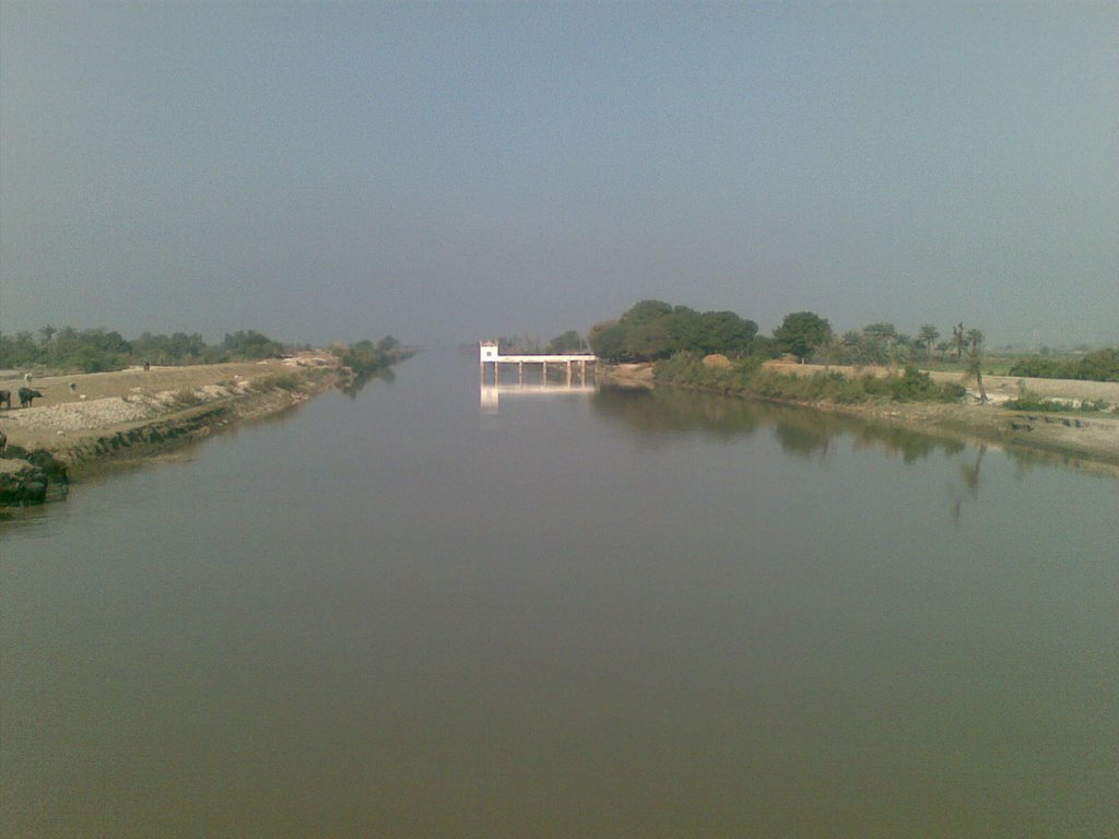
Figure 1.6 A Canal flowing through Garhi Yaseen
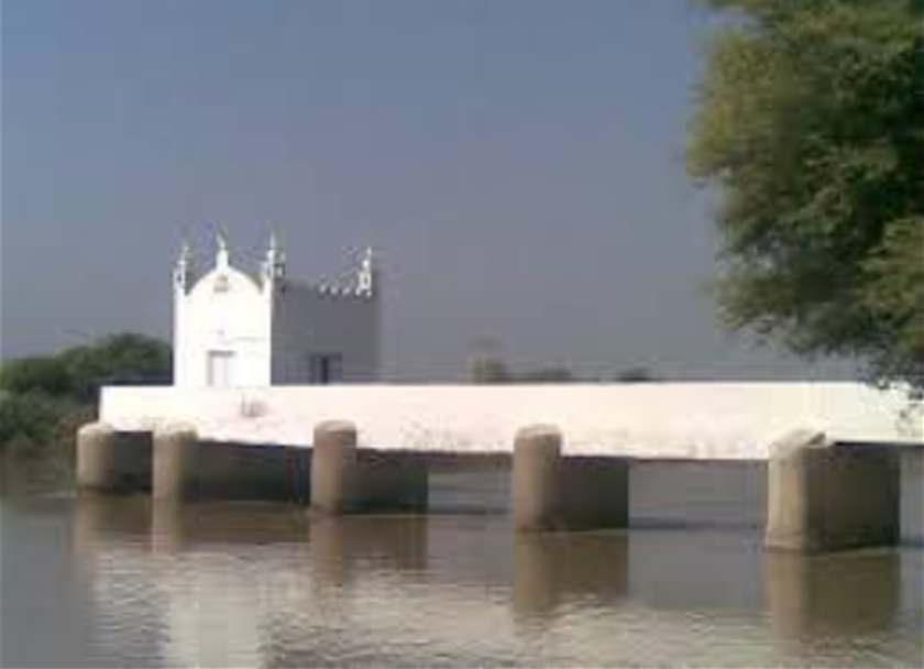
Figure 1.7 A Mosque on a Canal, Garhi Yaseen
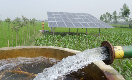
Figure 1.8 Solar Powered Waterpump , Shikarpur
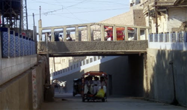
Figure 1.9 A Bridge connecting Buildings, Shikarpur
Figure 1.10 Shrine of Haji Faqirullah
[1] Official website Sindh Police
[1] Official website Pakistan Post
[2] List of Reporting Bank Branches 2019 by State Bank of Pakistan.
[1] Official Website of National Vocational and Technical Training Commission; retrieved July 2020 http://www.skillingpakistan.org/employer/province/9/district/51?page=2
[1] Table 17 Number of Commercial Poultry Farms and Number of Birds by Size of Flock
[1] As discussed earlier, there is significant discrepancy between acreage reported by Land Utilization Statistics and Forestry Statistics
Environment and Biodiversity; Shikarpur District
Shikarpur is an agro-industrial district. It is one of the fastest growing urban areas of Pakistan[1].
In urban areas, the ambient air quality, supply of contaminated water, unsafe disposal of municipal waste and solid waste, unsafe disposal of infectious hospital waste and congested houses have created severe environmental degradation.
Most houses have a shallow well, fitted with either a hand pump or a motorized pump or both. Some of these are located within the houses. The tube wells are 15 to 25 m deep and fitted with pipes ranging in diameter from 32 mm to 75 mm. The hand pumps are cast iron shallow lift pumps, most of which are manufactured in foundries in Sukkur.
Disposal of waste water from hand pump wells is a serious problem. Often, the waste water is allowed to accumulate in a pit immediately adjacent to the well. In many cases, the waste water seeps into the ground besides the well casing and contaminates the water.
Flora and Fauna; Shikarpur District
Flora
Flora[2] of Shikarpur district falls in the Scrub Dry Tropical Thorn Forest Zone. This is the natural vegetation of the Indus Basin. It has the capacity to survive and grow in areas with extremely high temperatures and low precipitation.
Trees include kikar (Acacia nilotica), phulai (Acacia modesta), siris or Indian walnut (Albizia lebbek), white siris (Albizia procera), neem (Azardica indica), karir (Capparis aphylla), amaltas (Cassia fistula), shisham (Dalbergio sissoo), bans or bamboo (Dendrocalamus strictus), sufaida (Eucalyptus spp.), peepal (Ficus religiosa), burh or banyan/burgad (Ficus benghalensis), bakain (Azaderach), sohanjna or drumstick tree (Pterygosperma), mulberry or toot (Morus alba), poplar (Populus spp.), jand (Prosopis cineraria), mesquite (Prosopis glandulusa and Prosopis juliflora), sukh chain or Indian beech tree (Pongamia glabra), willow or baid (Salix tetrasperma), and jhau or vann (salvadora oleoides).
Shrubs of the district include baonli or kikri (Acacia jacquemontii), camel thorn or jawain (Alhagi camelorum), aak (Calotropis procera), lani (Salsola foetida), and pilchi (Tamarix dioca).
Grasses of the district include khabbal (Cynodon dactylon), khawai (Cymbopogon jawarancusa), dhamah (Cenchrus ciliaris), dab (Eragrostis cynosouroides), kana or wild sugarcane (Saccharum munja), and cattail or kundan (Typha anguatifolia).
Fauna
Mammals of the district include wild boar, porcupine, jackals, deer, hare, chinkara gazelle, wolf, hedgehog, jungle cats, and hyenas.
Avifauna includes eagles, kites, hawks, parrots, quails, partridges, common crow, crested lark, myna, lark, owl, falcons, house sparrow, houbara bustard, vultures, quail, litter bustard, great bustard, grey and black partridges, Indian roller, crested lark, vultures and quail. Water fowls include white stork, white pelican, herring gull, ringed plover, pond heron, little brown dove, and white-beaked king fisher.
Reptiles include snakes like the cobra, rattle snakes, and rat-eater snakes. Small and medium sized lizards include goh kirli, kirla, gohira, sanda, spiny-tailed lizard, and fringe-toed lizard.
Fresh water turtles are also present in the region, especially in the vicinity of moist lands and ponds, and during rainy seasons.
Protected Wildlife Areas and Endangered Wildlife; Shikarpur District
Following are the protected wildlife areas in Shikarpur district:
- Shikarpur district is one of the three districts which contain the Indus Dolphin Reserve. The Indus Dolphin Reserve provides sanctuary to the endangered Blind Indus Dolphin known as Bulhan in Sindh
- Dhoung Block is a riverine forest Wildlife Sanctuary in Shikarpur district providing sanctuary to the game birds and mammals of the district.
[1] Presentation to World Bank on infrastructure development by Government of Sindh
[2] Environmental & Social Assessment for Construction of 500KV Transmission Line Shikarpur