Share now
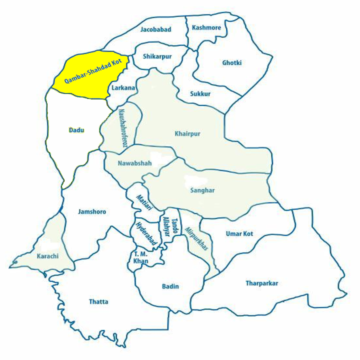
Map of Sindh
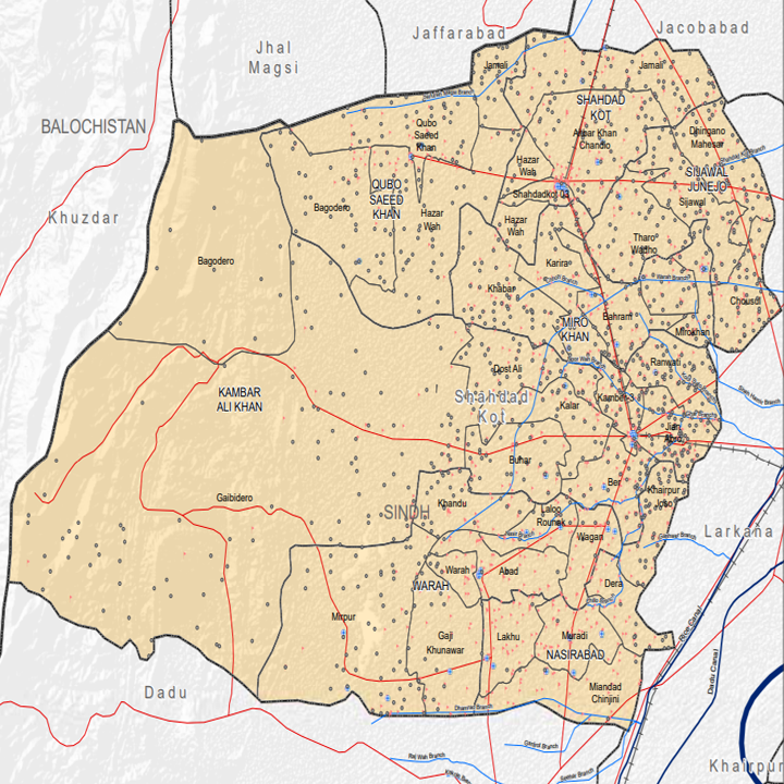
Map of Kambar-Shadadkot District
Sindh Districts
- Karachi District Profile
- Badin District Profile
- Dadu District Profile
- Ghotki District Profile
- Hyderabad District Profile
- Jacobabad District Profile
- Jamshoro District Profile
- Kashmore District Profile
- Khairpur District Profile
- Larkana District Profile
- Matiari District Profile
- Mirpurkhas District Profile
- Naushero FerozeDistrict Profile
- Sanghar District Profile
- Shahdadkot District Profile
- Shaheed Benazirabad District Profile
- Shikarpur District Profile
- Sukkhur District Profile
- Tando AllahYar District Profile
- Tando Mohammad Khan District Profile
- Tharparkar District Profile
- Thatta-Sajawal District Profile
- Umerkot District Profile
Also visit: Punjab, Balochistan, Khyber Pakhtunkhwa
Kamber-Shahdadkot District Profile
Introduction/Geographical Location Kamber-Shahdadkot District
Kamber Shahdadkot district is located in the Northwest of Sindh Province. The region is situated between 67° 10’ to 68° 12’ East longitude and 27° 26’ 31” to 27° 58’ 55” North latitude. It is bounded by Nasirabad, and Jhal Magsi districts of Balochistan in the Northwest, Shikarpur and Jacobabad districts of Sindh in the Northeast, Larkana district in the East, Kirthar Mountain Range in the West and district Dadu in the South. Beyond the Kirthar mountain range in the West is district Khuzdar of Balochistan.
Kamber-Shahdakot District at a Glance
| Name of District | Kamber Shahdadkot District | |
| District Headquarter | Kamber Town | |
| Population[1] | 1,341,000 persons | |
| Area[2] | 5,475 km2 | |
| Population Density | 244.9 persons/ km2 | |
| Population Growth Rate[3] | 1.97% | |
| Male Population[4] | 50.9% | |
| Female Population[5] | 49.1% | |
| Urban Population[6] | 29.7% | |
| Tehsils |
7 Talukas:
|
|
| Main Towns[7] | Kamber, Shahdadkot, Miro Khan, Qubo Saeed Khan, Sijawal Junejo, Warah, Nasirabad, Chakiyani, Gahibidero, Chhajra, Rawanti, Khairpur Juso, Karira, Bago Dero, and Seelra. | |
| Literacy Rate[8] | 39% | |
| Male Literacy Rate[9] | 51% | |
| Female Literacy Rate[10] | 27% | |
| Major Economic Activity[11] | Agriculture, livestock breeding, fishing & hunting | 65% |
| Professionals | 21.3 | |
| Service Workers, Shop & Market Sales Workers | 3.9% | |
| Other | 9.8% | |
| Main Crops | Rice, sugarcane, jowar, wheat, barley, gram, rapeseed & mustard, masoor, and pulses. | |
| Major Fruits | Guava, mangoes, citrus and dates | |
| Major vegetables | Peas, onion, okra, tinda, brinjal, luffa, lotus root, tomatoes, chilies, garlic, coriander, ajwain, and fennel. | |
| Forests (area)[12] | – HA[13] | |
| Total Black Topped Road[14] | 553 km | |
| Shingle roads[15] | – km[16] | |
| No of grid stations[17] | 3. Each = 132KV. 2, each = 66KV | |
| No. of Tel. Exchanges | No data available | |
| No of Industrial units | No industrial Estate; a few rice husking mills scattered across the district | |
| Major Industry[18] | Rice husking mills, as well as small industries including textile, electronic goods. Manufacturing includes agricultural tools, iron and steel, tractor trolleys, bullock and donkey carts. | |
| Household size[19] | 5.7 persons per house | |
| Houses with piped water inside[20] | 17.1%[21] | |
| Houses with electricity[22] | 84%[23] | |
[1] Larkana District1998 Census (talukas of Qambar-Shahdadkot Districts only)
[2] Larkana District1998 Census (talukas of Kamber-Shahdadkot Districts only)
[3] 2017 Census
[4] ibid
[5] ibid
[6] ibid
[7] Taken from The Profile of District Qambar-Shahdadkot Sindh, Compiled by Saroh Social Development Organization, Shahdadkot.
[8]Pakistan Social & Living Measurement survey 2014-15 (PSLM); Latest available
[9] ibid
[10] ibid
[11] Larkana District1998 Census (talukas of Kamber Shahdadkot Districts only); 2017 Census Data has not been made public yet.
[12] Sindh Development Statistics 2017-18
[13] Forest cover in the district is negligible
[14] Sindh Development Statistics 2017-18
[15] ibid
[16] There are no shingles roads of note in the district
[17] Environment & Social Assessment, HESCO by Elan Partners Ltd. 2007; Latest available.
[18] Taken from “A Profile of Kamber Shahdadkot” by Saroh
[19] Larkana District1998 Census (talukas of Kamber Shahdadkot Districts only)
[20] ibid
[21] Taken same as Larkana District
[22] Larkana District1998 Census (talukas of Kamber Shahdadkot Districts only); 2017 Census Data has not been made public yet.
[23] Taken same as Larkana District; 2017 Census Data has not been made public yet.
Brief History – Government Structure – Administrative divisions – Heritage Sites/ Picnic Spots/ Recreational Areas
Brief History of Kamber-Shahdadkot District
Kamber – Shahdadkot district was part of Larkana district till December 2004, when, due to administrative reasons, Larkana district was divided into two parts, with Larkana, Dokri, Ratodero and Baqarani allocated as part of Larkana District and Shahdakot, Kamber, Warah and Miro Khan as part of Shahdadkot District. The residents of Kamber Taluka wanted the name of the District as Kamber and petitioned for this right, leading to clashes and rioting, which in turn resulted in the deaths of four people. A compromise proposed the name as Kamber – Shahdadkot District.
The early history of this district is the same as that of Larkana district, which can be dated back to the civilization of Moen-jo-Daro, which, in turn, dates back five thousand years. Larkana’s product, cloth, was traded from Moen-jo-Daro to the rest of the country through specific water-ways. The most important of these was Sindhu or present-day River Indus.
As recounted earlier in this volume, Moen-jo-Daro was a center of worship for Buddhists, and some of the remains of ancient Buddhist Stupas have been excavated in the present-day. Alexander the Great (known as Sikandar-e-Azam locally) attacked, and conquered most of Sindh in 330 B.C. On crossing a small village, he called it Maota in Greek, which later became Mahota, now a part of Larkana district. From 320 CE to 525 CE, Sindh was ruled by the Gupta family. A tribe known as the Chandia helped the Guptas ascend the throne and, as their reward, the Guptas gifted the areas now known as Larkana District to them; the Chandia subsequently named this jagir as Chandka.
By the eighteenth century, the district had been consolidated as a part of the region ruled by the Kalhoro and the Talpur dynasties, established by tribes that arrived in Sindh with Nadir Shah’s invading armies. Both these tribes were the descendants of the Abbasi Caliphs. As the Abbasi caliphate declined, the Kalhora and the Talpur tribes settled in northern Sindh and Punjab, eventually establishing control of the region. The Kalhoro dynasty ruled this area from 1700 to 1783 and the Talpur dynasty ruled from 1783-1843. However, the Talpur were overthrown by the British East India Company, led by General Charles James Napier in 1843.
Shahdadkot was founded around 1713, by Shahdad Khan Khuhawar during the Kalhora reign, as a walled town[1]. It was a major town on the trade route between Larkana and Gandawah, Balochistan.
During British rule, the town of Jacobabad was the administrative headquarter of the Upper Sind Frontier District of the Bombay Presidency. General John Jacob, who was appointed the Brigadier General, established many outposts to protect Upper Sindh Frontier from mountain tribes. Outposts established in Dost Ali, Shahdadkot, Garhi Khero, Rojhan, Jacobabad, Dilmurad, Garhi Hassan, Tangwani, Kandh Kot, Kumri and Kashmore helped the British defend their border from 1839 to 1858. John Jacob is also credited for constructing roads, bridges and canals to develop Garhi Khero, Shahdadkot, Kamber and Larkana areas and for bringing peace and trade to the region. Jacob died in 1858, after which the Indian British government made Shahdadkot a taluka of Upper Sindh Frontier Jacobabad District around 1883-84 till Independence.
After Independence, Kamber and Shahdadkot both remained talukas of District Larkana. In 2004, the government of Pakistan bifurcated Larkana, forming a new district called Kamber Shahdadkot, including the towns of Kamber Khan and Shahdadkot, with Kamber as the headquarters of the new District. [2]
Government Structure; Shahdadkot district
At the Federal level, Kamber Shahdadkot district is allocated a set number of representatives in both the National Assembly and the Provincial Assembly:
- Number of seats in the National Assembly 3
- Number of seats in the Provincial Assembly 6
The district has 2 municipal committees:
- Shahdadkot
- Kamber
It has 7 town committees:
- Miro Khan
- Behram
- Warah
- Gaji Khuhawar
- Wagan
- Quba Saeed Khan
- Naseerabad
Administrative divisions; Kamber district
There are seven Talukas of Kamber Shahdadkot district with 40 Union councils as follows:
| Miro Khan | 04 union councils |
| Qubo Saeed Khan | 03 union councils (from Kamber) |
| Warah | 07 union councils |
| Shahdadkot | 06 union councils |
| Naseerabad | 06 union councils (from Warah Taluka) |
| Sijawal Junejo | 04 union councils (from Shahdadkot) |
| Kamber | 10 union councils |
Heritage Sites/Picnic Spots/Recreational Areas; Kamber Shahdadkot district
There are a number of lakes namely the Lungh Lake, Drigh Lake, Hamal Kutchri Lake, which are both wildlife sanctuaries and ideal picnic spots. Chachhangi Lake and Changro Lake provide good picnic spots as well. These lakes are all located in Kamber-Shahdadkot district
There are no protected heritage buildings in the district, but there are historical mosques, shrines, and temples that need Government protection. Some of these are:[1]
- Shrine of Mian Shahal Muhammad Kalhoro (Kamber); Kamber district
- Shrine of Mian Hamid Hazuri Tunio (Miro Khan); Kamber-Shahdadkot district
- Shrine of Mian Ghulam Siddique Mejan (Shahdadkot; Kambar-Shahdadkot district
- Shrine of Mir Hidayat Ali Tark Najfi (Laloo Raunk); Kamber-Shahdadkot district
- Shrine of Shaheed Haji Khan Mari (Qubo Saeed Khan); Kamber-Shahdadkot district
- Shrine of Pir Lakho (Mula Pass); Kamber-Shahdadkot district
- Shrine of Syed Hakim Ali Shah (Pat Waro); Kamber-Shahdadkot district
- Temple of Darbar Wali Vilayat Rai (Kamber); Kambar-Shahdadkot district
- Temple of Saint Wasandas Darbar (Kamber); Kamber-Shahdadkot district
- Bhai Hirda Ram Temple, Duwako Mandir, Prem Mandi (Shahdadkot); Kamber-Shahdadkot district
[1] Profile of District Kamber Shahdadkot by Sheikh Javaid Ali Sindhi for Saroh
[1] From: Hindu Castes and Sects of Shahdadkot, Sindh by Javaid Ali Sindhi
[2] Pakistan Emergency Situation Analysis for Kamber Shahdadkot District 2014.
Topography; Kamber-Shahdadkot district
The land of the Kamber Shahdadkot district is like a basin or bowl, surrounded as it is by the Kirthar range. Geographically, the region is divided into three parts: the Kohistan tract (Western tract), the Central Canal Irrigation tract and the Kachho Area.
The western portion of the region comprises uneven topography of hills and uplands collectively referred to as the Kohistan area. A range of lime stone hills and mountains—referred to locally as the Halar but generally known as the Khirthar range—extends along the whole western boundary of Kamber with a breadth of 19 to 21 Kms in a straight line. The Khirthar range consists of ascending series like the Kakrio (Broken), the Karo (Black) and the Pinaro (Saffron Colour).The most elevated peak, known as Kutte-ji-Qabar (Dog’s Grave) is 2,065 meters above sea level and 300 meters above the adjoining area. At the North of Kutte-ji-Qabar, the Darhyaro plateau (1,800 meters above sea level), is situated with nearly a thousand acres of cultivable land. Other notable mountain peaks in Kamber Shahdadkot district are:
| Miangun [1] | 1,553m |
| Machhul | 1,508 m |
| Wangoo | 1,483 m |
| Nighand | 913 m |
The Central Canal Irrigation tract is a low lying and vast flat land containing canal irrigated areas. All the main barrage canals irrigate this tract. The area extends from the protective bund east of Kohistan up to the protective bund close to River Indus. This tract includes the eastern part of Shahdadkot, Kamber, Miro Khan and Warah talukas.
The Qubo Saeed Khan Taluka mostly consists of Kachho[2] lands. The Kachho area starts from the Flood Protecting-Bund (FP Bund) to the Khirthar mountain range. The area has many hills with hill torrents or nais, some of which include Narani, Buz, Lanji, Mardan, Kharghani, Alkah, Durb, Dhadhar and Kheni or Wahandri. Most of these hill torrents are the main source of water for the people resident in the Kachho region.
Kirthar Mountains Shahdadkot
Rivers, Streams and Lakes; Kamber-Shahdadkot district
The only river in the district is the River Indus which flows in the East of the district near its borders with Larkana District. [3] A large number of hill torrents locally known as nais drain[4] the district. Some of these are Narani, Mardan, Khargani, Buz, Alkah, Dhadhar, Khenji, Wahandri, Trapen, Mazarani, Sita, Teerani, Tuni Nai, Gerelo, Buri, Dilan, Chhanhyar, Kehar Ji Nai, Radh, Saghro and Tuni. Natural lakes or dhands of the District include Saroh, Badam, Lihore, Drigh, Atan, Langh, Changro, Haso, Hamal, Kachhri and Lahori.
Forests; Kamber-Shahdadkot district
The forests of the district belong to Scrub Dry Tropical Thorn Forest Zone. This is the natural vegetation of the Indus Basin. It has the capacity to survive and grow in areas with extremely high temperatures and low precipitation. By 2010, the forest area of the district had disappeared due to natural, social and official constraints, but the Forest Department has reclaimed some of the land and since the reclamation, 1,709 HA[5] of forest lands have been re-planted under the Social Forestry Program, mostly to repurpose land for agriculture. The flora of these reclaimed forest land are mainly thorn tree (Acacia) and mesquite (Prosopis). There are several generas of shrubs; the more notable of those are seep weeds or sea blites (Suaeda), Russian cactus (Salsola), saxaul (Haloxvlon), milk weed (Calotropis) and bata (Periploca). Some of the generas of typical desert flora are a variety of ber (Capparis and Zizyphus) and peelu (Salvadora).
Soils; Kamber-Shahdadkot district
The soils of Ksmber Shahdadkot District are mostly formed by silt from the inundation called latiari and the gesari i.e. soils which are dusty. These type of soils are fertile and good for crop production.
Climate; Kamber-Shahdadkot district
Kamber Shahddkot district belongs to semi-arid area of Sindh. Kamber is the fourth hottest region of Sindh after Jacobabad, Nawabshah and Larkana. May, June and July are the hottest months, with temperature ranges between 52°C and 33°C. December and January are the coldest months and temperatures range between 21°C and 11°C. Average annual rainfall has been recorded as 102.6 mm during 2002-2007 at the Jacobabad meteorological station, which is the nearest station to Kamber Shahdadkot district.
Seismic Activity/Sesimicity; Kamber-Shahdadkot district
The district falls under zones 2A and 2B of the Pakistan seismic map which means that there will be moderate to low damage by earthquakes.
[1] Profile of Kamber Shahdadkot District by Sheikh Javaid Ali Sindhi for SAROH
[2] Kachho means flood plain areas of River Indus
[3] Profile of Kamber Shahdadkot District for Saroh, Social Development Organization, Shahdadkot
[4] Small dry river channels flow during rains and thus collect water to drain the land
[5] Report by Forestry Department Sindh; Profile of Kamber Shahdadkot District by Sheikh Javaid Ali Sindhi for SAROH
Population; Kamber-Shahdadkot district
The following table shows the population figures for the district. All figures have been taken from Sindh Development Statistics 2012-13, since the district was created after 1998.
| District/Taluka |
Area Km2 |
Population | Male% | Female % | Urban% |
Growth Rate % |
| Kamber Shahdadkot District | 5,475 | 1341,042 | 50.9 | 49.1 | 29.7 | 1.97 |
| Kamber Ali Khan Taluka | 2,260 | 395,206 | ||||
| Miro Khan Taluka | 752 | 158,191 | ||||
| Shahdadkot Taluka | 1,461 | 202,745 | ||||
| Warah Taluka | 1,002 | 229,971 | ||||
| Naseearabad Taluka | NA | 151,500 | ||||
| Sijawal Junejo Taluka | NA | 117,459 | ||||
| Quobo Saeed Khan | NA | 85,971 |
Religion; Kamber district[1]
| Muslim | 98.45% |
| Hindus | 1.42% (mainly concentrated in the urban areas) |
| Christians | 0.06% |
| Ahmaddiya | 0.06% |
| Others | 0.01% |
Languages; Shahdadkot district
| Sindhi | 95.08% |
| Urdu | 3.57% (mainly concentrated in the urban areas) |
| Baluchi | 0.50% |
| Punjabi | 0.31% |
| Seraiki | 0.12% |
| Pashto | 0.06% |
| Others | 0.35% (including Brahvi and Balochi) |
[1] Presumed same as of Larkana District 1998 Census, 2017 Census Data has not been made public yet.
Economic Activity – Economic Infrastructure
Economic Activity; Kamber-Shahdadkot District[1]
The major employers of the district are:
- Agriculture, livestock breeding, fishing & hunting (65%)
- Professionals (21.25%)
- Service Workers, Shop & Market sales workers (3.94%)
- Other (9.81%)
Land Use; Kamber-Shahdadkot district
The following table shows the main land use statistics of Kamber Shahdadkot district as per Sindh Development Statistics 2017-18:
| Land Use | Area | Land Use | Area |
| Geographical Area | 541,000 HA | Reported Area | 541,000 HA |
| Total Cultivated Area | 324,000 HA | Net Sown | 90,000 HA |
| Current Fallows | 234,000 HA | Un-cultivated Area | 144,000 HA |
| Culturable waste | 92,000 HA | Forest area | – HA |
Irrigation Network; Kamber-Shahdadkot district
The district is irrigated through canals off-taking from Sukkur Barrage. The main irrigation canals of the district are the Kirthar Canal and Saifullah Magsi Canal. Other canals and branches are Ghar Wah, Noor Wah, Shahdadkot Branch, Tanwary, Patooja, Kot Shahbeg, Qubo, Saifullah Magsi Branch, Edan, Begari, Dhori, Rabbi, Koor Dato, Koor Shah, Koor Maqsoodo, Kunwar, Puna, Ganhwar, Doabo, Naurang, Hasla, Khan Wah, Sheikh Wah, Fatoohal Wah, Raj Wah, Acho Wah, Panhwaro, Naseer, Kario Murad Ali, Koor Kamal, Koor Hasan Lakho, Koor Ali Khan, Koor Suleman, Koor Matal, Wagan and Chilo Wah.
The following table shows the mode of irrigation and area irrigated by each as per Sindh Development Statistics 2017-18:
| Mode of Irrigation | Area | Mode of Irrigation | Area |
| Total irrigated area | 57,575 HA | Canal Irrigated | 55,689 HA |
| Unirrigated Area | 32,873 HA | Tube well Irrigated | 1,886 HA |
Agriculture; Kamber-Shahdadkot district
The district belongs to Southern Irrigated Plains Agro-Ecological Zone of Pakistan. The lands are mostly irrigated through canals. The main crops of the district include rice, sugarcane, jowar, wheat, barley, gram, rapeseed & mustard, masoor and other pulses
The fruits grown in the district include guava, citrus, mangoes, and dates.
The vegetables grown in the district include peas, onion, okra, tinda, brinjal, luffa, lotus root, tomatoes, chilies, garlic, coriander, ajwain, and fennel.
Livestock; Kamber-Shahdadkot district
Livestock contribute roughly one third to the total share of agricultural production. The following table shows the livestock population of the district as per 2006 Livestock Census (latest available) as quoted in Sindh Development Statistics 2017-18:
| Cattle | 230,000 heads | Buffaloes | 375,000 heads |
| Sheep | 160,000 heads | Goats | 351,000 heads |
| Camels | 1,000 heads | Horses | 1,000 heads |
| Asses | 73,000 heads | Mules | – heads |
Local breeds of cattle are the same as those for Larkana District which include kooka sheep, Barbary goat, cross breed cattle and thorough bred horses.
Poultry Farms; Kamber-Shahdadkot district
Most farmers keep a few head of poultry for their eggs and meat. There are 170 poultry farms in the district.[1]
Fishing; Kamber-Shahdadkot district
Inland fishing is carried out in the various lakes and canals of the district.
Bee Keeping; Kamber-Shahdadkot district
Honey bee keeping was introduced in Pakistan in the 1980s when IUCN and UNDP introduced apiculture in the coastal villages of Sindh. Since then, honey bee-keeping has been slowly and gradually growing as a cottage industry in nearly all parts of Pakistan, including Qambar-Shahdadkot.
Minerals and Mining; Kamber-Shahdadkot district
Gas is being mined in the Meher Block in Kamber Taluka. Other minerals being mined are iron ore, chromite, lead, zinc, uranium, limestone, rock salt, gypsum, silica sand and Sulphur.[1]
Industry and Manufacturing; Kamber-Shahdadkot district
The main industry of the district is agro-based. Statistical data on number of manufacturing units in the district are not available but rice husking mills[2] are one source of employment in the industrial sector in the district. Additionally, the district hosts textile mills, cotton ginning mills, non-electrical machinery, manufacturing of agricultural tools (tractor trolleys for example), construction material and iron and steel fabrications, as well as the manufacture of bullock and donkey carts
Handicrafts; Kamber-Shahdadkot district
The district offers unique handicrafts such as embroidered, handmade Sindhi caps, handmade carpets, Ajraks (a special Sindhi block-printed fabric made by hand mostly used as a shawl), hand-woven cloth, leather items and hides, and other embroidered pieces.
Economic Infrastructure; Kamber-Shahdadkot district
Kamber Shahdadkot district is the main transportation link between interior Sindh and Balochistan. The detailed data for the complete road network has been included in the data for Larkana District.
Road Statistics; Kamber-Shahdadkot district
According to the Sindh Development Statistics 2017-18 there are 723 km of black topped roads in the District.
Some of the important roads of the district are:
- Larkana-Shahdadkot-Qubo Saeed Khan Road. 70km, Provincial highway.
- Jacobabad-Garhi Khairo-Shahdadkot Road. 83km, Provincial highway.
Rail and Airways; Kamber-Shahdadkot district
The main Karachi-Peshawar railway line passes through the district. There are other smaller railway stations in the district which connect it to other parts of Pakistan. In all, there are 8 railway stations in the district.
There is no airport in the district. The nearest airport is the Moen-jo-Daro Airport in Larkana district.
Radio and Television; Kamber-Shahdadkot district
There is no TV station or Radio Station in Kamber Shahdadkot district but TV can be viewed through cable TV and transmissions of the Radio Pakistan can be heard both on AM and FM.
Telecommunications; Kamber-Shahdadkot district
Internet is available in all Talukas of the district. Telephone connections are also available through Pakistan Telecommunication Company Ltd. Nearly all the major cellular companies operate in the district[1].
Post Offices/ Courier Services; Kamber-Shahdadkot district
No statistical data available for total number of post offices is available, but all taluka headquarters/capitals have post offices that deliver letters and parcels and provide other services like Military Pension payment, postal money orders/drafts etc.
Banking/ Financial Institutions; Kamber-Shahdadkot district[2]
The following banks operate in the district:
- National Bank of Pakistan Ltd.
- Muslim Commercial Bank Ltd.
- United Bank Ltd.
- Habib Bank Ltd.
- Al-Habib bank Ltd.
- JS Bank Ltd.
- Allied Bank Ltd.
- The Sindh Bank Ltd.
- Agriculture Development Bank Ltd.
In all there are 35 branches of conventional banks and 2 branches of Islamic banks in the District.
Electricity and Gas; Kamber-Shahdadkot district
Kamber Shahdadkot district gets its electricity through the grid stations and transmission lines provided by Hyderabad Electricity Supply Corporation which is a subsidiary of WAPDA and is responsible for supplying electricity to all of Sindh except Karachi. In all, there are 5 grid stations of which 3 are 132 KV and 2 are 266KV in the district.
Educational Institutions; Kamber-Shahdadkot district
Following table shows the number of educational institutions in the district[1]:
| Institution | Boys/Girls | Institution | Boys/Girls |
| Primary schools | 1,200/182 | Middle schools | 37/23 |
| High Schools | 46/10 | Higher Secondary School | -/02 |
| Colleges | 04/- | Technical schools | 03/- |
| Commercial | 02/- | Vocational | 01/03 |
There are a number of privately owned schools (all levels) in the district. In addition, there are a number of NGOs working to improve educational standards and accessibility in the district, some of which include HANDS (Health and Nutrition Development Society), Nishat Welfare Organization, and the Citizen Foundation.
Healthcare Facilities; Kamber-Shahdadkot district
The following table shows the number of health institutions in the district[2]:
| Institution | No./Beds | Institution | No./Beds |
| Government hospitals | 04/146 | Government Dispensaries | 47/- |
| Rural Health Centers | 04/72 | Basic Health Units | 28/56 |
| T B Clinics | 08/- | Mother Child Health Centers | 02/04 |
| Maternity Homes | 2/- | Unani Shifakhana | 1/- |
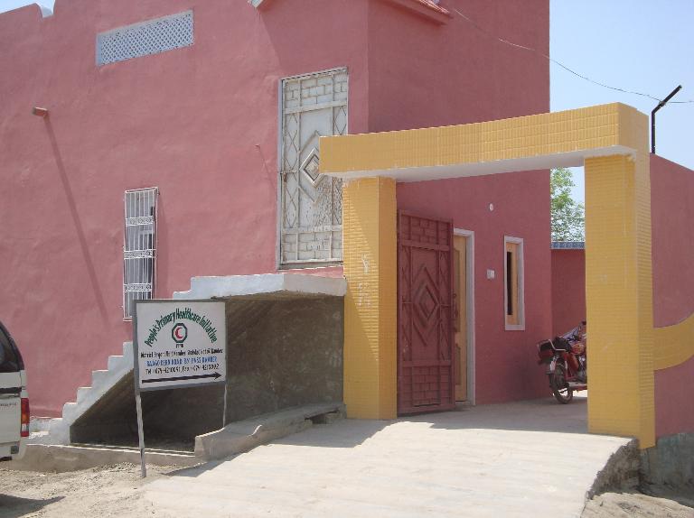
A Basic Health Unit, Kamber
Policing; Kamber-Shahdadkot district
The Kamber Shahdadkot district falls under the Larkana Zone which in turns is part of Sukkur Zone. District Police Officer (DPO) is the head of the Police department and is directly responsible for the law and order situation in the district. There are 18 police stations in the main towns of the district.
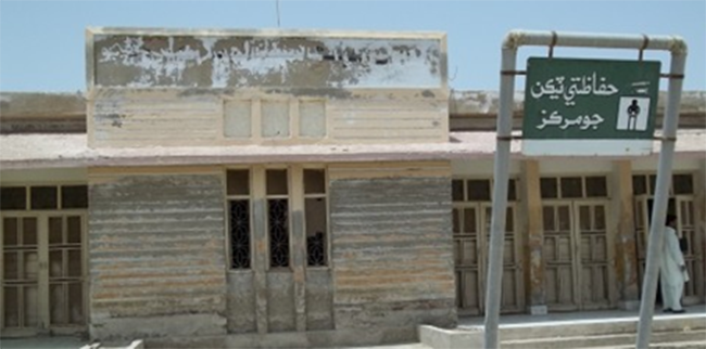
District Support Unit, Kamber Shahdadkot
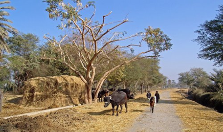
A Village Scene Kamber
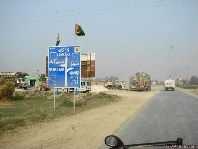
A Provincial Highway
[1] Sindh Development Statistics 2017-18
[2] Health Profile Sindh District 2017
[1] No statistical data on number of telephone exchanges/lines is available
[2] List of Reporting Bank Branches 2019 by State Bank of Pakistan
[1] Profile of Kamber-Shahdadkot District for Saroh, Social Development Organization, Shahdadkot
[2] ibid
[1] Table 17 NUMBER OF COMMERCIAL POULTRY FARMS AND NUMBER OF BIRDS BY SIZE OF FLOCK
[1]1998 Census, 2017 Census Data has not been made public yet.
Environment and biodiversity; Kamber-Shahdadkot District
Kamber Shahdadkot is an agro-industrial district. In urban areas, ambient air quality, supply of contaminated water, unsafe disposal of municipal waste and solid waste, unsafe disposal of infectious hospital waste and congested houses have created severe environmental degradation. Rural area is badly affected by water logging and salinity and non-availability of pure drinking water.
Flora and Fauna; Kamber-Shahdadkot District
Flora
The flora of the district is divided into three parts: irrigated areas, rangelands and the wetland.
The flora of the irrigated zones include gum Arabica or babul (acacia nilotica), Indian walnut or white sirin (albizia procera), ash leaved bead tree or neem (azadirachta indica), pudding pipe tree or amaltas (Cassia fistula), Ethiopian teak or kono (Conocarpus lancifolius), shisham (Dalbergia sissoo), red gum or sufaida (Eucalyptus camaldulensis), banyan tree or bargad (Ficus benghalensis), jungle jalaibee or Manila tamarind (Pithecellobium dulce), silk cotton tree or simal (Salmalia malabarica), Egytian pea or jantar (Sesbania aegyptiaca), arjun tree (Terminalia arjuna), and tulip tree or peepal (Thespesia populnea).
Flora of rangelands include desert acacia or Baveri (Acacia jacquemontii), Senegalian acacia or khoomhhat (Acacia Senegal), woolly amaranthus or boah (aerva tomentosa), camel thom or kandero (alhagi maurorum), amaranth strawberry or blight mareero (amaranthus gracilis), sheda grass (andropogon annulatus), prickly poppy or kanderi (argemone Mexicana), false creeping paspalum or gandhaer (brachiaria ramose), calligonum or phog (calligonum polygonoides), and mudar/rubber bush or ak (calotropis procera).
Plants growing in the wetlands of the district include reed grass or nar (arundo donax), banafsha or water velvet (azolla pinnata), pani jo phog (bergia suffruticosa), water thyme or pani jo booti (hydrilla verticillata), rush or kal (juncus martimus), water willow or aabi bed (justica heterocarpa), lotus or paboro (lotus garcinii), water grass or naro gah (phragmites karka), sedge or delo (scirpus capitatus), and elephant grass or pan (typha angustata).
Fauna
The pheasant, leopard, deer, Sindh ibex, black buck, fox, jackal, wild sheep, markhor, wild boar, and the otter are some of the fauna found in the Kirthar Mountains. Reptiles and amphibians indigenous to the region include include crocodiles, turtles, cobra, lizards, frogs, and a large variety of fish. Birds of the district include night herons, common coot, little cormorant, Eurasian teal, pochard, tufted ducks, eagle, hawk, kite, parrot, partridge, common crow and several varieties of water-fowls. The lakes provide wintering grounds for a large variety of birds, which include shorebirds, cormorants, pelicans, flamingos, jacanas, gulls and terns.
Protected Wildlife Areas and Endangered Fauna; Kamber-Shahdadkot District
- The Drigh Lake: This lake is located near Kamber town. The lake was declared as a wildlife sanctuary in 1972 with a view to conserve and protect natural habitat and provide optimum living conditions to resident and migratory waterfowl. In 1976, owing to its importance for waterfowl, the lake was designated as a Ramsar site.
- Hamal Kutchri Lake: This lake is also situated near Kamber town.It is a fresh water lake; the main source of water for the lake is the different streams that flow down from the Kirthar Mountains. The lake supports a large variety of migratory birds including ducks, geese, coots, shorebirds, cormorants, flamingoes, herons, ibises, gulls, terns and egrets.
- Lungh Lake: Situated in the Kamber taluka, Lungh lake was declared a wildlife sanctuary in 1982. It was developed by a natural depression of an abandoned Indus course in 1890. Because of the construction of the Sukkur barrage, the natural recharge of the wetland was discontinued, after which the Rice Canal became major source of water for the lake. It provides shelter and breeding grounds for a large variety of migratory water fowl
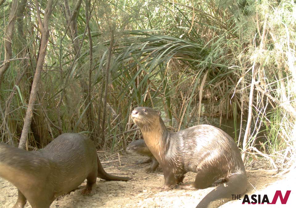
Otters at Shahdadkot
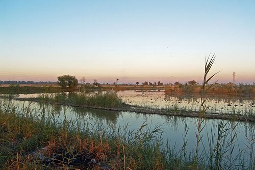
Marsh Vegetation