Share now
Map of Sindh
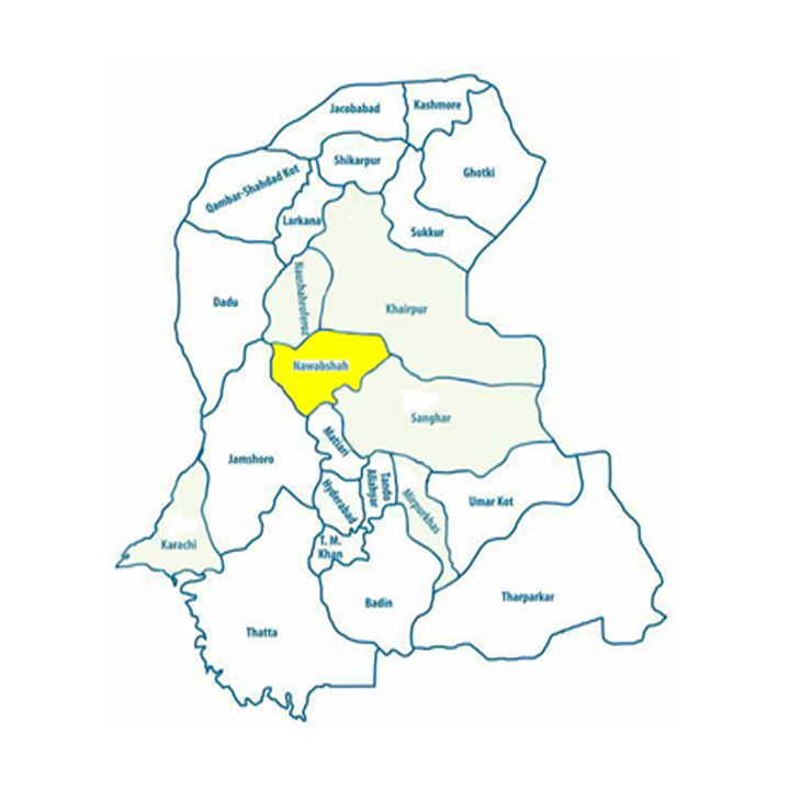
Map of Shaheed Benazirabad District
Sindh Districts
- Karachi District Profile
- Badin District Profile
- Dadu District Profile
- Ghotki District Profile
- Hyderabad District Profile
- Jacobabad District Profile
- Jamshoro District Profile
- Kashmore District Profile
- Khairpur District Profile
- Larkana District Profile
- Matiari District Profile
- Mirpurkhas District Profile
- Naushero FerozeDistrict Profile
- Sanghar District Profile
- Shahdadkot District Profile
- Shaheed Benazirabad District Profile
- Shikarpur District Profile
- Sukkhur District Profile
- Tando AllahYar District Profile
- Tando Mohammad Khan District Profile
- Tharparkar District Profile
- Thatta-Sajawal District Profile
- Umerkot District Profile
Also visit: Punjab, Balochistan, Khyber Pakhtunkhwa
Shaheed Benazirabad District Profile
Introduction/ Geographical Location; Shaheed Benazirabad district
Nawabshah district (now called Shaheed Benazirabad) was named after Syed Nawab Shah, son of Syed Nawaz Ali Shah, who migrated from Sann (District Dadu) to the region with his family in 1881. The district is located between 25° 59Ꞌ to 26° 38’ 5” North latitudes and 67° 52Ꞌ to 68° 27Ꞌ 2” East longitudes. It is bounded on the North by Naushero Feroze and Khairpur districts, on the South by Hyderabad district, on the East by Sanghar and Khairpur districts, and on the West by River Indus, beyond which are Larkana and Dadu districts. The district is situated nearly in the center of Sindh and is, thus, known as the Heart of Sindh. It was renamed Shaheed Benazirabad district[1] in April 2008. The district continues to be referred to with both names in common parlance.
Shaheed Benazirabad District at a Glance
| Name of District | Shaheed Benazirabad District (pre-2008: Nawabshah) | ||
| District Capital | Nawabshah Town | ||
| Population[2] | 1,613,000 persons | ||
| Area[3] | 4,502 km2 | ||
| Population Density[4] | 358.3 persons/ km2 | ||
| Population Growth Rate[5] | 2.3% | ||
| Male Population[6] | 51.7% | ||
| Female Population[7] | 48.3% | ||
| Urban Population[8] | 30.3% | ||
| Tehsils/Talukas |
4 Talukas: 1. Nawabshah Taluka 2. Sakrand Taluka 3. Daulatpur Taluka 4. Daur Taluka |
||
| Main Towns | Nawabshah, Sakrand, Daulatpur, Qazi Ahmad, Shahpur Jahanian, Bandhi, Jam Sahib, Hasan Jamali, Sabu Raho, Pahar Khan Jamali, Bucheri, Deh Phulleli, Rupa Mari, Khaddar, Mehwal Khan Mari, and Daur | ||
| Literacy Rate[9] | 46% | ||
| Male Literacy Rate[10] | 64% | ||
| Female Literacy Rate[11] | 27% | ||
| Major Economic Activity[12] | Agriculture, Livestock breeding, Fishing & Hunting | 62.5% | |
| Construction | 15.3% | ||
| Community, Social & Personal Services | 20.5% | ||
| Others | 1.7% | ||
| Main Crops | Rice, sugarcane, jowar, cotton, bajra, maize, sesanum, wheat, barley, gram, rapeseed & mustard, guar seed, linseed, sunflower, soya bean, moong, and masoor | ||
| Major Fruits | Bananas, guavas, watermelon, musk melon, dates, citrus, ber, and mangoes | ||
| Major Vegetables | Okra, tinda, bitter gourd, cucumber, peas, potatoes, onion, turnip, tomatoes, carrots, spinach, cauliflower, cabbage, fenugreek, chilies, and long melon. | ||
| Forests (Area)[13] | 309.2 HA[14] | ||
| Total Provincial Highways[15] | 71.8 km | ||
| Secondary Roads[16] | 469.5 km | ||
| Access Roads[17] | 714.2 km | ||
| No Of Grid Stations[18] | 05 grid stations of 132 KV capacity each and 1 of 66 KV | ||
| Industrial Zones |
1 Sindh Industrial & Trading Estate 1 Sindh Small Industries Corporation Industrial Estate, Nawabshah. Total number of Factories: 38 |
||
| Major Industry[19] | Cotton Ginning Factories | 24 Units | |
| Sugar Mills | 3 Units | ||
| Flour Mills | 5 Units | ||
| Rice Mills | 5 Units | ||
| Fiber Plant | 1 Unit | ||
| Household Size[20] | 6 persons per house | ||
| Houses with Piped Water Inside[21] | 23.6% | ||
| Houses with Electricity[22] | 75.5% | ||
Table 1.1 S. Benazirabad District at a Glance
[1] Since the name change of the district is relevantly recent, this chapter will use the older name (Nawabshah) when citing from documents published prior to the name change, and will use the new name (S. Benazirabad) when referring to documents published post-2008.
[2] 2017 Census Data
[3] 1998 Census
[4] 2017 Census
[5] 2017 Census
[6] 2017 Census
[7] 2017 Census
[8] 2017 Census
[9] Pakistan Social & Living Measurement Survey 2014-15 (PSLM); latest available
[10] PSLM
[11] PSLM
[12] 1998 Census; 2017 Census data is being compiled.
[13] Sindh Development Statistics 2017-18
[14] According to Land Utilization Statistics 26,000 HA have been marked as forests in the district
[15] Road List Issued by GoS 2009 (Latest available)
[16] Road List
[17] Road List
[18] HESCO Environmental and Social Assessment, 2007, Latest available
[19] Sindh Enterprise Development Fund; Investment Opportunities in District Shaheed Benazirabad
[20] 1998 Census; 2017 Census data has not been made public yet.
[21] 1998 Census; 2-17 Census Data has not been made public yet.
[22] 1998 Census; 2017 Census data has not been made public yet.
Brief History – Governmental Structure – Administrative Divisions – Heritage Buildings/ Archeological Sites and Picnic Spots
Brief History of Shaheed Benazirabad District
The history of the area called Nawabshah district (now S. Benazirabad district) is not distinguished from the history of Sindh, since no separate records are available. This part of Sindh has been ruled by Jains[1], Buddhists, Greeks, and Arabs. Sindh came under Muslim rule after the area was conquered in 711 AD, by Arab General Muhammad Bin Qasim who defeated Raja Dahir at Brahmanabad in Shahdadpur, which formed part of Nawabshah district till 1953, when it was separated and made part of Sanghar district. The Sammas (1351-1524 AD), Arghuns (1520-1554 AD), Tarkhans (1554-1591 AD), and the Kalhoras (under Noor Muhammad Kalhora) controlled the region after the Arab conquest. The Kalhoras ruled for 82 years, from 1701 to 1783, after which the Talpurs rose to power in the region, having defeated the Kalhoras at Halani in 1782. Halani was in Kandiaro which was formerly a Taluka of Nawabshah district but is now in Naushero Feroze district. At the time of the Kalhora defeat by the Talpurs, Abdul Nabi Kalhora was the chief of the Kalhoras.
After the 1843 invasion of Sindh by General Charles Napier, who was also made the first Governor General of Sindh, the region was divided into various administrative divisions which were assigned to Zamindars (or landlords) to collect taxes for the British. During the last decade of the 19th century, and the early half the 20th century, the rulers developed these areas as urban centers. People migrated from other districts and provinces as well, and started to reside in the region. The British Empire named these small developed areas talukas, administrative classifications relevant to-date.
Taluka Nawabshah was established in 1907, named after Syed Nawab Shah, son of Syed Nawaz Ali Shah, who migrated from Sann, (district Dadu) to Nawabshah with his family in 1881. The rulers of that period developed the area into an urban area and the town thus developed was called Nawabshah. Families from other districts and provinces also settled here and thus the area developed until it became big enough to be upgraded to Nawabshah district in 1912. Mr. Hamid Ali Khan was the first Deputy Commissioner of Nawabshah district, taking office on November 1, 1912. The first Superintendent of Police of the district was P.M. Stewart, while the first Muslim Superintendent of Police Nawabshah District was Moulvi Zia-ud-Deen who took office on July 26, 1918. At the establishment of the district in 1912, there were 7 talukas: Kandiaro, Naushero Feroze, Moro, Sakrand, Nawabshah, Sinjhoro, and Shahdadpur. Naushero Feroze is now a separate district and Kandiaro and Moro Talukas now form part of Naushero Feroze district. Sakrand is still part of Nawabshah district, whereas Sinjhoro is part of Sanghar district and Shahdadkot is itself a separate district.
Nawabshah district was renamed Shaheed Benazirabad District in April 2008, when a resolution was passed by Provincial Assembly, Sindh unanimously.
Nawabshah city was a sizeable town during the Indus Valley Civilization as is evident from recent discoveries at Chanhu Daro in S. Benazirabad district.
Governmental Structure; Shaheed Benazirabad District
At the Federal level, S. Benazirabad district is allocated a set number of representatives in both the National Assembly and the Provincial Assembly:
- Number of seats in the National Assembly 2
- Number of seats in the Provincial Assembly 5
The district has 1 municipal committee: Nawabshah, and 8 Town Committees as follows:
- Daur
- Bandhi
- Jam Sahib
- Bucheri
- Sakrand
- Kazi Ahmad
- Daulatpur
- Shahpur Jehania
Administrative Divisions; Shaheed Benazirabad District
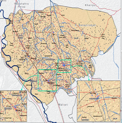
There are 4 tehsils/ talukas in the district as follows:
| Daulatpur Taluka | 12 Union Councils |
| Nawabshah Taluka | 13 Union Councils |
| Sakrand Taluka | 12 Union Councils |
| Daur Taluka | 14 Union Councils |
Table 1.2 S. Benazirabad Administrative Divisions
Heritage Buildings/Archeological Sites/Picnic Spots; Shaheed Benazirabad District
The following Sites are being protected under Pakistan Laws:
- Amri Mounds; Shaheed Benazirabad district: the site of an ancient settlement dating back to 3600 BC, containing excavated remains of a pre-Harappan fortified town. The site is located East of Nawabshah city
- Buddhist Stupa, and tomb of Thul Mir Rukun, Village Mir Rukan, Daulatpur; Shaheed Benazirabad district: this is built of bricks with 4 tiers, each one smaller than the one below, surmounted by a dome. This archeological and historical tomb is 18.3 m high, and is at least 1,000 years old
- Tomb of Mir Noor Muhammad Kalhora, Village Noor Muhammad; Shaheed Benazirabad district: located 27 km from Daulatpur, Nawabshah
- Bhiro Bham Mound, Tipa Chibore, Nawabshah; Shaheed Benazirabad district: it covers an area of about 40 acres. The mound is about 3 to 4.6 m higher than the surrounding fields. It shows traces of masonry work which indicates fortifications with brick sizes of 12” x 9” x 2” (30.5 x 22.9 x 5.1 cm). An assortment of pot shards, shell bangles, terracotta animals, stone beads, and copper coins was discovered at this site
- Fort of Dalel Dero: a mud fort built by Mir Dalel Khan, a member of the Talpur family; Shaheed Benazirabad district. It is located between Sakrand and Nawabshah
- Shrine of Sakhi Jam Datar, Village Jam Sahib, Syed Asghar Ali Shah; Shaheed Benazirabad district: popularly known as Sakhi Jam Datar, he was revered by both Muslims and Hindus
- Shrine of Faqir Bilawal or Balo Faqir known as Baloo Ja Quba, Nawabshah City
- Chaheen jo Daro: an archeological site near the village of Jamalkeerio, 2 km from Rohri Canal and 10 km South of Nawabshah; Shaheed Benazirabad district
Other tourist attractions include:
- Deh Aro II; Shaheed Benazirabad district: a natural wetland, comprising 36 lakes, and a complex of 4 major habitats types—desert, wetland, marsh, and agricultural lands—in S. Benazirabad district. The complex presents a unique example of a desert wetland ecosystem that supports a variety of rare and endangered wildlife species, as discussed already
- Pai Forest: a protected riverine forest in Nawabshah; Shaheed Benazirabad district. This also offers a recreational spot
- Momal Park; Shaheed Benazirabad district
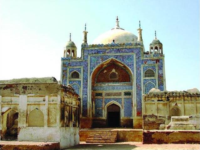
Figure 1.3 Tomb of Noor Muhammad Kalhoro
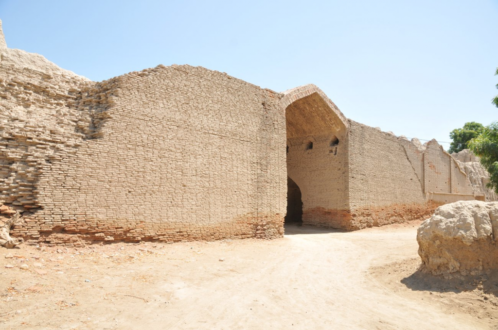
Figure 1.4 Dalel Dero Mud Fort
[1] Traditionally known as Jain Dharma, Jainism is an ancient Indian religion which preaches non-violence and respect for all living beings. Architectural remains of the practice of Jainism in Sindh can still be seen scattered in the districts of Tharparkar, Karachi, and Hyderabad.
Topography; Shaheed Benazirabad district
Geographically, most of the district is located in what is termed as vicholo or Middle Sindh, with Nawabshah town being almost the exact center of Sindh. With the exception of the northeastern part of Nawabshah Taluka which is a desert known as Gunjo Thar, the rest of the district is a fertile plain formed by the Indus River. The average elevation of the area is about 50 meters above sea level.
Rivers, Streams, and Lakes; Shaheed Benazirabad district
River Indus is the only river of the district, and runs along the western boundary of the district for about 90 km. Since the river is uncertain in its course, it is not always the boundary of the district. At present, it passes through Sakrand Taluka.
The Deh Akro II[1] Protected Wildlife Sanctuary is home to 36 lakes. It is a desert wetland complex in Sakrand Taluka of S. Benazirabad district and is on the Ramsar list of protected areas of Pakistan. The lakes include Akro, Chaachh, Loon Khan and Jansar, Mirco, Allah Dino, Mureed Waro, Masset Waro, Batnion, Sanahry 1, Sanahry 2, Taker, Karang, Bandan Wari, Wasso Wash, Baron Waron, Kinro, Murhne, Khararo, Kandy Waro, Chugri, Chhamb, Bolahi, Hadero, Baro, Khurand Wah, Khan Wari, Manak Waro, Wallan, Akan Wari, and Shore Jee lakes. These lakes have formed due to seepage from the irrigation canals—Nara and Jamrao.
Forests; Shaheed Benazirabad district
Total area marked for forests in S. Benazirabad district is 26,000 HA[2]. There are Riverine forests and irrigated plantations in the district. The main vegetation of these forests is babul (Acacia nilotica), kandi/jand or khejri (Prosopis spicigera), bahan or poplar (Populus euphratica) and 2 species of tamarisk: lai or French tamarisk (Tamarisk gallica) and jhao or salt cedar (Tamarisk dioica).
Some of the important reserved/ protected forests of the district include:
- Pai Forest, Sakrand Town: a 1,933 HA of Irrigated Plantation
- Amri Forest and Nasri Forest: both forests are adjacent to each other and are located between Goth Jan Muhammad Lashari and Goth Amri, close to Chachar town
- Riverine Forests of Keti Jurio, Mari and Butho: these cover a total area of 870 HA
- Lakhat Reserved Forest, Sakrand: 101 HA of Riverine Forest
- Kot Dhingano Reserved Forest, Sakrand: 30 HA of Riverine Forest
Soils; Shaheed Benazirabad district
The soil is sandy, with hard clay loams. The district benefited more than any other part of Sindh from the development of irrigation from Rohri Canal.
- Benazirabad district consists of sedimentary rocks of early Paleozoic Late Pre-Cambrian age. Two types of soil classes exist in the area: sandy soils in the desert and clay mixed sandy soil in the low-lying areas. Soils in the desert area are sandy, silty, and moderately calcareous while alluvial deposits date back to the time when Indus River flowed through this area. Salinity and water logging are common problems.
Climate; Shaheed Benazirabad district
For the purposes of climate records, S. Benazirabad district is divided into 2 zones: North and South. The northern part is affected by the desert and hence climatic conditions are extreme. The southern part enjoys the advantages of sea breeze from the Indian Ocean. The summer season commences from April and continues till October. May, June, and July are the hottest months in the district, with temperatures going up to 50 °C. The mean maximum and minimum temperatures during June (the hottest month) are 44 °C and 28 °C respectively. The months of August and September are humid and stifling. December, January, and February are the coldest months. Mean maximum and minimum temperatures during January (the coldest month) are 24 °C and 6 °C respectively. Frost is rare but does occur.
Rainfall is scanty, erratic, and mostly occurs during the monsoon season—June to September; mean annual rainfall is 200 mm.
Seismic Activity/Seismicity; Shaheed Benazirabad district
The district is located in Zone 2 A of the Seismic Activity Zone Map of Pakistan which means there will be low to moderate damage to property due to earthquakes.
[1] Official Website http://foreverindus.org/ie_protectedareas_ramsar.php
[2] According to Land Utilization Statistics for the year 2017-18
Population; Shaheed Benazirabad District
The following table shows the tehsil-wise population of Nawabshah district as per the 2017 Census:
| District/Taluka | Area km2 | Population | Male % | Female % | Urban% | Growth Rate % | ||
| Nawabshah District | 4,502 | 1,612,847 | 51.7 | 48.3 | 30.3 | 2.3 | ||
| Daulatpur Taluka[1] | 556 | 348,702 | ||||||
| Nawabshah Taluka | 2,552 | 413,913 | ||||||
| Sakrand Taluka | 1,394 | 372,675 | ||||||
| Daur Taluka[2] | NA | 477,357 | NA | |||||
Table 1.3 S. Benazirabad Population Statistics
Religions; Shaheed Benazirabad district[3]
| Muslims | 96.5% |
| Hindus | 2.8% |
| Christians | 0.3% |
| Ahmadis | 0.2% |
| Scheduled castes | 0.1% |
| Others | 0.03% |
Table 1.4 S. Benazirabad Religions
Languages; Shaheed Benazirabad district[4]
| Urdu | 8.7% |
| Punjabi | 7.9% |
| Sindhi | 79.3% |
| Pashto | 0.5% |
| Balochi | 1.8% |
| Seraiki | 0.9% |
| Others | 0.9% |
Table 1.5 S. Benazirabad Languages
[1]Also called Qazi Ahmad Taluka
[2] Constituted out of Nawabshah Taluka in 2005
[3] 1998 Census; 2017 Census Data has not been made public yet.
[4] 1998 Census; 2017 Census Data has not been made public yet.
Economic Activity – Economic Infrastructure
Economic Activity; Shaheed Benazirabad District
The major economic activities of the district are[1]:
- Agriculture, Livestock Breeding, Fishing & Hunting (62.5%)
- Construction (15.3%)
- Community, Social & Personal Services (20.5%)
- Others (1.7%)
Land Use; Shaheed Benazirabad District
The following table shows the main land use statistics of the district according to Sindh Development Statistics 2017-18:
| Land Use | Area | Land Use | Area |
| Total Area | 451,000 HA | Reported Area | 451,000 HA |
| Total Cultivated Area | 385,000 HA | Net Sown | 166,000 HA |
| Current Fallow | 218,000 HA | Total uncultivated Area | 67,000 HA |
| Culturable waste | 6,000 HA | Forest area | 26,000 HA |
Table 1.6 S. Benazirabad Land Use Statistics
Irrigation Network; Shaheed Benazirabad District
The district is irrigated through the Sukkur Barrage Irrigation System. There are 2 Irrigation Water Supply Divisions called Nasrat Division and Dad Division in the district. The canals of both these divisions off-take from Rohri Canal which, in turn, off-takes from Sukkur Barrage.
During British rule (1843-1932), there were 21 feeder canals, both big and small[3] tapping Indus at various times, which are still being used for irrigation purposes. The notable ones are Naulakhi, which is 40 km in length, and 12 m wide at its head[4], Nasrat (48 km long and 10 m wide) and Dad Wah (85 km long). There are now 74 channels, both big and small, about 645 km in length in the district. Naulakhi is one of the oldest canals and is believed to have been excavated during the Samma period. Nasrat canal was excavated by Nasrat Khan Chandio during the rule of Mian Noor Mohammad Kalhoro. Murad Branch (40 km long), Bagh Wah (44 km long) and Piroz Wah (29 km long) are 3 important branches off Naulakhi, excavated during Kalhora rule.
Since the ground water in Nawabshah Taluka contains arsenic, it is not fit for human consumption and tube well irrigation is not used. Other talukas use tube well irrigation, since the ground water is potable. The following table shows the mode of irrigation and area irrigated by each mode as per Sindh Development Statistics 2017-18:
| Total Irrigated Area | 91,669 HA | Un-Irrigated Area | 74,648 HA |
| Canal Irrigated | 80,041 HA | Wells Irrigated | – HA |
| Tube Well Irrigated Area | 11,628 HA |
Table 1.10 S. Benazirabad Irrigation Statistics
Agriculture; Shaheed Benazirabad District
The district belongs to the Southern Irrigated Plain Agro-Ecological Zone of Pakistan. Main crops of the district are rice, sugarcane, jowar, cotton, bajra, maize, sesanum, wheat, barley, gram, rapeseed & mustard, guar seed, linseed, sun flower, soya bean, moong beans, and masoor.
Major fruits are banana, mango, guava, watermelon, musk melon, citrus, and pomegranate.
Major vegetables include okra, tinda, bitter gourd, cucumber, peas, potatoes, onion, turnip, carrots, spinach, cauliflower, cabbage, fenugreek, chilies, and long melon.
Livestock Breeding; Shaheed Benazirabad District
Livestock plays an important role in the economy of the country. It provides job opportunities to a majority of the rural population. The following table shows the livestock statistics of the district according to Sindh Development Statistics 2017-18:
| Cattle | 339,000 Heads | Buffaloes | 390,000 Heads | Sheep | 102,000 Heads |
| Goats | 878,000 Heads | Camels | 5,000 Heads | Asses | 42,000 Heads |
| Horses | 3,000 Heads | Mules | – Heads |
Table 1.7 S. Benazirabad Livestock Breeding
The indigenous livestock of the district include kooka sheep, kamori, and barbary goats, and cross breed cattle.
Poultry farms; Shaheed Benazirabad District
The poultry industry is the second biggest industry of Pakistan, contributing significantly to the national economy while also providing jobs to a large segment of the population. There are 278 poultry farms[2] in the district.
Fishing; Shaheed Benazirabad District
Fishing is carried out in the Deh Akro II Wetland Complex and the River Indus. Most of this fish is consumed locally.
Minerals and Mining; Shaheed Benazirabad District
Carbonate soda is being mined in S. Benazirabad district. Part of the Sinjhoro Block exploration area for natural gas is located in the district. Gas is being mined at the block.
Industry and Manufacturing; Shaheed Benazirabad District
There are 2 Industrial Estates in District Shaheed Benazirabad: the Sindh Industrial & Trading Estate, Nawabshah, and Sindh Small Industries Estate, Nawabshah.
The following table shows the type and number of industries[3] working in the district:
| Industry | Units |
| Cotton Ginning Factories | 11 Units |
| Sugar Mills | 03 Units |
| Flour Mills | 04 Units |
| Rice Mills | 07 Units |
| Fiber Plant | 01 Unit |
| Textile Mills | 02 Unit |
| Oil Mill | 12 Unit |
| Chemical; Petroleum; Rubber & Plastic Goods | 01 Unit |
| Agricultural Machinery Factory | 01 Unit |
Table 1.8 S. Benazirabad Industrial Units
Handicrafts; Shaheed Benazirabad District
Most of Sindh’s interior areas, including S. Benazirabad district, produce rich and colorful traditional handicrafts and artwork in different mediums, like cloth, wood, clay, and glass. The main expertise of the region lies in the production of rallies, Sindhi caps, decoration pieces, embroidery work, gota kanari work, crochet work, and needle work. Khaddi cloth on hand looms is also produced in the region.
Economic Infrastructure; Shaheed Benazirabad District
Important modes of transport and communication in the S. Benazirabad district are roads and railways. The district is also linked to other parts of the country by air. There is a network of black topped roads in the district connecting all Taluka Headquarters and Towns. In addition, kacha (non-metaled) roads also exist in the district. Union councils have constructed a large number of links from farms to market roads, which have also facilitated trade and communication.
Road Statistics; Shaheed Benazirabad District
As per the Road List issued by the Sindh Government, the following table shows the road lengths in the district:
| Provincial Highways | 159.8 km |
| Secondary Roads | 469.5 km |
| Access Roads | 740.7 km |
Table 1.9 S. Benazirabad Roads Statistics
According to Sindh Development Statistics 2017-18, total roads in the district were 1,714 km.
Some important roads of the district include:
- National Highway N-5 passes through this district
- Nawabshah to Kotlalu Kumb Road
- Nawabshah to Sanghar Road
- Nawabshah to Sakrand Road
Railways and Airways; Shaheed Benazirabad District
Nawabshah Railway station is one of the main railway junctions of Pakistan Railways, located on the main Karachi-Peshawar Railway line. Other smaller railway stations include Sukhapur Railway Station, Bucheri Railway Station, Jam Sahib Railway Station, Tando Siro Railway Station, Bandhi Railway Station, Daur Railway Station, Sakrand Railway Station, and Sarhari Railway Station.
There is an International airport in Nawabshah, called Nawabshah Airport, which features the longest runway in Pakistan. In addition, there is a PAF air base in Nawabshah.
Figure 1.5 Nawabshah Railway Junction
Radio and Television; Shaheed Benazirabad District
There is no radio station in the district, nor is there a TV station, but both TV and radio can be accessed.
Telecommunications; Shaheed Benazirabad District
There are telephone exchanges in every city and town of the district. In addition, all the cellphone operators provide their services in every part of the district.
Post Offices/Courier Services; Shaheed Benazirabad District
Pakistan Post Office has its offices in all taluka headquarters with branch offices in various locations. Urgent Mail Service (UMS) is easily available. In all, there are 40 offices[1] and branch offices of Pakistan Post in the district.
Banking/ Financial Services; Shaheed Benazirabad District
Most of Pakistan’s major banks have their branches[2] in the district, including:
- Al-Baraka Bank Ltd.
- Allied Bank Ltd.
- Askari Bank Ltd.
- Al-Falah Bank Ltd.
- Bank Al Habib Ltd.
- Bank Islami Pakistan Ltd.
- Faisal Bank Ltd.
- Habib Bank Ltd.
- JS Bank Ltd.
- KASB Bank Ltd.
- Muslim Commercial Bank Ltd.
- Meezan Bank Ltd.
- National Investment Bank Ltd.
- Sindh Bank Ltd.
- Summit Bank Ltd.
- United Bank Ltd.
- National Bank of Pakistan Ltd.
- Zarai Taraqiati Bank Ltd.
In all there are 63 branches of conventional banks and 13 branches of Islamic banks in the District.
Electricity and Gas; Shaheed Benazirabad District
HESCO (Hyderabad Electric Supply Corporation) is responsible for providing electricity to S. Benazirabad. There are 6 grid stations in the district, out of which 5 grid stations have a capacity of 132 KV and one has 66 KV capacity.
Educational Institutions; Shaheed Benazirabad District
The literacy rate of the district as per Pakistan Social & Living Measurement Survey 2013-14 (PSLM) is 46% with 61% urban and 39% of the rural population being literate. The district is home to the only all-female medical college in Sindh: the Peoples’ Medical College.
The following table shows details of all government educational institutions of the district as per Sindh Development Statistics 2017-18:
| Institution | Boys/Girls | Institution | boys/girls |
| Primary Schools | 1,871/263 | Middle Schools | 102/27 |
| High Schools | 76/22 | Higher Secondary Schools | -/- |
| Colleges | 04/03 | Post Graduate College | 01/- |
| Technical schools | 02/01 | Commercial Training | 02/- |
| Vocational training | 01/15 | Medical Colleges/University[5] | 01 |
| Engineering University[6] | 01 | Universities[7] | 01 |
Table 1.11 S. Benazirabad Educational Institutes
There are private educational schools (Primary to Secondary level) in the district as well.
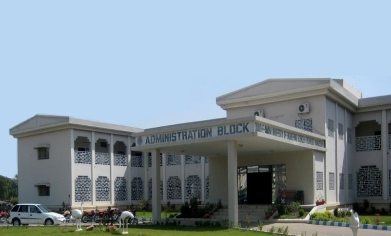
Figure 1.6 Quaid-e-Awam University, Admin. Block
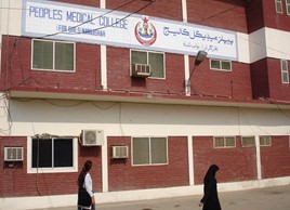
Figure 1.7 Peoples’ Medical College Building
Healthcare Facilities; Shaheed Benazirabad District
The following table shows the number of government healthcare institutions in the district as per Health Profile Sindh Districts 2017
| Institution | No./Beds | Institution | No./Beds |
| Teaching Hospitals | 02/925 | Hospitals | 01/20 |
| Basic Health Units | 37/74 | Dispensaries | 103/- |
| Rural health Centers | 10/164 | Mother Child Health Center | 21/- |
| T B Clinics | 06/- | Private Hospitals | 12/285 |
| Private TB Clinics | -/- | Private Dispensaries | 65/10 |
Table 1.12 S. Benazirabad Health Institutions
In addition there 01 Leprosy Clinic, 01 Truama Emergency Center and 01 Unani Shifa Khana[8].
Policing; Shaheed Benazirabad District
The Hyderabad Regional Officer is responsible for policing the district. The Additional Inspector General Police (AIGP) is in-charge of the Hyderabad Zone, and includes S. Benazirabad. The District Police Officer (DPO) Nawabshah is in-charge of the district, and reports directly to the AIGP Hyderabad.
There are a total of 28 police stations[9] in the district. Each Police station is headed by Deputy Police Officer/ Senior Superintendent Police.
Figure 1.8 Session Court, S. Benazirabad District
[1] Official Website: Pakistan Post
[2] List of Reporting Bank Branches by State Bank of Pakistan, 2019.
[3] M.H Panhwar. Six Thousand Years of History of Irrigation in Sindh. 2011.
[4] Head of a canal is its terminus with the main canal or river
[5] Peoples’ University of Medical & Health Sciences for Women
[6] Quaid-e-Awam University of Engineering & Technology
[7] Shaheed Benazir Bhutto University
[8] Unani Shifa Khana uses herbal medices
[9] Official Website: Sindh Police
[1] According to 1998 Census, 2017 Census Data has not been made public yet.
[2] Table 17, Number of Commercial Poultry Farms and Number of Birds by Size of Flock
[3] Official Website; http://skillingpakistan.org/employer/province/9/district/61?page=1 retrieved July 2020
Environment and Biodiversity; Shaheed Benazirabad District
Some parts of S. Benazirabad fall under the Nara desert Eco-Region of Pakistan. These areas are characterized by large tracts of barren land that receive very little rainfall leading to frequent drought-like conditions. The vegetation primarily comprises of stunted scrubs. The other parts are fertile and irrigated by the Indus Basin Irrigation System. Since the district is devoid of large-scale industry and also lacks a large industrial base, it is fairly free of air pollution; some pollution is caused by vehicular emissions and dust particles.
Flora and Fauna; Shaheed Benazirabad District
Flora
The most common trees found in the district are babul (Acacia nilotica), kandi or jand/khejri (Prosopis spicigera), bahan or poplar (Populus euphratica) and 2 species of tamarisk i.e lai or French tamarisk (Tamarisk gallica) and jhao or salt cedar (Tamarisk dioica). The riverine forests along the banks of the Indus support a variety of flora including acacia, tamarisk, and prosopis.
Common flora of the Pai Forest[1] consists of babur (Acacia nillotica), baid mushk (Eucalyptus camaldulensis), ber (Zizypus nummalaria), devi (Prosopis juliflora), dabh (Desmostrachya bipinnata), gah (Eragrostis japonica), 2 varieties of jaar/ khabbar (Salvadora deoides), kandi (Prosopis cineraria), kirar (Capparis deciduas), and 3 varieties of lai (tamarix sp.)
Common plant species of Deh Akro II Wetland Complex include jand (Prosopis cinerariea), valayti babul/babur (Prosopis juliflora), baonli (Acacia jacquementii), babul (Acacia nilotica), desert cotton (Aerva javanica), jhal (Salvadora oleoides), karir (Capparis deciduas), medicinal shrub Cassia Italica, phog (Calligonium polygonoides), a medcinal plant enpharibia prostrata, wild sugarcane (Saccharum spontaneum), a grass called Saccharum benealensis, farash (Tamarix aphylla), ber (Zizyphus mauritiana and Zizyphus nummularia), jawansa (Alhagi maurorum), elephant grass (Typha elephantica), medicinal plant aak (Calotropis procera),and lai (Tamarix indica). In addition, a large number of medicinal plants/herbs and fodder grow in the complex.
Fauna
Mammals found in the Pai Forest and Deh Akro II are Asiatic jackal, hog deer, grey mongoose, jungle cat, pangolin, Bengal fox, wild boar, desert cat, fishing cat, desert hare, and Indian porcupine.
Common birds found include Eurasian collared dove, grey shrike, green bee-eater, jungle babbler, purple sunbird, parakeet, red collared purple dove, black and grey partridges and green finch, black ibis, white-eyed pochard, darter or snakebird, marbled teal, mallard, moor hen, houbara bustard, spoon bill, garganey, and glossy ibis.
Reptiles include the marsh crocodile, ghariyal, snakes, and various types of lizards.
Protected Wildlife Areas and Endangered Fauna; Shaheed Benazirabad District
The following areas of the district have been declared as protected under Pakistan Government Laws:
- Pai Forest, Sakrand Town; S Benazirabad district: the entire plantation is spread over an area of 1,933 HA. Out of the total area, only 1,502 HA (78%) are under tree cover while the remaining 319 and 112 HA are blank or on high-lying areas, respectively. The forest provides sanctuary to hog deer, Asiatic jackal, Indian grey mongoose, small Indian mongoose, jungle cat, pangolin, Indian Bengal fox, desert hare, and Indian porcupine. There are a number of bird species found in the forest such as green finch, red vented-bulbul, white-cheeked bulbul, pied bush-chat, crow pheasant, black drongo, Indian roller, long-tailed prinia, grey wagtail, green pigeon, turtle dove, common starling, bank myna, common babbler, jungle babbler, purple sunbird, rose-ringed parakeet, common kite, small green bee-eater, crested lark, blue cheeked bee-eater, finch lark, Indian sand-lark, bay-backed shrike, and grey shrike
- Lakhat Wildlife Sanctuary, Sakrand Town; S Benazirabad district
- Kot Dinghano Wildlife Sanctuary, Sakrand Tehsil; S Benazirabad district
- Deh Akro II Wetland Complex (a Ramsar site) Nawabshah City; S Benazirabad district: This wetland complex is a unique example of a desert wetland ecosystem that hosts a variety of rare and endangered wildlife species. It is a natural wetland comprising 36 lakes and a complex of 4 major habitat types: desert, wetland, marsh, and agricultural lands. It supports more than 18 species of mammals, 16 species of reptiles, 14 species of fish, and 101 species of birds, and regularly supports over 20,000 water birds. The fauna also includes waterfowl, crocodiles, otters, and fish. Endangered fauna of Deh Akro II include desert cat, fishing cat, hog deer, darter or snake bird, garganey, glossy ibis, spoon bill, black ibis, houbara bustard, marbled teal, white-eyed pochard, and marsh crocodile
[1] foreverindus.org/pdf/sites/paiforest.pdf (retrieved on December 7, 2010)