Share now
Map of Balochistan

Map of Chitral District

Khyber Pakhtunkhwa Districts
- Peshawar District Profile
- Abbottabad District Profile
- Bannu District Profile
- Battagram District Profile
- Buner District Profile
- Charsadda District Profile
- Chitral District Profile
- Dera Ismail Khan District Profile
- Lower Dir District Profile
- Upper Dir District Profile
- Hangu District Profile
- Haripur District Profile
- Karak District Profile
- Kohat District Profile
- Kohistan District Profile
- Lakki Marwat District Profile
- Malakand District Profile
- Mansehra District Profile
- Mardan District Profile
- Nowshera District Profile
- Shangla District Profile
- Swabi District Profile
- Swat District Profile
- Tank District Profile
- Torghar District Profile
- Bajaur Tribal Distyrict Ptofile
- Khyber Tribal District Profile
- Kurram Tribal District
- Mohmand Tribal District Profile
- North Waziristan Tribal District Profile
- Orakzai Tribal District Profile
- South Waziristan Tribal District Profile
Also visit: Sindh, Punjab, Baluchistan
Introduction/Geographical Details; Chitral District
Chitral district lies between 35° 13Ꞌ to 36° 55Ꞌ north latitudes and 71° 12Ꞌ to 73° 53Ꞌ east longitudes. Situated in the extreme northeast of Pakistan and Khyber Pakhtunkhwa province, the district is bordered by Afghanistan in the north and west, and the narrow Afghan Wakhan Corridor separates it from Tajikistan. On its south is the Upper Dir district as well as the Kunar province of Afghanistan, and on the district’s east is the Ghizer district of the Northern Areas (Gilgit-Baltistan) and Swat district.
Chitral Town is situated on the west bank of the Chitral (or Kunar River) at the foot of Tirich Mir peak which at 7,708 m (25,289 ft) is the highest peak of the Hindu Kush.
Chitral District at a Glance
| Name of District | Chitral District | |
| Headquarters | Chitral Town | |
| Area[1] | 14,850 km2 | |
| Population[2] | 447,362 persons | |
| Population Density[3] | 30.3 persons/ km2 | |
| Growth Rate[4] | 1.8% | |
| Male Population[5] | 50.5% | |
| Female Population[6] | 49.5% | |
| Urban Population[7] | 11.1% | |
| Literacy Rate[8] | 62.0% | |
| Male Literacy Rate[9] | 76.0% | |
| Female Literacy Rate[10] | 45.0% | |
| Tehsils/ Talukas |
02 Tehsils: 1. Chitral Tehsil 2. Mastuj Tehsil |
|
| Important Cities | Chitral, Drosh, Shishi Kow, Kalash, Shandur, Ayun Valley, Garam Chashma, Sonughour, Booni, Charun Owir, Prayet, Reshun, Mastuj, and Upper Chitral | |
| Major Economic Activity[11] | Agriculture with its Allied Livestock Breeding & Fishing | 26.6% |
| Community, Social & Personal Services | 41.8% | |
| Construction | 4.4% | |
| Manufacturing | 5.6% | |
| Transport & Storage | 5.8% | |
| Whole Sale/Retail, Hotel/Restaurant | 8.9% | |
| Manufacturing | 5.6% | |
| Others | 1.3% | |
| Main Crops | Maize, barley, rice, wheat, bajra, maash, masoor, moong, and sorghum | |
| Major Fruits | Apples, apricots, pears, mulberry, grapes, citrus, peach, plums, pomegranate, cherry, walnut, persimmon, strawberry, prunes, almonds, hazelnut, and loquat | |
| Major Vegetables | Potatoes, onions, carrots, brinjal, turnips, tomatoes, chilies, garlic, peas, cauliflower, lettuce, okra, Chinese cabbage, and turnips | |
| Forests (Area)[12] | 50,860 HA[13] | |
| Total Black Topped Roads[14] | 208.0 km | |
| Shingle Roads[15] | 1,233.6 km | |
| Electricity[16] | Data on the no. of Grid stations is not available; electricity is supplied by Peshawar Electric Supply Company (PESCO) | |
| Telephone Exchanges[17] | 15 telephone exchanges, with 6,746 connections | |
| Industrial Zones[18] |
There are 04 Industrial Training Centers in the District: · Wood Working Center · Patti Training Center · Readymade Garments/Embroidery Center · Handicrafts Development Center. There are a total of 06 running Industrial units in the district. |
|
| Major Industry[19] | Marble and Chips (06 units) | |
| Household Size[20] | 7.9 persons per house | |
| Houses with Piped Water[21] | 25.1% | |
| Houses with Electricity[22] | 29.4% | |
Table 1.1 Chitral District at a Glance
[1] 2017 Census
[2] 1998 Census
[3] 2017 Census
[4] 2017 Census
[5] 2017 Census
[6] 2017 Census
[7] 2017 Census
[8] Pakistan Social & Living Measurement Survey 2014-15 (PSLM); Latest available.
[9] PSLM
[10] PSLM
[11] 1998 Census; 2017 Census data has not been released yet.
[12] KP Development Statistics, 2018-19
[13] Land Utilization Statistics report 41,949 HA under Forests.
[14] KP Development Statistics, 2018-19
[15] KP Development Statistics, 2018-19
[16] KP Development Statistics, 2018-19
[17] KP Development Statistics, 2018-19
[18] KP Development Statistics, 2018-19
[19] KP Development Statistics, 2018-19
[20] 1998 Census; 2017 Census data has not been released yet.
[21] 1998 Census; 2017 Census data has not been released yet.
[22] 1998 Census; 2017 Census data has not been released yet.
Brief History – Governmental Structure – Administrative Divisions – Historic/Heritage Sites and Tourist Attractions
Brief History of Chitral District
The district comprises of the whole of Kashkar Bala or Upper Kashkar (not to be confused with Kashghar in China) or the Tirich Valley, which runs northwards from Tirich Mir until it joins the Turikho Valley.
At the time of Partition, Chitral district was a Princely State in subsidiary alliance with British India. The State acceded to Pakistan in 1947 and continued to be independent till 1969 when it was merged and made a district of (then) NWFP (North West Frontier Province; now Khyber Pakhtunkhwa).
The recorded history of Chitral State is divided into various eras as follows:[1]
Iranian Era; Chitral district
The Achaemenid Empire of Persia (Iran) was extended to these regions around 400 BC. Many Persian cultural traits are still practiced in some parts of Chitral; one example of this influence is the use of the Persian language which is still spoken in some valleys of the district such as Wakhan, Shaghnan, and the upper parts of Chitral. The Nauroz festival (Persian New Year day) celebrated on 21 March is also observed in these areas. In some areas, burial practices bear a resemblance to the Zoroastrian religion (which has its roots in Persia); instead of burying their dead, people leave them in caves in the wilderness, or in the hollows of trees for scavengers, a practice that echoes the towers of silence built by those following the Zoroastrian faith.
Kushan Rule; Chitral district
The Kushan dynasty established its rule in this area in 200 AD. In the 2nd century, Kanishka, the most powerful emperor of the Kushan dynasty, had extended his rule all over Northern India, presumably as far as South Vindyas. Vasudeva (the Kushan King) who ruled from 190 AD to 230 AD, brought the areas now belonging to Chitral under Kushan rule.
Chinese Rule; Chitral district
In the 4th century AD, the Chinese occupied the area, and remained in power until the 8th century. The rock inscriptions of Pakhtoridini near Maroi in the Chinese script prove that the Chinese ruled the area.
By the beginning of the 8th century, China’s hold over the area began to weaken, and local chieftains rose to power. By the 10th century, Kalash tribes had established their own principalities in Lower Chitral, while Upper Chitral was ruled by the legendary Chinese ruler, Bahman-e-Kohistani [lucky man from the mountains], who is remembered for his heroism. Bahman-e-Kohistani established a stable and prosperous state. His seat of government was situated at Muzhgol, in a strong fort supplied with water by means of a unique distribution system constructed using interconnected ibex horns. Under his rule, which lasted around 50 years, a water channel was dug from Banggol in the Yarkhun valley to the Kaghlasht plateau.[2]
In 980 AD an Arab army invaded Chitral, having passed through the Baroghil Pass, and defeated Bahman-e-Kohistani, but instead of ruling or appointing an Arab as envoy, they left the region, assigning Bahman as their deputy; the Arab conquest of northern Chitral brought Muslim missionaries and Islam to the area.[3]
In the lower valleys, the Kalash princes continued to rule mainly uninterrupted until 1320.
Kalash Rule; Chitral district
Towards the end of the 10th century AD, Southern Chitral was invaded by the Kalash Tribe[4] from Afghanistan; this tribe occupied Southern Chitral, extending their reign as far north as Barenis village (43 km from Chitral). Remnants and ruins of Kalash forts are still visible in Uchusht and Asheret valleys. The famous bridge over Chitral River known as Chee Bridge was also built by a Kalash ruler. Bala Sing, Razhawai and Nagar Shao are still commemorated in the folklore of Chitral as they were the most prominent among the 8 Kalash Kings. The Kalash Rule lasted till the mid-1320s AD.
One of the Kalash rulers, Somalek, originally from Charkh, became the supreme ruler of Upper Chitral as well as Chilas, Ghizar, Gilgit, Hunza, and Skardu around 1005-1010 AD. According to folklore, his reign brought progress and prosperity to the valley. Instead of establishing and consolidating a centralized state, however, Sumalek divided the territory between his sons, who succeeded their father as independent rulers. The rule of the Sumaleki princes ended in the early 14th century when they were defeated by Shah Nadir Raees (1320–1341).
Raees Rule (1320-1590 AD); Chitral district
Shah Nadir Raees, the founder of the Raees Dynasty invaded Chitral in 1320 and occupied Southern Chitral after defeating the Kalash princes. He extended his dominion from Gilgit to the present southern boundaries of Chitral. The Raees family ruled over Chitral for about 300 years when the Katura family overthrew them in 1590 AD. During this period, 9 Raees Mehtars (Kings) occupied the throne. Most pursued a policy of expansionism, pushing the Kalash tribes further south and taking over more and more territory. Like the Kalash, the Raees family also claim descent from the Greeks.
Katoor Rule (1590-1969 AD); Chitral district
The Katoors (also spelled Katur) succeeded the Raees Dynasty in 1590. Baba Ayub (disciple of the saint Kamal Shah Shamsuddin Tabrizi), the patriarch of the Katoor family, hailed from Herat in Afghanistan and settled in Chitral in 1520. As the Raees princes fought among themselves, Baba Ayub’s son and grandsons mounted an attack on the ruling family. After a series of battles, in 1590, Baba Ayub’s army entered the capital and assumed control of the State. Baba Ayub’s grandson, Muhtaram Shah (1590–1630), later known as Katoor I, ascended the throne. In this struggle, Muhtaram Shah had been joined by his brothers. In recognition of their help, and to pre-empt dissent, Muhtaram Shah divided the State between his brothers. Muhtaram Shah held the main valley of Chitral while his brothers were handed charge of Drosh in the south, Innjigan in the west, Mastuj in the northeast, and Mulkhow in the north. Their heirs later became rivals for the Chitral throne and remained such for the next 400 years. During this time, Chitral was in constant warfare with its neighbors, like Gilgit, the Sikh governor of Kashmir and the Pathan tribes in the south. It also faced internal strife.
The Katoors ruled Chitral till 1969, when Chitral State was abolished and formed as a district. During their rule, the structure of the state machinery—civil, military, judicial, and financial—followed the same pattern more or less as that which had existed under the Raees Dynasty.[5]
British Rule; Chitral district
The British first[6] came into contact with the Chitralis in 1878. In 1885-86, Chitral district was visited by the Lockhart Mission and in 1889 a Political Agency was appointed in the area.
In 1880 Aman ul Mulk the youngest son of the Mehtar Shah Afzal took over as the Mehtar of Chitral, Yasin, Mastuj, and Ghizr. In 1892 Aman ul Mulk died and his younger son Afzal ul Mulk, taking advantage of the absence of his elder brother Nizam ul Mulk proclaimed himself the Mehtar. A war of succession thus followed which allowed Umra Khan of Jandol, the ruler of Dir, to invade Chitral. Umra Khan conquered the fort and district of Narsat. Afzal ul Mulk attacked the fort but was killed. Sher Afzal, uncle of Afzal ul Mulk, who had sided with Umra Khan, then proclaimed himself the Mehtar.
Nizam ul Mulk (Afzal ul Mulk’s eldest brother and the rightful heir to the throne), with British support, attacked Sher Afzal, who fled, and Nizam ul Mulk was crowned Mehtar.
Nizam ul Mulk was a weak ruler, and so the area was torn by factions and battles. In January 1895, Nizam ul Mulk was murdered by his younger brother, Amir ul Mulk, who took over the throne, becoming the Mehtar. Shortly after the murder of Nizam, Umra Khan Jandol (ruler of Dir) who still ruled Nasrat crossed the Lowari Pass and laid siege to Drosh. At this time, Sher Afzal returned, and Umra Khan again supported his claim to the throne. Amir ul Mulk, along with Dr. Robertson who was the British Representative in Chitral since 1893, were restrained in the fort. Umra Khan captured the fort after a month long siege. The British then organized an expedition known as the Chitral Expedition 1895 under Sir Robert Low. This expedition was successful; Sher Afzal was taken prisoner and Umra Khan fled to the Afghan territories. Later, Sher Afzal, Amir ul Mulk and their main followers were all deported to India. Shuja ul Mulk (only 14 years old at the time), the second youngest son of Aman ul Mulk, was made the Mehtar of Chitral.
Following the Expedition of 1895, Chitral became a Princely State in subsidiary alliance with the British Indian Empire with Shuja ul Mulk as its Mehtar.
Shuja ul Mulk reigned for 41 years, during which time Chitral enjoyed an unprecedented period of internal peace. He supported the British during the Third Afghan War in 1919, during which 4 of his sons and the Chitral State Forces served in several actions guarding the border against invasion.
Post-Partition; Chitral district
Nasir ul Mulk succeeded his father in 1936. He was given a modern education and became a noted poet and scholar in his own right. He took a deep interest in military, political and diplomatic affairs, and spent much of his time on improving the administration. He died without a surviving male heir in 1943; his successor was, thus, his younger brother, Muzaffar ul Mulk. He was also a military man. At the time of Partition, Muzaffar ul Mulk was the ruler of Chitral. His prompt action in sending his own Bodyguard to Gilgit was instrumental in securing the territory for Pakistan.
After the death of Muzaffar ul Mulk in 1948, the succession was passed on to his eldest son, Saif ur Rahman. Due to certain tensions, he was exiled from Chitral by the Government of Pakistan for 6 years. A board of administration composed of Chitrali and Pakistani officials was appointed to govern the State in his absence. He died in a plane crash while returning to resume charge of Chitral in 1954.
Saif ul Mulk succeeded his father at the age of four. He reigned under a Council of Regency for the next 12 years, during which Pakistan’s authority increased over the State. He was installed as a Mehtar when he came of age in 1966, but he remained a Mehtar for only 3 years as Chitral was fully integrated into Pakistan by General Yahya Khan (the then military ruler) in 1969. In order to reduce Saif ul Mulk’s influence in Chitral, he was asked to represent his country (Pakistan) as a diplomat. He served in various diplomatic posts, and retired from the service as Consul-General in Hong Kong in 1989.
Chitral is the largest (in area) and the northern-most district in Khyber Pakhtunkhwa. The word Chitral means “field” in the native Khowar language.

Figure 1.3 Umra Khan’s Army; 1895

Figure 1.4 Chitral Fort in 1895
Governmental Structure; Chitral District
At the Federal level, Chitral district is allocated a set number of representatives in both the National Assembly and the Provincial Assembly:
- Number of seats in the National Assembly 1
- Number of seats in the Provincial Assembly 3
Under the Local Government Act District Chitral has one District Council constituted by general seats, seats reserved for women, peasants/ workers, youth, and non-Muslims as prescribed under the Khyber Pakhtunkhwa Local Government Act 2013. Chitral District Council is composed of 24 general members, 8 women members, 2 peasants/ worker members, 2 minority members, and 2 youth members.
Administrative Division; Chitral district
Total Area of the district is 1097 sq. km (1998 Census; 217 Census uses spatial data) and this is divided into 2 Tehsils as follows:
| Chitral Tehsil | 14 Union Councils |
| Mastuj Tehsil | 10 Union councils |
Table 1.2 Chitral Administrative Divisions
[1] District Profile Chitral, by SMEDA (Small Medium Enterprise Development Authority)
[2] Chitral: A Study in Statecraft 1320-1969 IUCN Pakistan
[3] Chitral: A Study in Statecraft 1320-1969 IUCN Pakistan
[4] Kalash people claim to be direct descendants of the Greek; a discovery in the 1980s of Greek inscriptions in a former Kalash area in Afghanistan further strengthens this opinion.
[5] Chitral: A Study in Statecraft 1320-1969. IUCN Pakistan
[6] Indian Frontier Policy: An Historical Sketch, by John Adye (1897)
Historic/Heritage Sites and Tourist Attractions; Chitral district
There are a no historical sites which are protected under Government of Pakistan Laws in the district. Chitral is home to a number of heritage sites where important battles were fought in the past. Chokul Waht, Darband, Gasht, Jutilasht, Khandan, Khorkashandeh, Nisur Gole, and Rabat are among the dozens of such areas of historical interest. The ruins of ancient forts[1] dating as far back as the 3rd century BC are located in Ashret, Brep, Muzhgol, and Uchusht.
Some of the main tourist attractions are:
- Lowari Pass: this pass is situated at 3,200 m in the Hindu Raj Range and forms the boundary between Upper Dir and Chitral district
- Chitral Fort: a palace inside the fort and the fort itself are historically significant
- Garam Chashma: This is one of the most famous picnic spots, known for its hot springs which contain sulphur, good for healing skin diseases, headaches and other pains, especially gout
- Drosh: Located on the right bank of River Chitral
- Shandur Pass: Situated at 3,738 m above mean sea level. Shandur Lake is a big lake in the area. Shandur Top can be reached by jeep. Shandur festival, which hosts the Shandur Polo Tournament, is held in the area annually
- Kalash Valley: This valley is wooded, with deodar and holly oak, and is small, rugged and beautiful
- Rumbur and Birir: These are especially narrow valleys. The solid houses of wood, stone, and mud climb the hillsides, with the roof of each serving as the veranda of the next
- Bumboret: This location has the most spectacular views of Chitral’s valleys, with accessible walks
- Chitral Museum
The Kalash population holds a number of festivals annually, including:
- Joshio Chilmjusht(14th-15th of May): Organized to pay thanks to the Almighty on the arrival of spring season
- Uchao O Utchal(19th-20th August): Pays homage to the Almighty for grapes and other ripe fruit. Wine, cheese, and corns are prepared
- Choimusk(7th-22nd December): It is a winter festival, celebrated to welcome the New Year, as a thanksgiving to the Almighty. Winter in Chitral is full of snow, rain, and cold wind. People celebrate the season with wine, and fruit, and assemble for dancing, and singing
In addition to the above, mountaineering, hiking, and nature walks are other attractions for tourists in the district.

Figure 1.13 Chitral Fort

Figure 1.14 Another View of Chitral Fort

Figure 1.15 Kalash Festival

Figure 1.16 Summer Palace of Chitral Mehtars

Figure 1.17 Chitral Museum

Figure 1.18 A Hotel in Chitral
[1] The Ethnobotany of Chitral Valley, Pakistan with Particular Reference to Medicinal Plants by Haider Ali and M. Qaiser, Department of Botany, University of Karachi, Federal Urdu University for Arts, Science and Technology, Islamabad, Pakistan
Topography of Chitral District
Mountain Ranges and Peaks; Chitral district
The Chitral-Mastuj Valley, which is approximately 320 km long, is generally rough, rugged and mountainous, and is surrounded by three of the highest mountain ranges in the world. To the west, bordering Afghanistan, is the Hindu Kush range; to the east is the Hindu Raj Range, and in between is the Shandur-Karakoram Range.
- The Hindu Kush Range: The mountains of the Hindu Kush Range diminish in height as they stretch westward. The highest peak is the Tirich Mir; its height is 7,708 m
- Hindu Raj Mountains: The highest peak of this range in Chitral is the Boni Zom, which is 6,542 m high
- The Shandu-Karakoram Range: The highest peak is the Shandur Top, which is 3,700 m high
Other notable peaks, higher than 6,096 meters (20,000 feet), in the district are Nowshaq (7,492 m), Istoro Nal (7,398 m), Saraghrar (7,349 m), Shegh Neik (7,291 m), Darban (7,219 m), Shakawar (7,116 m), Nobiasun (7,070 m), and Langar (7,061 m).[1]
Glaciers; Chitral district
The district is glaciated, and contains some important glaciers of the world. Some of these include:
- Chianter: 33 km long, situated in Yarkhun (from where River Chitral/Kunhar originate)
- Gazikistan: 28 km long in Arkari
- Udren:s 18 km long in Tirich
- Darkhot: 14 km long in Yarkhun
- Pech Ouch: 13 km long in Yarkhun
- Kotgaz: 10 km long in Yarkhun
- Atahk: 9 km long in Tirich
- Kotal Kash: 8 km long in Yarkhun
- Zindi Kharum: 8 km long in Yarkhun
- Roshgole: 7 km long in Tirich[2]
Mountain Passes; Chitral district
Since Chitral district is landlocked by mountains on all four sides, it is only accessible through mountain passes. Some of the important passes[3] leading into the district are:
- Shandur: at a height of 3,751 m between Chitral and Gilgit
- Kachi Kani: at a height of 5,880 m between Chitral and Swat
- Dodorgaz: at a height of 5,372 m between Chitral and Gilgit
- Khatinza: at a height of 5,334 m between Chitral and Afghanistan
- Nuqsan: at a height of 5,048 m between Chitral and Afghaistan
- Zagar: at an altitude of 5,009 m between Chitral and Gilgit
- Kan Kun: at an altitude of 4,987 m between Chitral and Afghanistan
- Agram: at a height of 4,886 m between Chitral and Afghanistan
- Darkot: at a height of 4,577 m between Chitral and Gilgit
- Durah: at a height of 4,511 m between Chitral and Afghanistan
- Khrambara: at a height of 4,343 m between Chitral and Gilgit
- Boroghil: at an altitude of 3,804 m between Chitral and Afghanistan
- Lowari: at an altitude of 3,200 m between Chitral and Dir
- Chumarkan: at a height of 4,344 m between Chitral and Gilgit
- Thui: at a height of 4,499 m between Chitral and Gilgit
High Altitude Towns; Chitral district
Most of the main towns[4] of Chitral are at high altitudes, and include Chitral Town at 1,518 m; Mastuj at 2,341 m; Bomborate at 2,315 m; Booni at 2,195 m; Drosh at 1,311 m; Arandu at 1,158 m; Susum 3,139 m, Shagron Tirich at 2,941 m; Shongosh Owir at 2,929 m; Garam Chashma at 2,225 m; Brep at 2,530 m; Drasun at 2,134 m; Shagram Torkhow at 2,377 m; and Madaklasht at a height of 2,591 m.
Valleys in Chitral district
Many small and important valleys are located among the mountains of Chitral. Most important and the largest is the Chitral-Mastuj Valley, which stretches from Broghil in the Pamirs to Arandu on the southern tip, on the Afghan border. The other valleys are Laspur, Mulkhow, Torkhow, Terich, Owir, Lotkoh, Shishi, and Ashuret. These valleys are rich in wildlife, and served as State Game Reserves during both Raees and Katoor dynasties. These reserves were granted as jagirs (estates) to various tribes and individuals.
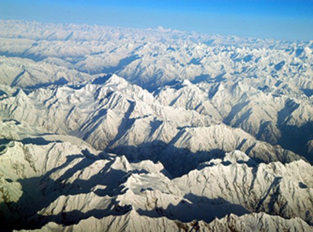
Figure 1.5 Mountains Chitral District

Figure 1.6 Laspur Valley
Rivers, Streams, and Lakes; Chitral district
Chitral lies in the heart of the Hindu Kush Mountains, which average a height of 6,000 m. Vast glaciers from the highest peaks (7,690 meters) feed the Chitral River (known as Kunar River after it exits the district) and its tributaries, providing abundant water for irrigation.
River Chitral has its origin in the Chianter Glacier. Various tributaries of River Chitral are the Laspur River, Torkhow River, Lotkoh River, Jughoo Gole, Ayun Gole, Kalashgum, Shishi Kuh, Ashuret, Molen Gole, Chitral Gole, Uchust Gole, Bomborate Gole, Birir Gole, Akri Gole, Jungerate Gole, Laldam Gole, and numerous hill torrents.
Some of the streams flowing in Chitral include Maluki Shal, Chakar Uts, Koghozi Gol, Uchusht Gol, Nardit Gol, Ishpeder Gol, and Dundini Gol.
There are 4 famous lakes in the district which are Karaza Lake, Shandur Lake, Chattibai Lake, and Chiyan Tar Lake. Hot springs of brackish water are found at various places in Chitral, such as Lutkoh, Ambore, Treech, Boni, Shah Jinnali, Yarkhoon, and Sindoor. People visit these in great numbers to find the cure for skin diseases and asthma.

Figure 1.7 A Rope Bridge over River Chitral

Figure 1.8 Broghil Valley Lake, dividing Chitral and Ghizer
Forests; Chitral district
4% of all land area[5] of Chitral district is under forests. The district is home to coniferous forests and Alpine pastures. Silver fir (Abies alba), spruce (Picea smithiana), deodar (Cedrus deodara), blue pine (Pinus wallichiana), and chir pine (Pinus roxburghii) are the most common varieties of coniferous forests. Oak forests occupy the southern part of the district. Deodar (Cedrus deodara), Greek juniper (Juniperus excels) and maple (Quercus incana) are the main flora of these forests. Most of the forests are located in the Shishi valley.
The following table shows the type of forests in Chitral district as per KP Development Statistics 2018-19:
| Total Forest Area | 125,677 A | Resumed Land | – A |
| Reserved Forests | – A | Communal Forests | – A |
| Protected Forests | 90,196 A | Guzara Forests | – A |
| Unclassed Forests[6] | – A | Private Plantation | 35,351 A |
| Miscellaneous | 130 A | Linear Plantation | – km |
Table 1.3 Chitral Forests
Chitral Gol National Park is a protected National Park of Pakistan, and Drosh Gol, Gehrait Gole, Puritgol, Chinar, Toshi Gol, and Goleen Gole are Protected Game Reserves. Begusht, Arkari, Tooshi Shasha, Madaklasht, and Manur are community-owned Protected Game Reserves of the district.

Figure 1.9 Chitral Gol National Park
Soils of Chitral district
The upper parts of mountain slopes have very shallow soils only in cracks and crevices. The lower parts of the mountain slopes have deep stony alluvial formed soils. In the valleys, mostly stony or gravelly soils formed in old river terraces or alluvial fans of streams flowing down the mountain slopes. Stony soils of the river terraces and alluvial fans have been cultivated at many places for a few centuries, and the addition of irrigation silt has greatly improved these soils. In addition, silty soils have formed in wind laid material, and loess are found.
Climate of Chitral district
The climate of Chitral is distinctly continental. It is hot in the summer, ranging from very hot in the lowlands, to warm in the uplands, and cool in the higher elevations. Spring weather is unpredictable, with frequent rain and snowfall. Autumn has mild and pleasant temperatures. The extreme summer temperature recorded in Drosh is 37 °C for the month of July, while in Chitral it is 36 °C for the same month. The summers at high altitude areas such as Broghil, Sorlaspur, Gobore, Bagusht, Kiyar, Arkari, Owir, and Rech are cold and windy with extremely cold nights.
In winter, most of the valleys are in the grip of northerly winds and blizzards; the winters are less severe in the lowlands as compared to the uplands. The extreme minimum temperature recorded at Drosh and Chitral stations have been -4 °C and -1 °C for the month of January and February respectively.
Chitral district receives more rain in the winter than in the summer. These rains are received from the thunderstorms brought about by western frontal systems.
Maximum rainfall is in the month of March. Average annual rainfall in the district is 442 mm.
Seismic Activity/Sesmicity; Chitral district
The district belongs to Zone 4 of the Seismic Zone Map of Pakistan, which means severe damage due to earthquakes.
[1] http://www.chitralnews.com/Geography.htm (retrieved in 2016)
[2] http://www.chitralnews.com/Geography.htm (retrieved in 2016)
[3] http://www.chitralnews.com/Geography.htm (retrieved in 2016)
[4] http://www.chitralnews.com/Geography.htm (retrieved in 2016)
[5] Official website: Govt. of KP Finance & Planning Department, Chitral District Profile
[6] Owned by Government
Population of Chitral District
The following table shows the population of Chitral district as per 2017 Census:
| District |
Area km2 |
Population | Male % | Female % | Urban % | Growth Rate % |
| Chitral | 14,850 | 447,362 | 50.5 | 49.5 | 11.1 | 1.8 |
| Chitral Tehsil | 6,459 | 278,122 | ||||
| Mastuj Tehsil | 8,392 | 169,240 |
Table 1.4 Chitral Population Statistics
Religions; Chitral district[1]
| Muslims | 99.1% |
| Christians | Negligible % |
| Hindus | Negligible % |
| Ahmadis | Negligible % |
| Scheduled Castes | Negligible % |
| Others | 0.9% |
Table 1.5 Chitral Religions
Languages; Chitral district[2]
| Urdu | 0.1% |
| Punjabi | Negligible % |
| Sindhi | Negligible % |
| Pushto | 3.8% |
| Balochi | Negligible % |
| Seraiki | Negligible % |
| Others | 96% |
Table 1.6 Chitral Languages
The main religion of the residents of Kalash Desh (formed by the valleys of Kalash Valley, Rumbur Valley, Brumbret and Birir) of Chitral district is polytheist, with elements of Greek Mythology and Zoroastrian religion. Some of the people of Kalash Valley claim to be descendants of the soldiers of Alexander the Great.
The local language of Chitral district is Khowar or the Chitrali language which is spoken in 13 different dialects.
The district is uniquely diverse, with over a dozen different cultures, and more than 14 different spoken languages and dialects. The diversification extends to religion as approximately 70% of the population is Sunnis, 30% are Ismaili and Kalash as a small non-Muslim minority. Total population of the Kalash is estimated to be 2,500 to 3,000, inhabiting areas at altitudes of 2,000 m to 2,500 m, in 3 small villages of the narrow, isolated valleys
[1] 1998 Census; 2017 Census data has not been released yet
[2] 1998 Census; 2017 Census data has not been released yet
Economic Activity – Economic Infrastructure
Economic Activity; Chitral District
The major industrial occupations in the district (1998 census, 2017 Census data has not been released yet) are:
- Agriculture with its Allied Livestock Breeding & Fishing (26.6%)
- Community, Social & Personal Services (41.8%)
- Construction (4.4%)
- Manufacturing (5.6%)
- Transport & Storage (5.8%)
- Wholesale/Retail, Hotel/Restaurant (8.9%)
- Manufacturing (5.6%)
- Others (1.3%)
Land Use; Chitral district
The following table shows the major land use statistics of the district (KP Development Statistics 2018-19):
| Total Area | 109,700 HA | Reported Area | 97,619 HA |
| Total Cultivated Area | 21,500 HA | Net Sown | 20,108 HA |
| Current Fallow | 1,392 HA | Uncultivated Area | 76,119 HA |
| Culturable Waste | 3,884 HA | Forest Area | 41,949 HA |
Table 1.7 Chitral Land Use Statististics
Agriculture; Chitral district
The district belongs to the Northern Dry Mountain Agro-Ecological Zone of Pakistan. Agriculture in the district is mostly subsistence level agriculture, and depends on irrigation through canals dug from glacial melt-fed springs and rivers (River Chitral and its tributaries).
Maize, barley, rice, wheat, bajra, msash, masoor, moong, and sorghum are the main crops of the district.
Main fruits of the district are apples, apricots, pears, mulberry, grapes, citrus, peach, plums, pomegranate, cherry, walnut, persimmon, strawberry, prunes, almonds, hazelnut, and loquat.
Potatoes, onions, carrots, brinjal, turnips, tomatoes, chilies, garlic, peas, cauliflower, lettuce, okra, Chinese cabbage, and turnips are some of the vegetables produced and grown in the district.

Figure 1.10 River Chitral/Kunhar flowing alongside green fields

Figure 1.11 A lush green valley in Chitral
Livestock Breeding; Chitral district
The following table shows the livestock population in Chitral district as per Livestock Census 2006 (qtd. In KP Development Statistics 2018-19):
| Cattle | 174,842 Heads | Buffaloes | 296 Heads | Sheep | 181,146 Heads |
| Goats | 347,977 Heads | Camels | – Heads | Horses | 295 Heads |
| Mules | 63 Heads | Asses | 3,256 Heads |
Table 1.8 Chitral Livestock Statistics
A rare breed of sheep has been discovered[1] in Chitral district. This sheep (named Chitrali breed) can breed four times in a single year. Livestock breeds commonly found in the district include the achai cow.
Poultry Farms; Chitral district
According to Table 17 (Number of Commercial Poultry Farms and Number of Birds by Size of Flock) the data on number of poultry farms in Chitral district is not available. There were 423,749 poultry birds in the district according to the Livestock Census 2006.
Fishing; Chitral district
Fishing is one of the important economic activities in the district. Trout fishing is carried out on a commercial basis. Trout is found in River Chitral and its tributaries. River Chitral supports 11 species[2] of fish, out of which 2 are exotic and 9 indigenous. The exotics (brown trout and rainbow trout), introduced for sport in the cold water streams of Bumburet, Golain, Lotkuh and Shishi, are stocked annually with hatchery reared fingerlings. Most of the indigenous species belong to the genus Schizothorax.
Bee Keeping/Api Culture; Chitral district
In Chitral, bee keeping plays[3] a critical role in the livelihoods of the rural communities in different ways: it is an income generating activity; medicinal value of honey and other hive products is invaluable; bee keeping supports agricultural activities through facilitating critical processes, for example cross pollination, and improves crop and seed yield; it facilitates healthy linkages between biodiversity (insects and plants) towards sustainable livelihoods while playing a role in conservation.
Minerals and Mining; Chitral district
There is a lot of mineral potential in the district but the area’s rugged topography and inaccessibility makes their exploitation labour intensive and difficult. At present iron ore, marble, soapstone, and serpentine are being mined.
Surveys[4] show that there are deposits of lead antimony, sulphide containing gold, silver tin, and vanadium in Awiret Gol; antimony in Krinj, Parstan; magnetite ore at Damel Nisar; marble and dolomite at Reshun; granite at Gahiret, and Koghuzi; arsenic minerals such as orpiment and realgar at Lonkoh, Mirghash, Galena; pyrite and copper minerals such as chalkopyrite at Kaldam Gol (Drosh); quartz veins containing lead-zinc ore and copper at Pakhtori (Owir); talc at Tar (Shishikoh); gemstones such as aquamarine and topaz at Manorgol (Garam Chashma); and dolomite, galene, and pyrite at Madashil.
Irrigation Network; Chitral district
Generally, Chitral belongs to the Northern Dry Mountain Agro-Ecological Zone of Pakistan and the irrigation sources are mostly glacier-fed streams; most sources of irrigation are community-owned and managed irrigation channels. Nearly three-fourths of the irrigated area in Chitral is irrigated through[1] community-owned and managed irrigation channels and a quarter is irrigated through Government-owned irrigation channels.
The following table shows the area and mode of irrigation in the district (KP Development Statistics 2018-19):
| Total Irrigated Area | 20,934 HA | Government Canals | 4,521 HA |
| Private Canals | 16,413 HA | Wells | – HA |
| Tube Wells | – HA | Others | – HA |
Table 1.10 Chitral Irrigation Statistics
[1] District Government Chitral, Planning and Finance Department
Industry and Manufacturing; Chitral district
There are only 6 industrial units in the District. These are all Marble and Chips units.
Handicrafts in Chitral district
Handicrafts include embroidery work, and woollen shu or patti (a hand woven woollen cloth), available in black, white, and neutral colors. Chitral also offers intricately embroidered woollen gowns known as “chughas”, as well as colorful woollen rugs, embroidered household linen, bags, belts, watch straps, shirt collars and sleeves, shoes and sandals, musical instruments such as sitars, antique weapons, string-bows and precious gems.
Chitral’s artisans manufacture a wide range of elegant and delicately crafted products, including pottery, weaponry, jewellery, woodwork, and embroidered, woven and knitted textiles. Clay, wood, stone, bone, animal skin, and copper are the materials most commonly used.
Chitral’s woollen fabric, shu (or patti), embroidered cloth, and walnut-wood furniture are popular in handicraft markets throughout the country. The Kalash Valleys also offer hand-crafted wooden chairs with leather seats, baskets, and wooden effigies of men on horseback. The Kalash tribal garments and headgear are also available.
[1] The Daily Dawn: PESHAWAR: “Rare breed of sheep found in Chitral”, July 16, 2002
[2] Chitral; An integrated Development Vision by IUCN
[3] Chitral Times.com. Jan 08, 2012
[4] Chitral: An Integrated Development Vision by IUCN
Economic Infrastructure; Chitral District
Roads account for over 91% of passenger and 96% of freight transport in KP.[1] There are two types of roads in KP: high type, which are black topped all weather roads, and low type. Black topped roads consist of National Highways, Motorways, and Provincial roads and also urban area roads.
Chitral town is connected to Garam Chashma, Gilgit, Mastuj, and Peshawar through black topped roads.
Road Statistics; Chitral district
Khyber Pakhtunkhwa Development Statistics 2018-19 gives the road statistics of the district as:
| High Type | 208.0 km |
| Low Type | 1,234 km |
| Total | 1,442 km |
Table 1.9 Chitral Road Statistics
Important roads of Chitral district include:
- The Lowari Pass
- Shandur Pass
- Chitral Dir Road (National Highway N-45)
- Garam Chashma Road
- Road Connecting National Highway N-45 and Garam Chashma Road

Figure 1.19 Baroghil Pass

Figure 1.20 Lowari Tunnel on Lowari Pass
Rail and Airways; Chitral district
There is no railway station in the district. The nearest railway stations are Nasarpur Railway station (Peshawar), Kalpani Railway Station (Mardan), Pabbi Railway Station (Nowshera district), Pir Pai Railway Station (Nowshera district) and Charsadda Railway Station.
There is a commercially operated domestic airport in Chitral called Chitral Airport.

Figure 1.21 Chitral Airport
Radio and Television; Chitral district
Pakistan Broadcasting Corporation (PBC) has 2 Radio Stations (one AM and one FM) in the district. There is one privately-owned radio station in the district.
There is no TV station in the district, but TV Can be viewed through cable.
Telecommunications; Chitral district
According to KP Development Statistics 2018-19, there are 15 telephone exchanges in Chitral district with 6,746 connections.
Post Offices/ Courier Services; Chitral district
There are 100 post offices in the district with 1 head office, 14 sub-post offices and 85 branch post offices in the district (KP Development Statistics 2018-19).
Banking/ Financial Institutions; Chitral district
According to the List of Reporting Bank Branches 2019, by State Bank of Pakistan the following banks are operating in the district:
- Allied Bank Ltd.
- Bank al Falah Ltd.
- Bank Islami Pakistan Ltd.
- Habib Bank Ltd.
- The Khyber Bank Ltd.
- Muslim Commercial Bank Ltd.
- National Bank of Pakistan
- Soneri Bank Ltd.
- United Bank Ltd.
- Zarai Tariqiati Bank
In all there are 30 branches of various conventional banks and 08 branches of different Islamic banks in the District.
Electricity and Gas; Chitral district
Peshawar Electric Supply Company (PESCO) looks after electricity distribution and transmission to all the districts of KP including Chitral.
[1] Khyber Pakhtunkhwa, Comprehensive Development Strategy 2010-2017 P&D Govt. of Khyber Pakhtunkhwa
Educational Institutions Chitral district
The following table shows the number of Government Educational Institutions in the district as per KP Development Statistics 2018-19:
| Institution | Boys/Girls | Institution | Boys/Girls |
| Primary Schools | 320/174 | Middle Schools | 45/37 |
| High Schools | 53/20 | Higher Secondary Schools | 10/03 |
| Mosque Schools | 166 | Degree Colleges | 02/02 |
| Polytechnic Institutes | – | Commerce Colleges/Institutes | 1 |
| Vocational Centers | 02 | Private Primary Schools | 191 |
| Private Schools (Middle to Higher Secondary) | 157 | Medical Colleges | – |
| Engineering Colleges | – | Universities[1] | 03 |
| Homeopathic Colleges | – | Law Schools | – |
Table 1.11 Chitral Educational Institutes
Healthcare Facilities; Chitral district
The following table shows Government Health Care Institutions in the district as per KP Development Statistics 2018-19:
| Institution | No./Beds | Institution | No./Beds |
| Hospitals | 04/306 | Dispensaries | 29/- |
| Rural Health Centers | 06/116 | Basic Health Units | 19/- |
| Mother Child Health Centers | 02/- | Sub-Health Centers | -/- |
| Leprosy Clinic | 03/- | TB Clinics | 02/- |
| Private Hospitals | -/- | Private Medical Practitioners | – |
Table 1.12 Chitral Health Care Institutes
Policing; Chitral district
The District Police Officer (DPO), Chitral is in-charge of policing Chitral district. The DPO reports to the Deputy Inspector General Police, who, in turn, reports to the District Co-ordination Officer. In Chitral district, there are[2] 18 police stations.

Figure 1.22 Shandur Polo Ground

Figure 1.23 Traditional Dance Performance, Kalash Valley

Figure 1.24 Nauroz decorations

Figure 1.25 Wooden Houses Chitral

Figure 1.26 Chitral Museum

Figure 1.27 PTDC Motel at Mastuj

Figure 1.28 Chitral Valley

Figure 1.29 A Micro Hydro Power House; Garam Chashma

Figure 1.30 Chitral Fort
[1] Abdul Wali Khan University Mardan; Chitral Campus; Shaheed Benazir Bhutto University; Chitral Campus, University of Chitral and Hindukush Institute of Languages and Linguistics Studies.
[2] Table no. 19.7 (a) Number of Police Stations by Division/District 2019
Environment and Biodiversity; Chitral district
The illegal cutting of forests is a major environmental concern, but generally, the air is free of pollution and the physical environment is clean.
Flora and Fauna; Chitral district
Flora; Chitral district
A total of 83 taxa are recorded for their ethno-botanical uses, belonging to 78 genera, and 48 families. Of these, [1] 13 are trees, 14 shrubs, 41 perennial herbs, 3 biennial herbs, and 12 annual herbs. Most common trees of the district include maple (Acer pentapomicum), Indian horse chestnut or bakhnor (Aesculus indica), deodar or diyar (Cedrus deodara), hawthorn (Crataegus songarica), wild olives or shinjoor (Elaeagnus angustifolia), sum or ash (Fraxinus hookeri), chilghoza pine (Pinus gerardiana), Chinese pistachios or kakkar (Pistacia chinensis), binju or wild pistachio (Pistacia khinjuk), poplar or terik (Populus euphratica), pomegranate (Punica granatum), willow (Salix sp.), birch (betula), juniper (Juniperus communis), poplar (Populas sp.), hawthorn (Crataegus monogyna [this is a small tree or shrub]), and chinar (Platanus orientalis).
Some of the perennial and annual shrubs and herbs include buckthorn (Rahmnus sp.), sage brush (Artemisia tridentata), wormwood or green ginger (Artemisia absinthium), bulbous iris or tulips (iris), boi baro or (Achillea wilhelmsii), kauri boti or neel kanthi (Ajuga bracteosa), kach or wild onion (Allium barszczewski), marjarai or ornamental onion (Allium barszczewskii), stinking chamomile or sherisht (Anthemis cotula), Himalayan berginia or bisabur (Bergenia stracheyi), kunakh or a species of oak (Chenopodium botrys), and chontruk or orange peel clematis (Clematis orientalis).
Fauna; Chitral district
Chitral district has[2] 45 species of mammals, 195 species of birds, 42 species of reptiles, 3 species of amphibians, and 9 species of fishes that have been reported so far.
Some of the endangered species[3] of wildlife still exist in the remote valleys of the Hindu Kush and include snow leopard (which was once thought to be extinct in Pakistan, but it has re-emerged), brown bear, Tibetan wolf, golden marmot, Himalayan ibex, markhor, urial, black bear, lynx, musk deer, 2 species of bats, woolly flying squirrel, common red fox, stone marten, yellow-throated marten, Himalayan palm civet, stoat or ermine, striped hyena, pallas cat, leopard, and panther.
In addition to the above common mammal species of the district include fox, jackals, hare, rat, common otter, hyena, royales pika, etc.
The avifauna of the district includes migrant birds as well as birds endemic to the area. Some endangered bird species include scavenger vulture, Eurasian woodcock, Himalayan griffon vulture, Himalayan monal, koklas pheasant, bearded vulture, reddy shelduck, shaker falcon, snow pigeon, bar-headed goose, greyleg goose, marbled teal, tufted duck, long legged buzzard, pallid harrier, red capped falcon, Barbary falcon etc.
The chakor (rock partridge), Himalayan snow cock, lammergeier, monal pheasant and snow partridge, oriental turtle dove are resident species. Golden oriole is one of the most favoured migrant birds of the area.
Reptilian fauna include 2 species of turtles, 12 types of lizards, and 14 snake varieties. The Himalayan pit viper, Indian krait, Indian monitor, Indian softshell turtle, Oxus cobra, and saw scaled viper are some of the endangered species found in Chitral.

Figure 1.12 A Snow Leopard in Chitral Gol National Park
Protected Wildlife Areas; Chitral district
The following areas have been declared protected under Government of Pakistan Laws:
- Chitral Gol National Park
- Drosh Gol Game Reserve; Chitral district
- Gehrait Gol Game Reserve; Chitral district
- Tooshi Gol Game Reserve; Chitral district
- Goleen Gol Game Reserve; Chitral district
- Puritgol Game Reserve; Chitral district
- Chinar Game Reserve (protected under Government of KP Laws); Chitral district
The following Game Reserves are community-owned and protected
- Arkari Game Reserve; Chitral district
- Begusht Game Reserve; Chitral district
- Tooshi Shasha Game Reserve; Chitral district
- Madaklasht Game Reserve; Chitral district
- Manur Game Reserve; Chitral district
- Gehrait Game Reserves; Chitral district
The Chitral Gol National Park was established by H. H. Shuja ul Mulk as his private game reserve in 1910. The present owner is Prince Saif ul Mulk, and is maintained by the Pakistan Government. The park provides protection to markhors, snow leopards, wolf, marmot, weasels, Himalayan otter, ibex, and all other mammals inhabiting it. The avifauna of the park include monal pheasant, falcon, hawk, eagle, lammergeyer, snow cock, chakor, and many other species. Migratory birds include black-throated thrush, golden oriole, oriental turtledove, grey heron, and different species of waterfowl.
[1] The Ethnobotany of Chitral Valley, Pakistan with Particular Reference to Medicinal Plants by Haider Ali and M. Qaiser, Department of Botany, University of Karachi, Federal Urdu University for Arts, Science and Technology, Islamabad, Pakistan
[2] Chitral: An Integrated Development Vision, IUCN Pakistan
[3] Chitral: An Integrated Development Vision, IUCN Pakistan