Share now
Map of Khyber Pakhtunkhwa

Map of Lakki Marwat District including former FR Lakki Marwat

Khyber Pakhtunkhwa Districts
- Peshawar District Profile
- Abbottabad District Profile
- Bannu District Profile
- Battagram District Profile
- Buner District Profile
- Charsadda District Profile
- Chitral District Profile
- Dera Ismail Khan District Profile
- Lower Dir District Profile
- Upper Dir District Profile
- Hangu District Profile
- Haripur District Profile
- Karak District Profile
- Kohat District Profile
- Kohistan District Profile
- Lakki Marwat District Profile
- Malakand District Profile
- Mansehra District Profile
- Mardan District Profile
- Nowshera District Profile
- Shangla District Profile
- Swabi District Profile
- Swat District Profile
- Tank District Profile
- Torghar District Profile
- Bajaur Tribal Distyrict Ptofile
- Khyber Tribal District Profile
- Kurram Tribal District
- Mohmand Tribal District Profile
- North Waziristan Tribal District Profile
- Orakzai Tribal District Profile
- South Waziristan Tribal District Profile
Also visit: Sindh, Punjab, Baluchistan
Introduction/Geographical Details; Lakki Marwat District
The Tribal Regions adjoining Lakki Makki Marwat (originally part of FATA) are now part of Lakki Marwat District which is situated in the southern part of Khyber Pakhtunkhwa, between Bannu and Dera Ismail Khan districts, and between 32° 17Ꞌ to 32° 53Ꞌ north latitudes and 70° 04Ꞌ to 71° 16Ꞌ east longitudes. The district is bounded on the north by Bannu and Karak districts, on the east by Mianwali district (Punjab), on the southeast by Dera Ismail Khan district, on the southwest by Tank district and South Waziristan tribal district (former South Waziristan Agency of former FATA). There are no urban localities in the former FR Lakki Marwat.
Lakki Marwat District at a Glance
| Name of District | Lakki Marwat District | ||
| District Headquarter | Lakki City | ||
| Population[1] | 902,551 persons | ||
| Area[2] | 3,296 km2 | ||
| Population Density[3] | 273.8 persons/ km2 | ||
| Population Growth Rate[4] | 5.16% | ||
| Male Population[5] | 51.0% | ||
| Female Population[6] | 49.0% | ||
| Urban Population[7] | 10.2% (No urban Localities in the FR) | ||
| Tehsils/Talukas |
03 Tehsils: 1. Lakki Marwat 2. Serai Naurang 3. Lakki Marwat Sub-Division (formerly FR Lakki Marwat |
||
| Main Towns | Ghandi Khan Khel, Bakhmal Ahmad Zai, Serai Naurang, Ghazni Khel, Kot Kashmir, Kaka Khel, and Isa Khel | ||
| Literacy Rate[8] | 59.0% (Literacy rates for FR Lakki Marwat 12%) | ||
| Male Literacy Rate[9] | 82.0% (FR Lakki Marwat is 21%) | ||
| Female Literacy Rate[10] | 34.0% (FR Lakki Marwat 1.8%) | ||
| Major Economic Activity[11] | Agriculture with its Allied Livestock Breeding & Fishing | 48.3% | |
| Community, Social & Personal Service | 18.2% | ||
| Manufacturing | 1.9% | ||
| Transport | 6.8% | ||
| Wholesale/Retail & Hotel /Restaurant | 9.1% | ||
| Construction | 13.6% | ||
| Others | 2.1% | ||
| Main Crops | Wheat, maize, barley, rapeseed & mustard, gram, chick peas, sugarcane, bajra, jowar, masoor, linseed, guar seed, and sunflower | ||
| Major Fruits | Dates, citrus, bananas, guava, water melon, musk melon, ber etc. | ||
| Major Vegetables | Onions, tomatoes, sugarbeet, brinjal, okra, cucumber, various kinds of squashes, bitter gourd, bottle gourd, sponge gourd (tinda), peas, and cauliflower | ||
| Forests (Area)[12] | – A[13] | ||
| Black Topped Road[14] | 547.9 km | ||
| Shingle Roads[15] | 112.7 km | ||
| No. of Grid Stations | PESCO looks after the distribution and transmission of electricity in the district. | ||
| No. of Tel. Exchanges[16] | 11 automatic exchanges with 1,530 connections | ||
| Industrial Zones[17] | There is no industrial estate or zone in the district, but there are 17 registered industrial units, out of which 16 units are working and 01 unit is closed | ||
| Major Industry[18] | Ice Factories | 8 Units | |
| Flour Mills | 2 Unit | ||
| Daal Processing | 2 Units | ||
| Cement | 1 Unit | ||
| Beverages | 1 Unit | ||
| Sugar | 1 Unit | ||
| Vegetable Ghee (Oil) | 1 Unit | ||
| Household Size[19] | 8.4 persons per house | ||
| Houses with Piped Water[20] | 40.8% | ||
| Houses with Electricity[21] | 87.0% | ||
Table 1.1 Lakki Marwat District
[1] 2017 Census population for FR Lakki Marwat has been added here
[2] 1998 Census; area of former FR Lakki Marwat added
[3] 2017 Census
[4] 2017 Census (Population growth rate for FR Lakki Marwat is 7.2%)
[5] 2017 Census (Average of FR Lakki Marwat and Lakki Marwat District)
[6] 2017 Census (——————–Do———————————————)
[7] 2017 Census (only Lakki Marwat district)
[8] Pakistan Social & Living Measurement Survey 2014-15 (PSLM)
[9] PSLM
[10] PSLM
[11] 1998 Census; 2017 Census data has not been made public yet.
[12] KP Development Statistics 2018-19
[13] Forestry Statistics reports 17,883 HA under forests
[14] KP Development Statistics 2018-19
[15] KP Development Statistics 2018-19
[16] KP Development Statistics 2018-19
[17] KP Development Statistics 2018-19
[18] KP Development Statistics 2018-19
[19] Average of FR Lakki Marwat and Lakki Marwat Districts as per1998 Census; 2017 Census data has not been made public yet.
[20] 1998 Census; 2017 Census data has not been made public yet. (Same as above)
[21] 1998 Census; 2017 Census data has not been made public yet.
Brief History – Governmental Structure – Administrative Divisions – Heritage Sites, Tourist Attractions and Picnic Spots
Brief History of Lakki Marwat District
Until July 1, 1992, Lakki Marwat district was a Tehsil of Bannu district; hence, the early history is the same as the history already recounted in the chapter on Bannu district. Here, the history of the Marwat Tribe—the main residents of the district and after whom the district is named—is being paraphrased.
Etymology and History (Lakki Marwat district)
There are 3 historical accounts/ explanations for the word “Lakki” (which is part of the name: Lakki Marwat)[1]:
- The first version states that, after the battle between the Marwat and Waziri tribes, the Marwats gathered a 1,00,000 (1 lakh or 0.1 million) men strong army, people started calling the area “Lakki” (or “of lakhs”)
- According to the second version, a Hindu trader called Lakki Ram or Lukko Ram, can be considered to be the original founder of Lakki town. However, another source[2] claims that the town was known as Ihsanpur, which would then contradict the claim that the Hindu merchant lent his name to the town
- The third story claims that the word Lakki is a Pali language word, in which ‘Lakki’ is thought to be a derivation of the Hindu goddess Lakshmi, the goddess of beauty and fortune
The Marwats are a branch of the Lohani Afghan tribe who were driven out of Ghor (Afghanistan), and settled in the areas that included Lakki Marwat district, Frontier Region Lakki Marwat, parts of Dera Ismail Khan and some villages of Tank district as well as the Federally Administered Tribal Areas (FATA) of Pakistan. Originally, the Marwats were traders who traveled to Bukhara and Samarkand for trading. They lived a nomadic life. The Marwats were driven out of Ghor by the Chilzais (Khiljis) and came to Tank, where they settled down with the Niazi tribe, who were already living there. The Niazis spread into what is now called the Marwat area, but was then a nameless sandy plain. The Marwats ultimately took advantage of the internal dissensions among the Niazis, and drove them out. They then inhabited the banks of River Tochi/Gambila as graziers.
The Marwats remained independent during the Moghul rule, and continued to expand their tribal institutions. In 1756 Ahmad Shah Abdali/Durrani conquered the eastern provinces of the Mughal Empire, making them a part of his newly formed Kabul Kingdom. Bannu was part of the eastern provinces of the Mughal Empire, and was thus, made a part of the Durrani kingdom. The Durranis ruled the area for 70 years, but the Marwats remained practically independent.
In the beginning of the 19the century, the Marwats fell into severe disunity, and began to engage in internal feuds. Nawab Hafiz Ahmad Khan, the Chief of Mankera (now in the district of Bhakkar Punjab), took advantage, and captured the area in 1819. He, however, submitted to the Sikhs in 1823.
In 1836 Maharaja Ranjit Singh formally annexed Marwat areas into his empire. In 1844 Malik Fateh Khan Tiwana (revenue collector of the Sikhs) built and garrisoned a small fort in the heart of the Marwat land and settled a number of people in and around it. He called this settlement Ihsanpur, which later became known as old Lakki.
After the Second Anglo-Sikh War, the British annexed the Marwat areas in 1849. Ihsanpur remained the capital of Marwats till 1864, when it had to be abandoned because it was completely destroyed by the floods in the Gambila/Tochi River. The inhabitants moved across the River Gambila, and settled among a cluster of villages consisting of Mina Khel, Khoedad Khel and Sayed Khel (now Lakki City).
At the time of annexation of Punjab in 1849 by the British, the trans-Indus portion of Mianwali and Dera Ismail Khan were formed into one district, with their headquarters at Bannu. In 1861 Bannu district was formed, and Lt. Reynal Taylor was appointed its first Deputy Commissioner. District Bannu was divided into the Tehsils of Bannu, Lakki or Marwat, Isa Khel, and Mianwali. When the North West Frontier Province (NWFP) was formed in 1901, the Isa Khel tehsil and Mianwali tehsil were merged to form the Mianwali district and made a part of Punjab province.
After the Partition of India in 1947 Bannu was made part of Pakistan. Lakki Marwat became a subdivision in October 1950, and was upgraded as an independent district in July 1992.
Figure 1.3 Flag of the Marwats
History Former FR Lakki Marwat (now Lakki Marat Sub-Division)
The main tribe inhabiting F R Lakki Marwat is the Bhittani tribe (also spelled Bettani), a brief history of which is included here.
The Bhitannis claim descent from Baitan, the third son of Qais Abdur Rashid who is the founder of all Pashtun groups/ tribes. The Bhittanis are also referred to as Bitani, Bhitani, Battani, or Bhetanni. Some families who reside in Balochistan refer to themselves as Bottani. The Bhittanis are a branch of the Waziri tribe.
A popular legend claims[3] that the Bhittanis’ ancestor Beaṭ Baba is the first Pashtu poet. He is said to have lived in the Altamur Range of Afghanistan, which is located between Logar and Zurmant, and was buried in Ghazni. The Bhittani are known to have lived in the Logar, Zurmant and Ghazni area until the 15th century; from here they were expelled towards the east by the Ghilzai (Khilji) Pathans. They occupied the eastern edge of the Suleiman Mountains. A part of the Bhittani clan also settled in the Gangetic plains of India and integrated with other Pashtun groups.
After the annexation of Punjab in 1849, the British needed to control the Bhittani territory since the Mahsūd tribe (of South Waziristan Agency, to the south of Lakki Marwat) used this route to raid British controlled areas. Since the Bhittanis are not a large or influential tribe/ group, they knew that they would not be able to provide any resistance to the British Army. Thus in 1853, when the British threatened them with an expedition, the tribe offered their formal submission. In 1874 they agreed to provide active support to the British and formed a Bēṭani (Bhittani) Militia Company; this was merged into the South Waziristan Militia in 1921, and became known as The South Waziristan Scouts.
While the Bhittanis had officially declared their allegiance to the British, they were practically unable to prevent the Mahsūd incursions into their territory. In fact, they were often ready, whenever the occasion permitted, either to take part in raids by the Mahsuds or to oppose the advance of the British column, behavior for which they periodically sought pardon. This double political game, forced the British Army to maintain, from August 1892 until 1923, a permanent garrison at Janḍōla (Frontier Region Tank), the principal town of the Bhittani country, in a strong strategic position at the entrance to the Šīnkay and Šahūr valleys. During the entire colonial period the territory of the Bhittani thus played the role of a buffer tract between the Tribal Area proper and the settled districts. This role was recognized administratively in its status as a Frontier Region, which it still maintains and which makes it an enclave of the Tribal Area placed under the direct authority of the District Commissioner of the then Dera Ismail Khan district which contained the tehsil of Lakki Marwat.
Originally, F R Lakki Marwat was part of F R Bannu, but it was given the status of a separate Federal Region in 1996.
Governmental Structure; Lakki Marwat District
At the Federal level, Lakki Marwat district is allocated a set number of representatives in both the National Assembly and the Provincial Assembly:
- Number of seats in the National Assembly 1
- Number of seats in the Provincial Assembly 2
Under the Local Government Act District Lakki Marwat has 1 District Council constituted by general seats, seats reserved for women, peasants/workers, youth, and non-Muslims as prescribed under the Khyber Pakhtunkhwa Local Government Act 2013. Lakki Marwat District Council is composed of 33 general members, 11 women members, 2 peasants/worker members, 2 minority members, and 2 youth members.
The Deputy Commissioner of District Lakki Marwat is responsible for the administration of Frontier Region (FR) Lakki Marwat, and manages its affairs with the help of an Assistant Political Agent (APA).
The Sub-Division Lakki Marwat is divided into 05 Village councils but no neighbourhood councils.
Administrative Divisions; Lakki Marwat District
The district has a total area of 3164 sq. km and is divided into 2 tehsils as follows:
| Lakki Marwat Tehsil | 20 Union Councils |
| Serai Naurang Tehsil[4] | 12 Union Councils |
| Subdivision Lakki Marwat | 05 Village Councils |
Table 1.2 Lakki Marwat Administrative Divisions
[1] Khyber Pakhtunkhwa Official Website
[2] This information has been extracted from District Profile Lakki Marwat 1998 by Government of Pakistan, which does not identify the sources
[3] The following historical account of the tribe has been retrieved from Encyclopaedia Iranica. “Betani” originally published in 1989.
[4] Serai Naurang is a newly constituted tehsil, first constituted in 2003
Heritage Sites/Tourist Attraction/ Picnic Spots; Lakki Marwat District
There are no protected heritage sites in the district. The following areas are tourist attractions and picnic spots:
- The hill station of Pezu Mountains provides a good tourist spot (Lakki Marwat district). The resort is located at an altitude of 1,400 m above sea level
- The banks of River Kurram and Gambila/Tochi (Lakki Marwat district), specially the banks near the confluence of the two rivers, provide good picnic areas
- The highest peak (1,216 m) of the Lakki Marwat subdivision is located to the south of Walai and Kharaghora mountain range in the southern part of the Region can be made into a tourist attraction.
Topography of Lakki Marwat District
The district[1] is a combination of hills and sandy plains. The hilly areas are mostly along the boundaries of the district, especially in its east, southeast, southwest, and northwest. The general elevation of these hill ranges is from 500 to 1,000 m above sea level. Following are the important hill ranges of the district:
- In the southeast, the Marwat Range separates Lakki Marwat fromDera Ismail Khan district
- In the east, the Karak Niazi Range separates it fromMianwali district
- Baittani Range is on the west and southwest of Lakki Marwat, and separates the district fromTank district and the Tribal Area adjoining Tank district as well as South Waziristan Agency
- The Marwat Range culminates near Sheikh Budin, and Baittani Range starts where the Marwat Range ends
The land beyond these hills gradually slopes to the central part, which looks like a basin. The major part of this basin is an alluvial plain. The northern portion of this plain/basin is situated chiefly in the River Kurram and River Gambila/Tochi Doaba and is a flat, sandy area.
The southern part of the district is made up of undulating sand dunes, furrowed at regular intervals by deep torrent beds which carry the drainage of the Marwat and Baittani Ranges to the River Gambila or Tochi.
Rivers, Streams, and Lakes; Lakki Marwat district
The important river of the district is the River Kurram, which rises in the Koh-e-Sufaid on the Pak-Afghan border. The River Gambila or Tochi flows from the hills of North Waziristan. Both rivers enter the district in the northwest and unite near Lakki Marwat town, from where they join River Indus. The Kurram River flows through the district from Northwest to the southeast, and joins the Indus River south of Isa Khel town.
Among other important streams are Shinwa, Sain, and Raka; they flow from the north and join Kurram. The streams flowing from the southwest and south to north into Kurram River are Kharoba, Chunai Torwah, and Laghar.
In addition a large number of perennial and intermittent streams are generated in the mountains and join Tochi and Kurram Rivers. Some of these are Durrani Vial, Badri Kurra Nala, Vial Bararai, and Wariki Baran River. Some of the intermittent streams are Shaktu Nala, Sra Oba Nala, Zor Nala, Khua Nala, and Rishtana Nala. Kawa Dhand is an intermittent lake of the district.
According to the District Profile Tribal Areas Adjoining Lakki Marwat 1998:
The entire territory of this tribal area is composed of hills of medium height between 450 to 1,200 meters. The highest peak (1,216 meters) of the area is located to the south of Walai. Kharaghora is the prominent range in the southern part of the area with an average height of almost 850 meters.
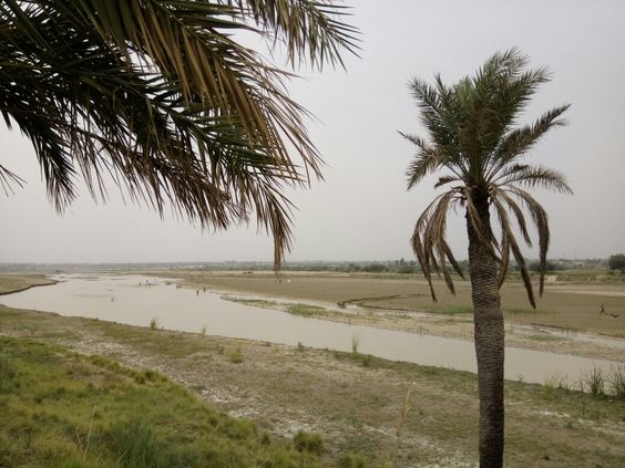
Figure 1.4 River Tochi/ Gambila in Lakki Marwat
[1] Mostly extracted from District profile Lakki Marwat by Government of Pakistan 1998
Forests; Lakki Marwat district
The following table shows the area and type of forests in Lakki Marwat district (KP Development Statistics 2018-19):
| Total Forest Area | 44,430 A | Resumed Land | – A |
| Reserved Forests | – A | Communal Forests | – A |
| Protected Forests | 241 A | Guzara Forests | – A |
| Un-classed Forests[1] | – A | Private Plantation | 44,189 A |
| Miscellaneous | – A | Linear Plantation | 333 km |
Table 1.3 Lakki Marwat Forests
Most of the forested plantations are privately-owned. Manjiwala Game Reserve is a privately‑owned forest of the district. Lands in Village Musabad Mouza Gandi Khan Khel (101 A), Village Pahar Kehl Thal (92 A), and Dara Tang Mouza Chowki Jand (500 A) are being maintained as community-owned and protected game reserves of the district.
These plantations are Tropical Thorn Forests, which mainly consist of low and scanty trees and shrubs of thorny species.
Soils of Lakki Marwat district
In the western portion of the district, the soil is fairly stiff clay, covered by a layer of stones at the foot of the hills. The whole district is intersected by numerous hill torrents and deep ravines. The general elevation of the plain area is about 200 to 300 m above sea level.
The Lakki area is underlain by a thick blanket of alluvial plain which consists of unconsolidated, quarternary deposits of sand, silt, gravel, and clay.
Climate of Lakki Marwat district
The region has all the characteristics of a desert climate due to its sand dunes, scorching heat, and dry weather. Summers are very hot, while winters are moderately cool. The summer season begins from early April and continues until late October. June is the hottest month, with a maximum temperature range of 42 °C to 45 °C and a minimum temperature range of about 27 °C to 30 °C. Periodic sand storms rage through the area during May and June. The hot wind, locally known as “Lu” blows across the district during these months. The cool wave starts from early November. December, January, and February are the winter months. January is the coldest month. The mean maximum and minimum temperatures during this month are 20 °C and 4 °C respectively. Rainfall is very rare and sporadic, and generally occurs in July and August. Mean Average annual rainfall in the district is 270 mm.
Seismic Activity/Seimicity; Lakki Marwat district
The district belongs to Zone 2B of Seismic Zone Map of Pakistan, which means minor to moderate damage due to earthquakes.
[1] Un-classed Forests are owned by the Government
Population of Lakki Marwat District
The following table shows the population of the district as per the 2017 Census:
| District | Area km2 | Population | Male% | Female% |
Urban % |
Growth Rate % |
| Lakki Marwat District | 3,164 | 490,025 | 51.1 | 48.9 | 9.6 | 3.3 |
| Lakki Marwat Tehsil | 3,164 | 490,025 | 51,1 | 48.9 | 9.6 | 3.3 |
| Serai Naurang[1] | – | – | – | – | – | – |
| Lakki Marwat Sub- division | 132 | 26,359 |
Table 1.4 Population Statistics
Religions Lakki Marwat district[2]
| Muslims | 99.7% |
| Christians | Negligible % |
| Hindus | Negligible % |
| Ahmadis | 0.2% |
| Scheduled Castes | Negligible % |
| Others | Negligible % |
Table 1.5 Lakki Marwat Religions
Languages; Lakki Marwat District[3]
| Urdu | 0.2% |
| Punjabi | 0.3% |
| Sindhi | Negligible % |
| Pushto | 99.3% |
| Balochi | Negligible % |
| Seraiki | 0.19% |
| Others | Negligible % |
Table 1.6 Lakki Marwat Languages
[1] Since Serai Naurang is a newly constituted tehsil, separate data is not available.
[2] 1998 Census; 2017 Census data has not been made public yet.
[3] 1998 Census; 2017 Census data has not been made public yet.
Economic Activity – Economic Infrastructure
Economic Activity of Lakki Marwat District
The economy of the district is dominated by agriculture with its allied livestock breeding and fishing. The major industrial occupations of the district are:
- Agriculture with its allied livestock breeding and fishing (48.3%)
- Community, Social & Personal Service (18.2%)
- Manufacturing (1.9%)
- Transport (6.8%)
- Wholesale/Retail & Hotel /Restaurant (9.1%)
- Construction (13.6%)
- Others (2.1%)
Land Use; Lakki Marwat district
The total geographical area of the district is 316,400 HA. The following table gives the land use of the district (KP Development Statistics 2018-19):
| Total Area | 329,600 HA | Reported Area | 314,973 HA |
| Total Cultivated Area | 116,900 HA | Net Sown | 36,073 HA |
| Current Fallow | 80,827 HA | Uncultivated Area | 198,073 HA |
| Culturable Waste | 85,910 HA | Forest area | – HA |
Table 1.7 Lakki Marwat Land Use Statistics
Irrigation Network; Lakki Marwat district
The following table shows the mode and area irrigated by each mode (KP Development Statistics 2018-19):
| Total Irrigated Area | 36,298 HA | Canal Irrigated (Private) | 9,625 HA |
| Tube Wells | 10,130 HA | Canal Irrigated (Govt.) | 16,158 HA |
| Wells | 370 HA | Lift Pumps | 10 HA |
| Tanks | 05 HA | Others | – HA |
Table 1.11 Lakki Marwat Irrigation Statistics
River Kurram and Tochi provide water for irrigation purposes, and spate irrigation, or rod Kohi or flood irrigation is also practiced on a large scale in the district.
Agriculture; Lakki Marwat district
The district belongs to Barani Lands Agro-Ecological Zone of Pakistan. Agriculture is mostly dependant on rains, and thus agriculture is mostly subsistence level.
Wheat, maize, barley, rapeseed & mustard, gram, chickpeas, sugarcane, bajra, jowar, masoor, linseed, guar seed, and sunflowers are the crops grown in the district.
Dates, citrus, bananas, guava, watermelon, musk melon, and ber are some of the fruits grown in the district.
Onions, tomatoes, sugar beet, brinjal, okra, cucumber, various kinds of squashes, bitter gourd, bottle gourd, sponge gourd (tinda), peas, and cauliflower are the vegetables grown in the district.
Livestock Breeding; Lakki Marwat District
The following table shows the statistics of Livestock (2006 Census, qtd. in KP Development Statistics 2018-19; Livestock data for former FR Lakki Marwat added) for the district:
| Cattle | 163,471 Heads | Buffaloes | 3,727 Heads | Sheep | 140,542 Heads |
| Goats | 397,290 Heads | Camels | 7,215 Heads | Horses | 1,245 Heads |
| Mules | 131 Heads | Asses | 19,174 Heads |
Table 1.8 Lakki Marwat Livestock Breeding
Lohani, and rojhan cattle, damani goat, balkhi sheep, and gaddi and gulmani camels are the native breeds of the district.
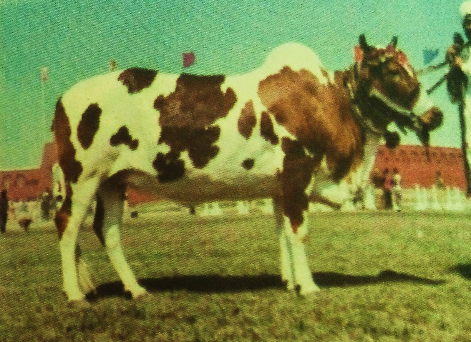
Figure 1.6 Rojhan Cattle

Figure 1.7 Balkhi Sheep
Poultry Farms Lakki Marwat district
There are 76 poultry farms[1] in the district.
Bee Keeping/Apiary; Lakki Marwat district
Honey is an important non-wood forest production Khyber Pakhtunkhwa. The province offers ample opportunities for the promotion of bee keeping, and the Government of Khyber Pakhtunkhwa is providing training to its rural population in the art of apiculture and honey processing.
Fishing; Lakki Marwat district
Fishing is carried out in the Kurram, Tochi, and other smaller rivers and streams in the district. Most of the fish caught is consumed locally.
Mining; Lakki Marwat district
At present, laterite, limestone, quartz, and shale clay are being commercially mined in the district. Uranium silica sand, building stones, fire clay, and potter’s clay are also present and being mined.
Oil and Gas is being explored in the Marwat Block, which is located in D I Khan, Tank, and Lakki Marwat districts.
Industry and Manufacturing; Lakki Marwat district
There is no industrial estate in the district, but there are 17 industrial[2] units, out of which 16 units are working.
| Industry | Number | Industry | Number |
| Beverages | 01 | Cement | 01 |
| Daal Processing | 02 | Flour Mills | 02 |
| Ice Factories | 08 | Sugar | 01 |
| Vegetable Ghee & Oil | 01 |
Table 1.9 Lakki Marwat Industries
According to the Former Federally Administered Trial Area (FATA) Development Authority Industries Survey Report 2010, there are 07 small industries working in the Lakki Marwat Subdivision (former FR Lakki Marwat). The following table shows the type and number of industrial units in the Region:
| Type of Industry | No. of Units | Type of Industry | No. of Units |
| Steel Trunks | 01 | Potato Chips | 01 |
| Mats | 01 | Jewelry | 01 |
| Handicrafts | 01 | Furniture & Fixtures | 01 |
| Cloth | 01 |
Table 1.8 Lakki Marwat Subdivsion Industries
Trade (Import/Export); Lakki Marwat district
The only trading item of the district is cement, which is exported to other parts of Pakistan.
Handicrafts; Lakki Marwat district
The handicrafts of the district include embroidery on clothes, and leather items, and household items made with the leaves of the mazri palm or dwarf palm.
[1] Table 17, Number of Commercial Poultry Farms and Number of Birds by size of Flock
[2] KP Development Statistics 2018-19
Economic Infrastructure; Lakki Marwat District
Lakki Marwat district is connected with other parts of Pakistan through the Bannu-Dera Ismail Khan Road which enters the district at Serai Naurang and leaves at Pezu. This road passes through the middle of the district from north to south.
The District Headquarter, Lakki Marwat, is connected to most of the urban areas through black topped roads.
The district is also linked via rail to other parts of Pakistan. There is no direct air link.
Road Statistics; Lakki Marwat district
According to the KP Development Statistics 2018-19, the road statistics of the district are as follows:
| Total Roads | 660.6 km |
| High Type Roads | 547.9 km |
| Low Type Roads | 112.7 km |
Table 1.10 Lakki Marwat Road Statistics
Some of the important roads of the district include
- Landiwah–Darratang Road
- Tajazu-Lakki-Darratang Road
- Gambila-Tajori Road
- Lakki-Shahbazkhel
- Ghaznikhel-Baina Road
- Marwat Canal Road.
- Road connecting South Waziristan district to Bannu district, connecting Waziri Dhaki, Shadi Khel, Gazooba, and Ayub Khel in Lakki Marwat subdivision
- Road from Shadi Khel to Kotla Awal Khan
Rails and Airways; Lakki Marwat district
The district is well-linked to the rest of Pakistan by rail and there are a number of railway stations in the district. Some of these are Thanedarwala Railway Station, Ghoriwala Railway Station, Makarwal Railway Station, Tank Railway Station, and Shahbaz Railway Station.
There is no airport in the district. The nearest international airport is at Dera Ismail Khan.
Radio and Television; Lakki Marwat district
Pakistan Broadcasting Corporation (PBC) does not have its broadcasting station in the district. There is one privately-owned FM radio station and the district has a modern cable TV network.
Telecommunications; Lakki Marwat district
There are 11 automatic telephone exchanges in the district. These exchanges provide 1,530 connections.[1] Cellular phone services, with considerable coverage in all major towns are also available.
Post Offices; Lakki Marwat district
There are 79 offices of Pakistan Post but 01 Head Office, and 17 Sub-Post Offices as well as 61 Branch Offices in the district (KP Development Statistics 2018-19).
Electricity and Gas; Lakki Marwat district
Electricity is supplied by Peshawar Electric Supply Corporation (PESCO).
[1] KP Development Statistics 2018-19.
Banking/ Financial Services; Lakki Marwat district
In all, there are 12 bank branches in the district.[1]
Following banks all have their branches in the district:
- Allied Bank Ltd.
- Habib Metropolitan Bank
- Habib Bank Ltd.
- Muslim Commercial Bank Ltd.
- National Bank of Pakistan Ltd.
- The Bank of Khyber
- Zarai Taraqiati Bank Ltd.
According the List of Reporting Bank Branches 2019 provided by the State bank of Pakistan in all there are 11 branches of various conventional banks and 0ne branch of Islamic banking in the District.
Educational Institutions; Lakki Marwat district
Lakki Marwat district has a literacy rate of 59%. The following table shows the number of Government Educational Institutions in the district as per KP Development Statistics 2018-19:
| Institution | Boys/Girls | Institution | Boys/Girls |
| Primary Schools | 592/339 | Middle Schools | 59/56 |
| High Schools | 60/29 | Higher Secondary Schools | 13/01 |
| Mosque Schools | 29 | Degree Colleges | 04/02 |
| Polytechnic Institutes | 01 | Commerce Colleges/ Institutes | 01 |
| Vocational Centers | 01 | Private Primary Schools | 05 |
| Private Schools (Middle + Secondary + Higher Secondary ) | 66 | Post Graduate College | 01 |
| Medical Colleges | – | Engineering Colleges/ University | – |
| Military Institutes | – | Universities | – |
Table 1.12 Lakki Marwat Educational Institutes
Healthcare Facilities; Lakki Marwat district
The following table shows the Government Health Care Institutions in Lakki Marwat district as per KP Development Statistics 2018-19:
| Institution | No./Beds | Institution | No./Beds |
| Hospitals | 08/426 | Dispensaries | 09/- |
| Rural Health Centers | 05/70 | Basic Health Units | 30/- |
| Mother Child Health Centers | 02/- | Sub-Health Centers | 02 |
| Leprosy Clinic | – | TB Clinics | 07/- |
| Private Hospitals | 04/- | Private Medical Practitioners | 47 |
Table 1.13 Lakki Marwat Health Institutes
Policing; Lakki Marwat district
The District Police Officer (DPO) is directly responsible to the Zila Nazim for public safety. The Police Department is headed by the Senior Superintendent of Police (SSP). The SSP supervises and controls the police force in maintaining law and order and investigation of cases of criminal nature. The Police Department operates under the Police Rules. The DPO is in-charge of policing the district. There are 13 Police Stations[2] in the district including women’s police stations.
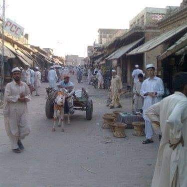
Figure 1.8 View of Lakki Marwat Bazaar
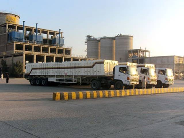
Figure 1.9 Lucky Cement Factory, Lakki Marwat

Figure 1.10 Sunset at River Tochi/Gambila

Figure 1.11 Wheat Fields Lakki Marwat

Figure 1.12 Cattle Grazing
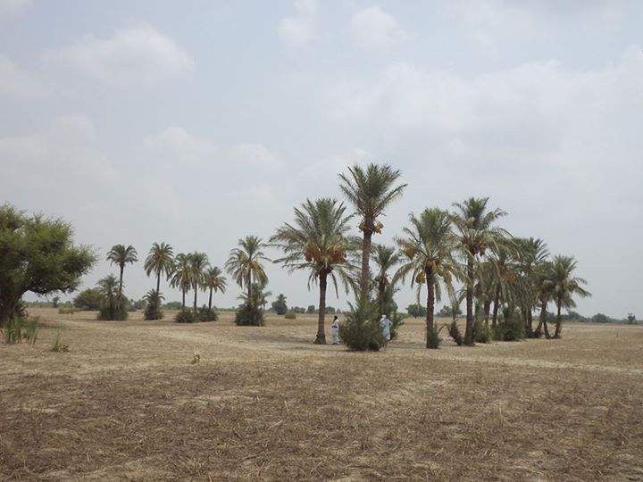
Figure 1.13 Date Orchard Lakki Marwat

Figure 1.14 Desert Area Lakki Marwat
[1] KP Development Statistics 2018-19
[2] KP Development Statistics 2018-19
Environment and Biodiversity; Lakki Marwat District
The physical environment of the district is clean, but it is a forest deprived district.
Flora and Fauna; Lakki Marwat district
Flora; Lakki Marwat district
The most common trees of the district include shisham (Dalbergio sissoo), mulberry (Morus alba), palusa (Acacia modesta), kikar (Acacia nilotica), ber (Zizyphus jujube), phulai (Acacia modesta), kao or wild olives (Olea oleaste), banyan or burr/burgad (Ficus benghalensis), date palm or khajoor (Phoenix dactylifera), pomegranate or anar (Punica granatum), ghaz (tamarix aphylla), khabal or false coffee tree (Fagraea racemosa Jack), and neem (Azadirachta indica).
Some of the herbs, shrubs and grasses include kapok bush or booh (Aerva javanica), camel thorn (Alhagi maurorum), onion or piyaz (Allium cepa), aloe vera (aloe vera), phog (Calligonum polygonoides), rubber tree or aak (calotropis procera), bind weed or lehli (Convolvulus arvensis), and lemon grass (Cymbopogon distans).
Fauna; Lakki Marwat district
The district, being forest deprived, lacks mammalian wildlife. The mammals most commonly found are the wolf and jackal, but a large number of migratory birds pass through the district. The Government of Pakistan has created a sanctuary for the threatened demoiselle crane, which also provides sanctuary to other migratory birds. These include heron, cranes, bustard, falcons, varieties of ducks (pochard, common tail, shell duck), bar headed goose, grey leg goose, and pelicans. Indigenous birds of the district include various types of partridges.
Protected Areas and Endangered Fauna; Lakki Marwat district
There is no government-owned wildlife protected area in the district, but there are privately-owned and community-owned protected game reserves as follows:
- Manjiwala Game Reserve (privately-owned; 23 A area) (Lakki Marwat district
- Village Musabad Mouza Gandi Khan Khel (101 A land; community-owned and protected); Lakki Marwat district
- Village Pahar Kehl Thal (92 A land); Lakki Marwat district
- Dara Tang Mouza Chowki Jand (500 A land; community-owned and protected); Lakki Marwat district
These provide sanctuary to the grey partridge, black partridge, raptors, song bird, water fowl, all types of cranes, and pelicans, as well as wolf, and jackals.