Share now
Map of Khyber Pakhtunkhwa

Map of Mansehra

Khyber Pakhtunkhwa Districts
- Peshawar District Profile
- Abbottabad District Profile
- Bannu District Profile
- Battagram District Profile
- Buner District Profile
- Charsadda District Profile
- Chitral District Profile
- Dera Ismail Khan District Profile
- Lower Dir District Profile
- Upper Dir District Profile
- Hangu District Profile
- Haripur District Profile
- Karak District Profile
- Kohat District Profile
- Kohistan District Profile
- Lakki Marwat District Profile
- Malakand District Profile
- Mansehra District Profile
- Mardan District Profile
- Nowshera District Profile
- Shangla District Profile
- Swabi District Profile
- Swat District Profile
- Tank District Profile
- Torghar District Profile
- Bajaur Tribal Distyrict Ptofile
- Khyber Tribal District Profile
- Kurram Tribal District
- Mohmand Tribal District Profile
- North Waziristan Tribal District Profile
- Orakzai Tribal District Profile
- South Waziristan Tribal District Profile
Also visit: Sindh, Punjab, Baluchistan
Introduction/Geographical Details; Mansehra District
Mansehra is located at the eastern border of the Khyber Pakhtunkhwa (KP) province, and is situated between 34º 15Ꞌ to 35º 12Ꞌ north latitudes, and 72º 50Ꞌ to 74º 03Ꞌ east longitudes. The district is bounded in the north and northwest by Battagram and Kohistan districts, by Abbottabad and Haripur districts in the south, Muzaffarabad district of Azad Jammu and Kashmir in the northeast, and Swat district in the east.
Mansehra District at a Glance
| Name of District | Mansehra District | ||
| District Headquarter | Mansehra City | ||
| Population[1] | 1,556,460 persons | ||
| Area[2] | 4,579 km2 | ||
| Population Density[3] | 363.1 persons/ km2 | ||
| Population Growth Rate[4] | 2.5% | ||
| Male Population[5] | 49.6% | ||
| Female Population[6] | 50.4% | ||
| Urban Population[7] | 9.3% | ||
| Tehsils/ Talukas |
3 Tehsils: 1. Ogai 2. Mansehra 3. Balakot |
||
| Main Towns | Balakot, Kaghan Valley, Shogran, Naran, Baffa, Shinkiari, and Jabori. | ||
| Literacy Rate[8] | 64.0% | ||
| Male Literacy Rate[9] | 78.0% | ||
| Female Literacy Rate[10] | 52.0% | ||
| Major Economic Activity[11] | Agriculture with its Allied Livestock Breeding & Fishing | 46.8% | |
| Community, Social & Personal Services | 18.2% | ||
| Construction | 12.6% | ||
| Transport, Storage & Communication | 8.6% | ||
| Wholesale/ Retail & Hotel/ Restaurant | 9.0% | ||
| Manufacturing | 2.4% | ||
| Others | 2.4% | ||
| Main Crops | Wheat, maize, rice, barley, tobacco, rapeseed and mustard, fodder, soy bean, maash, masoor, moong, sugarcane, canola, and tea | ||
| Major Fruits | Citrus, banana, apple, guava, apricot, peach, pears, plums, loquat, walnuts, persimmon, mango, figs, and lychee | ||
| Major Vegetables | Onions, potatoes, tomatoes, garlic, peas, cabbage, carrots, radish, turnips, cauliflower, brinjal, cucumber, capsicum, mint, spinach and other leafy vegetables, french beans, and okra | ||
| Forests (Area)[12] | 332,252 HA[13] | ||
| Black Topped Roads[14] | 778.7 km | ||
| Shingle Roads[15] | 136.1 km | ||
| No. of Grid Stations | Peshawar Electric Supply Company (PESCO) supplies electricity to the district. No other data is available | ||
| No. of Tel. Exchanges[16] | 44 Telephone Exchanges with 10,750 connections | ||
| Industrial Zones[17] | 1 Small Industries Estate set up in 1986, but activity within the zone has been suspended. 60 industrial units are producing manufactured goods in the District. | ||
| Major Industry[18] | Biscuits & Sweets | 3 Unit | |
| Ceramics | 2 Units | ||
| Flour Mills | 17 Units | ||
| Fiber Glass | 2 Units | ||
| Furniture | 7 Units | ||
| Ice Factories | 2 Units | ||
| Marble & Chips | 12 Units | ||
| Metal Work | 2 Units | ||
| Mel Crock | 3 Units | ||
| Plastic & Rubber | 3 Unit | ||
| Soap | 2 Unit[19] | ||
| Household Size[20] | 6.7 persons per house | ||
| Houses (Piped Water Inside)[21] | 32.1% | ||
| Houses with Electricity[22] | 49.1% | ||
Table 1.1 Mansehra District at a Glance
[1] 2017 Census
[2] 1998 Census; 2017 Census uses spatial data
[3] 2017 Census
[4] 2017 Census
[5] 2017 Census
[6] 2017 Census
[7] 2017 Census
[8] Pakistan Social & Living Measurement Survey 2014-15 (PSLM); Latest available
[9] PSLM
[10] PSLM
[11] 1998 Census; 2017 Census data has not been made public yet.
[12] KP Development Statistics 2018-19
[13] Forestry Statistics report 217,083 HA
[14] KP Development Statistics 2018-19
[15] KP Development Statistics 2018-19
[16] KP Development Statistics 2018-94
[17] KP Development Statistics 2018-19
[18] KP Development Statistics 2018-19
[19] For complete list of all industry please see article on Industry.
[20] 1998 Census; 2017 Census Data has not been made public yet.
[21] 1998 Census; 2017 Census Data has not been made public yet.
[22] 1998 Census; 2017 Census Data has not been made public yet.
Brief History – Governmental Structure – Administrative Divisions – Heritage/ Cultural Sites, Tourist Attractions, and Picnic Spots
Brief History of Mansehra District
The areas[1] belonging to Mansehra district are a part of Hazara Region which now constitutes the Abbottabad, Battagram, Haripur, Mansehra, Kohistan, and Torghar districts. These areas belonged to the ancient Pakhli Sarkar (district). The archeological sites discovered in the district show that it was part of the Gandhara Civilization. The area was just off the path taken by Alexander the Great, and thus, was never ruled by him directly, but he still exercised some authority over it, allowing him to hand it over to the Indian King Abisares;[2] it was called “Urasha” or “Urasa”.[3]
Later the area was ruled by the Mauryan Empire founded by Chandragupta Maurya in 322 BC. This Empire was ruled by kings based in Taxila. Bindusara Maurya’s (the second Mauryan Emperor) son Ashoka was the Governor of this area. After the death of his father in 272 BC, Ashoka became the king, and adopted Buddhism as the state religion. He inscribed edicts on rocks which proclaimed Ashoka’s adherence to the Buddhist philosophy and demonstrared his efforts to develop the Buddhist dharma/religion throughout his kingdom. These rocks were located in public places and were meant for people to read. Today, the Edicts of Ashoka inscribed on three large boulders on the side of a rocky outcrop near Bareri Hill serve as evidence of his rule. The Mansehra rocks record 14 of Ashoka’s edicts, presenting aspects of the Emperor’s dharma or righteous law, and represent the earliest irrefutable evidence of writing in South Asia. Dating to the middle of the 3rd century BC, they are written from right to left in the Kharosthi script.
After the Mauryan Dynasty, there is no recorded history of the area. Legends state that in the 2nd century AD, a mythical Hindu King, Raja Risalu, son of Raja Salbahan of Sialkot brought this area under his sway. The next official historical account is by the Chinese pilgrim Hiuen Tsang who visited the area in the 7th century AD. He found the area to be a dependency of Kashmir. The area remained a part of Kashmir till the end of the 12th century[4] under Hindu dominion. After that, the next historical account is of the 14th century when, in 1399, Tamerlane the Great handed the Hazara areas to a number of Karlugh Turks. In 1472 AD the Karlugh Turk Prince Shahab-ud-Din Ghori (founder of the Ghorid Dynasty) established his rule in the region. He founded the State and called it Pakhli Sarkar, chosing Village Gulibagh as the capital of his Princely State. Ghori brought Islam to the region. These Karlugh Turks ruled the area until 1703 AD.
During the rule of the Mughals, the Karlugh Turk Chiefs acknowledged their authority. Since Mansehra (Pakhli) provided the main route to Kashmir, the Mughal Emperors used it whenever they had to visit Kashmir. During the last days of the rule of Akbar, the Turk Chief, Sultan Hussain Khan, revolted after crushing this revolt, the Mughals at first exiled him, but later pardoned him, and returned his territories. In 1619-20 Emperor Jahangir stayed with Hussain Khan while going to Kashmir.
The last Karlugh Turk ruler of the Pakhli Sarkar was Sultan Mehmud Khurd. The Karlugh Turk rule of Pakhli Sarkar ended in 1703 AD, when, on the behest of Sultan Mehmud Khurd’s son-in-law, Syed Jalal Baba, the Swatis attacked Pakhli Sarkar and defeated the Karlugh Turks, establishing their rule in the plains of Pakhli and the mountains of Kaghan Valley.
In the early 19th century, the Pakhli Sarkar formed a part of the Durrani Empire of Kabul (modern day Afghanistan). The high road connecting Kabul to Kashmir ran through it. Makhan Singh, the Sikh general, attacked Pakhli in 1818, and after defeating the forces of Pakhli Sarkar built a fort at Serai Saleh, levying tribute from the Hazara plains. Ranjit Singh annexed Kashmir after that, and by 1825 the whole area (except Kaghan) was under Sikh rule.
In 1828 Muslims, led by Ahmad Ali Shah, a nephew of Syed Ahmad Barelevi,[5] rose against the Sikhs. The Tanolis of Hazara joined his forces but fled before the war started. Ahmad Ali Shah and all his men were killed in this battle. In 1830 the Muslims rose again, this time under the leadership of Syed Ahmad Barelvi. They were able to capture some parts of the area including Konsh, Bhogarmang, and the valley of Kunhar down to Balakot. They were joined by the Swatis and the Syeds of Kaghan. At Balakot they were met by a Sikh force led by Sher Singh and were defeated. A large number of Syed Ahmad’s army personnel were killed, including Syed Ahmad. After this battle, Syed Ahmad was dubbed “Shaheed” and the entire area was brought under the Sikh rule.
On 19th March, 1846 a peace treaty was signed between the Sikhs and the British according to which Raja Gulab Singh was given the territories of Kashmir and Hazara. Inhabitants of Hazara disliked the idea of being ruled by a Sikh ruler, and launched a widespread resistance movement and civil disorder against the Raja, who then asked the British government to exchange Hazara with the Jammu-Jhelum belt in 1847. The British accepted this proposal and deputed Major James Abbot to Hazara to try and restore peace. He defeated Chattar Singh, the Sikh general, and completely ousted the Sikhs from power. After the end of the Second Anglo Sikh War in 1849 AD this area came under the direct control of the British. At first, the British faced no resistance here, but in 1852 Zaman Shah of Kaghan (Mansehra) turned against the British. James Abbot sent an expedition to Kaghan which deprived Zaman Shah of his territory and he was exiled to the Pakhli plain. After 4 years the British forgave him and he was permitted to regain control of his territory.
During the British period, Mansehra remained in the forefront of various religio-political movements in the Subcontinent. The people of this area joined the ranks of the Muslim freedom fighters, joining movements like the Khilafat Movement (1919-1924)[6] zealously. Mansehra refused to acknowledge British Rule, and selected its own leaders and functionaries in different villages. In order to subdue the populace and ensure their rule the British sent more than 4 expeditions against the tribes of Kala Dhaka or Torghar Mountains (from 1852-92)[7] then part of Hazara district.
Torghar/Black Mountain tribal area remained the tribal area adjacent to Mansehra district till 2011, when it was given the status of a district.
During the War of Independence of 1857, the people inhabiting the Mansehra area revolted against the British but were subdued. After the war, the area formally became part of the British Empire. In 1901 when North West Frontier Province (NWFP) was formed, Hazara district was made part of NWFP (now Khyber Pakhtunkhwa).
The Princely State of Amb (Tanawal Area) used to be on the north of Haripur and Mansehra Tehsils. The States of Amb and Phulra belonged to the Nawab of Amb (Sir Muhammad Akram Khan, Knight Commander Star India; KCSI) and to the Khan of Phulra (Ata Muhammad Khan). During British Rule, the administration of the Tanawal area remained in the hands of these two chiefs who were both Tanawalis and descendants of Painda Khan.[8] Muhammad Akram Khan was awarded titles by the British for his services during the War of Independence (1857) and during the Hazara Expedition of 1868.
When the Muslim League began its movement for a separate homeland, the people of this region joined it, and, under the leadership of Quaid-e-Azam Muhammad Ali Jinnah, were able to get independence from the British. Hazara became a part of Pakistan, and at that time, Mansehra was a Tehsil of Hazara district. The Princely States of Amb and Phulra which were at that time ruled by Nawab Sir Muhammad Farid Khan and Nawab Abdul Latif respectively, opted for Pakistan, and ruled independently till 1969, when the states were abolished. The Nawab’s royal status was taken from him in 1972.
In 1976 Mansehra Tehsil of Hazara district was upgraded to a district level containing 2 subdivisions: Mansehra and Battagram. Some parts of Amb State were merged into Mansehra district whereas Phulra is now part of Mansehra district as a Union Council. Later, in 1981, Battagram was upgraded to district level, and Balakot and Oghi subdivisions were added to Mansehra. In 2011, the Kala Dhaka or Tor Ghar Tribal Areas were separated and formed into a district.
The name of Mansehra district is derived from its headquarters town Mansehra, which is named after Man Singh, the Governor General under the rule of Ranjit Singh who was the founder of the city.
Governmental Structure; Mansehra district
At the Federal level, Mansehra district is allocated a set number of representatives in both the National Assembly and the Provincial Assembly:
- Number of seats in the National Assembly 2
- Number of seats in the Provincial Assembly 6
Under the Local Government Act, District Mansehra has 1 District Council constituted by general seats, seats reserved for women, peasants/workers, youth, and non-Muslims as prescribed under the Khyber Pakhtunkhwa Local Government Act 2013. Mansehra District Council is composed of 59 general members, 20 women members, 3 peasants/worker members, 3 minority members, and 3 youth members.
Administrative Divisions; Mansehra district
The district has a total area of 4579 sq. km and is divided into 3 tehsils as follows:
| Balakot Tehsil | 16 Union Councils |
| Mansehra Tehsil | 33 Union Councils |
| Ogai Tehsil | 11 Union Councils |
Table 1.2 Mansehra Administrative Divisions
[1] Most of the history of the district has been summarized from Hazara District Gazetteer 1907 and the Official Website of Khyber Pakhtunkhwa Government.
[2] Abisares King of Kashmir was an ally of Porus, who, after the defeat of Raja Porus, submitted to Alexander.
[3] The name Hazara has also been derived from Urasa, or ‘Urasha’, an ancient Sanskrit name for this region, according to Prof. Aurel Stein. Some distinguished Indologists, including Dr. H. C. Ray Chaudhury, Dr. B. N. Mukerjee, Dr. B. C. Law, Dr. J. C. Vidyalankar, Dr. M. Witzel, Dr. M. R. Singh and Prof. K. N. Dhar concur with Prof. Stein’s identification of modern Hazara with ancient Urasa.
[4] Hazara District Gazetteer 1907
[5] Syed Ahmad Barelvi was a Muslim leader born in Bareli (India). He is considered to be the first modern Islamic leader to lead a movement that was “religious, military and political,”(Islam and Resistance in Afghanistan, p.56) and to address the common people and rulers with a call for jihad. He was later addressed as “Shaheed” after his death in the Battle of Balakot (Mansehra) in 1831
[6] Khilafat Movement was started by the Indian Muslims who wanted to preserve the authority of the Ottoman Sultan as Caliph of Islam
[7] These expeditions have been described in the Chapyer on Torghar district.
[8] Painda Khan was the ruler of the Khanate of Amb (Princely State; Tanawal area) from 1818-1840; he is famed for his rebellion against Maharaja Ranjit Singh’s governors of Hazara.
Heritage/ Cultural Sites, Tourist Attractions, Picnic Spots; Mansehra district
The following historical places of the district are being protected under the Government of Pakistan Laws:
- Tomb of Syed Ahmad Shaheed Barelvi, Balakot; Mansehra district
- Tomb of Shah Ismail Shaheed Balakot; Mansehra district
- Fourteen Rock Edicts of Ashoka inscribed on three rock boulders, Mansehra
- Buddhist Inscribed Rock at Shahdaur Agror, Mansehra
A UNESCO team has discovered graves, the headstones of which are carved with ducks, wheels, and horses, while some are decorated in floral designs. Historians do not know who these graves belong to, but most locals believe them to be the graves of the Turks. The recorded graveyards sites are:
- Pludaran Graves: this is a modern graveyard with only 2 graves decorated as described earlier; Mansehra district
- Pona Graves; Mansehra district
- Rajwal Graves; Mansehra district
- Rawal Kot Graves; Mansehra district
- Kaghan Graves; Mansehra district
- Agla Garan Graves; Mansehra district
- Pahli Lari Graves; Mansehra district
- Mahandri Graves; Mansehra district
- Sehri Manoor Graves; Mansehra district
- Jaraid Graves; Mansehra district
- Batangi Graves; Mansehra district
- Bandian Graves; Mansehra district
- Metti Kot Graves; Mansehra district
- Karnol Graves; Mansehra district
In addition to the above mentioned graves, the UNESCO team also discovered some ancient houses and mosques as follows:
- 4 wooden houses situated in village Paludaran; Mansehra district: All these houses are made of stone and wood. One of the houses is about 500 years old according to its owner. This house is now being utilized as a store. The rest of the houses are from 100 to 120 years old. There might have been old wooden houses in the lower valleys before the earthquake of 2005, which are now presumed destroyed
- 5 wooden mosques; Mansehra district:
- Bela Mosque, constructed 50 years ago
- Batla Mosque, the materials used for which (wooden pillars and capitals) are old and were reused in the construction of the present mosque
- Paludaran Mosque
- Jaraid Mosque, which was completely destroyed during the 2005 earthquake, but the carved pillars are part of the debris and need to be preserved
- Metti Kot Mosque, which was destroyed by the Sikhs and only one wooden pillar and capital was preserved. These are now displayed in the Hazara Cultural Museum, Hazara University, Mansehra
- Sikh Temple/ Gurdwara: this temple was destroyed during the 2005 earthquake and only the wall stone structure can now be observed; Mansehra district
- Tombs of the Syed family in Kaghan: This is located in the main Kaghan village and is made of stone and cement; Mansehra district
- Tomb of Zinda Pir, Village Karnol; Mansehra district
The team also discovered some other buildings and sites which the team has recommended be protected under the Pakistan Laws; they are:
- Shamori Dheri; Mansehra district
- Government High School, Garhi Habibullah; Mansehra district
- Attar Singh House; Mansehra district
- Iron Bridge, a British constructed bridge connecting Garhi Habibullah and Karnol; Mansehra district
- Burhi Ki Dheri; Mansehra district
- Nokot Cemetery and Haveli[1]
The entire district is considered to be a tourist paradise; some of the main tourist spots of the district include:
- Mansehra city: among its notable features are the Ashoka Edicts inscribed on rocks as old as the relics of Taxila
- Baffa Town: one of the major trade centers of Mansehra district
- Dadar: known for its TB clinic; Mansehra district
- Balakot: located on the banks of River Kunhar. Mujahideen leaders Syed Ahmad Shaheed and Hazrat Shah Ismail Shaheed are buried here; Mansehra district
- Kaghan Valley: famous for its natural beauty; Mansehra district
- Shogran: lying at an altitude of 2,326 m, the peaks Malka-e-Parbat (5,290 m) and Musa Ka Massalla (4,419 m) are visible; Mansehra district
- Naran: situated on the banks of River Kunhar at an altitude of 2,498 m, this is the starting point for Lake Saiful Malook, Lalazar Plateau, Lake Lulusar, and Babusar Pass
- Lake Saiful Malook: situated at an altitude of 3,500 m, the area provides a breath-taking view of Malika-i-Parbat. A charming legend about a prince called Saiful Malook who fell in love with a fairy of the lake is associated with the lake; Mansehra district
- Lake Dodipat; Mansehra district
- Barreri Hil; Mansehra districtl: Barreri is a female deity in the Hindu religion. Here, the Barreri Mata is a combination of rocks situated on top of a hill. There are two main rocks, one of which takes the shape of a basin which collects rain water which pours into it from the rock fissures; this water is treated as Holy milk by believers. The other rock lays supine and juts outward. A fair, Durga Ashttami, was held twice a year, once in Chat (March-April) and the other in Assu (October)
- Babusar Top: this is located at 3,983 m above sea level; Mansehra district
- Lake Lulusar: this lake is located 3,455 m above sea level; Mansehra district
- Lalazar: located at an altitude of 3,350 m; Mansehra district

Figure 1.8 Lake Saiful Malook in Winter
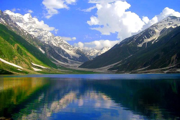
Figure 1.9 Kaghan Valley
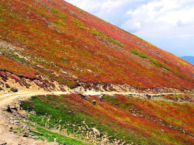 Figure 1.10 Babusar Pass in Spring
Figure 1.11 Shogran Valley
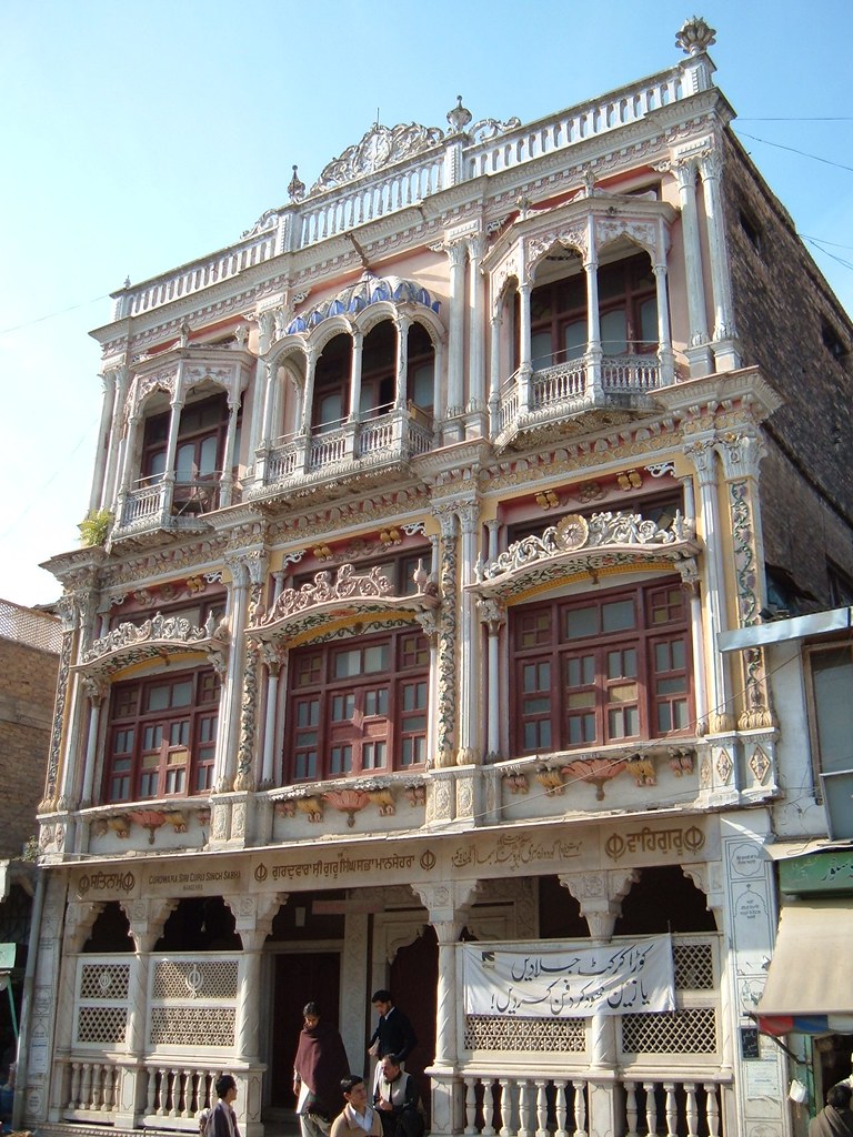
Figure 1.12 Sikh Temple Mansehra

Figure 1.13 Balakot
[1] Mapping and Documentation of Cultural Assets of Kaghan Valley, Mansehra, UNESCO Islamabad, Final Report.
Topography of Mansehra District
The topography[1] of the district is dominated by mountains, valleys, and plains. The height of the mountains in the district varies in elevation from 2,000 m in the south, to over 4,500 m above sea level in the north.
The mountain ranges which enter Mansehra district from Kashmir in the north are the off-shoots of the great Himalayan System. In Kaghan Valley, this mountain system is the highest of the area, and includes the Babusar Top also called Babusar Pass. The maximum height of the Top is 4,173 m. It is the highest point in the Kaghan Valley and is accessible by cars.
The general direction of the mountain ranges in the district is from northeast to southwest. Of the 2 important ranges, one range flanks the west bank of the rivers Kunhar and Jhelum, and terminates in the hills of Murree. In the northern end, its peak attains a height of over 4,500 m which decreases at the southern end to only about 2,000 m above sea level. In this range, the highest peak is Musa Ka Mussalla at 4,078 m. Another range diverges from this range, towards the west, skirting the northern end of Bhogarmang and Kuz Konsh Valleys, encircling the Agror valley, and along the boundary of Battagram district. Its western chain forms the Black Mountains with the highest peak at a height of about 3,036 m. This range breaks up at the southern end of the Black Mountains into numerous spurs and off-shoots and becomes a maze of hills constituting the Tanawal Tract, where the highest point is 2,587 m.
Another range flanks the left bank/west bank of the Kunhar River and forms part of a boundary between Mansehra and Azad Kashmir. It has the highest peak of the district, the Malika-Parbat, which is 5,182 m above sea level. Shortly before the convergence of the Kunhar and the Jhelum Rivers, the range passes into Azad Kashmir.
Plains; Mansehra district
In between[2] these high mountains, there are a few level tracts and fertile valleys. Some plains of Mansehra are Pakhli, Chuttar, Agror, and Mangal. The Pakhli tract is 914.4 m (3,000 ft) above the sea level, 18 km (11 miles) from north to south, and 16 km (10 miles) from east to west. It is the most fertile and intensively cultivated plain, especially on the western side, and is irrigated by bourns (small streams), nallahs, and the Siran River. The Chuttar plain is located on the north of the Pakhli plain and is 1,676 m (5,500 ft) above sea level.
Valleys; Mansehra district
The Kaghan Valley, Konsh Valley, Agror Valley, Bhogarmang Valley, and Pakhal Valley are important valleys of Mansehra. The Kaghan Valley is one of the most popular tourist resorts of Pakistan. Agror is a small valley lying at the foot of Black Mountain, and is separated from Pakhli by the ridge of Tanglai. Konsh and Bhogarmang are also famous valleys.
Mountain Passes; Mansehra district
The most important Mountain Pass of the district is the Babusar Top/Pass. This Pass is situated at a height of 4,173 m, and connects Kaghan Valley with Chilas (Gilgit-Baltistan) on the Karakorum Highway
Rivers, Streams, and Lakes; Mansehra district
2 major rivers—the River Kunhar and River Siran—flow through the district. River Siran passes through Pakhal Valley. River Kunhar starts from Lake Saiful Malook, flowing through a large number of villages, and reaches Balakot and Garhi Habibullah, from where it turns to Muzaffarabad to meet River Neelum.
In addition to the two major rivers, there are numerous streams/nullahs which flow down the mountains in summer and rainy seasons. Some of the major streams include Jinjal from Jaba area, Ichhar Nullah from Ichhrian area, and Kodar Nullah. These streams originate from adjoining mountains and join River Siran at various places.
Some of the tributaries of River Kunhar are Jalkad Nar, Jora Nullah, Saiful Malook Nullah, Chitta Katha, Bagner Katha, Shisham Nullah, Parla Gran, Gul Deri, and Ochri Katha.[3] Other Nullahs and streams are Pootkatha in Mansehra, Nadi Unhar (Shergarh), and Butkus (River Siran Tributary).
There are a lot of lakes in the district nestled among the mountains, the most important (and that serve as major tourist attractions) of which are the Lake Saiful Malook, Lulu Sar Lake, Aansoo Lake, Jati Jheel, Jhulkhad Lake, and Dodipatsar Lake.
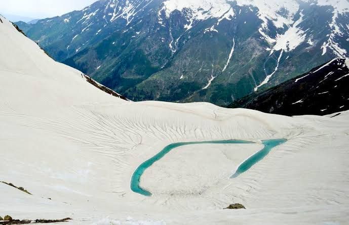
Figure 1.3 Aansoo Lake in Winter

Figure 1.4 Lake Saiful Malook
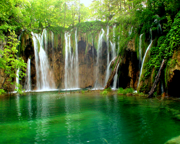
Figure 1.5 A Waterfall in Kaghan Valley
[1] Most of this section has been extracted from Mapping and Documentation of the Cultural Assets of Kaghan Valley, Mansehra by UNESCO
[2] The names of valleys and plains have been extracted from the Government of Khyber Pakhtunkhwa’s Official Website
[3] Morphometry and Geotectonic of Kunhar Basin, Kaghan Valley by Kalida Khan
Forests; Mansehra district
Mansehra district is home to Coniferous and Sub-tropical Dry Forests types of forests. The flora of Coniferous Forests includes silver fir (Abies alba), spruce (Picea smithiana), deodar (Cedrus deodara), blue pine (Pinus wallichiana), and chir pine (Pinus roxburghii). Dominant tree species of Sub-Tropical Dry Forests are phulai (Acacia modesta), kau (Olea cuspidate), and hopbush (Dodonea viscosa).
The following table shows the area by use of forests as notified under government laws in Mansehra district[1] (KP Development Statistics 2018-19):
| Total Forest Area | 536,423 A | Resumed Land | 29,142 A |
| Reserved Forests | 84,809 A | Communal Forests | – A |
| Protected Forests | 6,765 A | Guzara Forests | 150,937 A |
| Un-classed Forests[2] | 175,712 A | Private Plantation | 88,378 A |
| Miscellaneous | 680 A | Linear Plantation | 274 km |
Table 1.3 Mansehra Forests
Some important forests of the district include Batrasi Chir Pine Forest, Jaba Pine Forest, Dadar Chir Pine Forest, and Paraziarat Chir Pine Forest. Other forests include Tangali Reserved Forest, and Bazkhan Reserved Forest. Community-owned and protected Game Reserves of the district include Palsala Dhanaka, Battal, Parhana, Karair, Khawajagan, Lassan Thukral, Sheikhabad, Bhalli Ghatti, Behali, and Jallo.

Figure 1.6 Batrasi Chir Pine Forest
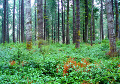
Figure 1.7 Undergrowth in Chir Pine Forests on Mountains
Soils of Mansehra district
The soils of Mansehra consist mainly of silt loam to silty clays, non-calcareous to slightly calcareous, and some rock outcrops of humid mountainous regions.
Climate of Mansehra district
The climate of the district is warm in summer and cold in winter. The northern part—the Kaghan Valley with surrounding high mountains—is cold in the summer and very cold in winter. It receives heavy snowfall on the mountains. The months from May to August are the summer months. The mean maximum and minimum temperatures during the month of June (the hottest month) are 35 °C and 21 °C. January is the coldest month with mean maximum and minimum temperatures of about 14 °C and 2 °C. Rainfall is less in the northern part (the Kaghan Valley) as compared to the southern part which includes the Agror Konsh and Bhogarmang valleys. Average annual rainfall in the district is 1,680 mm.
Seismic Activity/Seimicity Mansehra district
The district belongs to Zone 3 of the Seismic Zone Map of Pakistan, which is the moderate to severe damage seismic zone. It was one of the districts that were badly affected by the 2005 earthquake that hit Kashmir and KP.
[1] includes data for Torghar district also
[2] un-classed forests are owned by the Government
Population of Mansehra District
The following table shows the population of the district as per 2017 Census:
| District |
Area km2 |
Population | Male% | Female% |
Urban % |
Growth Rate % |
| Mansehra District | 4,579 | 1,556,460 | 49.6 | 50.4 | 9.3 | 2.47 |
| Balakot Tehsil | 2,376 | 273,257 | 49.4 | – | 1.28 | |
| Mansehra Tehsil | 1,340 | 1,017,521 | 50.1 | 49.9 | 14.2 | 3.04 |
| Oghi Tehsil | 409 | 264,964 | 47.8 | 52.2 | – | 1.8 |
Table 1.4 Mansehra Population Statistics
Religions; Mansehra district[1]
| Muslims | 99.8% |
| Christians | Negligible % |
| Hindus | Negligible % |
| Ahmadis | 0.1% |
| Schedule Castes | Negligible % |
| Others | 0.2% |
Table 1.5 Mansehra Religions
Languages; Mansehra district[2]
| Urdu | 0.3% |
| Punjabi | 0.1% |
| Sindhi | 0.1% |
| Pushto | 26.6% |
| Balochi | Negligible % |
| Seraiki | 0.1% |
| Others | 72.9% |
Table 1.6 Mansehra Languages
The Gujjri Language or Gujrati Language, Brahvi, and Hindko languages are some of the other languages spoken in the district.
[1] 1998 Census, 2017 Census Data has not been made public yet.
[2] 1998 Census; 2017 Census Data has not been made public yet.
Economic Activity – Economic Infrastructure
Economic Activity; Mansehra District
The economy of Mansehra district is mainly based on agriculture and its allied activities as 46.8% of the employed population of the district is engaged in this activity. Other activities include[1]:
- Community, Social & Personal Services (18.2%)
- Construction (12.6%)
- Transport/ Storage & Communication (8.6%)
- Wholesale/ Retail & Hotel/ Restaurant (9.0%)
- Manufacturing (2.4%)
- Others (2.4%)
Only one-fourth of the total area of the district is constituted of plains. In the plains where irrigation facilities are available, agriculture is practiced, and food grains like wheat and maize are produced in sufficient quantity. An important cash crop of the district is tobacco.
[1] 1998 Census; 2017 Census Data has not been made public yet.
Land Use; Mansehra district
The total area of Mansehra district is 457,900 HA. The following table shows the land use statistics of the district (KP Development Statistics 2018-19):[1]
| Total Area | 457,900 HA | Reported Area | 439,423 HA |
| Total Cultivated Area | 80,747 HA | Net Sown | 69,015 HA |
| Current Fallow | 11,732 HA | Uncultivated Area | 358,676 HA |
| Culturable waste | 17,702 HA | Forest Area | 332,252 HA |
Table 1.7 Mansehra Land Use Statistics
[1] In the absence of separate statistics, the table includes statistics for Torghar district also
Irrigation Network; Mansehra district
River Siran and River Kunhar flow parallel to each other through the valleys, and irrigate major portions of the land. The other areas near seasonal streams depend upon rains. Irrigation in the district depends upon a network of small canals spread throughout the area. Lower Siran Canal takes off from Siran River, and the waters are regulated by a head regulator on the left/east bank of Siran River at Shinkiari.
The following table shows the mode and area irrigated by each mode: (KP Development Statistics 2018-19, Mansehra District):[1]
| Total Irrigated area | 16,500 HA | Canal Irrigated (Private) | 11,565 HA |
| Tube Wells | 12 HA | Canal Irrigated (Govt.) | 4,923 HA |
| Wells | – HA | Lift Pumps/Others | – HA |
Table 1.11 Mansehra Irrigation Statistics
[1] Includes data for Torghar District also
Agriculture; Mansehra district
The district belongs to the Wet Mountains Agro-Ecological Zone of Pakistan, where the soils are mostly silt loam to silty clays, non-calcareous to slightly calcareous (pH 7.5-8.1); organic matter is 1% in cultivated fields, and 2-4% in forest areas.
The crops of the district include wheat, maize, rice, barley, tobacco, rape seed and mustard, fodder, soy bean, maash, masoor, moong, sugarcane, canola, and tea. The fruits grown are citrus, banana, apple, guava, apricot, peach, pears, plums, loquat, walnuts, persimmon, mango, figs, and lychee. The vegetables are onions, potatoes, tomatoes, garlic, peas, cabbage, carrots, radish, turnips, cauliflower, brinjal, cucumber, capsicum, mint, spinach and other leafy vegetables, french beans, and okra.
Livestock Breeding; Mansehra district
The following table shows the population of livestock for Mansehra district according to the 2006 Census of Livestock (qtd. in KP Development Statistics 2018-19):
| Cattle | 181,973 Heads | Buffalo | 191,064 Heads | Sheep | 86,729 Heads |
| Goats | 316,759 Heads | Camels | 1,676 Heads | Horses | 7,906 Heads |
| Mules | 4,393 Heads | Asses | 36,061 Heads |
Table 1.8 Mansehra Livestock Statistics
Kaghani, and Gaddi breeds of goats are local/ indigenous breeds of livestock in the district.
Poultry Farms; Mansehra district
According to Table 17 (No. of Commercial Poultry Farms and Number of birds in Pakistan), there are 243 poultry farms in the district.
Fishing; Mansehra district
Fishing is a substantial economic activity in the district and is chiefly carried out in the Siran River and other Nullahs/lakes of the district. Most of the fish caught are cold water fishes like crossocheillus Latius, diplocheillus, trout, and Labeodero. In fact, River Kunhar abounds in trout. There is a trout hatchery in Mansehra, and 2 privately-owned trout fish farms in Kaghan Valley.
Bee Keeping/Api Culture; Mansehra district
In Mansehra there are a number of plant species which are important for honey bees. The University of Hazara in Mansehra district has a honey bee research program. Through this program, the university is spreading awareness about the importance of employing scientific methods for increase of honey production. Hashoo Foundation (a Non-Governmental Organization or NGO) works for empowering women as honey bee keepers.
Mining; Mansehra district
The commercially mined minerals in Mansehra district are coal, corundum, feldspar, granite, marble, quartz, and phosphates. In addition, there are deposits of mica, soapstone, and chromites which are yet to be exploited. Corundum and smoky quartz are the gemstones found in the district.
Industry and Manufacturing; Mansehra district
One Small Industries Estate was established in Mansehra in 1986, but the activities have now been suspended. In all, there are 60 industrial units registered in the district.
The following table shows the type and number of industrial units in Mansehra district, according to KP Development Statistics 2018-19:
| Industry | Number | Industry | Number |
| Biscuits & Sweets | 03 | Ceramics | 02 |
| Flour Mills | 17 | Furniture | 07 |
| Fiber Glass | 02 | Marble & Chips | 12 |
| Paints | 01 | Pharmacy | 01 |
| Tea Packing | 01 | Printing Press | 01 |
| Spice Grinding | 01 | Mel Crock | 03 |
| Soap | 02 | Plastic & Rubber | 03 |
| Preservation of Fruits | 01 | Beverages | 01 |
| Garments | 01 | Poultry Feed | 01 |
Table 1.9 Mansehra Industries
Trade (Import/ Export); Mansehra district
Baffa, Shinkiari, and Mansehra city are the main trading centers. Agricultural products like fruits and vegetables are the main trading items. Tobacco is the main cash crop, and other exportable items include poultry and its products. Handmade woolen cloth, garments, and blankets are also exported within Pakistan.
Handicrafts; Mansehra district
Handicrafts include household items made in crotchet, as well as embroidered shawls and dresses, namdas (woolen felt rugs), household/ decoration items made with walnut wood, and carpets.
Economic Infrastructure; Mansehra District
The district has a network of black topped roads linking the district headquarter Mansehra to its tehsil headquarters and also to other parts of Pakistan. The Karakorum Highway or National Highway N-35, which traces many paths of the ancient Silk Road (the Silk Road was an ancient trade route connecting Asia with the Middle East) passes through the district. The district is not connected to other parts of Pakistan through rail, but there is an airport in the district.
Road Statistics; Mansehra district
According to the KP Development Statistics 2018-19 the road statistics of the district are as follows:
| Total Roads | 914.8 km |
| High Type Roads | 778.7 km |
| Low Type Roads | 136.1 km |
Table 1.10 Mansehra Road Statistics
Two National Highways—the N-35 (Karakoram Highway) and National Highway N-15—pass through the district. The N-15 connects Mansehra to Chilas, and is a 240 km long road. Other important roads of the district include:
- Tallhatta-Garhi Habibullah Link Road
- Kashmir Road
- Lassan Nawab Road

Figure 1.14 Road from Mansehra to Balakot
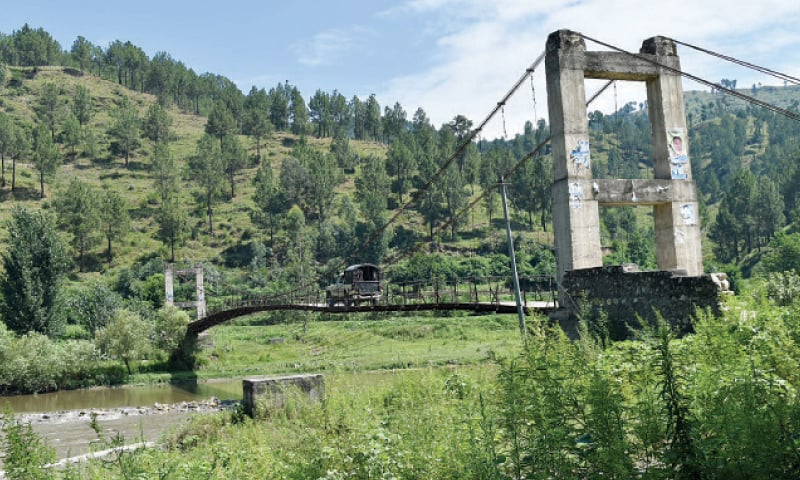
Figure 1.15 Mansehra Bridge
Rail and Airways; Mansehra district
There is no railway station in the district. The nearest railway station is at Havelian, Abbottabad. There is a commercial airport located in Mansehra city.
Radio and Television; Mansehra district
Pakistan Broadcasting Corporation (PBC) does not have its broadcasting station in the district. There is one privately-owned FM radio station in the district, and the district has a modern cable TV network.
Telecommunication; Mansehra district
There are 44 telephone exchanges providing 10,750 connections in the district (KP Development Statistics 2018-19). Cellular phone services, with considerable coverage in all major towns, are also available.
Post Offices; Mansehra district
There are 191 offices of Pakistan Post in the district, with 1 Head Office, 38 Sub-Post Offices, and 152 Branch Offices in the district (KP Development Statistics 2018-19).
Electricity and Gas; Mansehra district
Peshawar Electric Supply Company (PESCO) provides electricity to the district. Gas for domestic use is not available.
Banking/ Financial Services; Mansehra district
Most of the major banks of Pakistan have branches in the district; in all, there are 96 branches of various banks (KP Development Statistics 2018-19).
Following banks have their branches in the district:
- Al Baraka Bank Ltd.
- Alfalah Bank Ltd.
- Bank Al Habib Ltd.
- Allied Bank Ltd.
- Askari Bank Ltd.
- Bank Al Islami Ltd.
- Faysal Bank Ltd.
- Habib Bank Ltd.
- Habib MetropolitanBank Ltd.
- JS Bank Ltd.
- Khyber Bank Ltd.
- Meezan Bank Ltd.
- Muslim Commercial Bank Ltd.
- National Bank of Pakistan Ltd.
- Silk Bank Ltd.
- Soneri Bank Ltd
- Summit Bank Ltd.
- The Bank of Punjab Ltd
- United Bank Ltd.
- Zarai Taraqiati Bank
According to the “List of Reporting Bank Branches 2019” by State Bank of Pakistan, in all there are 82 branches of various conventional banks and 14 branches of different Islamic Banks in the District.
Educational Institutions; Mansehra district
Mansehra district has a literacy rate of 64%. The following table shows the number of Government Educational Institutions in the district as per KP Development Statistics 2018-19:
| Institution | Boys/Girls | Institution | Boys/Girls |
| Primary Schools | 951/648 | Middle Schools | 115/71 |
| High Schools | 86/50 | Higher Secondary Schools | 26/14 |
| Mosque Schools | 04 | Degree Colleges | 04/03 |
| Polytechnic Institutes | 01 | Commerce Colleges/Institutes | 02 |
| Vocational Centers | 04 | Private Primary Schools | 146 |
| Private Schools (Middle to Higher Secondary) | 204 | Post Graduate College | 01 |
| Medical Colleges | – | Engineering Colleges/University | – |
| Military Institutes | – | Universities[1] | 01 |
| Law Schools | 02 | Homeopathic Colleges | 01 |
Table 1.12 Mansehra Educational Institutes

Figure 1.16 Hazara University Dodhial, Mansehra
Healthcare Facilities; Mansehra district
The following table shows the Health Care Institutions in Mansehra district as per KP Development Statistics 2018-19:
| Institution | No./beds | Institution | No./beds |
| Hospitals | 12/782 | Dispensaries | 59/- |
| Rural Health Centers | 09/180 | Basic Health Units | 59/- |
| Mother Child Health Centers | 03/- | Sub-Health Centers | – |
| Leprosy Clinic | 01/- | TB Clinics | 01/- |
| Private Hospitals | -/- | Private Medical Practitioners | 287 |
Table 1.13 Mansehra Health Institutes
Policing; Mansehra district
The District Police Officer (DPO) is directly responsible to the Zila Nazim for public safety. The Police Department is headed by the DPO, who supervises and controls the police force in maintaining law and order, and investigation of cases of criminal nature. The Police Department operates under the Police Rules. There are 13 police stations[2] in the district including women’s police stations.
[1] University of Hazara, Dodhial, Mansehra
[2] KP Development Statistics 2018-19
Environment and Biodiversity; Mansehra District
The natural beauty and good climate is the chief tourist attraction of the district. Mansehra is one of the most enriched forest territories, and most of the forests are either reserved or guzara.[1]
The air quality is good, and industrial pollution is limited; the only air pollutants are emissions from vehicles.
Flora and Fauna; Mansehra district
Flora; Mansehra district
The flora of the district varies from place to place due to the variation in height and rainfall. The most common broad leaved trees are walnut (Juglans regia), Narri (acanthus), eucalyptus (Eucalyptus), kikar, or babool (acacia), chestnut (castanea), bird-cherry (Prunus padus), yew (Taxus baccata), wild olive (Olea oleaster), ash (Fraxinus), plane tree (platanus), alder (alnus), Persian lilac or derek (Melia azedarach), elm (ulmus), and mulberry (Morus alba). Many species of willow (salix), poplar (populus), birch (betula) and occasionally juniper (juniperus) are found in the higher parts. The conifers include pine (pinus), deodar (Cedrus deodara), blue pine (Pinus wallichiana), spruce (picea) and silver fir (Abies alba).
The common shrubs and herbs of the area are sanatha (Dodonea viscosa), phulai (Acacia modesta), wild indigo (baptisia), valerian (Valeriana officinalis), peony (paeonia), sorrel (Rumex acetosa), timar (Zanthoxylum alatum), ber (zizyphus), hawthorn (crataegus), oleaster (oleo Europa), wayfaring (Viburnum lantana), barberry (berberis), bramble (rubus) and others.
Sunflower, rose, jasmine, jasmine-zambak, narcissus, tulip, lily, dog violet, brush flax, iris, and musk-rose are some of the ornamental flowering plants of the district.
The district hosts a large number of herbs, many of which are used for medicinal purposes locally as well as outside the district. Some medicinal herbs include sultani booti (Achillea millefolium linn.), arusha (Adhatoda vasica), horse chestnut (Aesculusindica Wall), kori booti (Ajuga bracteosa), Pakistani aloe (Aloe barbadensis mill), green amaranth (Amaranthus viridis), shakakul (Asparagus racemosus), and bhang (Cannabis sativa).
Fauna; Mansehra district
The mammalian fauna of the district include leopard, porcupine, black bear, jackal, wild goat, brown bear, wolf, barking deer, rhesus monkeys, langur, musk deer, flying squirrel, and wild boar.
Avifauna includes several species of herons, teals, doves, cuckoos, bee-eaters, wood peckers, larks, shrikes, bulbuls, finches, wagtails, swallows, parrots, mynas, pigeon, sparrows, hoopoe, kingfishers, and crows, while western-horned tragopan, imperial monal pheasant, and koklas pheasant are found only in hilly areas. Black and grey partridges as well as quails are also common. The birds of prey are shikra, sparrow hawk, owl, and several species of vulture.
The district also has a variety of snakes and lizards like cobras, Indian kraits, sang choor, rat eaters, Pakistani agama, spiny-tailed lizards, brown turtles, frogs, and common toads.
Protected Wildlife Areas and Endangered Fauna; Mansehra district
Following are the wildlife protected areas of the district:
- Saiful Malook & Lulusar-Dodipat National Park, Naran, District Mansehra: These National Parks were created in 2003 covering an area of 88,000 HA. The National Parks are representative of alpine ecosystems, having excellent landscaping due to the lakes. These lakes are ecologically important, as they serve as wetlands and staging grounds for migratory waterfowl who visit them from May to September. Key fauna of the alpine/temperate ecosystems of the parks include snow leopard, black bear, marmot, weasel, lynx, leopard, Himalayan snow cock, and snow partridge
- Makhnial Game Reserve’ Mansehra district: Government-owned and protected, it provides sanctuary to barking deer, kalij pheasant, chakor partridge, and black partridge
- Palsala Dhanaka; Mansehra district: Community-owned and protected Game Reserve
- Battal: community-owned and protected Game Reserve; Mansehra district
- Pharhana: community-owned and protected Game Reserve; Mansehra district
- Karair: community-owned and protected Game Reserve; Mansehra district
- Other community-owned and protected Game Reserves of Mansehra district are Khawajagan, Lassan Thukral, Sheikhabad, Bhalli Ghatti, Behali, and Jallo
The largest bird sanctuary of Asia—the Dodhial Pheasantry—is located in Dodhial, Mansehra district. This sanctuary houses and provides sanctuary to 38 types of pheasants, including the re-introduction of chir pheasant. This pheasantry is also providing breeding grounds to tigers, chinkara, urial, and other protected animals for their subsequent re-introduction to their habitats. The endangered koklas, monal, western tragopan, kalij, and chir are provided sanctuary here.
[1] Guzara Forests are sizable patches of wooded lands close to settlements that were set aside to meet the needs of local communities in Hazara in 1872. Guzara forests are managed by the forest department which regulates the removal of timber for commercial as well local use