Share now
Map of Punjab

Map of Bahawalpur District

Punjab Districts
- Islamabad Capital Territory Profile
- Lahore District Profile
- Attock District Profile
- Bahawalnagar District Profile
- Bahawalpur District Profile
- Bhakkar District Profile
- Chakwal District Profile
- Chiniot District Profile
- Dera Ghazi Khan District Profile
- Faisalabad District Profile
- Gujranwala District Profile
- Gujrat District Profile
- Hafizabad District Profile
- Jhang District Profile
- Jhelum District Profile
- Kasur District Profile
- Khanewal District Profile
- Khushab District Profile
- Layyah District Profile
- Lodhran District Profile
- Mandi Bahauddin District Profile
- Mianwali District Profile
- Multan District Profile
- Muzaffargarh District Profile
- Narowal District Profile
- Nankana Sahib District Profile
- Okara District Profile
- Pakpattan District Profile
- Rahimyar Khan District Profile
- Rajanpur District Profile
- Rawalpindi District Profile
- Sahiwal District Profile
- Sargodha District Profile
- SheikhupuraDistrict Profile
- Sialkot District Profile
- Toba Tek Singh District Profile
- Vehari District Profile
Also visit: Sindh, Balochistan, Khyber Pakhtunkhwa
Introduction/Geographical Details; Bahawalpur District
The district derives its name from its headquarter town, Bahawalpur, which was founded by Nawab Bahawal Khan in 1748 AD. It is situated between 27° 40′ to 29° 50′ north latitudes and 70° 54′ to 72° 50′ east longitudes. The district is bounded on the north by Multan, Lodhran and Vehari districts, on the east by Bahawalnagar district and India, on the south by India and on the west by Rahim Yar Khan and Muzaffargarh districts. Bahawalpur is one of the largest districts in terms of area in Punjab, covering an area of 24,830 km2. The district is situated almost in the center of Pakistan, at an elevation of 152 m above mean sea levels (MSL). The district is located south of the Sutlej River and nearly two-thirds of the district is located in Cholistan Desert.
Bahawalpur District at a Glance
| Name of District | Bahawalpur district | |
| District Headquarter | Bahawalpur city | |
| Population[1] | 3,668,106 persons | |
| Area[2] | 24,830 km2 | |
| Population Density[3] | 153.4 persons/ km2 | |
| Population Growth Rate[4] | 2.2% | |
| Male Population[5] | 51.2% | |
| Female Population[6] | 48.8% | |
| Urban Population[7] | 31.9% | |
| Tehsils |
5 Tehsils: 1. Ahmadpur Sharqia Tehsil 2. Hasilpur Tehsil 3. Khairpur Tamewali Tehsil 4. Yazman Tehsil 5. Bahawalpur Tehsil |
|
| Main Towns | Dera Bakha, Abbas Nagar, Khanqah Sharif, Dingarh, Mouj Garh, Khairpur Tamewali, Qaimpur, Yazman, Musafir Khana, Noorpur Noranga, Mubarakpur, Dera Nawab, Chani Goth, and Uch Sharif | |
| Literacy Rate[8] | 45.0% | |
| Male Literacy Rate[9] | 55.0% | |
| Female Literacy Rate[10] | 36.0% | |
| Major Economic Activity[11] | Agriculture with its Allied Livestock Breeding, Forestry & Fishing | 44.7% |
| Elementary Occupations | 34.8% | |
| Service & Shop/ Market Sales Workers | 9.2% | |
| Crafts and Related Trades Workers | 3.5% | |
| Others | 7.8% | |
| Main Crops | Cotton, sugarcane, wheat, sun flower, rape/ mustard seed, rice, gram, tobacco, jowar, barley, bajra, moong, maash, masoor, maize, groundnut, sesanum, sugar beet, guarseed, linseed, and sunn hemp | |
| Major Fruits | Mangoes, citrus, dates, guavas, pomegranate, jaamun, and phalsa | |
| Major Vegetables | Onion, tomato, cauliflower, potatoes, carrots, bottle gourd, ladyfinger, turnip, peas, spinach, garlic, and chillies | |
| Forests (Area)[12] | 72,000 HA[13] | |
| Total Black-topped Roads[14] | 3,226.0 km | |
| National Highways[15] | 83.0 km | |
| Provincial Roads[16] | 3053.0 km | |
| Sugar Cess Roads[17] | 90.0 km | |
| No. of Grid Stations[18] | 10 grid stations ranging in capacity from 66 KV to 220 KV | |
| No. of Tel. Exchanges[19] | 41 telephone exchanges ranging in capacity from 250 lines to 10,000 lines | |
| Industrial Zones[20] | 1 Industrial Estate and 252 industrial units | |
| Major Industry[21] | Cotton ginning, rice and flour milling, and hand woven textiles. Soap making and cotton ginning are important enterprises; cotton, and silk embroidery, carpets, and extraordinarily delicate pottery are produced as part of the handicrafts industry | |
| Household Size[22] | 7 persons | |
| Houses with Piped Water Inside[23] | 16% | |
| Houses with Electricity[24] | 50% | |
Table 1.1 Bahawalpur District at a Glance
[1] 2017 Census
[2] 1998 Census
[3] 2017 Census
[4] 2017 Census (Rounded off from 2.18%)
[5] 2017 Census
[6] 2017 Census
[7] 2017 Census
[8] Pakistan Social & Living Measurement Survey 2014-15 (PSLM); Latest available
[9] PSLM
[10] PSLM
[11] 1998 Census; 2017 Census data has not been made public yet
[12] Punjab Development Statistics 2018-19
[13] Land Utilization Statistics of the same document reports 3,000 HA under Forests.
[14] Punjab Development Statistics 2018-19
[15] Punjab Development Statistics 2018-19
[16] Punjab Development Statistics 2018-19
[17] Punjab Development Statistics 2018-19
[18] Directorate of Industries- Investment Study Bahawalpur District 2012 (Latest Available)
[19] Directorate of Industries- Investment Study Bahawalpur District 2012 (Latest Available)
[20] Directorate of Industries- Investment Study Bahawalpur District 2012 (Latest Available)
[21] Directorate of Industries- Investment Study Bahawalpur District 2012 (Latest Available)
[22] 1998 Census; 2017 Census results have not been made public yet.
[23] 1998 Census; 2017 Census results have not been made public yet
[24] 1998 Census; 2017 Census results have not been made public yet
Brief History – Governmental Structure – Administrative Units – Historic/ Heritage Buildings
Brief History of Bahawalpur District
The region, given its proximity to Sindh, shares much with the province’s early history, starting with the conquest of Sindh (and also Bahawalpur) by Alexander the Great, who started his Indian/ Punjab campaigns in 327 BC and conquered Multan and Uch (which includes the Bahawalpur region) in 326 BC. He appointed one of his generals, Phillipos, to rule Multan and Uch, and advanced towards Alor (or Arore, now Rohri in Sukkur). The area remained under Phillipos till he was ousted by King Porus after Alexander’s death. After the Persian conquest, the area became part of the Buddhist Empire of Ashoka and the Kushan rulers. Little is known of the history of this region after that till 495 AD, when Raja Rai Dewa Ji of the Rai dynasty ascended the throne in Sindh. His capital was Alor, and during his rule, Sindh was divided into four provinces. These were Chachpur (which comprised of the greater parts of Bahawalpur), Brahmanabad (now Sanghar district), Sewistan (now Sehwan), and the province which consisted of Multan and West Punjab. The Rai dynasty governed the area for 137 years. After the death of Rai Sahasi II, a Brahmin named Chach married Sahasi’s widow, killed the rightful heirs of Rai, and established himself on the throne. After his death, his nephew, Raja Dahir, succeeded to the throne. Raja Dahir’s rule ended when Sindh and parts of Punjab were conquered by the Arab army led by Muhammad bin Qasim in 711 AD. The area remained under the Abbasi and Umayyad Caliphate, but after the decline of the caliphates in 871 AD, the area was ruled by the Saffarid Dynasty (a Persian Muslim Dynasty; 861-1002 AD). In 1002, Mahmood of Ghazni invaded and overthrew the rule of the Saffarid Dynasty.
In 997 AD, Sultan Mahmud of Ghazni took over the Ghaznavid Empire in Khorasan (Afghanistan), and after first conquering the Shahis of Kabul,[1] entered India/ Punjab and conquered it as well. Mahmud of Ghazni made Punjab a part of his empire in 1021 AD. The Ghaznavid Empire was followed by the Delhi Sultanate,[2] which was, in turn, succeeded by the Mughals.
In 1370 AD,[3] Sultan Ahmad II, son of Shah Muzammil of Egypt, a descendant of the Abbasi Caliphs, left Egypt and arrived in Sindh with a large following of Arabs who were mostly Abbasis. He came to Sindh as an official emissary to manage Caliphate rule in the region and work jointly with Sindh’s Local Authorities. The Hindu Raja, Dhorang Sahta, of the Bhangar territory (which included Alor and Brahmanabad) tried to stop Shah Muzammil, but failed, and was forced to give his daughter in marriage as well as one-third of his land as dowry to him. Muzammil’s descendants later conquered all of the Bhangar territory as well as the Parkar area (now in Tharparkar district). The rising power of the Abbasi Amirs evoked the resentment of the neighbouring kings and rulers. Raja Dallu Wattu, ruler of Bhamanabad[4] and Rowar[5] attacked the Amir, Fathu’llah Khan Abbasi, while he was still a minor (he was the fourth descendant of Sultan Ahmad). The young Amir was forced to leave his territory and consequently established himself at the Delta of River Indus.
At his death, his son, Amir Muhammad Chani Khan Abbasi was crowned Amir. He joined the army under Mughal Emperor Akbar in 1583. Chani Khan died at the age of 150 and left his tribe under the leadership of his son Amir Muhammad Mehdi, and bequeathed his Holy Quran and Tasbeeh, the most prized heirlooms of the family since the time of the Abbasi Caliphs, to his other son Daud Khan. After the death of Amir Mehdi Khan, dispute arose over the question of succession. One of the two main contestants to the throne was Kalhora, son of Mehdi Khan. The other was Daud Khan, who was Kalhora’s uncle and Mehdi Khan’s brother. Ultimately, Amir Daud Khan gave up his claim, vacating the throne for Kalhora, and settling near Bhakkar with his followers. They prospered in Bhakkar, and founded many villages and towns, becoming known as the Daudpotras or Daudpotas. Amir Bahadur Khan Abbasi Daudpota laid the foundation of Shikarpur town in 1617 AD. The Kalhoras rose in prominence and ruled Sindh from 1701 to 1783, but remained in a state of constant warfare with the Daudpotas.
The Kalhoras attacked Shikarpur a number of times but were repelled; in 1726 AD, Noor Muhammad Kalhora again attacked Shikarpur. By this time, the head of the Daudpotas was Amir Sadiq Muhammad Khan I who was still a minor. He could not adequately defend the city, and fled to Dera Ghazi Khan, where he had been invited by the Bukharis and Gillani Makhdums of Uch (Bahawalpur). He met Nawab Hayatullah Khan, the Governor of Multan during the reign of Muhammad Shah (Mughal Emperor between 1719 and 1748) at Dera Ghazi Khan, and proffered allegiance to him and the Mughals. He was granted the areas of Shikarpur, Larkana, Sewistan (now Sehwan) and the Derawar now in Bahawalnagar[6] as his own. He was also given the title of Nawab.
The State of Bahawalpur was founded in 1727 with Nawab Sadiq Muhammad Khan I as its ruler. Sadiq Khan was killed in a battle with Khuda Yar Khan Kalhora in 1746. He had three sons: Muhammad Bahawal Khan, Mubarak Khan, and Fateh Khan, the first of whom was chosen by the tribe as king. Upon ascending the throne, he took the title of Nawab Muhammad Bahawal Khan I. He died in 1749. During his short reign, he built the towns of Bahawalpur, Qaimpur, Hasilpur, Tanda Ali Murad Khan, Shahbazpur, and Mohammadpur Laman. He also constructed canals including Khan Wah, Qutab Wah, and Wah Qadir Dina. As a result, the agriculture of the State improved, and people became prosperous. Nawab Mubarak Khan II (1749-1772) succeeded Nawab Muhammad Bahawal Khan I. In 1750, he wrested Marot from Jaisalmir and Madwala‒with its dependencies west of the Sutlej and Panjnad, now part of Muzaffargarh District‒from Nahrs. Bet Doma territory, which belonged to Makhdum Sheikh Raju of Sitpur, was also conquered, and a part of the country, including the important towns of Dunyapur and Kahror were occupied after these conquests. Bahawal Khan I also kept the Sikhs from Punjab in check, and constructed many canals, generally improving the infrastructure of the region.
Nawab Muhammad Bahawal Khan Abbasi II succeeded him, and ruled from 1772 to 1809 AD. In 1777, the Sikhs captured Multan. Between 1785 and 1788, Taimur Shah, the Durrani monarch of Kabul, invaded the region, and plundered the Bahawalpur State. The town was burnt and destroyed. The fort of Derawar was also occupied and Taimur Shah garrisoned it with troops under the leadership of his General Shah Muhammad Khan Badozai, but eventually the Nawab drove out the Durranis. In 1802, Shah Muhammad of Kabul sent a valuable Khilat[7] and title of Mukhlis-ud-Daula. A mint was established at Bahawalpur in 1802 with the permission of the Shah of Kabul, where gold, silver, and copper coins were produced. Prior to this, the State had no coinage.[8]
After Muhammad Bahawal Khan Abbasi II, Prince Abdullah Khan, under the title of Nawab Sadiq Muhammad Khan II (1809-1825), was proclaimed Nawab of Bahawalpur. The greater part of his reign was spent in repelling the attacks of the various Amirs of Sindh and also suppressing the rebellions of his own Umaras and protecting his conquered territories.
On the death of Nawab Sadiq Mohammad Khan II in 1825, Amir Bahawal Khan III ascended the throne at Derawar. He ruled from 1825-1852 AD. As some dues for the lease of Dera Ghazi Khan had not been paid for several years, Ranjit Singh sent a force under General Ventura to expel the Governor appointed by the Nawab of Bahawalpur without any notice. General Ventura occupied Dera Ghazi Khan, Muzaffargarh and Multan, and these areas thus passed from the rule of the State. In order to avoid further attacks by the Sikhs, the Nawab entered into a treaty with the British in 1833. This treaty remained in force till 1947, when the State acceded to Pakistan.
In 1842, the parganas[9] of Kot Sabzal and Ghung Bhara, lost by the State of Bahawalpur in 1807, were conquered by the British from the Mirs of Sind and restored to Bahawalpur State by Sir Charles Napier.
On the death of Nawab Bahawal Khan III, Sadiq Mohammad Khan III, (1852-1853) was crowned as Nawab. He was dethroned by Prince Haji Khan who assumed the title of Fateh Khan; he ruled the State from 1853 to 1858 AD. Prince Rahim Yar Khan succeeded his father (the late Nawab Fateh Khan Abbasi), as Muhammad Bahawal Khan IV (1858-1866). He was poisoned and killed on 25 March, 1866. On his death, Sir Sadiq Muhammad Khan IV was crowned but he was only four and half years old at that time. The British Officers looked after the affairs of the State till he matured and given full ruling powers in 1879. Nawab Sadiq Muhammad Khan IV ruled the State till his death in 1899. Nawab Muhammad Bahawal Khan V, the next successor, was 16 years old at the time of his father’s death, hence the British again looked after the State, and he was vested full ruling powers by Lord Curzon at a Darbar held at Bahawalpur on the 12th of November, 1903. He ruled till his death in 1907. Nawab Sadiq Mohammad Khan Abbasi V (1907-1955) was proclaimed Nawab of Bahawalpur on the death of his father in 1907. He was then a child of 3 years. A Council of Regency, with Sir Rahim Bakhsh as its President, ruled on his behalf until 1924, when he was vested with full ruling powers. The Nawab served as an officer with the Royal British Empire Army, fighting in the Third Afghan War (1919) and commanding forces in the Middle East during World War II. In August 1947, the Nawab received the title of Amir of Bahawalpur, and a month later, his State became part of the then Dominion of Pakistan. He ruled the State till 1955, when the State was integrated into the Punjab province of Pakistan.
During the reign of the Abbasis, many institutions were established and the last Abbasi ruler Nawab Sadiq Muhammad Khan V constructed Jamia Abbasia Mosque and established Sadiq Public School. Sutlej Valley Project was launched during his reign. He promoted Urdu and was the first Muslim ruler to accede to Pakistan in 1947. The State was merged into the province of West Pakistan on 14 October 1955. Nawab Sadiq Khan left for London, England where he died in 1966.
After the independence of Pakistan, Nawab of Bahawalpur, Sadiq Muhammad Khan V gave 70 million rupees to the government and the salaries of all the government departments for one month were also drawn from the treasury of Bahawalpur State. He donated his private property to the University of the Punjab, King Edward Medical College, and the Mosque of Aitchison College, Lahore. The Ameer of Bahawalpur Refugee Relief and Rehabilitation Fund was instituted in 1947 to provide a central organization for the relief of the refugees arriving in Pakistan from India.
In 1953, the Nawab represented Pakistan at the installation of Faisal II of Iraq and at the coronation of Queen Elizabeth II. In 1955, an accord was signed between Nawab Sadiq Muhammad and General Ghulam Muhammad Malik according to which Bahawalpur State became a part of the province of West Pakistan and the de facto Nawab began to receive a yearly stipend of 32 lakh rupees, and also maintained the title of Nawab and protocol inside and outside Pakistan. In May 1966, Nawab Sadiq, the last ruling Nawab of Bahawalpur died in London; his body was brought to Bahawalpur and he was buried in his ancestral graveyard of Derawer Fort. His eldest son Haji Muhammad Abbas Khan Abbasi Bahadur succeeded to the title of Nawab of Bahawalpur, but with no administrative or political power. His nephew, Salah ud-Din Muhammad Khan currently holds the title of the Nawab.

Figure 1.3 Bahawalpur State Flag

Figure 1.4 Bahawalpur State Arms Seal (Crest)

Figure 1.6 Bahawalpur Government Seal
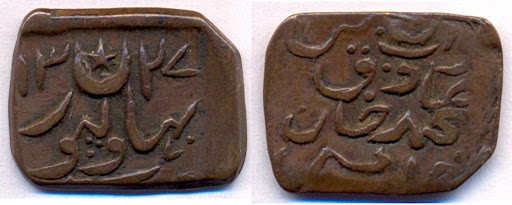
Figure 1.7 Historic coins of Bahawalpur State
Governmental Structure; Bahawalpur District
At the Federal level, Bahawalpur district is allocated a set number of representatives in both the National Assembly and the Provincial Assembly:
- Number of seats in the National Assembly 5
- Number of seats in the Provincial Assembly 10
Under the Local Government and Community Development, Bahawalpur district has one District Council, one Municipal Corporation and 5 Municipal Committees which are as follows:
- Ahmadpur Sharqia (East)
- Hasilpur
- Khairpur Tamewali
- Yazman
- Uch Sharif
Administrative Units; Bahawalpur district
Bahawalpur district covers an area of 24,831 km² and is subdivided into 5 Tehsils as follows:
| Bahawalpur | 36 Union Councils |
| Ahmadpur Sharqia | 31 Union Councils |
| Hasilpur | 14 Union Councils |
| Khairpur Tamewali | 08 Union Councils |
| Yazman Mandi | 18 Union Councils |
Table 1.2 Bahawalpur Administrative Units
Historic/ Heritage Buildings; Bahawalpur District
Following are some of the cultural/ heritage sites of the district:
- Cholistan Forts; Bahawlpur district: Archaeological finds around the Derawar Fort (the only place with a perennial waterhole) show that there were 400 forts in the area. The forts here were built at 29 km intervals, and probably served as guard posts for the camel caravan routes. There were 3 rows of these forts, with the first line of forts beginning from Phulra and ending in Lera; the second from Rukhanpur to Islamgarh; and the third from Bikaner to Kapoo. The forts are all in ruins. It is clear from these ruins that they were built with double walls of gypsum blocks and mud. Some of these forts date back to 1000 BC, and were destroyed and rebuilt many times over the centuries. Some of the notable forts are Derawar, Vingrot, Banwar, Marcot, Wilhar, Mauj Garh, Mao, Phuira, and Dingarh
- Derawar Fort and Mosque; Bahawlpur district: The Derawar Fort was built by the Raja (chief) of the Bhatti tribe in 757 AD. This fort is situated in the middle of the Cholistan Desert. In 1825, Nawab Muhammad Sadiq Khan built a mosque in front of this fort. It was built with white marble stone and is an exact replica of the Moti Masjid of the Red Fort of Delhi
- Noor Mahal: Bahawlpur district: Built in 1872, by Nawab Sadiq Muhammad Khan IV’s wife, the Noor Mahal is located in Cantt. and remains in the jurisdiction of the Pakistan Army
- Channan Pir; Bahawlpur district: This is a shrine of a Muslim saint. It is situated in the desert between Derawar and Dingarh Forts
- Uch Sharif; Bahawlpur district: 75 km from Bahawalpur, Uch Sharif is a very old town. It is believed that it was established in 500 BC.The surviving shrines, sanctuaries, cemeteries, and mausoleums, including the Bibi Jawandi tomb, incorporate glazed tile and brick revetments, lime plaster panels, terracotta embellishments, brick structural walls laid in earth mortars, and ingenious corner tower buttresses. The famous shrines at Uch include those of Hazrat Bahawal Haleem, Hazrat Jalaluddin Surkh Bukhari, Makhdoom Jahanian Jahangasht, Shaikh Saif-ud-din Ghazrooni, and Bibi Jawandi. The shrine of Bibi Jawandi is of a Central Asian design, tiled in blue and white faience[1]
- Sadiq Garh Palace; Bahawlpur district: Located in Ahmadpur Sharqia (East), this palace is in the use of the ex-royal family’s descendants. The palace is embellished with delicate and intricate paintings. It displays chandeliers and a collection of carpets from all over the world, armaments of European and Asian make, and a number of other items¾gifts that must have been bestowed on the ex-royal family of Bahawalpur over the centuries
- The palaces of the Amirs; Bahawlpur district: These are located mainly in Dera Nawab Saheb at a distance of 35 km (22 miles) from Bahawalpur. The palaces are the gateway to Cholistan
- Mau Mubarak Fort; Bahawlpur district: According to Tarikh-e-Murad,[2] a fort was built by Raj Hans Karar in Mau Mubarak as a residence for his mother, due to which the name Mau, which means mother in Seraiki, the local language, was added to the name of the fort. The fort was captured by Shah Arghun in 1525. It was one of 6 fortresses of Raj Sahasi II. It had 20 bastions and towers. The ramparts were about 549 m in circumference and the walls were strongly and thickly built. The shrine of Saint Sheikh Hakim, located within the fort, is of great importance
- Shrine Khwaja Noor Muhammad known as Qibla-e-Alam at Chishtian; Bahawlpur district
- Shrine of Saint Khwaja Ghulam Farid at Chachran; Bahawlpur district
- Shrine of Hazrat Mohkam Din known as “Sahib-us-Sair” (great traveler): This is located at Khanqah Sharif, 20 km south of Bahawalpur
- Central Library; Bahawlpur district: The foundation stone of this library was laid by the Governor General and Viceroy of India, Sir Rufus Daniel Isaacs, in 1924
- Bahawalpur Zoo, Bahawalpur City
- Museum, Bahawalpur City
- Islam Barrage Headworks
- Panjnad Barrage Headworks
- Cantonment Park
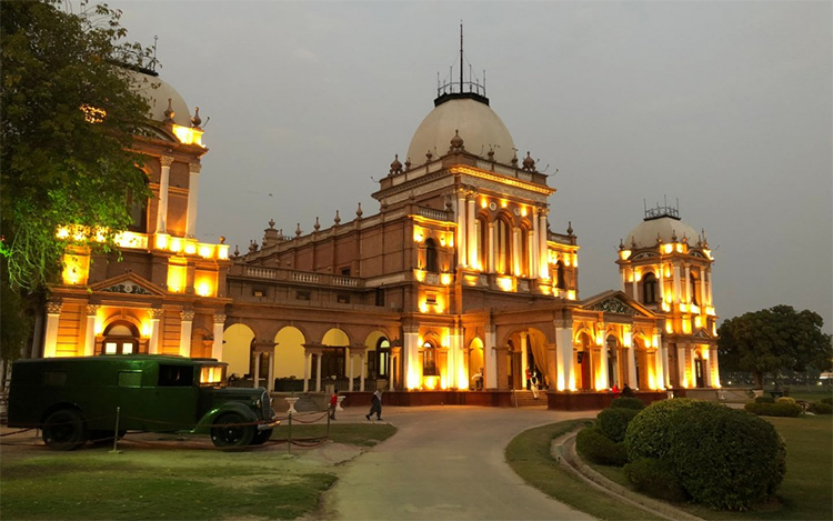
Figure 1.12 Noor Mahal, Bahawalpur
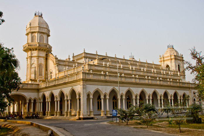
Figure 1.13 Central Library, Bahawalpur
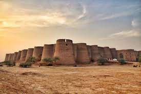
Figure 1.14 Derawar Fort, Bahawalpur
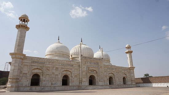
Figure 1.15 Derawar Mosque
[1] Glazed ceramic ware, in particular, decorated tin-glazed earthenware of the type which includes delftware and maiolica.
[2] Translated as “The History of/ by Murad,” the book was written in Urdu by Syed Murad Shah Gardezi in 1865
[1] Kabul Shahis or Shahis of Kabul ruled the Kabul Valley from the 3rd century to 9th century AD
[2] The Delhi Sultanate was a Muslim Sultanate based in Delhi. This term includes 5 dynasties: Mamluks (1206-90), Khiljis (1290-1320), Tughlaq (1320-1414), Sayyid (1414-51), and Lodhis (1451-1526).
[3] Bahawalpur State Gazetteer 1904
[4] Brahamanabad was a city founded by the Brahaman son of Isfandyar, a Persian King who held territories of Sindh after the Macedonians (Bahawalpur State Gazetteer 1904)
[5] Bahawalpur State Gazetteer 1904
[6] Bahawalpur State Gazetteer 1904
[7] A ceremonial robe or other gift given to someone by a superior as a mark of honour
[8] Bahawalpur State Gazetteer 1904
[9] Parganas were a revenue unit; these were abolished in 1793 in favour of the Zamindari system. The Parganas remained as a geographical term, which fell out of use completely after 1947.
Topography of Bahawalpur District
The Bahawalpur district is situated almost in the center of Pakistan, at an elevation of 152 m from sea level, and is a completely landlocked area. The Cholistan Desert, which reaches the Indian Border, is in its south and southeast.
Topographically, the district can be divided into 3 parts:
- The Riverine Area lies close to the River Sutlej, which flows in the north along the district’s border with the Lodhran and Vehari districts. Most of the lands in this area have been brought under cultivation. The area is regularly inundated when the river floods
- The area east of Bahawalpur is that of the Pat, or Bar, which is a tract of land at a significantly greater altitude than the adjoining valley
- The desert area, which is also known as Cholistan, lies towards the south and east of the irrigated track and north of the desert of Bikanir and Jaisalmir in India. It extends along the entire eastern boundary with the Bahawalnagar district in the north and Rahim Yar Khan district in the south. The surface of the desert consists of a succession of sand dunes rising, in some places, to a height of 150 m. It is covered with vegetation peculiar to sandy tracts
Rivers, Streams, and Lakes; Bahawalpur district
The only river of the district is the River Sutlej which flows in its north. The total length of the river from Head Islam to Head Panjnad is 176 km. Mincha nullah is one important stream of the district.
There are many small lakes in the Cholistan area of the district. These lakes are known as tobas in the local language, and they help store rain water.
Forests; Bahawalpur district
As per Punjab Development Statistics 2013-14, the total forested area in Bahawalpur district is 72,000 HA. The major forest types of the district are Irrigated Plantations and Tropical Thorn Forests. The vegetation of these forests consists of peelu or vann/ tooth brush tree (Salvadora oleoides), jand (Prosopis cineraria), frash (Tamarix aphylla), karir (Caparis decidua), and ber or jujube (Zizyphus mauritiana) as well as a large number of shrubs of all sizes, most common being thor or dhodak (euphorbia).
The following table shows the kind of forests and area of each kind according to Punjab Development Statistics 2018-19:
| Total Forest Area | 178,173 A | Protected Forests under Provincial Govt. | 151,594 A |
| Reserved Forests under Provincial Govt. | 23,600 A | Reserved Forests under District Govt. | – A |
| Linear Plantation | 3,175 km | Unclassed Forests | 2,979 A |
Table 1.3 Bahawalpur Forests
The Bahawalpur Plantation Reserved Forest, Shahiwala Plantation (unclassed forest), Januwala Reserved Forest, and the Chak Katora Reserved Forest are important forests/game reserves of the district.
The Lal Suhanra National Park and Cholistan Game Reserve are also situated in Bahawalpur district.
Soils; Bahawalpur district
The district mostly consists of alluvial soils of River Sutlej. The Cholistan, on the other hand, is a deep mass of sand and there is no soil even at the lowest depths, due to which cultivation is not possible in this tract. The stratum is about 12 m (40 ft) above the level of River Sutlej, and so the river has not been able to penetrate the sandy depths of this region.
Climate; Bahawalpur district
The climate of the district is hot and dry during the summer, and cold and dry in the winter. The summer season starts in April and continues till October. May, June, and July are the hotter months, with June being the hottest month. The mean maximum and minimum temperatures during this period are 42 °C and 28 °C respectively. Dust storms are common during the summer. Winter months are November to March, with January being the coldest month. The mean maximum and minimum temperatures during this period are 22 °C and 6 °C respectively.
July and August are Monsoon months, during which the district gets most of its rains. The mean annual precipitation in the district is 125 to 200 mm.
Seismic Activity/Seismicity; Bahawalpur district
The district belongs to Zone 2A of the Seismic Zone Map of Pakistan, which means that it is classified as a low hazard zone with minor to moderate damage due to earthquakes.
Population of Bahawalpur District
The following table shows the population of Bahawalpur district as per the 1998 Census with Projected Population:
| District/ Tehsil |
Area km2 |
Population | Male% | Female% | Urban% | Growth Rate % |
| Bahawalpur District | 24,830 | 3,668,106 | 51.2 | 48.8 | 31.9 | 2.18 |
| Ahmadpur East Tehsil | 1,707 | 1,078,683 | ||||
| Bahawalpur Tehsil | 2,372 | 681,696 | ||||
| Hasilpur Tehsil | 1,372 | 456,006 | ||||
| Khairpur Tamewali Tehsil | 888 | 262,628 | ||||
| Yazman Tehsil | 18,491 | 614,143 |
Table 1.4 Bahawalpur Population Statistics
Religions; Bahawalpur district[1]
| Muslims | 98.1% |
| Christians | 0.6% |
| Hindus | 0.9% |
| Ahmadis | 0.1% |
| Scheduled Castes | 0.03% |
| Others | 0.3% |
Table 1.5 Bahawalpur Religious distribution
Languages; Bahawalpur district[2]
| Urdu | 5.5% |
| Punjabi | 28.4% |
| Sindhi | 0.1% |
| Pushto | 0.6% |
| Balochi | 0.07% |
| Seraiki | 64.3% |
| Others | 1.1% |
Table 1.6 Bahawalpur Languages
[1] 1998 Census; 2017 Census data has not been public yet.
[2] 1998 Census; 2017 Census data has not been made public yet.
Economic Activity – Economic Infrastructure
Economic Activity; Bahawalpur District
The economy of the district is essentially agrarian, and agriculture is the main source of earning for 58.7% of the population. Bahawalpur district is a well-known cotton and wheat growing area; in fact, it produces 14% of all cotton and 4% of all wheat in Punjab. Other economic activities include manufacturing and elementary services.
The main employers of the district are:
- Agriculture with its Allied Livestock Breeding, Forestry & Fishing (44.7%)
- Elementary Occupations (34.8%)
- Service & Shop/ Market Sales Workers (9.2%)
- Crafts (3.5%)
- Others (7.8%)
Irrigation Network; Bahawalpur district
In 1920-21, the Sutlej Valley Project was launched to bring the Sutlej Valley under agriculture. Under this project, 4 headworks¾the Islam Headworks, Panjnad Headworks, Sulemanki Headworks, and the Ferozepur Headworks¾were built. Except for Ferozepur Headworks, the rest were located in then Bahawalpur State. Ferozepur Headworks were constructed in 1926 to control the waters of River Sutlej and Beas, and is located in India.
The main sources of irrigation are the Bahawal, Panjnad, Abbasia, Eastern Siddiqia and Upper Qaim Canals from the Panjnad Headworks, and other narrow water channels. The total number of water channels in the district is 549. The length of all canals (main, branches and link) is 1,167 km (725 miles).[6] The following table shows the irrigation statistics as per Punjab Development Statistics 2018-19:
| Total Irrigated Area | 685,000 HA | Un-irrigated Area | 4,000 HA |
| Canal Irrigated | 288,000 HA | Wells Irrigated | 16,000 HA |
| Tube Well Irrigated Area | 55,000 HA | Canal Wells | 2,000 HA |
| Canal Tube Wells Irrigated Area | 322,000 HA | Others | 2,000 HA |
Table 1.11 Bahawalpur Irrigation Statistics
Land Use; Bahawlpur district
The following table shows the major land use statistics of the district as per Punjab Development Statistics 2018-19:
| Reported Area | 608,000 HA | Cultivated Area | 457,000 HA |
| Net Sown | 347,000 HA | Current Fallows | 110,000 HA |
| Un-cultivated Area | 151,000 HA | Culturable Waste | 70,000 HA |
| Forest Area | 3,000 HA |
Table 1.7 Bahawalpur Land Use Statistics
Agriculture; Bahawalpur district
Agriculture being the dominant sector of the economy, almost 58.7% of the total population is engaged in the activity. Agriculture is dependent on irrigation, and most of the irrigation is through canals and tube wells.Cotton, sugarcane, wheat, sunflower, rape/mustard seed and rice as well as gram, tobacco, jowar, bajra, moong, mash, masoor, and maize are the main crops grown in the district.
Major fruits of the district include mangoes, citrus, dates, and guavas. Pomegranate, jaamun, and phalsa are minor fruits. Main vegetables are onion, tomato, cauliflower, potatoes, and carrot. Bottle gourd, ladyfinger, turnip, matar (green peas), garlic, and chillies are grown in smaller quantities.
Bahawalpur district[1] is the second highest producer of cotton and the fifth largest producer of wheat in Punjab.
Livestock Breeding; Bahawalpur district
The following table shows the total number of small ruminants of the district, as per Livestock Census 2010, reprinted in Punjab Development Statistics 2018-19:
| Cattle | 516,000 Heads | Buffaloes | 393,000 Heads | Sheep | 123,000 Heads |
| Goats | 801,000 Heads | Camels | 883 Heads | Horses | 1,682 Heads |
| Mules | 1,332 Heads | Asses | 27,036 Heads |
Table 1.8 Bahawalpur Livestock Statistics
Nili Ravi cattle, Cohistani/Cholistani cattle, khaddali and sipli sheep, nachi breed of goats, and mehra breed of camels are local breeds.
Poultry Farms; Bahawalpur district
According to Table 17 (Number of Commercial Poultry Farms and Number of Birds by Size of Flock), there are 462 commercial poultry farms in the district. As per Punjab Development Statistics 2018-19; there are 227 boiler and 32 layer poultry farms (privately owned) in the District.
Fishing; Bahawalpur district
Sutlej River, Chenab River, and canals like Abbasia canal, Bahawal canal, Qaim canal and Panjnad Canal supply angling activity which provides livelihood to a great number of people. Most of the fish is consumed locally; some of the fish is exported to other parts of Pakistan.
Bee Keeping/Apiculture; Bahawalpur district
In Pakistan, honey bee colonies were introduced in the 1980s; since then, there are more than 300,000 honey bee colonies in Pakistan. In Bahawalpur, beekeeping is taken up on a commercial basis.
Minerals and Mining; Bahawalpur district
There is no mineral mining activity in the district. In 2005, the government awarded 2 blocks for oil and gas exploration in Bahawalpur to OGDCL.
Industry and Manufacture; Bahawalpur district
The Punjab Small Industries Corporation has established an Industrial Estate[2] at Bahawalpur. 203 plots, varying in sizes, are available within the estate. In all, there are 252 industrial units and 145 brick kilns in the district. The following table[3] shows the type of industry and number of units of each in the district:
| Type of Industry | No. of Units | Type of Industry | No. of Units |
| Cotton Ginning & Pressing | 154 | Flour Mills/ Wheat Milling | 39 |
| Oil Mills/ Vegetable Ghee | 07 | Paper & Paper Board | 01 |
| Poultry Feed | 03 | Sugar Mills | 01 |
| Textile Spinning | 07 | Textile Weaving | 03 |
| Transport Equipment (Motorcycle/ Rickshaw) | 01 | Agricultural Implements | 01 |
| Cold Storage | 16 | Iron & Steel Re-Rolling | 01 |
| Rice Mills | 06 | Oil Extraction | 05 |
| Vegetable Ghee/ Oil | 05 |
Table 1.9 Bahawalpur Industrial Units
Trade (Import/Export); Bahawalpur district
Trading activities include trade in commodities, livestock, dairy, and fruits, as well as wholesale, retail, and transport. The district hosts a grain wholesale market, a vegetable wholesale market and a few specialized wholesale markets catering to both the local and other regional retail trade markets of Pakistan; these include silver jewellery, traditional textiles and clothing, among others.
Handicrafts; Bahawalpur district
Bahawalpur is known for its handicrafts, which include silver jewellery, hand-embroidered clothes and bed linens, as well as handloom fabric in both cotton and silk, delicate and decorated earthenware, and carpets. The Punjab Small Industries Corporation (PSIC) has established a Craft Development Center for Cholistan area outside Farid Gate, Bahawalpur, where handicrafts manufactured in Cholistan can be purchased. Some of the souvenirs available include flassi, which is a fabric piece of 4 ft to 7 ft, made with camel hair and cotton yarn, used as a wall hanging, decoration piece, or a rug. Other handicrafts include gindi or rilli, which is made of small pieces of many colors of cotton cloth. It can be used as wall hangings, bed covers, carpets, or blankets. Changaries are like big plaques, and are made of palm leaves in different bright colors in beautiful patterns. These are used for keeping the chapattis (flat bread or roti) warm, and also as wall decoration. Khalti is like a purse embroidered with multi colored threads. Ariwork is an attractive type of embroidery done on dupatta, kurta, and chaddar (items of clothing that are a part of traditional dress).
The district is also renowned for articles made with camel skin. Usually, the skin of the camel is stretched over clay moulds for drying. After it has dried, the clay moulds are broken and thrown away. The skin is cleaned and dried again. It is then painted in colors prepared by craftsmen themselves. The mixing of these colors is a professional secret handed down from father to son.
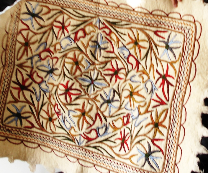
Figure 1.8 Flassi work
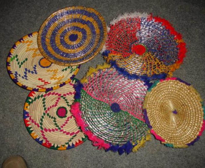
Figure 1.9 Hand Made Changaries
Economic Infrastructure; Bahawalpur District
The district is linked by road and rail to other parts of Punjab and Pakistan.
Road Statistics; Bahawalpur district
Total length of roads in the district as per Punjab Development Statistics 2018-19 is 3,226.0 km.
The following table shows the type of road and its length in the district as per Punjab Development Statistics 2018-19:
| National Highways | 83.0 km |
| Motorways | – km |
| Provincial Highways | 3053.0 km |
| Sugar Cess Roads | 90 km |
Table 1.10 Bahawalpur Road Statistics
Some of the important road links of the district include the National Highways N 5 and N 70, both of which pass through the district.
All the tehsils are connected through black topped roads with Bahawalpur City and the rest of Punjab and Pakistan. All the important places of the district and Cholistan Desert are also connected through roads. Some of the important roads of the district are:
- Bahawalpur-Hasilpur Road
- Bahawalpur-Yazman Road
- Bahawalpur-Ahmadpur Sharqia (East) Road
- Bahawalpur-Lodhran Road
- Bahawalpur-Khairpur Tamewali Road
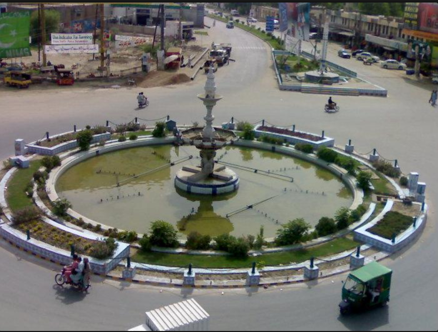
Figure 1.16 Fawwara Chowk or Bahawalpur Roundabout, Bahawalpur City
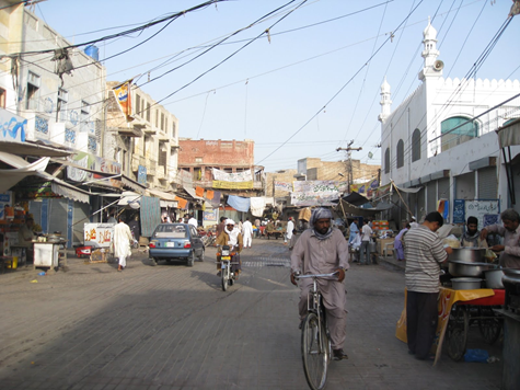
Figure 1.17 A view of Bahawalpur City
Rail and Airways; Bahawalpur district
The main Peshawar-Karachi railway line passes through Bahawalpur district. The district is linked with Rahim Yar Khan and Lodhran through the railway network. There are railway stations at Bahawalpur, Hasilpur, and Ahmadpur Sharqia (East), among others.
There is an airport near Bahawalpur City; originally it was just a domestic airport, but in 2009, PIA started international flights to the Middle Eastern countries from this airport.
Radio and Television; Bahawalpur district
The Pakistan Broadcasting house has a radio broadcasting station in Bahawalpur. There is no television station in the district, but TV can be viewed through cable.
Telecommunications; Bahawalpur district
Pakistan Telecommunications Ltd. has established a network of telephone lines. In addition, a number of cellular companies also provide their services in the district. In all, there are 41 telephone exchanges operating in the district, ranging in capacity from 250 lines to 10,000 lines.[1]
Post Offices/ Courier Services; Bahawalpur district
There are nearly 35 offices of Pakistan Post[2] in the district, with 18 branches in Bahawalpur, 7 in Ahmadpur Sharqia (East), 4 in Hasilpur, 4 in Yazman, and 2 in Khairpur Tamewali.
Banking/ Financial Institutions; Bahawalpur district
There are a total of 103 branches[3] of various banks in the district, with 47 in Bahawalpur, 20 in Ahmadpur Sharqia (East), 12 in Hasilpur, 17 in Yazman, and 7 in Khairpur Tamewali.
Banks[4] operating in the district include:
- Al Baraka Bank Ltd.
- Allied Bank Ltd.
- Askari Bank Ltd.
- Bank Al Falah Ltd.
- Bank Al Habib Ltd.
- Bank Islami Pakistan Ltd.
- Dubai Islamic Bank Pakistan Ltd.
- Faisal Bank Ltd.
- First Women Bank Ltd.
- Habib Bank Ltd.
- Habib Metropolitan Bank Ltd.
- JS Bank Ltd.
- KASB Bank Ltd.
- Muslim Commercial Bank Ltd.
- Meezan Bank Ltd.
- National Bank of Pakistan Ltd.
- National Investment Bank Ltd.
- Silk Bank Ltd.
- Soneri Bank Ltd.
- The Bank of Khyber Ltd.
- The Bank of Punjab Ltd.
- Punjab Provincial Cooperative Bank Ltd.
- United Bank Ltd.
- Zarai Tariqiati Bank Ltd.
In all there are 158 branches of various conventional banks and 25 branches of various Islamic banks in the District.
Electricity and Gas; Bahawalpur district
There are 10 electric grid stations[5] in the district (ranging in capacity from 66 KV to 220 KV). Natural gas is available in Ahmadpur Sharqia (East), Uch Shareef, Khanqah Sharif, and Bahawalpur City.
Healthcare Facilities; Bahawalpur district
The District Health Officer (DHO) is overall incharge of health services provided in the district. The DHO is supported by doctors, paramedics, technicians, and other support staff. The following table shows the number of health care institutions in the district as per Punjab Development Statistics 2018-19:
| Institution | No./Beds | Institution | No./Beds |
| Government Hospitals | 14/2,432 | Dispensaries | 75/04 |
| Rural Health Centers | 12/222 | Basic Health Units | 82/146 |
| T B Clinics | 02/- | Mother Child Health Centers | 10/- |
| Private Hospitals[7] | 01/40 | Private Clinics[8] | 167/- |
| SubHealth Centers | -/- | ||
Table 1.12 Bahawalpur Health Institutions
Educational Institutions; Bahawalpur district
The following table shows the details of educational facilities of the district as per Punjab Development Statistics 2018-19:
| Institution | Boys/Girls | Institution | Boys/Girls |
| Primary Schools | 800/653 | Middle Schools | 104/146 |
| Secondary Schools | 104/98 | Higher Secondary | 22/26 |
| Degree Colleges | 31/27 | Other Higher Secondary[9] | 05/04 |
| Other Degree Colleges[10] | 15/18 | Technical Training Institutes[11] | 08/02 |
| Vocational Institutes[12] | -/05 | Commercial Training Institutes[13] | 04/- |
| Universities[14] | 01 | Govt. Mosque Schools | 20/- |
| Medical Schools[15] | 01 | Engineering Schools[16] | 02 |
Table 1.13 Bahawalpur Educational Institutions
There are 55 colleges (both private and public) affiliated with Islamia University which award degrees to their students.
Policing; Bahawalpur district
The Deputy Inspector General Police looks after Bahawalpur region which comprises of Bahawalpur, Rahim Yar Khan, and Bahawalnagar districts. Bahawalpur district is further subdivided[17] into 6 subdivisions and 24 police stations. The police force in each region is headed by a District Police Officer who is assisted by a varying number of Superintendents and Deputy Superintendents of Police.
[1] Directorate of Industries Punjab- Investment Study Bahawalpur district 2012; Latest available.
[2] Directorate of Industries Punjab- Investment Study Bahawalpur district 2012; Latest available.
[3] Directorate of Industries Punjab- Investment Study Bahawalpur district 2012; Latest available.
[4] List of Reporting Bank Branches 2019; State Bank of Pakistan
[5] Directorate of Industries Punjab- Investment Study Bahawalpur district 2012; Latest available.
[6] Official Website Bahawalpur Irrigation Zone.
[7] Three Years Rolling Plan Bahawalpur District 2010-13; Latest available.
[8] Three Years Rolling Plan Bahawalpur District 2010-13; Latest available.
[9] Includes Private, Federal and Schools owned by PAF and other Organizations
[10] Includes Private, Federal and Schools owned by PAF and other Organizations
[11] Pre-Investment study, Bahawalpur District 2012, Directorate of Industries Punjab; Latest available.
[12] Pre-Investment study, Bahawalpur District 2012, Directorate of Industries Punjab; Latest available.
[13] Pre-Investment study, Bahawalpur District 2012, Directorate of Industries Punjab; Latest available.
[14] Islamia University Bahawalpur, Quaid-e-Azam Medical College, Swedish College of E&T, University College of E&T
[15] Islamia University Bahawalpur, Quaid-e-Azam Medical College, Swedish College of E&T, University College of E&T
[16] Islamia University Bahawalpur, Quaid-e-Azam Medical College, Swedish College of E&T, University College of E&T
[17] Punjab Development Statistics 2013-14
[1] Profile of District Bahawalpur by South Asian Partnership, Pakistan
[2] Directorate of Industries Punjab, Investment Study Bahawalpur, 2012; Latest available.
[3] Directorate of Industries Punjab, Investment Study Bahawalpur, 2012; Latest available.
Environment and Biodiversity; Bahawalpur District
The physical environment of the district consists of agricultural lands, forests, and parts of the Cholistan Desert. Wide variations in physical features and climate have produced diverse landscapes, ecosystems, and habitats that are important to natural and global heritage in the district.
Pakistan’s first national park, the Lal Sohanra Park, is situated in Bahawalpur district. The park consists of irrigated forest plantations (20,974 acres), desert branch pond (4,780 acres) and Cholistan Desert (51,726 acres) for a total of 77,480 acres. The park was established to protect existing wildlife and vegetation, reintroduce extirpated species, rehabilitate a wildlife habitat, create educational/ research facilities for local and foreign tourists, and provide recreational facilities for the local population.
The district is located in an arid climate area with low rainfall and high temperatures. In general, the ambient air quality of the district is good. The primary sources of environmental pollution are vehicular emissions and suspended dust particles. The ground water is fresh and potable.
Flora and Fauna; Bahawalpur district
Flora; Bahawalpur district
The main flora of the district include jand (Prosopis spicigera), karir (Capparis aphylla), farash (Tamarix articulata), pilchi (Tamarix gallica), phog (Caligonum polygonoides), lana (Haloxylon salincornicum), lani (Salsola foetida), khar (Suaeda fruticosa), jawan or camel thorn (Alhagi camelorum), aak or milkweed (calotropis procera), lumb (Aristida depressa), dhaman (Cenchrus ciliaris), chhimber (Eleusine flagellifera), kapok bush or bui (Aerva javanica), baluka saag (Gisekia pharnaceoides Linn.), choti ulwaiti (Trianthema triquetra Rottler. ex.), itsit (Zaleya pentandra Linn.), tandla or tandula (Digera muricata), ssetu or peepun (Caralluma edulis), piazi (Asphodelus tenuifolius), bathu (Chenopodium album),and wild sugarcane or sarcanda (Saccharum munja).
Fauna; Bahawalpur district
Mammals of the district include deer, hog deer, black buck, blue bull, fox, jackal, hare, wild cat, mole, squirrel, weasel or chachundar, wild rats, porcupines, and wild boars.
Avifauna includes larks, owls, bashin, tamtari, pigeons, crows, parrots, sand grouse, quails, and hawks.
A variety of lizards like kirla, gohiri and sanaha (poisonous varieties), sanda, chameleon, common wall lizard, and goh are common. The varieties of snakes include kala mushki, sangchoor, dhobi, lundi, kharpa, and jalebi. The lundi, kharpa and kala mushki are extremely poisonous, and their bite is usually fatal. Sah pina snake is found in the Cholistan area. Other reptiles include frogs and alligators.
Protected Wildlife Areas; Bahawalpur District
There are a total of 17,536 HA of Reserved Forests protected by the provincial government, and 2,109 HA of Protected forests.
Besides natural vegetation and irrigated lands, the district houses the first national park of Pakistan, the Lal Suhanra Park, which was declared a national park on 26 October 1972. This park has been created to preserve wildlife and natural and irrigated plantations. It is crossed by the dried-up bed of the Hakra River, and has a wetland of international importance called the Patisar Lake which regularly holds between 10,000 and 30,000 ducks as well as the common coot in mid-winter. This lake supports extensive reed beds and an abundant growth of submerged and floating aquatic vegetation like wild sugarcane or fodder cane (Saccharum spontaneum) which grows in dense stands along the margin of the lake, and Salvinia natans, a water weed, which covers much of the shallow water areas near the lake’s edge. Other aquatic plants/ weeds include Chara sp., Eichhornia crassipes, Hydrilla verticillata, Nelumbium speciosum, Nymphaea lotus, Phragmites karka, Potamogeton crispus, P. pectinatus, P. perfoliatus, Ranunculus aquatillis, Typha angustata, Vallisneria spiralis, and Zannichellia palustris. The natural plant communities around the lake include tropical thorn forest, Suaeda-Salsola scrub and riverine Tamarix (trees and large shrubs) forests. The dominant species include babul (Acacia nilotica), jand (Prosopis cineraria), mesquite (Prosopis juliflora), peelu (Salvadora oleoides), lebbek (Albizzia lebbek), ber (Zizyphus nummularia), jujube (Zizyphus mauritiana), cedar (Tamarix aphylla), and jhao (T. dioica).
Patisar Lake is a very important wintering area for waterfowl, particularly Anatidae, and a staging area for large numbers of birds, particularly in autumn. The wetland formerly supported a small population of marbled teal but the birds have not been sighted for many years. The wetland still hosts a large population of birds of prey including the houbara bustard, griffon vulture, honey buzzard, marsh harrier, hen harrier, laggar falcon, peregrine falcon, kestrel, Indian sparrow hawk, Egyptian vulture, larks, shrikes, wheatears, and barn owls. The total number of bird species currently in the park is 160.
Mammals common in the park include chinkara, nilgai, wild boar, caracal, wolf, striped hyena, common fox, and jackal. The area around the lake once supported a population of blackbuck but this population has been nearly exterminated, and the species is now being bred in captivity and reintroduced into the park.
Fish known to occur in the lake include Ambassis nama, A. ranga, Bagarius bagarius, Catla catla, Channa marulius, C. punctatus, C. striatus, Cirrhinus mrigala, C. reba, Heteropneustes fossilis, Labeo calbasu, L. microphthalmus, L. rohita, Mastacembelus armatus, Mystus aor, Nandus nandus, Notopterus chitale, N. notopterus, Puntius sarana, P. sophore, P. ticto, Rita rita, and Wallago attu. Other aquatic fauna include Rana tigrina and Kachuga smithi.
The Cholistan Desert Wildlife Sanctuary provides sanctuary to the desert wolf (rare), Indian fox, red fox, jackal, small Indian civet, small Indian mongoose, Indian grey mongoose, Indian desert cat, jungle cat, caracal cat, chinkara gazelle, blackbuck, nilgai antelope, Houbara bustard, peregrine falcon, saker falcon, black backed vulture, Indian cobra, monitor lizard, saw-scaled viper, and Russells viper.
Bahawalpur Plantation and Chak Kotora Reserve forests are protected Game Reserves of the district.
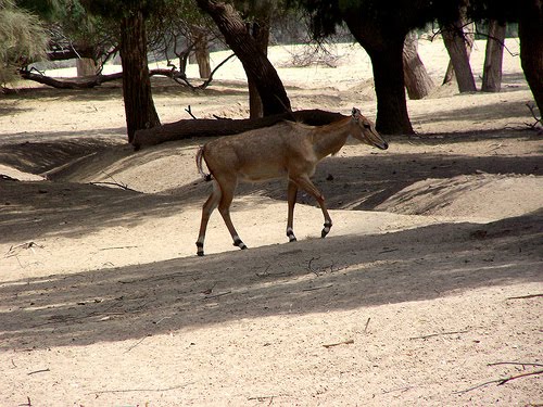
Figure 1.10 Bahawalpur Nilgai, Lal Suhanra National Park
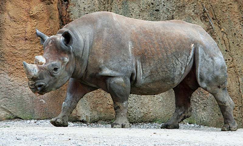
Figure 1.11 A Rhinocerous at Lal Suhanra National Park, Bahawalpur