Share now
Map of Punjab

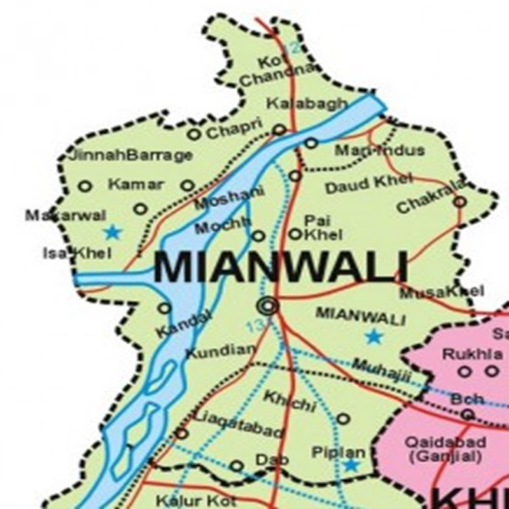
Map of Mianwali District
Punjab Districts
- Islamabad Capital Territory Profile
- Lahore District Profile
- Attock District Profile
- Bahawalnagar District Profile
- Bahawalpur District Profile
- Bhakkar District Profile
- Chakwal District Profile
- Chiniot District Profile
- Dera Ghazi Khan District Profile
- Faisalabad District Profile
- Gujranwala District Profile
- Gujrat District Profile
- Hafizabad District Profile
- Jhang District Profile
- Jhelum District Profile
- Kasur District Profile
- Khanewal District Profile
- Khushab District Profile
- Layyah District Profile
- Lodhran District Profile
- Mandi Bahauddin District Profile
- Mianwali District Profile
- Multan District Profile
- Muzaffargarh District Profile
- Narowal District Profile
- Nankana Sahib District Profile
- Okara District Profile
- Pakpattan District Profile
- Rahimyar Khan District Profile
- Rajanpur District Profile
- Rawalpindi District Profile
- Sahiwal District Profile
- Sargodha District Profile
- SheikhupuraDistrict Profile
- Sialkot District Profile
- Toba Tek Singh District Profile
- Vehari District Profile
Also visit: Sindh, Balochistan, Khyber Pakhtunkhwa
Mianwali District Profile
Introduction/Geographical Location; Mianwali District
Mianwali district is located between 32° 10Ꞌ to 33° 15Ꞌ north latitudes, and 71° 0Ꞌ to 71° 57Ꞌ east longitudes. It borders 8 districts: Kohat district of Khyber Pakhtunkhwa (KP) and Attock district of Punjab in the north, Chakwal district and Khushab district in the east, Bhakkar district in the south, and Lakki Marwat, Karak and Dera Ismail Khan districts (KP) in the west.
Mianwali District at a Glance
| Name of District | Mianwali District | ||
| District Headquarter | Mianwali City | ||
| Population[1] | 1,546,094 persons | ||
| Area[2] | 5,840 km2 | ||
| Population Density[3] | 256.4 persons/ km2 | ||
| Population Growth Rate[4] | 2.0% | ||
| Male Population[5] | 50.1% | ||
| Female Population[6] | 49.9% | ||
| Urban Population[7] | 21.2% | ||
| Tehsils/Towns |
03 Tehsils: 1. Mianwali Tehsil 2. Piplan Tehsil 3. Isakhel Tehsil |
||
| Main Towns | Mianwali, Kundian, Piplan, Kalabagh, Isakhel, Kamar Mushani, Tabbi Sarr, Iskandarabad, Daudkhel, Mochh, Wan Bachran, Alluwali, Shakardara, Thamewali, Beruli, Paikhel, Hernoli, Uttrakalan, Musa Khel, and Chickrala | ||
| Literacy Rate[8] | 58% | ||
| Male Literacy Rate[9] | 78% | ||
| Female Literacy Rate[10] | 41% | ||
| Major Economic Activity[11] | Agriculture with its Allied Livestock Breeding & Fishing etc. | 35.1% | |
| Manufacture | 2.5% | ||
| Construction | 30.6% | ||
| Wholesale/Retail & Hotel/ Restaurant | 6.1% | ||
| Transport, Storage & Communication | 7.3% | ||
| Community, Social & Personal Services | 13.7% | ||
| Activities not adequately defined | 2.9% | ||
| Others | 1.8% | ||
| Main Crops | Wheat, sugarcane, gram, guar seed, groundnut, rice, cotton, moong, maash, masoor, bajra, barley, jowar, maize, rapeseed & mustard, canola, sesanum, sunflower, linseed, sunn hemp, and castor seed | ||
| Major Fruits | Guavas, citrus, mangoes, bananas, pomegranate, dates, figs, loquat, mulberry, ber, musk melon, watermelon, and phalsa | ||
| Major Vegetables | Chilies, onion, potatoes, tomatoes, sugarbeet, coriander, garlic, peas, turnip, bottle gourd, bitter gourd, carrot, cauliflower, spinach, radish, sweet potatoes, brinjals, pumpkins, okra, and tinda | ||
| Forests (area)[12] | 16,000 HA[13] | ||
| Total Black Topped Road[14] | 2,047.9 km | ||
| National Highways[15] | – km | ||
| Motorways[16] | – km | ||
| Provincial Roads[17] | 2,047.9 km | ||
| Sugar Cess Roads[18] | – | ||
| No. of Grid Stations[19] | 12 grid stations, ranging in capacity from 66 KV to 220 KV | ||
| No. of Tel. Exchanges[20] | 31 telephone exchanges, ranging in capacity from 206 lines to 5,850 lines | ||
| Industrial Estates[21] | There is no industrial estate, but there are 35 large, medium, and small enterprises in the district. | ||
| Major Industry[22] | Flour Mills | 8 Units | |
| Unani Medicines | 1 Units | ||
| Cotton Ginning & Pressing | 11 Units | ||
| Cement | 1 Unit | ||
| Fertilizers | 1 Unit | ||
| Iron & Steel Re-Rolling | 1 Unit | ||
| Power Generation | 3 Units | ||
| Soaps & Detergents | 9 Units | ||
| Household Size[23] | 7.1 persons per house | ||
| Houses with Piped Water Inside[24] | 23.2% | ||
| Houses with Electricity[25] | 65.4% | ||
Table 1.1 Mianwali District at a Glance
[1] 2017 Census
[2] 1998 Census
[3] 2017 Census
[4] 2017 Census
[5] 2017 Census
[6] 2017 Census
[7] 2017 Census
[8] Pakistan Social & Living Measurement Survey 2014-15 (PSLM); Latest available.
[9] PSLM
[10] PSLM
[11] 1998 Census; 2017 Census data has not been made public yet.
[12] Punjab Development Statistics 2018-19
[13] Land Utilization Statistics reports 10,000 HA under forests.
[14] Punjab Development Statistics 2018-19
[15] Punjab Development Statistics 2018-19
[16] Punjab Development Statistics 2018-19
[17] Punjab Development Statistics 2018-19
[18] Punjab Development Statistics 2018-19
[19] Directorate of Industries, Punjab. Pre-Investment Study Mianwali District 2012; Latest available.
[20] Directorate of Industries, Punjab. Pre-Investment Study Mianwali District 2012; Latest available.
[21] Directorate of Industries, Punjab. Pre-Investment Study Mianwali District 2012; Latest available.
[22] Directorate of Industries, Punjab. Pre-Investment Study Mianwali District 2012; Latest available.
[23] 1998 Census; 2017 Census data has not been made public yet.
[24] 1998 Census; 2017 Census data has not been made public yet.
[25] 1998 Census; 2017 Census data has not been made public yet.
Brief History – Governmental Structure – Administrative Divisions – Heritage Sites/ Buildings and Tourist Attractions
Brief History of Mianwali District
Nothing is known of the early history of Mianwali district beyond the fact that it was inhabited by Hindus and that it formed an integral part of the Greco-Bactrian Empire of Kabul and Punjab. The Imperial Gazetteer of India, in fact, clearly asserts that “There are no remains of earlier stage/ history in the Thal and there is every reason to suppose that this area was previously an uninhabited desert” (v.17, p. 318). Since the district was a part of the Indus Valley Civilization, it was also a part of the kingdoms of all major rulers and invaders, which means that after the invasions by Alexander the Great in 327 BC, the area has been ruled by the Maurya Empire (322-185 BC), Indo-Greek Kingdom (155-130 BC), Indo Scythian (or the Sakas, from the middle of the 2nd century BC to 1st century BC), Indo Parthian Kingdom (20 AD to 250 AD), Kushan Dynasty (60-375 AD), White Huns (455 AD-533 AD), Kabul Shahis (500 AD-1020/ 1026 AD), and the Delhi Sultanate.[1]
The upper portions of the Mianwali district (including Isakhel tehsil and upto Mianwali tehsil) were ruled by the Gakkar tribe. The Gakkars were a fiercely independent tribe; they are now mostly concentrated in Rawalpindi, Islamabad, Jhelum (Punjab), Kashmir, Gilgit, Baltistan (Northern Areas, now Gilgit-Baltistan), Chitral, Khanpur (North-West Frontier Province or NWFP, now Khyber Pakhtunkwa or KP) and Mirpur regions in modern day Pakistan. They formed a feudatory rule over the areas they controlled.
The Gakkars were Sassanian Persian nobles using the suffix Kai or Kayani[2] with their names; their chief, Gakhar Shah (son of Kai Gohar II), joined forces with Mahmud of Ghazni in 1008[3] AD and afterwards was rewarded with the kingdom of Potohar, which has, since then, been considered the traditional territory of the clan. They remained an independent tribe and supported Mughal Emperor Babar against the invasion of the Lodhis, and thereby earned the Mughal decree to rule the upper half of Mianwali district (specially the Isakhel tehsil), which remained under Gakkar rule until the invasion of the region by Nadir Shah in 1738. In exchange for staying away from the Gakkar territories, Nadir Shah levied a heavy tribute on them. In 1739, the Mughal forces conceded the areas west of River Indus to Nadir Shah, and these areas passed on to his son, Ahmad Shah Abdali, after his death. In 1748 Abdali’s army crossed the Indus at Kalabagh (Mianwali district) and drove out the Gakkars, destroying their capital and stronghold in Muazam Nagar. The armies of Ahmad Shah Abdali marched repeatedly through the district, the cis-Indus[4] portion of which, along with the rest of Punjab, was incorporated into the Durrani Empire[5] in 1756. Towards the end of the century, the area was ruled by Nawab Muhammad Khan Sadozai, who established his headquarters at Mankera and Bhakkar. On his death in 1815 he was succeeded by his son-in-law, Hafiz Ahmad Khan, who extended his rule to Isakhel, part of the cis-Indus tract of Mianwali and Marwat (also called Lakki Marwat, now a district of KP).
During this period, the Sikhs were gaining strength in the region, and had begun taking control of Punjab under the leadership of Maharaja Ranjit Singh. Ranjit Singh started making demands of the Nawab of Mankera,[6] Nawab Sarbuland Khan, and, on being refused, attacked and conquered first Dera Ismail Khan, then Bhakkar, Leiah (Layyah), Khangarh, and Maujgarh. Mankera was also conquered by the Sikhs, which ultimately lead to Ranjit Singh’s control of the Indus (he crossed the Indus with a large force and marched through Isakhel and Marwat to push on to the outskirts of Bannu in 1823), allowing him to extend his frontiers to the Suleiman Range. By 1837, the entire cis-Indus country, as far as Mianwali, was handed over to Sawan Mal, the Sikh Governor of Multan. He continued to rule the area until the Second Anglo Sikh war in 1849 which lead to the annexation of the area by the British.
When the British annexed Punjab, the areas now belonging to Mianwali district were part of Bannu district. In 1862 the Mianwali and Isakhel tehsils were formed into a subdivision, with Mianwali as its headquarters. In 1901, the NWFP, now Khyber Pakhtunkwa) was formed out of Punjab and Bannu was made a part of NWFP, but Mianwali and Isakhel tehsils remained part of Punjab and were made into a separate district with Mianwali, Isakhel, Bhakkar tehsil and Leiah (Layyah) as its tehsils. In 1909 Layyah tehsil was separated and transferred to Muzaffargarh district but Bhakkar tehsil remained a part of Mianwali district till 1982 when it was upgraded to a district level.
District Mianwali derives its name from the name of a local saint, Syed Mian Ali, who migrated from Baghdad, Iraq, in the 16th century AD. He was a spiritual leader and laid the foundations of Mianwali. Initially, the region was called “Mian Ali Wali”, which later converted to Mianwali. After him, his son, Hazrat Syed Sultan Muhammad Zikria, became the holy leader and saint of the area. He is known as Sahib-e-Karamat Wallay. His descendants are still respected and have political influence in the area.
During the Pakistan Movement, the predominantly Muslim population supported Pakistan and thus it became part of Pakistan in 1947.
Governmental Structure; Mianwali District
At the Federal level, Mianwali district is allocated a set number of representatives in both the National Assembly and the Provincial Assembly:
- Number of seats in the National Assembly 2
- Number of seats in the Provincial Assembly 4
Under the Local Government and Community Development Mianwali district has 1 District Council, and 7 Municipal Committees as follows:
- Mianwali
- Isakhel
- Piplan
- Kundian
- Daud Khel
- Kamar Mushani
- Kalabagh
Administrative Divisions; Mianwali district
Mianwali district covers an area of 5,840 km2 and is subdivided into 3 tehsils as follows:
| Mianwali Tehsil | 28 Union Councils |
| Isakhel Tehsil | 14 Union Councils |
| Piplan Tehsil | 14 Union Councils |
Table 1.2 Mianwali Administrative Divisions
[1] Delhi Sultanate was a Muslim kingdom based in Delhi. This Sultanate consisted of 5 dynasties: Mamluks (1206-90), Khiljis (1290-1320), Tughlaq (1320-141414), Sayyid (1414-51), and Lodhis (1451-1526)
[2] Kai or Kayani is a royal Persian title used by the Sassanian aristocracy.
[3] There are two versions: one by Farishta, who argues that the Gakkars were from Kanauj (UP, India) and attacked Ghaznavid forces, causing heavy losses to his army; the historical account “Kaigoharnama” written by Rāyzāda Dunīchand Bālī in 1725, claims that the Gakkars were Sassanian nobles who joined the Ghaznavid forces.
[4] Cis-Indus means “on the near side” or “on this side”
[5] Durrani Empire (1747-1826), also called the Afghan Empire, was founded by Ahmad Shah Durrani and, at its peak, included Afghanistan, Pakistan, Northeast Iran, and Western India.
[6] Mankera, now in Bhakkar district, was part of Mianwali during British rule.
Heritage Sites/Buildings/Tourist Attractions; Mianwali district
The following buildings are protected heritage buildings of Mianwali district:
- Sher Shah’s Baoli, in Wan Bachran; Mianwali district: This is a well (baoli) built by Sher Shah Suri in the 16th century. This Baoli was not just a source of fresh water for people. It was built in a way to enable animals as huge as elephants to go down to drink water directly from the well. People started settling in the area due to the availability of fresh water and the first tribe which settled there was the Bachar tribe, which contributed to the name of Wan Bhachran, which means The Well of Bhachars. The Baoli is still present, though water wells are no more in use, and the condition of the well is deteriorating
- A Buddhist Stupa with its surrounding area; Mianwali district: This is located on the banks of the River Indus to the north of Village Rokhri. This village had a Buddhist stupa which was destroyed in the floods of 1928, but later excavations by Punjab Archaeology Department unearthed relics from the Buddhist stupa, which included Buddha’s statues, Bodhisattva’s and Bodhisattva Matria’s heads, mother goddess, goblets, and terracotta bricks, all of which are displayed in the Lahore Museum
Non-protected heritage sites include:
- Ruins at Mari Indus and Mari City; Mianwali district: At Mari in Mianwali tehsil, picturesque ruins of a set of Hindu Temples crowns the gypsum hill, and is locally called Maniot (from Manikot, meaning fort of jewels). This is where the “Kalabagh diamonds” were discovered (Quartz Crystal). There is evidence[1] that the ruins were part of an extensive site, possibly built over with a large palace or fort
- Architectural Objects and Remains/ Ruins of Sirkapp Fort; Mianwali district: Overlooking the village site of Nammal in Khudri is a ridge of great natural strength, cut off on three sides by hill torrents. On the top of this ridge, there are extensive ruins of what is said to have been the stronghold of Sirkapp (a Greco-Bactrian[2] site), king of the region, a contemporary of Raja Risalu of Sialkot, by whom he was vanquished. The outer wall of the fort still exists in a dilapidated condition, but the enclosure, which must once have contained accommodation for a fairly large garrison, is now one mass of fallen houses and piles of hewn or chiselled stones. The series of lifts, made for carrying water from the bed of the stream to the top of the hill, have left their marks
Following are some of the important places to visit in Mianwali district:
- Chashma Barrage and Lake; Mianwali district
- Jinnah Barrage and Lake; Mianwali district
- Nammal Lake; Mianwali district
- Thal Desert; Mianwali district: This is a large area which is mostly desert and semi-arid. It is located between Jhelum and Indus River (the Sindh Sagar Doab)
- River Indus; Mianwali district
- Kalabagh Old Town; Mianwali district
- Kalabagh Dam Site; Mianwali district
- Some of the important shrines in Mianwali district include the Shrines or Khanqah of Mian Malook, Pir Adil of Isakhel, Shah Abdur-Rehman’s Tomb, Shrine of Sheikh Naka, Bhore Sharif Isakhel, Tomb of Makhdoom Haji, Khangah of Sheikh Sultan Zakaria, and Khangah Sirajia near Kundian
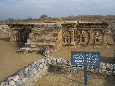
Figure 1.8 The Double-Headed-Eagle Stupa at Sirkapp, the Indo-Greek Archaeological Site

Figure 1.9 Old Kalabagh Bridge
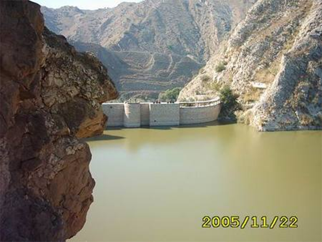
Figure 1.10 Nammal Lake and Dam
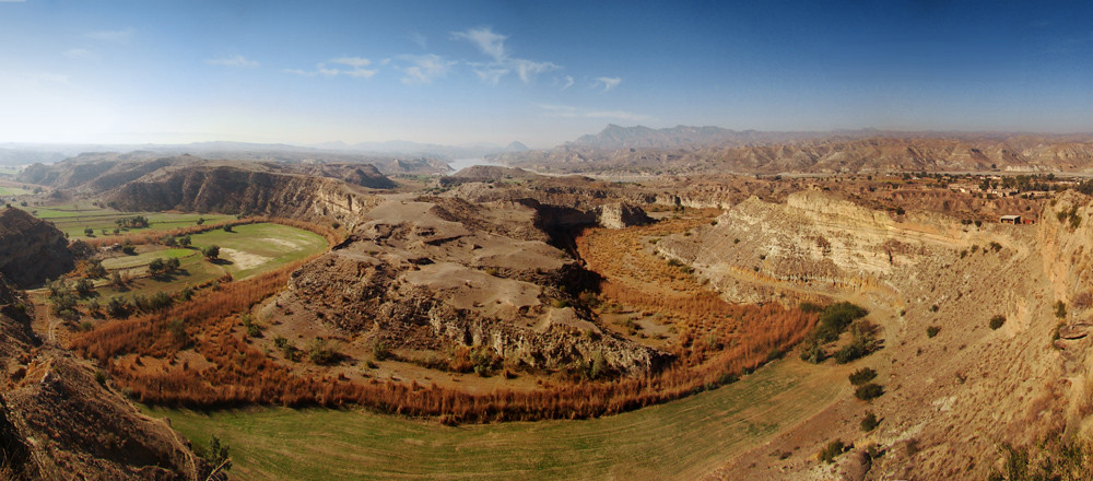
Figure 1.11 Kalabagh Dam Site
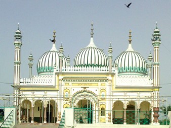
Figure 1.12 Khanqah Sirajia, Piplan Tehsil
[1] Mianwali District Gazetteer 1915
[2] Mianwali District Gazetteer 1915
Topography of Mianwali District
Mianwali district forms a part of the Sindh Sagar Doab.[1] The northern area of the district is a continuation of the Potowar Plateau and the Salt Range, whereas the south is the extension of the Great Thal Desert. The district includes 3 distinct tracts:
- A hilly terrain in the north, southwest, and northeast
- The uplands along the high banks of the Indus and the hills
- A sandy plain in the center and the south, a part of the Thal Desert
Hilly Terrain; Mianwali district
The extreme north of the district is the Isakhel tehsil, which is on the west of River Indus. This portion is known as the Bhangi Khel, which is a mountainous terrain, consisting of a succession of steep hills and deep ravines with cultivation on flattened hill tops or on sides of ridges and along the beds of hill torrents.
The Bhangi Khel Hills (highest point is called Vishorgun which is 1,220 m high) are a continuation of the Khattak Hills of Kohat. The main direction of these hills is north to south; they bifurcate at the base, with one range/ spur known as the Khattak Niazi or Maidani Hills. This spur goes round the north and west of Isakhel tehsil until it almost touches the Khesore and Paniala Hills of Dera Ismail Khan district at Dara Tang, which is a pass cut out by the waters of River Kurram. The Khesore Hills run along the southern boundary of Isakhel tehsil parallel to the Kurram River, forming its bank until the borders of Mianwali tehsil. The other spur of the Bhangikhel Hills is also a part of the Salt Range, and is also called the Kalabagh Hills. It runs through Mianwali tehsil and is linked with the Salt Range proper at Sakesar.
The area to the northeast of these hills is known as Khudri, and consists of rough ground and rugged hillocks intersected by ravines and hill torrents. The tract between this range and the Niazi Khattak Hills is a regular valley encircled by hills.
Uplands or Riverine Lands; Mianwali dsistrict
Along the River Indus is a strip of Riverine Lands known as Kachhi which is subject to flooding by River Indus, is very fertile, and lies in the extreme south of Mianwali tehsil.
Sandy Desert or Thal; Mianwali district
The southern part of the district is part of the Great Thal Desert. It starts at the south of the Sakesar Hills and extends across the southern limits of the district. The area slopes steadily from north to south, enabling canal water to flow. The eastern portion of the Thal tract has relatively high sand hills as compared to the western portion. This area was previously a desert but after construction of the Thal Canal the areas irrigated by the canal are now green and fertile.

Figure 1.3 Bhangi Khel Mountains, Isakhel Tehsil
Rivers, Streams, and Lakes; Mianwali district
The River Indus enters the district a few kilometers above Kalabagh, and flows in a southerly direction till it reaches the end of the district. After flowing in a narrow channel among the hills, it rapidly spreads out in the plain, until its bed, from bank to bank, attains a maximum width of 21 km just east of Isakhel.
River Soan, mainly a hill torrent, joins the River Indus at the northern border of the district. River Kurram also flows into the River Indus within the boundary of the district. Other nullahs/ hill torrents of the district include Gabhir, Chichal, Aadwala, Broch, Wahi, Golar, and Tarapi.
Some of the intermittent streams include Golar Nala, Raghaira Nala, Patala Nala, and Guraddi Nala. The (now dry) bed of old Rikhi Nala is also still evident.
The only lakes of note in the district are the Nammal Lake and the Chashma Barrage Lake, both of which are artificially created lakes.
Forests; Mianwali district
The forests of the district are mainly Irrigated Plantations, Riverine, and Scrub Forests. Flora of these forests includes kikar (Acacia Arabica), shisham or tahli (Dalbergio sissoo), jhand (Prosopis spicigera), ber (Ziziphus jujube), eucalyptus, and poplar (Populus).
The following table shows the total forest area under various departments in Mianwali district as per Punjab Development Statistics 2018-19:
| Total Forest Area | 39,721 A | Under Provincial Govt. | 575 A |
| District Govt. | – A | Reserved Forests | 19,274 A |
| Un-Classed Forests | 19,872 A | Resumed Land | – A |
| Linear Plantation | 1,080 km |
Table 1.3 Mianwali Forests
Harnoli Plantation, Kundian Plantation, Chak Plantation, Shelter Belts, Chak Sarkar Plantation, and Rakh Wanbhachran are some of the important forests of the district.
Soils; Mianwali district
There are 3 types of soil in the region: sandy, clay, and loamy. In the Thal area, the soils are alluvial, with sandy textured sand dunes.
Climate; Mianwali district
The district has extremes of climate. The summers are extremely hot and winters are cold. The summer season begins in April and continues till October. May, June, and July are the hottest months, when the mean maximum and minimum temperatures remain at 42 °C and 22 °C respectively. The summer temperatures may go up to 52 °C. The winter season is from November to February, and the first fortnight of February has the coldest days. The maximum and minimum temperatures in the month of January are 20 °C and 4 °C respectively.
Rainfall in the district is scanty, with the average annual rainfall being 400 mm.
Seismic Activity/Seismicity; Mianwali district
The district belongs to Zone 2B of the Seismic Zone Map of Pakistan which means minor to moderate damage due to earthquakes.
[1] Area between River Indus and River Jhelum
Population of Mianwali District
Population figures for Mianwali district as per 2017 Census are as follows:
| District/Tehsil | Area km2 | Population | Male% | Female% | Urban% | Growth Rate % |
| Mianwali District | 5,840 | 1,546,094 | 50.1 | 49.9 | 21.2 | 2.02 |
| Isakhel Tehsil | 1,863 | 375,026 | ||||
| Mianwali Tehsil | 2,689 | 767,130 | ||||
| Piplan Tehsil | 1,288 | 403,938 |
Table 1.4 Mianwali Population Statistics
Religions; Mianwali district[1]
| Muslims | 99.1% |
| Christians | 0.8% |
| Hindus | Negligible % |
| Ahmadis | 0.08% |
| Scheduled Castes | Negligible % |
| Others | 0.05% |
Table 1.5 Mianwali Religious Distribution
Languages; Mianwali district[2]
| Urdu | 3.5% |
| Punjabi | 74.2% |
| Sindhi | 0.1% |
| Pushto | 10% |
| Balochi | Negligible % |
| Seraiki | 11.9% |
| Others | 0.2% |
Table 1.6 Mianwali Languages
[1] 1998 Census; 2017 Census data has not been made public yet.
[2] 1998 Census; 2017 Census data has not been made public yet.
Economic Activity – Economic Infrastructure
Economic Activity; Mianwali District
The main employers of the district are:
- Agriculture with its Allied Livestock Breeding & Fishing etc. (35.1%)
- Manufacture (2.5%)
- Construction (30.6%)
- Wholesale/Retail & Hotel/ Restaurant (6.1%)
- Transport, Storage & Communication (7.3%)
- Community, Social & Personal Services (13.7%)
- Activities not adequately defined (2.9%)
- Others (1.8%)
Land Use; Mianwali district
The land use statistics of Mianwali district as per Punjab Development Statistics 2018-19 are shown in the following table:
| Total Area | 584,000 HA | Reported Area | 578,000 HA |
| Total Cultivated Area | 428,000 HA | Net Sown | 225,000 HA |
| Current Fallows | 203,000 HA | Total Uncultivated Area | 150,000 HA |
| Culturable Waste | 3,000 HA | Forest Area | 10,000 HA |
Table 1.7 Mianwali Land Use Statistics
Irrigation Network; Mianwali district
The district is irrigated through canals off-taking from the Chashma Barrage and the Jinnah Barrage. The two systems of Thal Canal, namely the Mohajir Branch and the Dullewala Branch, also irrigate the district. The Chashma Link Canal connects River Indus to River Jhelum through the Chashma Barrage. Other smaller canals include Kundian Distributary, Tibbi Distributary, and the Harnoli Distributary.
Irrigation Statistics as per the Punjab Development Statistics 2018-19 are shown in the following table:
| Total Irrigated Area | 279,000 HA | Un-irrigated Area | 59,000 HA |
| Canal Irrigated | 119,000 HA | Wells Irrigated | 29,000 HA |
| Tube Wells Irrigated Area | 118,000 HA | Canal Wells | – HA |
| Canal Tube Wells | 9,000 HA | Others | 4,000 HA |
Table 1.11 Mianwali Irrigation Statistics
Agriculture; Mianwali district
Part of the district belongs to the Sandy Desert Agro-Ecological Zone of Pakistan and another part of it belongs to Barani Areas. Agriculture and its allied livestock breeding is the main occupation of the rural areas of the district. Nearly 35.1% of the population is engaged in this occupation. The crops of the district include wheat, sugarcane, gram, guar seed, groundnut, rice, cotton, moong, maash, masoor, bajra, barley, jowar, maize, rapeseed, mustard, canola, sesanum, sunflower, linseed, sunn hemp, and castor seed.
Fruits of the district include guavas, citrus, mangoes, bananas, pomegranate, dates, figs, loquat, mulberry, ber, musk melon, watermelon, and phalsa. Main vegetables are chilies, onion, potatoes, tomatoes, sugarbeet, coriander, garlic, peas, turnip, bottle gourd, bitter gourd, carrot, cauliflower, spinach, radish, sweet potatoes, brinjals, pumpkins, okra, and tinda.
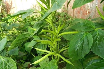
Figure 1.4 Guar Seed Plant
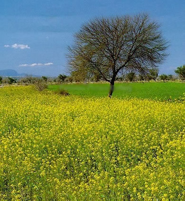
Figure 1.5 Mustard fields, Mianwali
Livestock Breeding; Mianwali district
Livestock breeding is the second most important economic activity of the district. The following table shows the livestock statistics of Mianwali district as per Livestock Census 2010 (quoted in Punjab Development Statistics 2018-19):
| Cattle | 456,000 Heads | Buffaloes | 152,000 Heads | Sheep | 188,000 Heads |
| Goats | 439,000 Heads | Camels | 3,988 Heads | Horses | 1,647 Heads |
| Mules | 162 Heads | Asses | 23,092 Heads |
Table 1.8 Mianwali Livestock Statistics
Dhanni cow, kajli sheep, and thalli sheep are the indigenous livestock breeds in Mianwali district.
Poultry Farms; Mianwali district
According to Table 17 (Number of Commercial Poultry Farms and Number of Birds by Size of Flock) there are 211 poultry farms in the district. In addition there are privately owned poultry farms in the District. As per Punjab Development Statistics 2018-19 there are 58 broiler and 14 layer privately owned poultry farms in the District.
Fishing; Mianwali district
Fishing is carried out in the River Indus (Isakhel tehsil), River Sindh (downstream, Mianwali tehsil), Chashma-Jhelum Link Canal, Thal Canal, Mohajir branch, and other lakes and ponds.[1] Most of this fish is consumed locally.
Bee Keeping/ Apiculture; Mianwali district
In Pakistan, honey bee colonies were introduced in the 1980s, and since then more than 300,000 honey bee colonies have been successfully established in Pakistan, including Mianwali district.
[1] Fish Manual, Fisheries Department Punjab
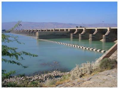
Figure 1.15 Chashma Barrage
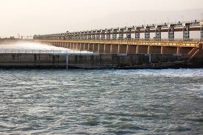
Figure 1.16 Jinnah Barrage
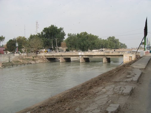
Figure 1.17 Thal Canal, Piplan tehsil
Minerals and Mining; Mianwali district
The district is rich in minerals. Rock salt, alum, coal, iron ore, silica sand, fire clay, dolomite, and gypsum are being mined in the district.
Oil and gas are also being mined in Isakhel tehsil.
Industry and Manufacturing; Mianwali district
All four of Punjab’s nuclear power generating plants are located in Mianwali district. At present, there is no industrial estate in Mianwali district.
There are a total of 35 small, medium, and large size industrial units in Mianwali district. The following table shows the position of existing industry in Mianwali district:
| Type of Industry | Number of Units | Type of Industry | Number of Units |
| Cement | 01 | Cotton Ginning & Pressing | 11 |
| Fertilizer | 01 | Flour Mills | 08 |
| Iron & Steel Re-Rolling | 01 | Power Generation | 03 |
| Soaps & Detergents | 09 | Unani Medicines[1] (8 closed) | 09 |
Table 1.9 Mianwali Industries
Trade (Import/Export); Mianwali district
The district trades in minerals, and agricultural produce.
Handicrafts; Mianwali district
Leather footwear, traditional embroidery on shoes and clothes, and decorative items made with leather are the famous handicrafts of the districts.
[1] Unani Medicines are Herbal Medicines
Economic Infrastructure; Mianwali District
The district is linked with Sargodha, Chakwal, Bhakkar and Khushab districts through black topped roads and is also linked with Attock district through the railway network.
Road Statistics; Mianwali district
The following table shows the road statistics of the district as per Punjab Development Statistics 2018-19:
| Total Road Length | 2,047.9 km |
| National Highways | – km |
| Provincial Highways | 2,047.9 km |
| Motorways | – km |
| Sugar Cess Roads | – km |
Table 1.10 Mianwali Road Statistics
Some of the important roads of the district include
- Mianwali-Talagang Road
- Mianwali-Kalabagh Road
- Mianwali-Sargodha Road
- Mianwali-Muzaffargarh Road
- Wan Bacchran-Harnoli Road
- Muzaffargarh-Hafizwala Road
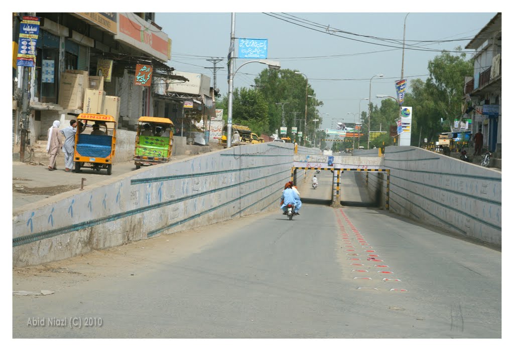
Figure 1.13 Mianwali Underpass at Balokhel Road
Rail and Airways; Mianwali district
The district is connected by the following railway lines:
- Kundian-Mari Indus-Daudkhel-Attock railway line
- Mar Indus-Laki Marwat-Bannu (small guage) railway line
- Kundian-Sher Shah-Multan railway line
- Trag-Makerwal (small guage) railway line.
There are a total of 17 railway[1] stations in the district.
There is an international airport at Chashma and a military airbase in the district.
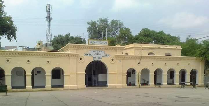
Figure 1.14 Mianwali Railway Station
Radio and Television; Mianwali district
There is an FM radio station broadcasting programs in the district. There is no TV station but TV can be viewed through boosters and cable.
Telecommunications; Mianwali district
Pakistan Telecommunications Ltd. has established a network of telephone lines. In all, there are 31 telephone exchanges[2] operating in the district, ranging in capacity from 206 lines to 5,850 lines. In addition, a number of cellular companies also provide their services in the district.
Post Offices/ Courier Services; Mianwali district
There are 36 offices[3] of Pakistan Post in the district, with 19 offices in Mianwali tehsil, 10 in Isakhel tehsil, and 7 in Piplan tehsil.
Banking/ Financial Institutions; Mianwali district
There are 52 branches[4] of various banks in the district with 28 bank branches in Mianwali tehsil, 14 in Isakhel tehsil, and 10 in Piplan tehsil.
According to the List of Reporting Bank Branches 2019 by State Bank of Pakistan, the following banks have branches in Mianwali:
- Allied Bank Ltd.
- Askari Bank Ltd.
- Alfalah Bank Ltd.
- Bank Islami Pakistan Ltd.
- Habib Bank Ltd.
- Muslim Commercial Bank Ltd.
- Meezan Bank Ltd.
- National Bank of Pakistan Ltd.
- The Bank of Punjab Ltd.
- The Punjab Provincial Cooperative Bank Ltd.
- United Bank Ltd.
- Zarai Taraqiati Bank Ltd.
In all there are 79 branches of various conventional banks and 06 branches of different Islamic banks in the District.
Electricity and Gas; Mianwali district
There are 16 grid stations[5] ranging in capacity from 66 KV to 220 KV in the district.
Gas connections for residential purposes are available in Mianwali, Daudkhel, Chashma, Iskandarabad, and Kundian.
[1] Directorate of Industries, Punjab. Pre-Investment Study Mianwali District 2012; Latest available.
[2] Directorate of Industries Punjab. Pre-Investment Study Mianwali District 2012; Latest available.
[3] Directorate of Industries Punjab. Pre-Investment Study Mianwali District 2012; Latest available.
[4] Directorate of Industries Punjab. Pre-Investment Study Mianwali District 2012; Latest available.
[5] Directorate of Industries Punjab. Pre-Investment Study Mianwali District 2012; Latest available.
Educational Institutions; Mianwali district
The following table shows the details of educational facilities of the district as per Punjab Development Statistics 2018-19:
| Institution | Boys/Girls | Institution | Boys/Girls |
| Primary Schools | 407/571 | Middle Schools | 94/71 |
| Secondary Schools | 81/47 | Higher Secondary | 09/07 |
| Degree Colleges | 13/09 | Other Higher Secondary[1] | 04/01 |
| Other Degree Colleges[2] | 07/08 | Technical Training Institutes[3] | 05/- |
| Vocational Institutes[4] | -/05 | Commercial Training Institutes[5] | 02/01 |
| Universities[6] | 01 | Govt. Mosque Schools | 05/02 |
| Medical Schools | – | Engineering Schools[7] | 01 |
Table 1.12 Mianwali Educational Institutions
There are a large number of private schools and colleges in the district.
Healthcare facilities; Mianwali district
The District Health Officer (DHO) is overall in-charge of health services provided in the district. The DHO is supported by doctors, paramedics, technicians, and other support staff. The following table shows the number of health care institutions in the district as per Punjab Development Statistics 2018-19:
| Institution | No./Beds | Institution | No./Beds |
| Government Hospitals | 06/471 | Dispensaries | 15/- |
| Rural Health Centers | 10/200 | Basic Health Units | 41/- |
| T B Clinics | -/- | Mother Child Health Centers | 05/- |
| Private Hospitals | -/- | Sub-Health Centers | -/- |
| Private Health Care Providers[8] | 15/NA |
Table 1.13 Mianwali Health Institutions
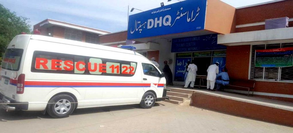
Figure 1.18 DHQ Hospital, Trauma Center, Mianwali
Policing; Mianwali district
The Deputy Inspector General Police looks after Sargodha Region which comprises of Sargodha, Khushab, Mianwali, and Bhakkar districts. Mianwali district is further subdivided into 04 subdivisions with 19 police stations.[9] The police force in each region is headed by a District Police Officer who is assisted by a varying number of Superintendents and Deputy Superintendents of Police.
[1] Includes Private, Federal and Schools owned by PAF and other organizations
[2] Includes Private, Federal and Schools owned by PAF and other organizations
[3] Directorate of Industries, Punjab. Pre-Investment Study 2012 Mianwali District; Latest available.
[4] Directorate of Industries, Punjab. Pre-Investment Study 2012 Mianwali District; Latest available.
[5] Directorate of Industries, Punjab. Pre-Investment Study 2012 Mianwali District; Latest available.
[6] Campus of University of Sargodha and Nammal College of E&T affiliated with University of Bradford (Private)
[7] Campus of University of Sargodha and Nammal College of E&T affiliated with University of Bradford (Private)
[8] Three Year Rolling Plan 2010-13 District Mianwali GoPunjab (No. of beds not available); Latest available.
[9] Punjab Development Statistics 2018-19
Environment and Biodiversity; Mianwali District
Since the district is relatively less industrialized, it is comparatively less polluted. Most of the air pollution is due to suspended dust particles and emissions from vehicles. The population explosion has forced most of the wildlife to migrate.
Flora and Fauna; Mianwali district
Flora; Mianwali district
The flora of the district can be divided into 2 zones: that occupying the riverine levels and that occupying the higher surrounding areas.
The predominant flora of the riverine tracts is lai (Tamarix dioca), pilchi or manna plant (Tamarix gallica), khaddar or bulrush (Typha elephantina), sarkanda (Saccharum munja), kai/kans (Saccharum spontaneum), navra or giant cane (Arundo donax), kikar (Acacia nilotica), shisham (Dalbergio sissoo), ber (Zizyphus jujuba), mesquite (Prosopis juliflora), jhand (Prosopis cineraria), khabbal (Cynoden dactylon), bhan (Populus euphratica), sirin or white poplar (Albezzia lebbek), dharak or Persian lilac (Melia azedarach), kao or Indian olive (Olea ferruginea), harmal or dogbane (Rhazya stricta), chaunga or gems of the hills (Caralluma tuberculata), aak (Calotropis procera), khansoor (Calendula arvensis), bhaswat or coatbuttons (Lanaea procubens), lamb’s quarters or bathu (Chenopodium album), and sanatha or hopbush (Dodonea viscosa).
The flora of the higher surrounding areas includes jhand (Prosopis cineraria), karir (Capparis aphyla), vann (Salvadora oleoides), peelu (Salvadors persica), kikar (Acacia nilotica), lana (Suaeda fructicosa), lani (Salsola foetida), and khabbal (Cynodon doactylon).
Principal vegetation at the water body sites are water thyme (Hydrilla verticillata), wild water lily (Nelumbium speciosum), Egyptian water lily (Nymphaea lotus), Typha angustata (a type of floating weed), Phragmites karka (a common weed), fennel pond weed (Potamogeton pectinatus), kai/kans (Saccharum spontaneum), tape gras (Vallisneria spiralis) and horned pond weed (Zannichellia palustris).
Fauna; Mianwali district
Wild boar, hare, brown hare, Indian hare, jackal, porcupines, fox, various species of deer (confined to game sanctuaries) and hedgehogs are the common mammals found in the district. Smooth-coated otter occurs in the wetlands, and jungle cats, red fox, desert cat, nilgai, black buck, caracal, civet cat, and Punjab Urial are found in the protected game reserves.
A large number of wintering water fowl are found on the lakes of Chashma and Jinnah barrages. The lake at Chashma Barrage has been given the status of “protected” and is on the international Ramsar List. This lake provides sanctuary to as many as 50,000 birds. Some of the most abundant and common are Eurasian widgeon, common teal, northern pintail, common pochard, Eurasian coot, domestic goose, little cormorant, black-crowned night heron, little egret, grey heron, shell duck, pochard, great crested grebe, great cormorant, pied myna (IUCN Red List), and the bar-headed goose (rare). The Indus dolphin occurs in some stretches of River Indus upstream of Chasma Barrage.
Seven species of freshwater turtles are found in the wetlands of Chashma and Jinnah barrages; these include brown-roofed turtles, Indian roofed turtle (on IUCN Red List), Brahiminy river turtle (IUCN Red list), soft shell turtle (IUCN Red List), Black pond turtle (IUCN Red List), spiny soft shell turtle, and flap shell turtle (IUCN Red List). Other amphibians include various types of toads and frogs.
Reptiles include diadem snake (IUCN Red List), cobra, krait, Russel’s viper, saw-scaled viper, yellow varanus, and many other small lizard species.
Protected Wildlife Areas and Endangered Species; Mianwali district
Following are the protected wildlife areas of Mianwali district:
- Chashma Barrage lake area in Mianwali district is a designated wildlife sanctuary and is on the Ramsar List of internationally important wetlands. This provides refuge to a large number of migratory birds. In the article “Waterfowl Diversity at Chashma Barrage (Wildlife Sanctuary Mianwali) and Marala Headworks (Game Reserve Sialkot), Pakistan during 1996–2005” M. Akbar, M. Mushtaq-ul-Hassan, Zaib-un-Nisa, M. Mahmood-ul-Hassan and M. Hassan show that for the period 1996-2005, there were 46 waterfowl species recorded at Chashma Barrage Reservoir.[1] Some of these include grebes, cormorants, egrets, herons, storks, goose, teals, mallards, widgeons, shovelers, pochards, moorhens, lapwings, and gulls
- Nammal Lake Wildlife Sanctuary; Mianwali district is also on the Ramsar List of internationally important wetlands. This is a brackish water lake bounded by a dam on one corner, and fed by hill torrents of the Salt Range. This lake also attracts a large number of migratory birds like grebes, geese, and coots
- Harnoli Plantation and Kundian Plantation; Mianwali district are protected game reserves/forests
These areas provide sanctuary to all species of deer, smooth-coated otter, jungle cats, red fox, desert cat, nilgai, black buck, wildboar, caracal, civet cat, porcupine, jackals, pied myna bar-headed goose (rare), and black and grey partridges. The Indus dolphin occurs in some stretches of River Indus upstream of Chashma Barrage, as well as turtles, diadem snake, cobra, krait, Russel’s viper, saw-scaled viper, yellow varanus, and many other small lizard species.
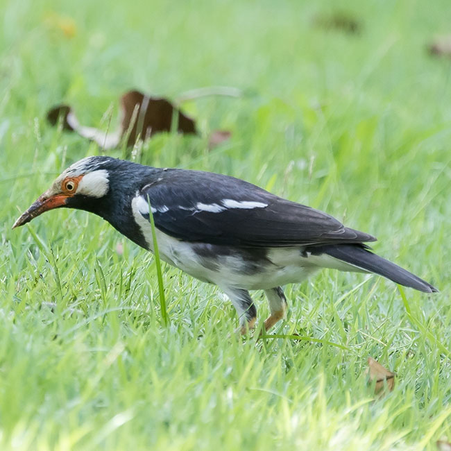
Figure 1.6 Endangered Pied Myna

Figure 1.7 Endangered Indus Dolphin
[1] Published in International Journal of Agriculture and Biology vol. 11. Number 2, January 2009